
Satellite Snapshots
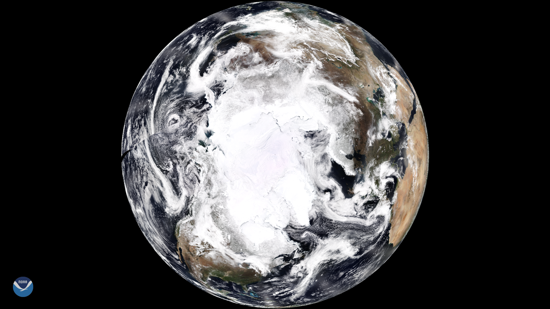
NOAA's newest polar-orbiting satellite, NOAA-20, captured this magnificent view of the Earth's North Pole on April 12, 2018. By…
Satellite Snapshots
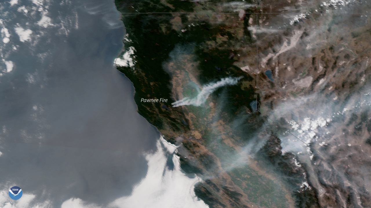
Plumes of smoke blow across northern California in the wake of several wildfires that erupted across the region due to hot, dry weather…
Satellite Snapshots
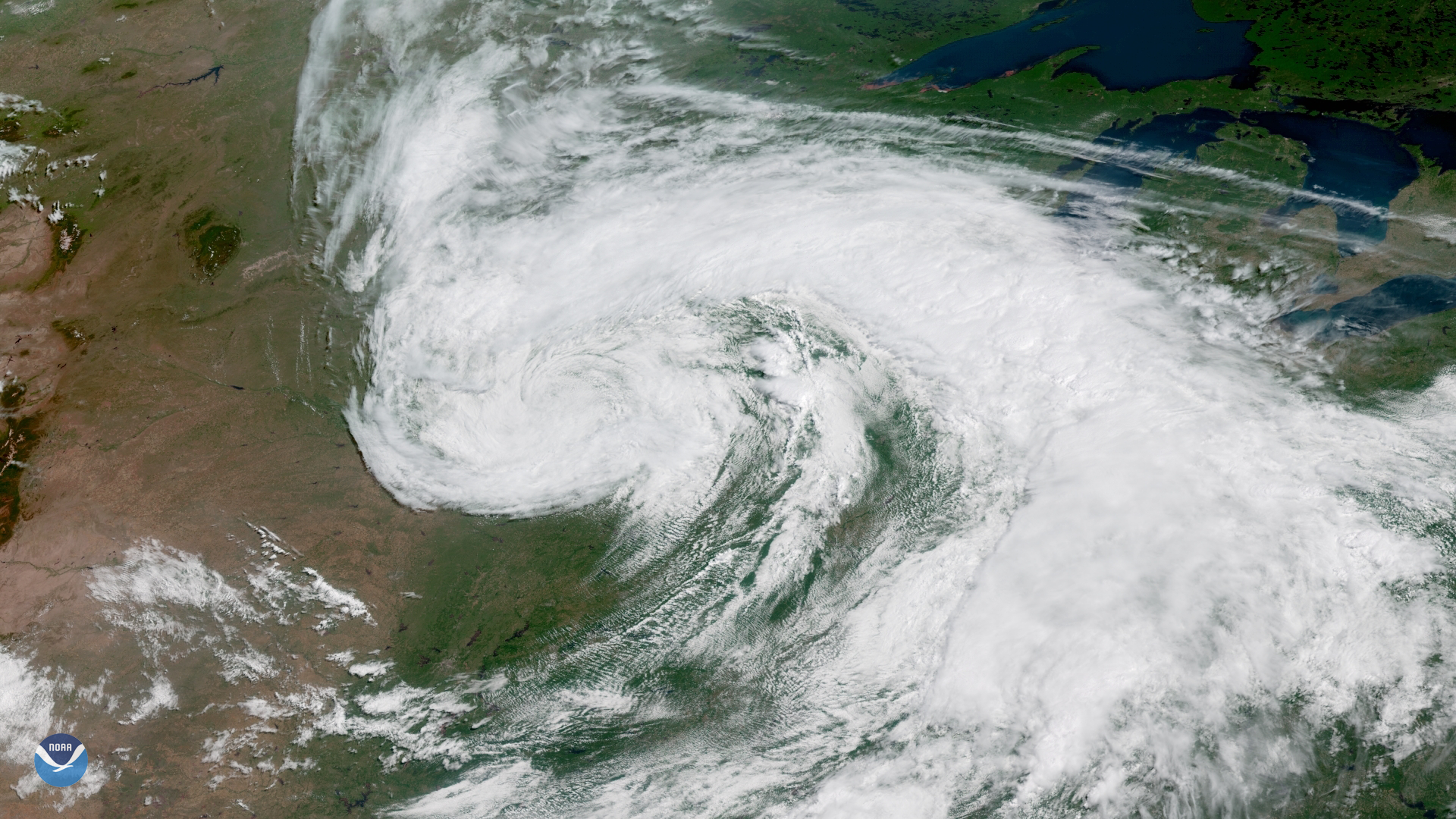
On the first day of astronomical summer , the GOES East satellite captured this image of a large storm system moving across the central…
Satellite Snapshots
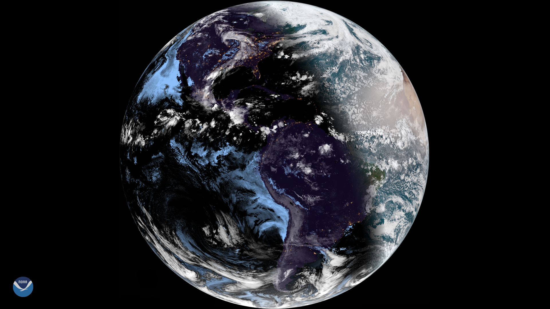
The 2018 summer solstice occurred at 6:07 a.m. Eastern Time on June 21, marking the longest day of the year and the first day of…
Satellite Snapshots
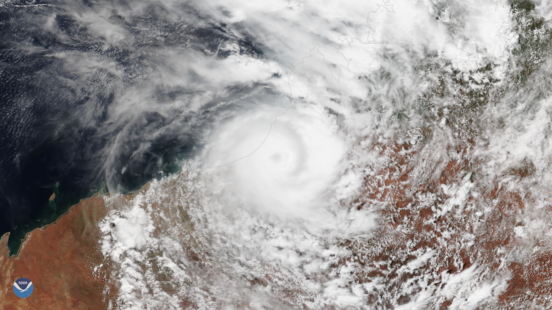
he Suomi NPP satellite's VIIRS instrument captured this image of Tropical Cyclone Kelvin in northwest Australia at 0630 UTC on…
Satellite Snapshots
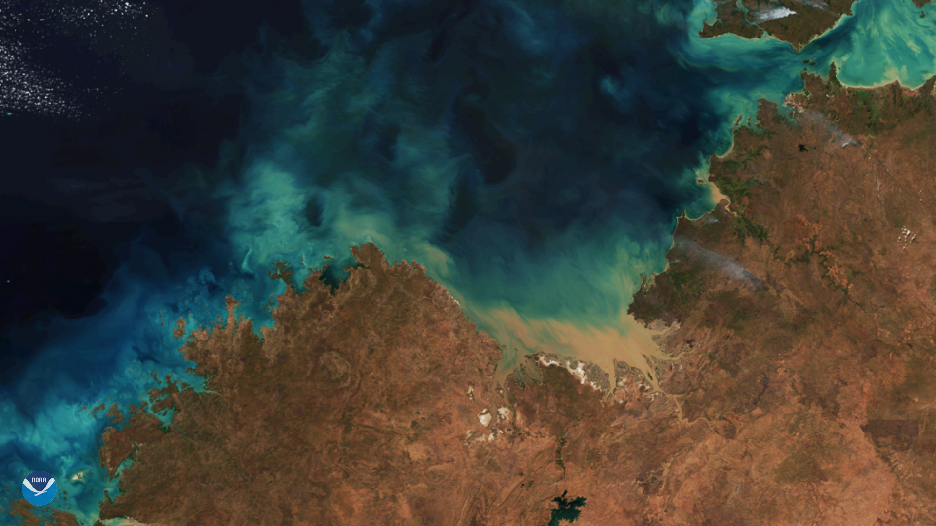
Clear skies over Australia's northwest coast reveal a magnificent pattern of blue and green sediment swirling in the waters of the…
Satellite Snapshots
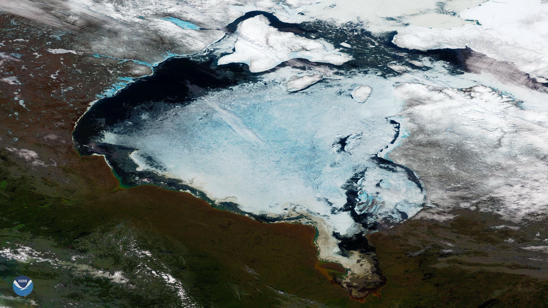
Clear skies over northeastern Canada this week offer a spectacular view of the seasonal summer ice melt that occurs on the Hudson Bay…
Satellite Snapshots

The powerful midlatitude #BombCyclone has several meso-vortices spinning within its center, the GOES East ABI captured these images of the storm…