
Feature Story
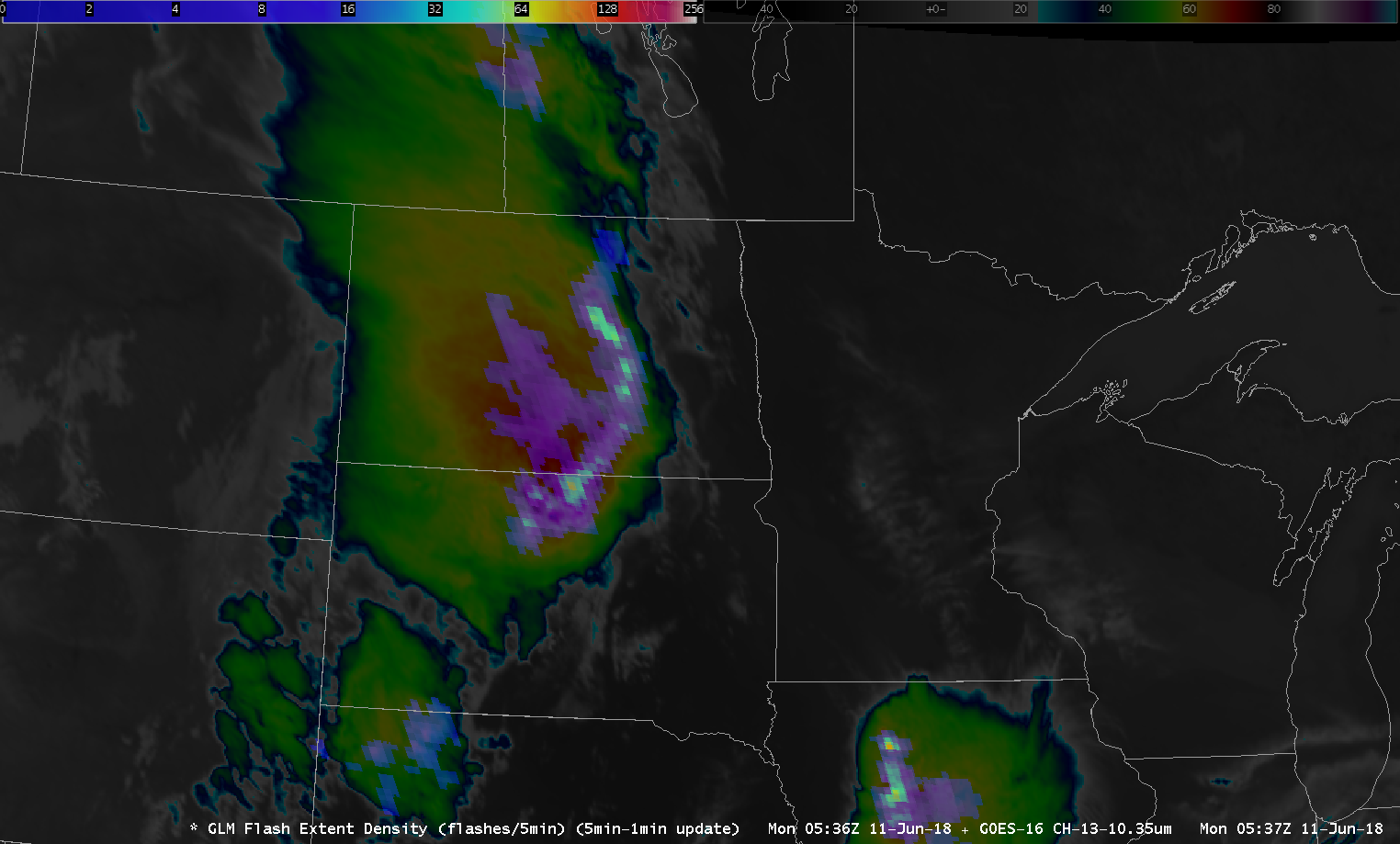
Lightning strikes, giant sparks of electricity in Earth’s atmosphere that are hotter than the surface of the sun , are a major…
Satellite Snapshots
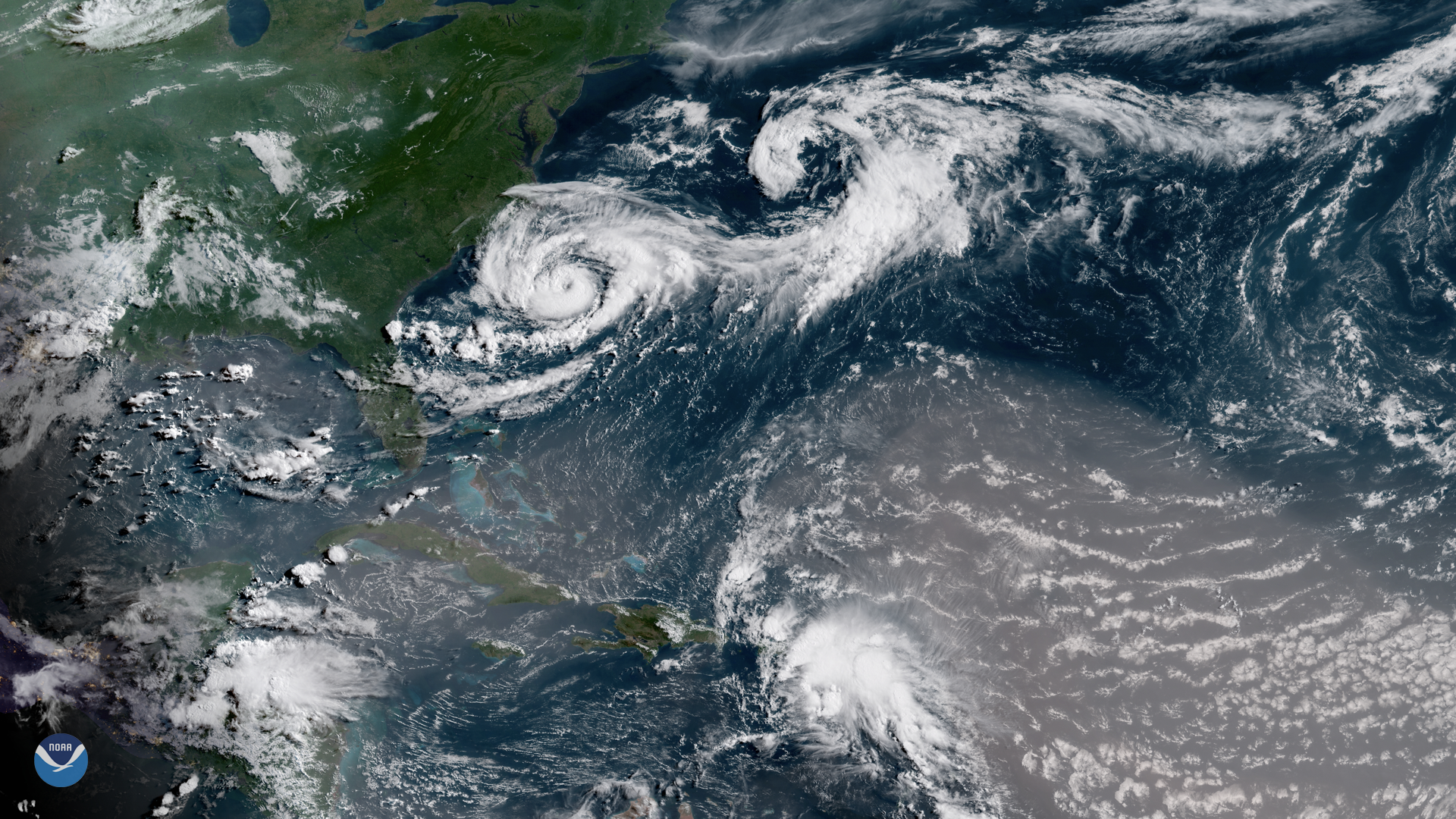
Several interesting atmospheric features appear in this GOES East satellite image of the western Atlantic Ocean, captured July 9, 2018…
Feature Story
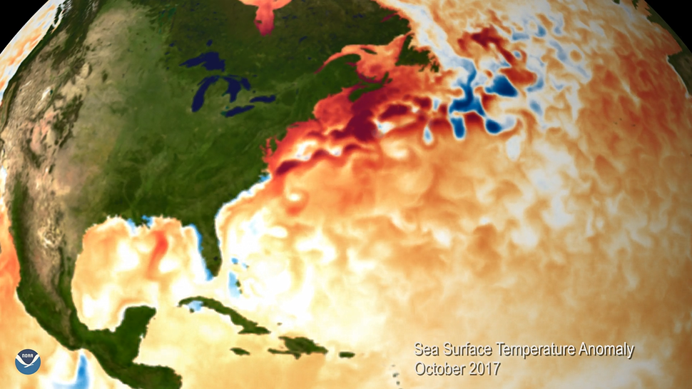
Satellites are a valuable tool for monitoring Earth’s oceans, which cover more than 70 percent of our planet. This visualization…
Satellite Snapshots

This multi-day infrared imagery from the NOAA-20 and Suomi NPP polar orbiting satellites shows the dangerous wildfires that continue to…
Feature Story

NOAA began monitoring sea level more than 20 years ago, with the TOPEX/Poseidon satellite in 1992. NOAA launched its newest in the series, Jason 3.
Feature Story
A year has passed since the Jason-3 satellite rocketed into space. NOAA's Laboratory of Satellite Altimetry provided us a report on those 365 days.
Satellite Snapshots
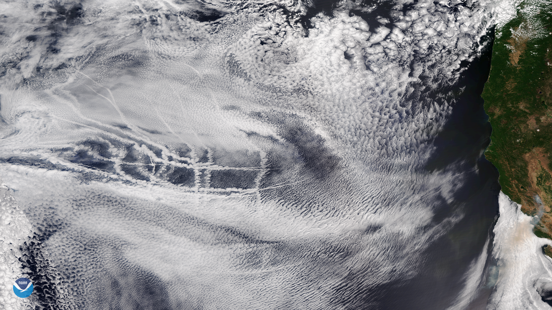
Ship tracks embedded in a layer of mid- and high-level clouds over the eastern Pacific Ocean on July 2, 2018
Satellite Snapshots
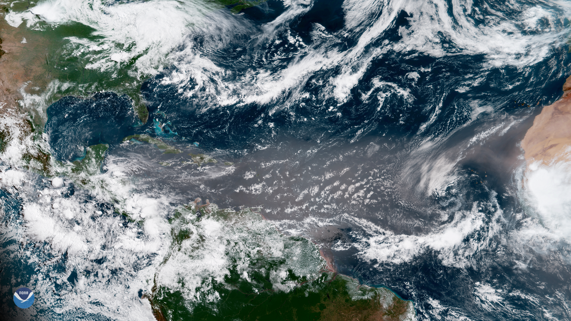
A massive plume of Saharan dust appears across the tropical North Atlantic Ocean in this image captured by the GOES East satellite on June 27, 2018.