
Satellite Snapshots

A thick plume of Saharan dust swirls over the Red Sea in this image captured by the Suomi NPP satellite’s VIIRS instrument on April 1,…
Satellite Snapshots
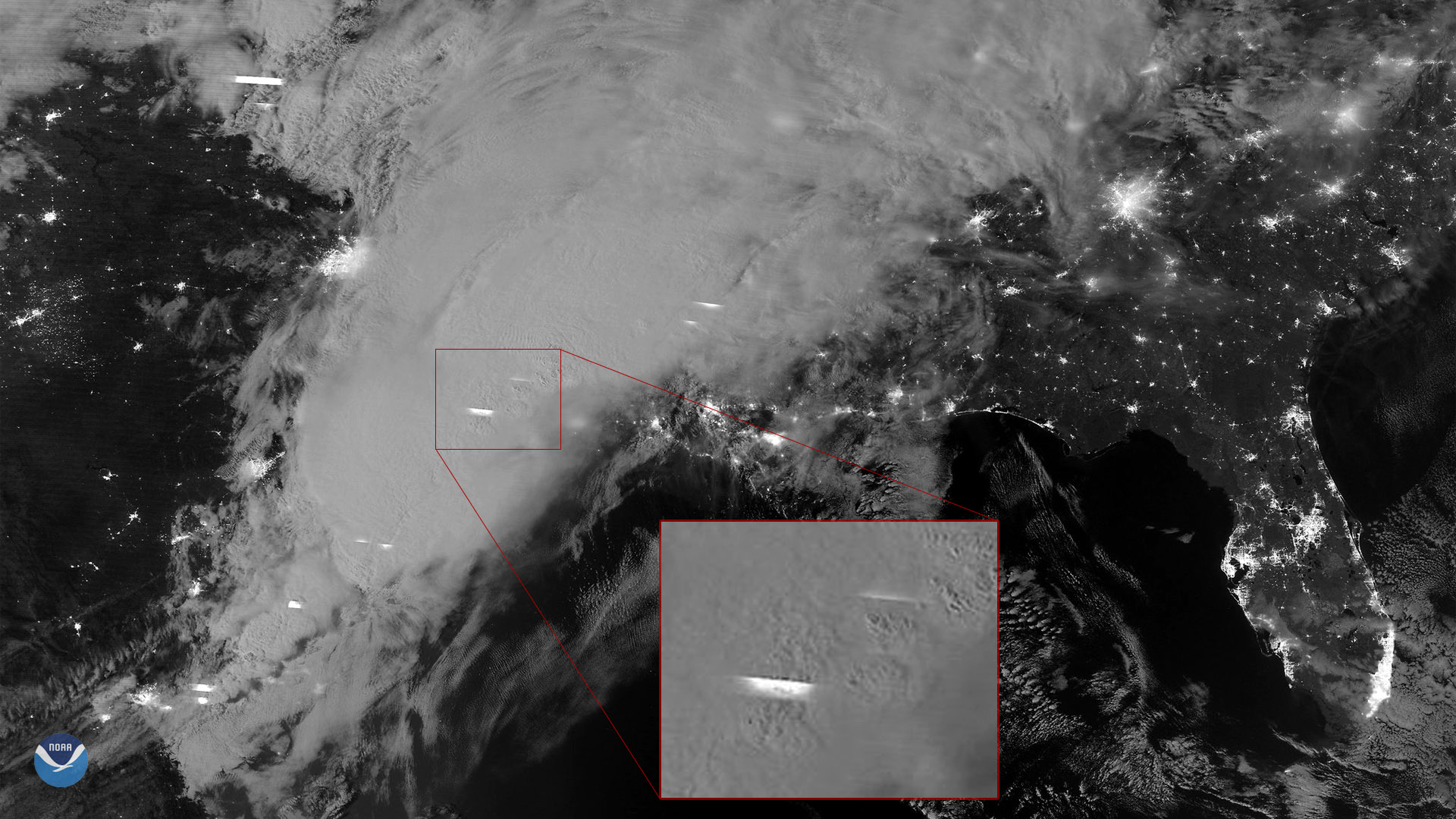
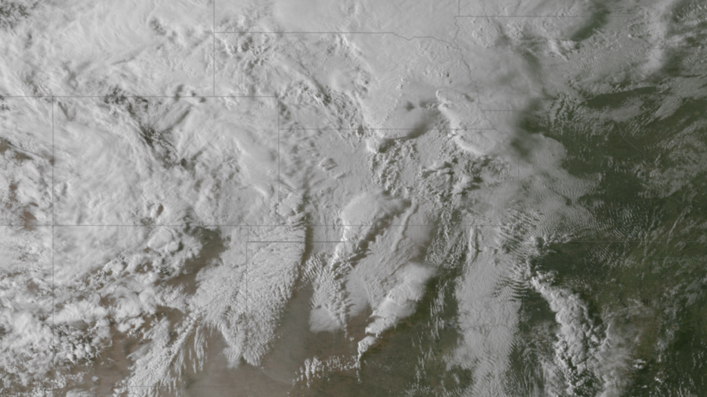
The NOAA-20 polar-orbiting satellite captured this moonlit nighttime imagery of severe thunderstorms moving over the Southern U.S. on…
Satellite Snapshots

NOAA operates three types of satellite systems for the United States. Our polar orbiting satellites, geostationary satellites and deep space…
Feature Story
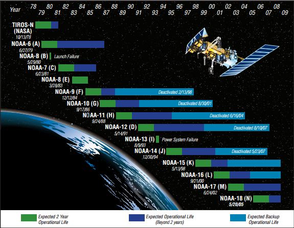
NOAA's satellites provide the bulk of the information for generating weather models, advisories, and warnings to the nation and world. Maintaining…
Satellite Snapshots
The National Centers for Environmental Information (NCEI) Pathfinder Seas Surface Temperature (SST) Climate Data Record (CDR) is an essential input…
Satellite Snapshots
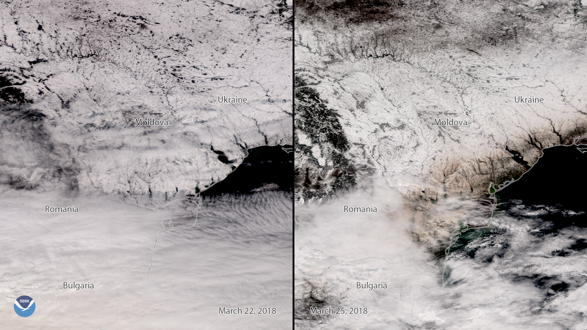
This side-by-side comparison from the Suomi NPP polar-orbiting satellite shows snow-covered Eastern Europe before and after a plume of…
Feature Story
From thundersnow to upwards striking lightning, weather on Planet Earth can get pretty weird and NOAA’s fleet of satellites has…
Feature Story
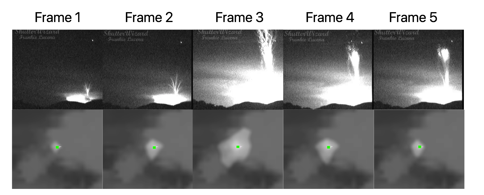
NOAA GOES East (GOES-16) satellite's Geostationary Lightning Mapper has captured the first images from space of 'gigantic jet' lightning.