
Satellite Snapshots
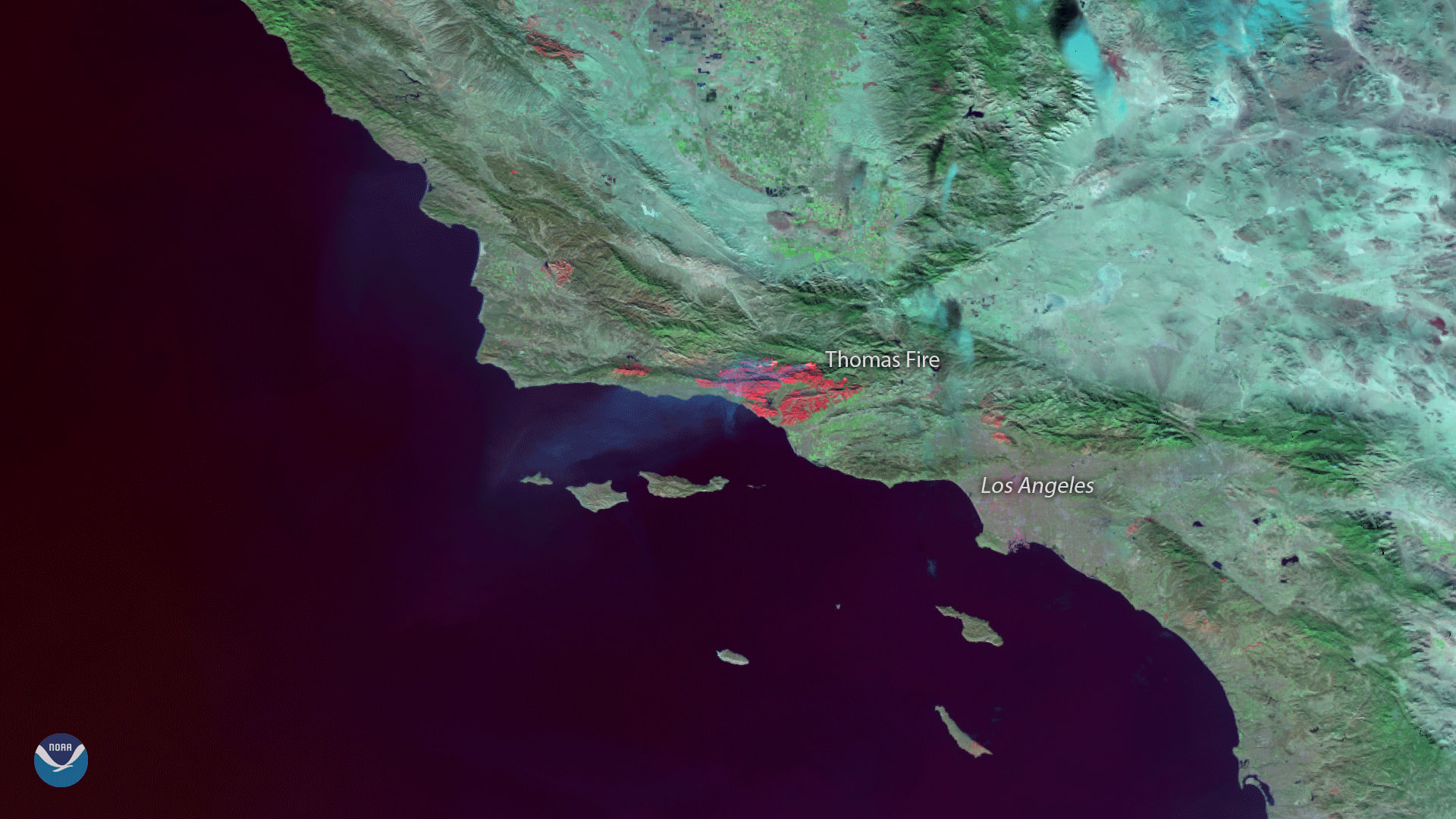
The Suomi NPP satellite's VIIRS instrument captured this image of burn scars from the massive Thomas Fire that has been raging in…
Satellite Snapshots

The official start of astronomical winter, the winter solstice, occurred at 11:28 a.m. Eastern Time this morning, marking the…
Satellite Snapshots
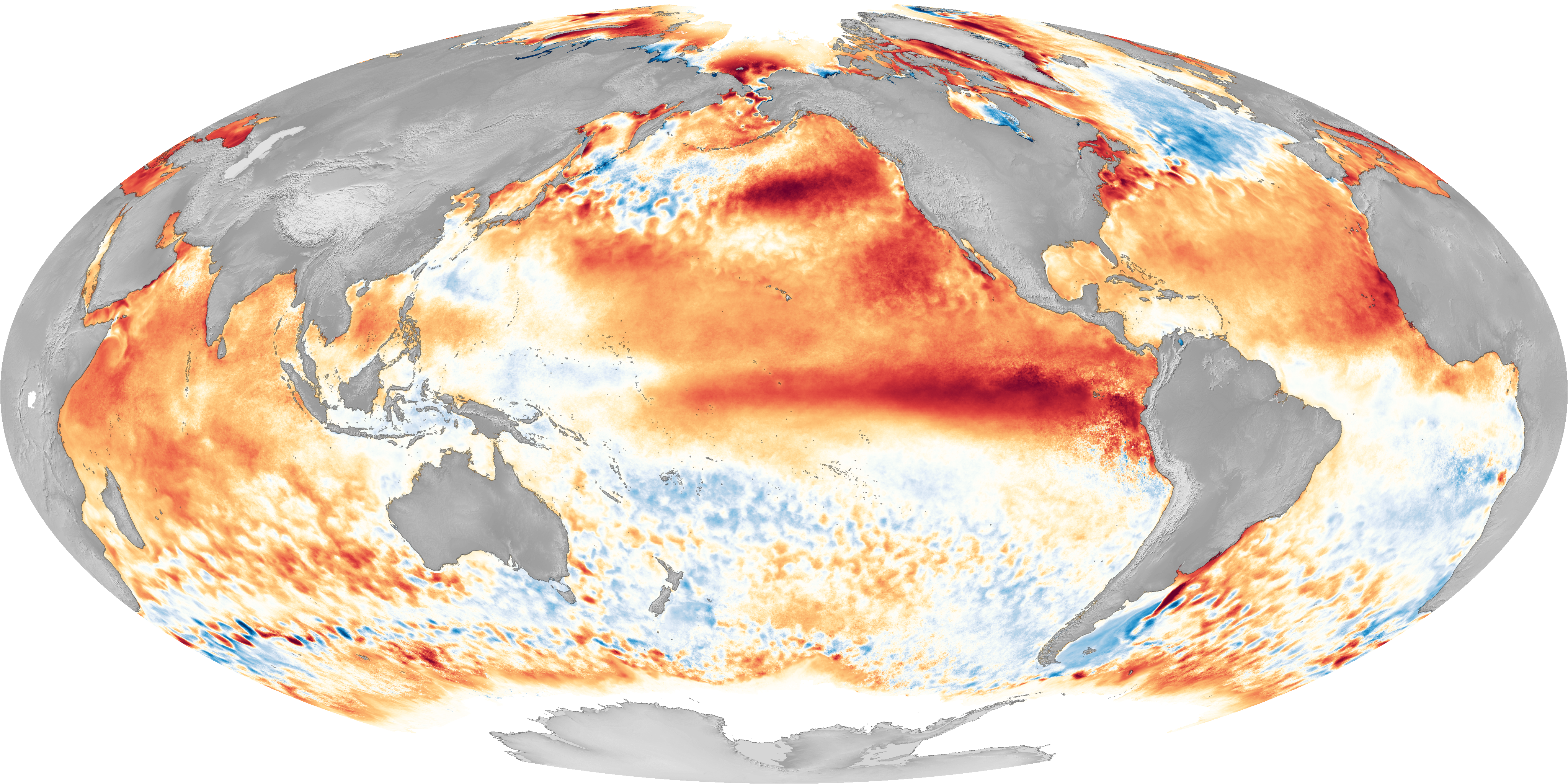
El Nino is part of a global climate cycle that typically occurs every 2 to 5 years, and is associated with warmer than normal…
Satellite Snapshots

The NOAA-20 polar-orbiting satellite's Visible Infrared Imaging Radiometer Suite (VIIRS) sent back its first day-night band images…
Satellite Snapshots
Twenty-five days after JPSS-1 (NOAA-20) was launched into Earth orbit, the satellite sent back its first Visible Infrared Imagery.
Feature Story
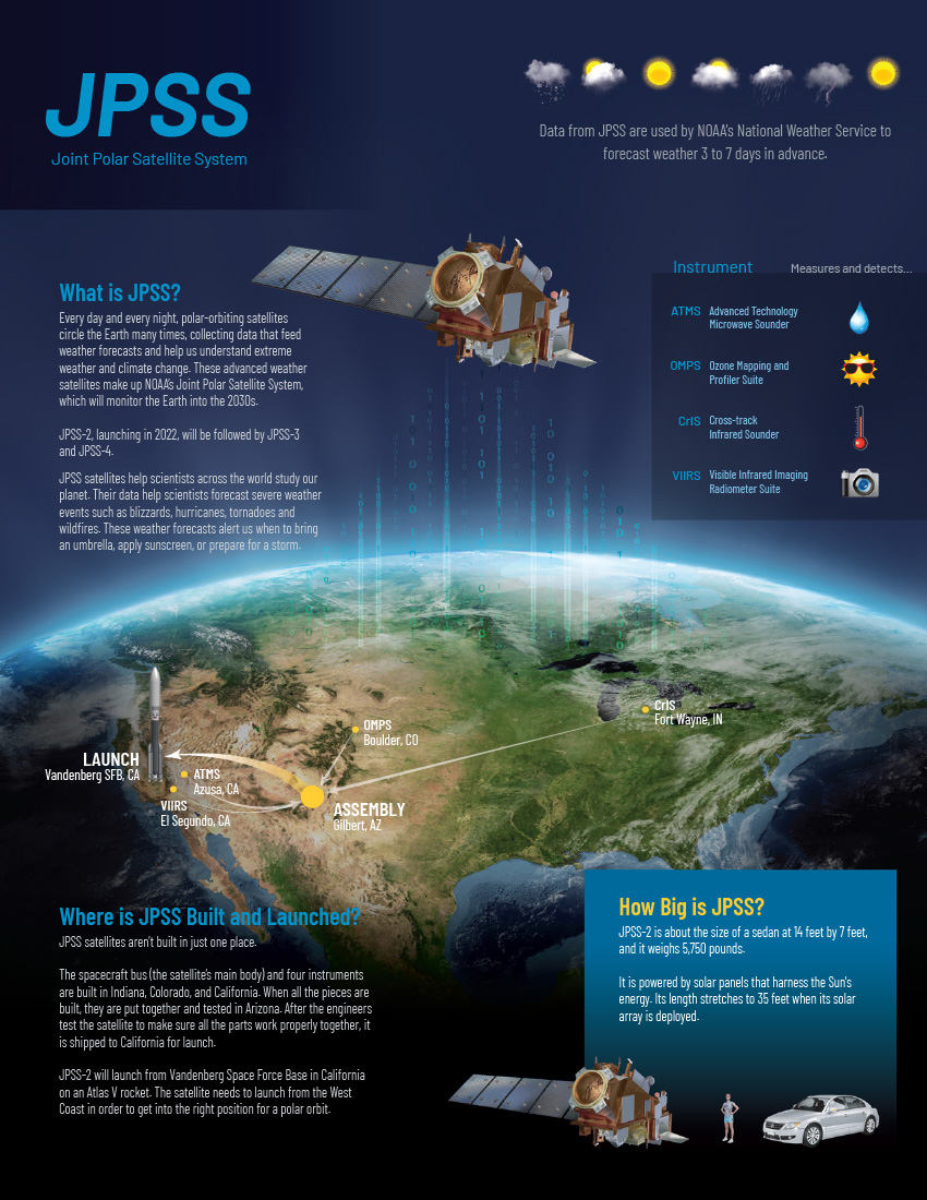
In 2017, the National Oceanic and Atmospheric Administration (NOAA), with the support of their partners at The National Aeronautics and Space…
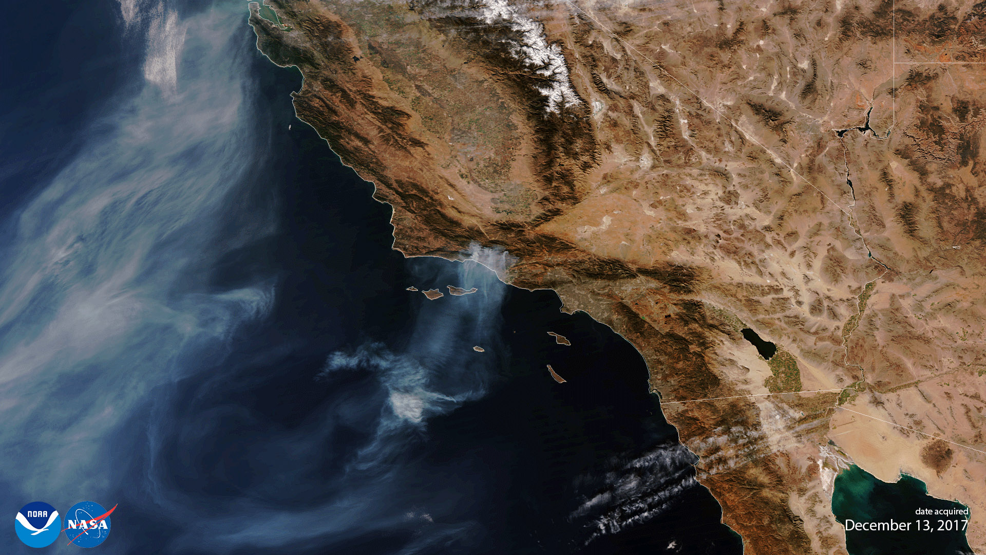
Satellite Snapshots
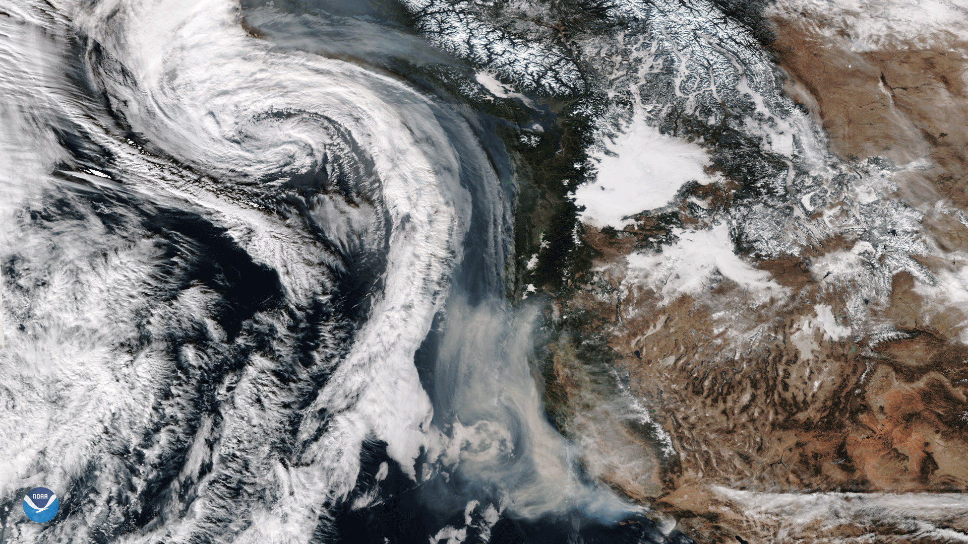
The Suomi-NPP satellite captured this image of smoke from California's wildfires being drawn northward into an approaching storm system.
Feature Story
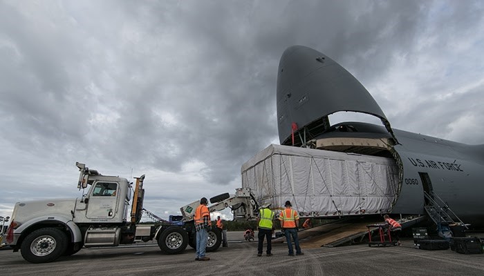
NOAA’s GOES-S, the second in a series of next-generation satellites, headed south for the winter this week as it readies for launch.