
Feature Story
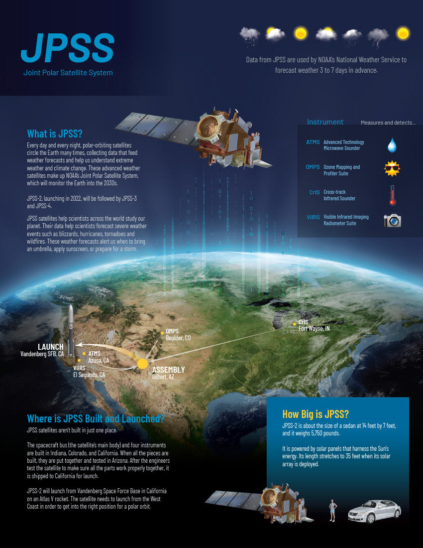
Orbiting around the planet from pole to pole 14 times per day JPSS keeps track of weather.
Feature Story
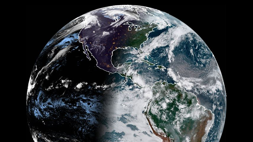
Every morning NOAA’s GOES-16 Satellite takes in an amazing view of Earth.
Satellite Snapshots
The Visible Infrared Imaging Radiometer Suite instrument aboard the NOAA/NASA Suomi NPP satellite captured this image.
Feature Story
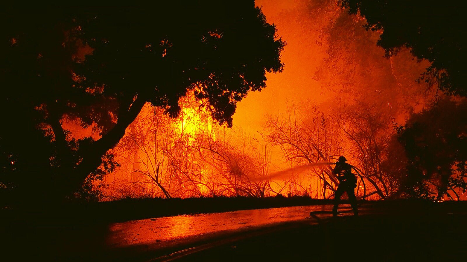
As news of the rising death toll from the California fires continues, NOAA satellites help capture the extent of the wildfires.
Satellite Snapshots
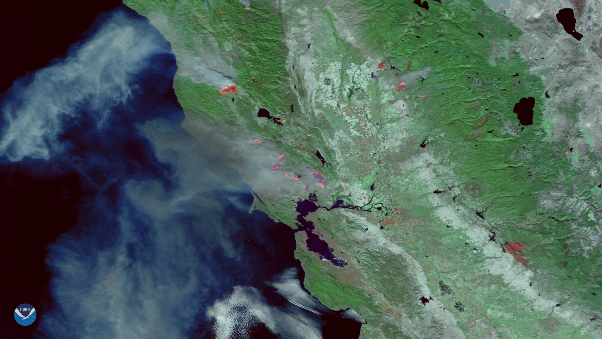
This false-color image (captured on Oct. 9th) was created by combining three of the Suomi NPP satellite's high resolution thermal visible channels.
Satellite Snapshots
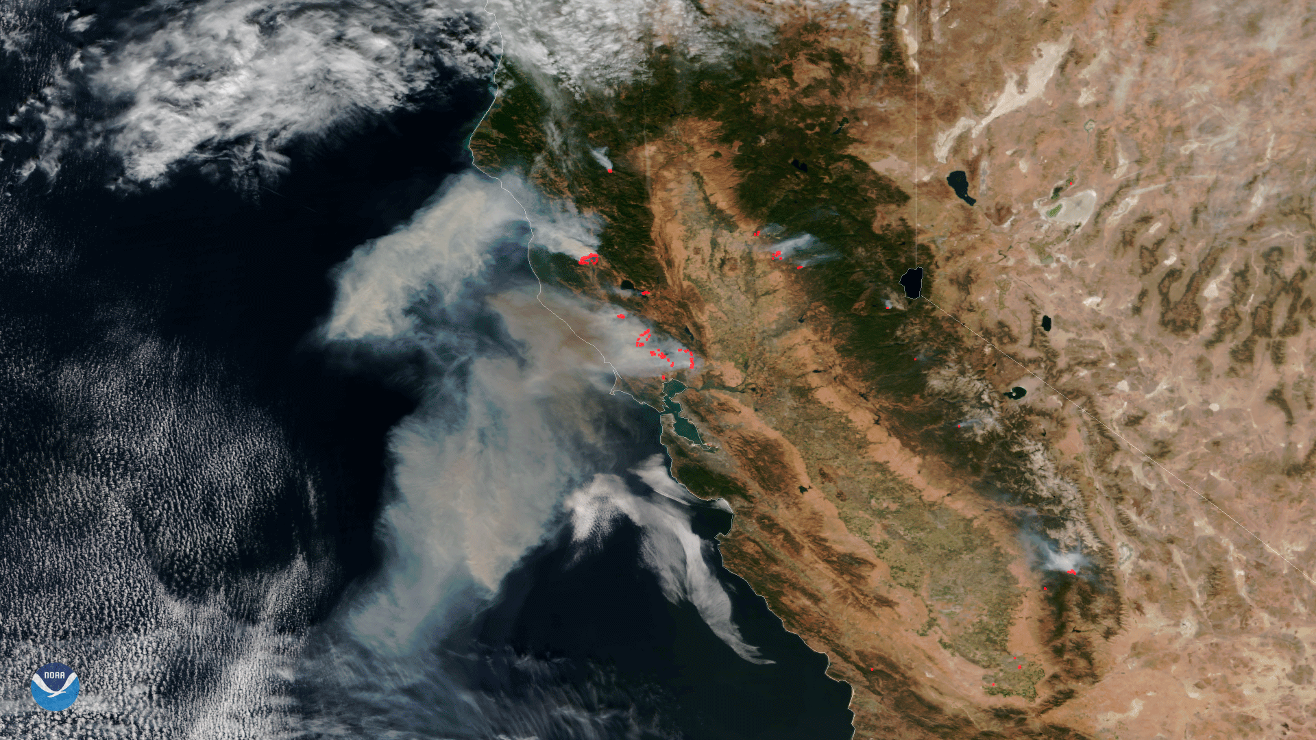
Data from the VIIRS instrument aboard NOAA/NASA Suomi NPP satellite from October 9, 2017 shows the extent of the fires burning in California.
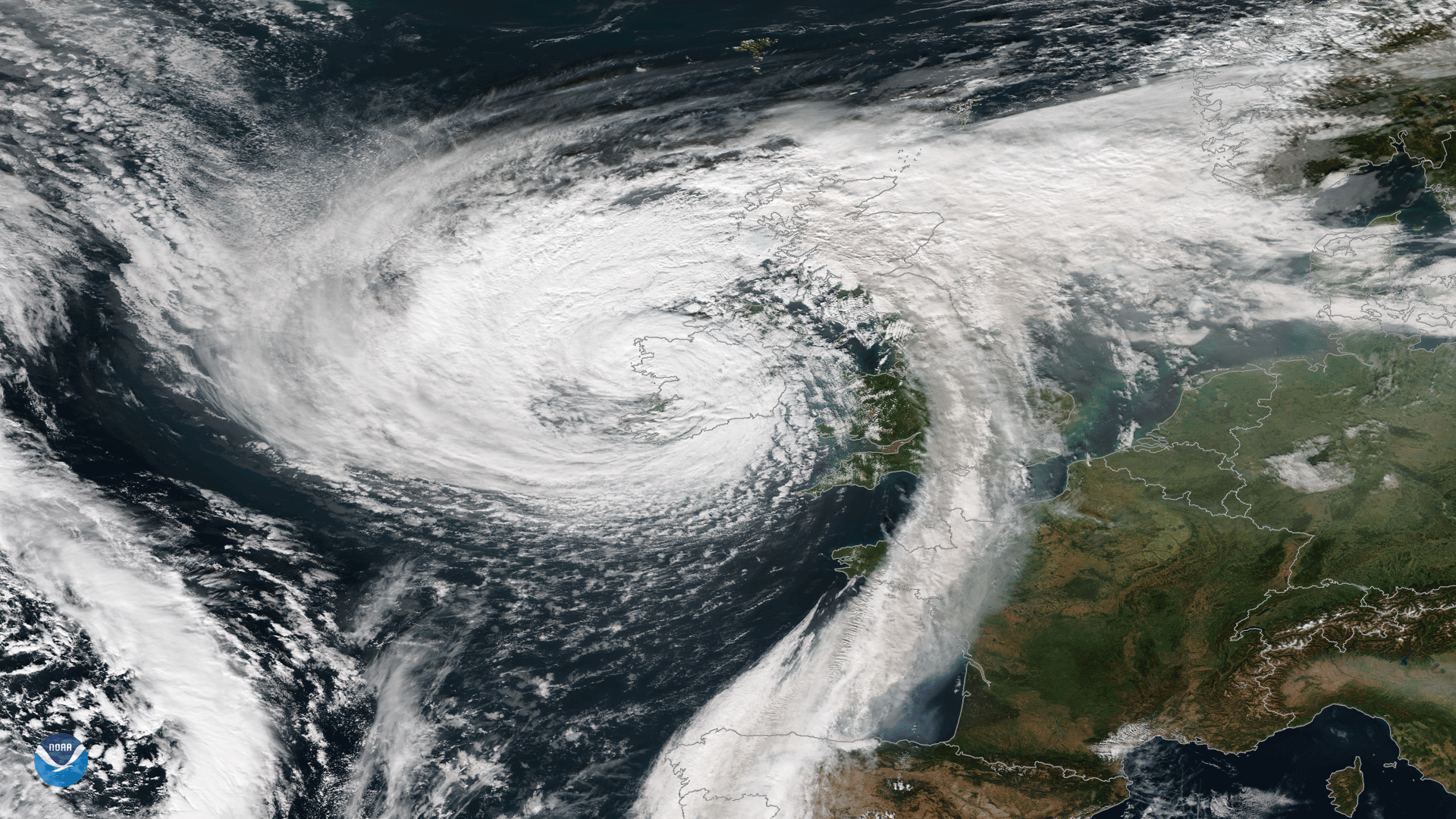
Feature Story
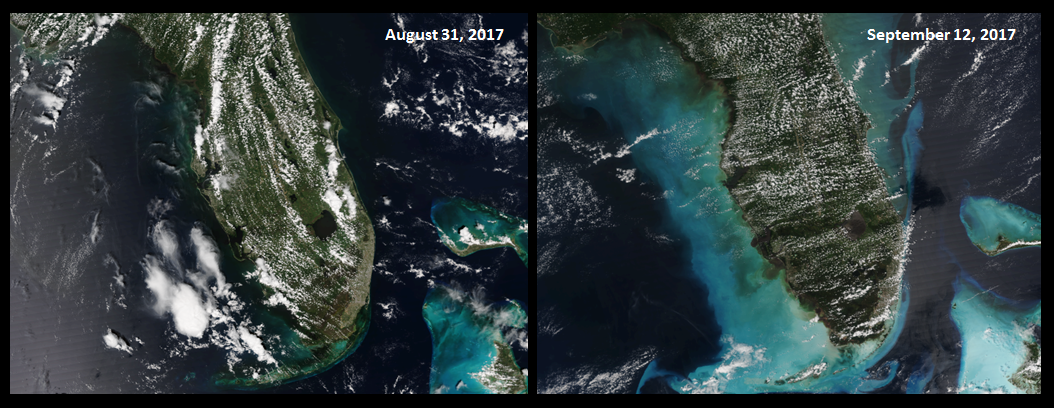
Hurricane Irma didn't just impact land. As seen in these before-and-after true-color images captured by the VIIRS…
Feature Story

If you’ve ever wondered how satellites maintain their orbit and don’t just drop out of the sky you’re not alone. It…