
Satellite Snapshots
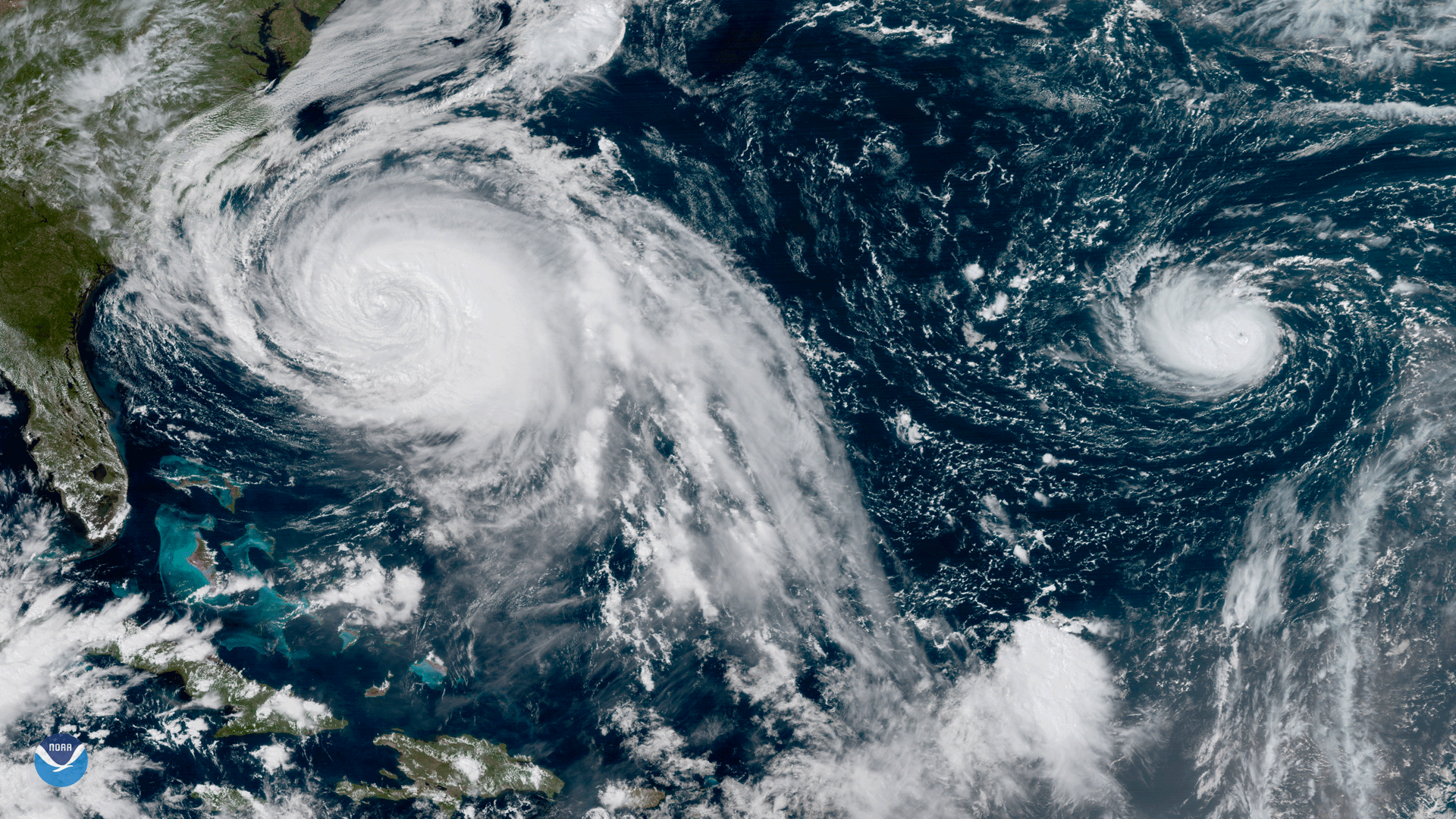
This GOES-16 geocolor image shows Hurricane Lee in the open Atlantic Ocean.
Feature Story
Although not yet operational, data from NOAA’s GOES-16 satellite proved vital in forecasting operations for Hurricane Maria as it neared Puerto Rico.
Satellite Snapshots

Scientists at the National Snow and Ice Data Center say that Arctic sea ice likely reached its minimum extent for the year, at 4…
Satellite Snapshots
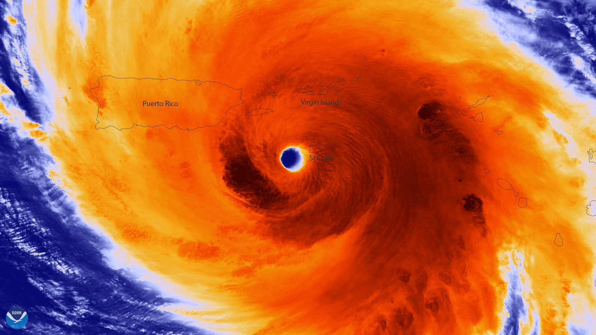
Colorized infrared image from Suomi NPP of the well-defined eye of Hurricane Maria
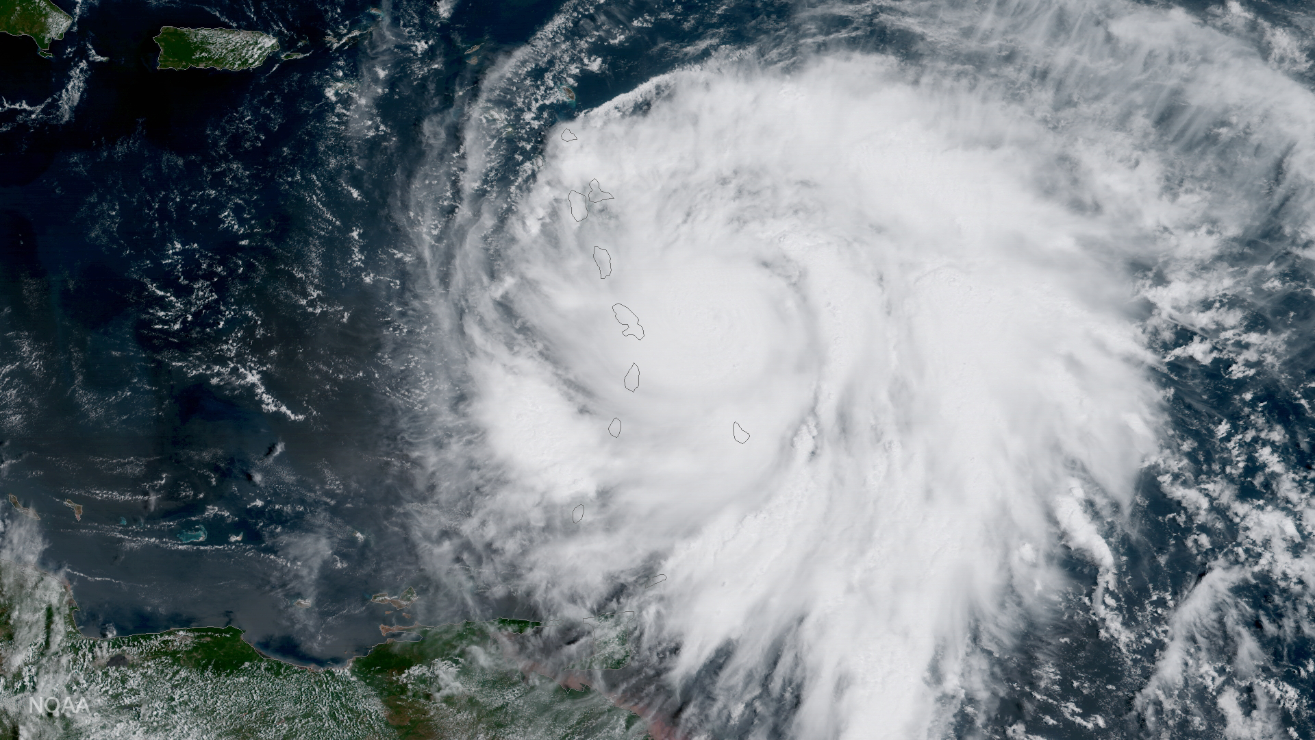
Satellite Snapshots
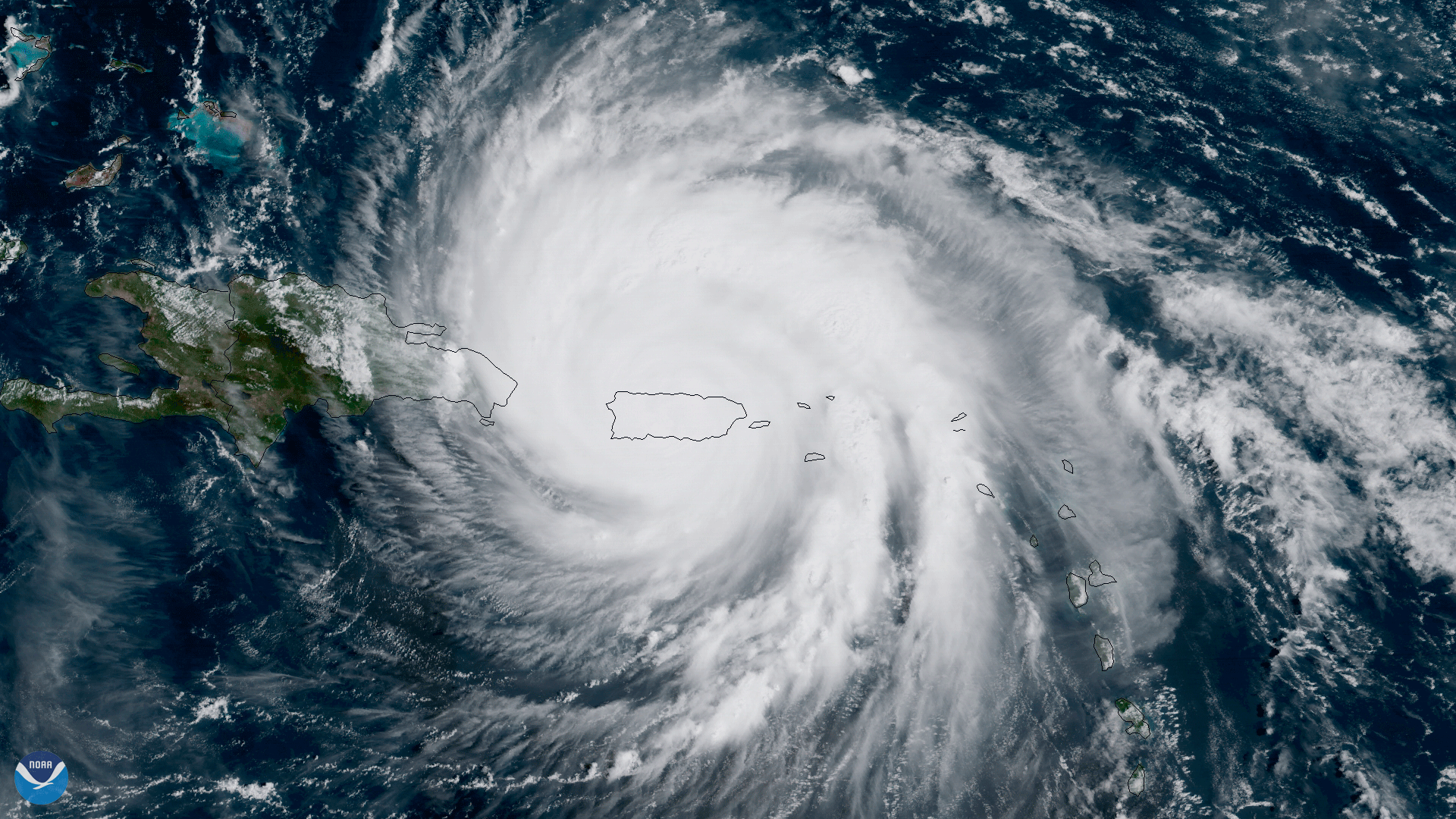
The center of Hurricane Maria approaches the northern coast of Puerto Rico in this geocolor image captured by NOAA's GOES-16.
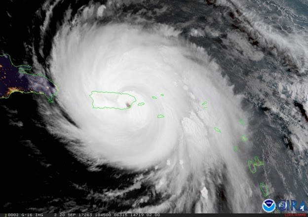
Satellite Snapshots
GOES-16 shows Hurricane Maria as it moves across the northeastern Caribbean toward the Virgin Islands.
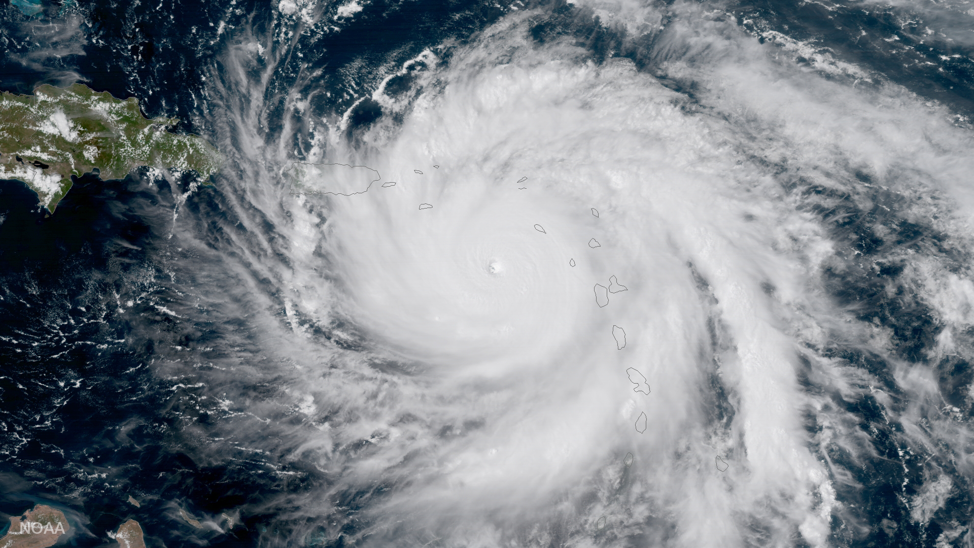
Satellite Snapshots
GOES-16 satellite captured this image of Hurricane Maria approaching the Leeward Islands.
Satellite Snapshots
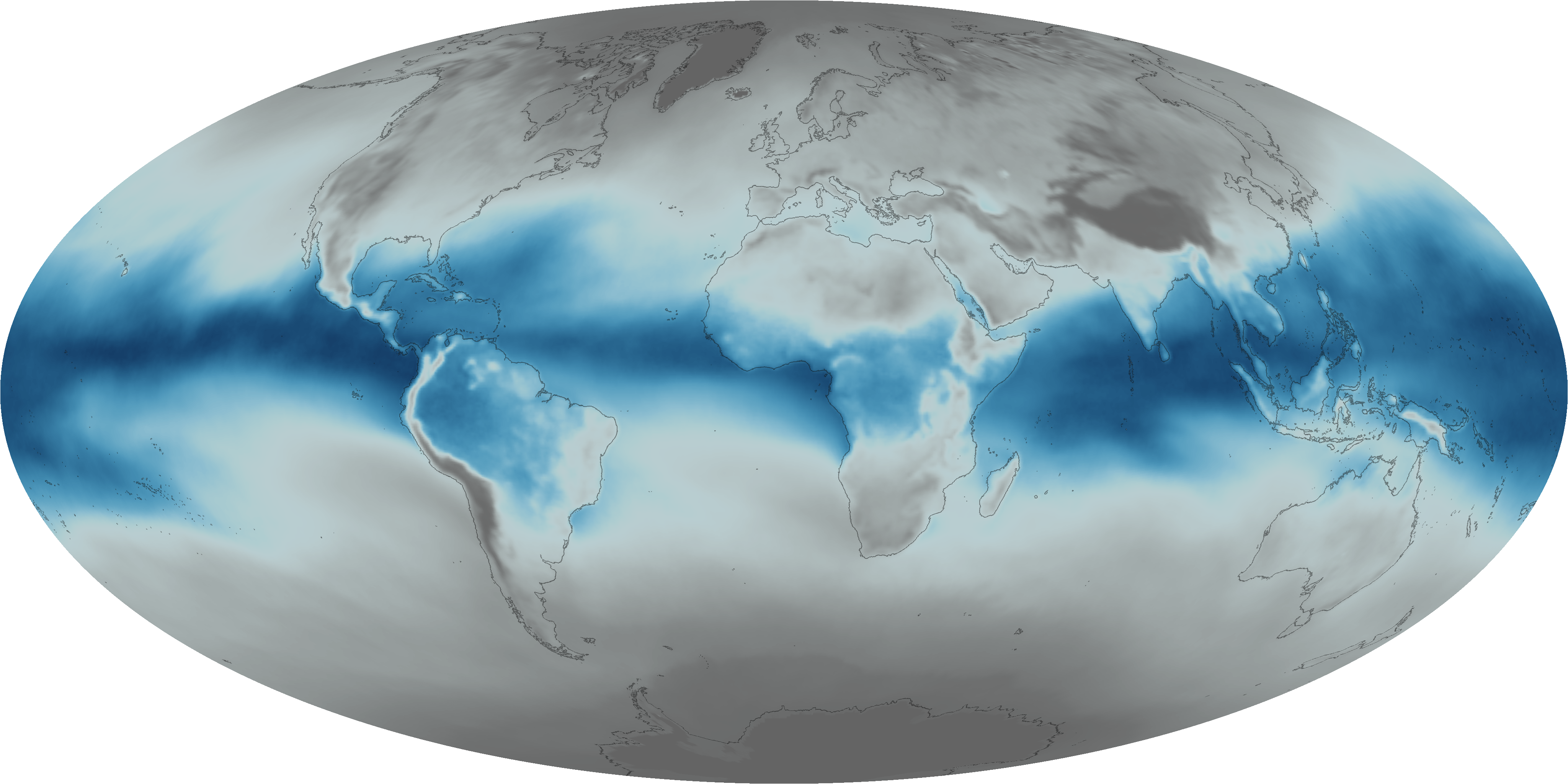
Everyday, invisible plumes of water vapor circulate through the atmosphere, and when conditions are right, they form clouds and…