
Satellite Snapshots
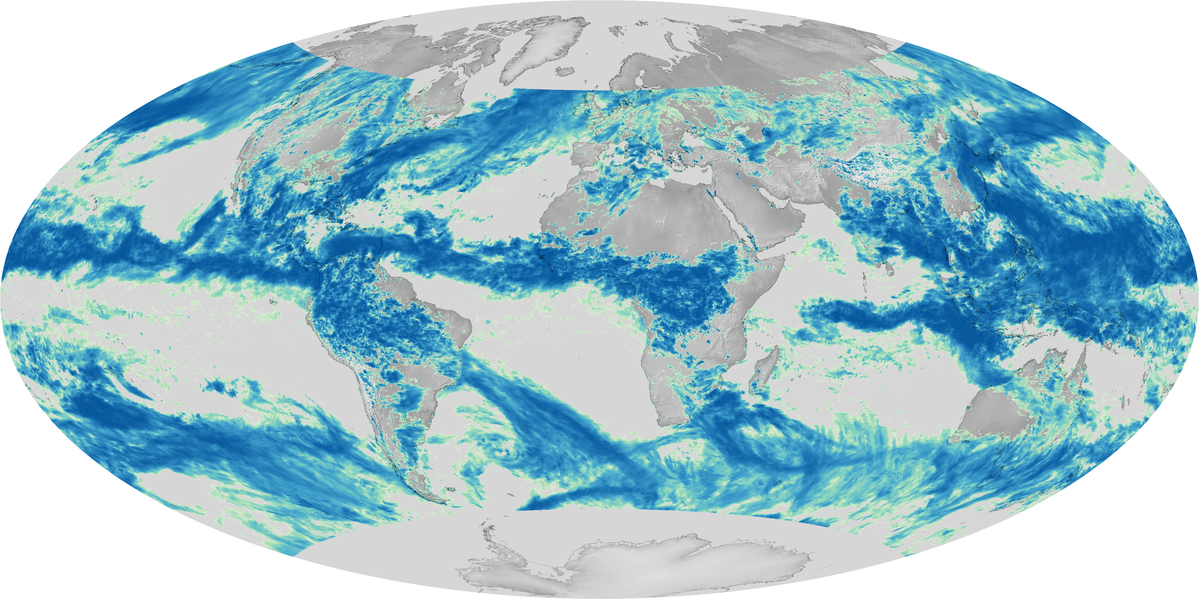
Global rainfall measurements using rain gauges are somewhat sparse, especially in less-developed areas and over the ocean. Radars…
Satellite Snapshots
This data visualization shows the maximum wind gusts from Hurricane Irma from September 7 to September 10, 2017. Note how the…
Satellite Snapshots
This data visualization shows the maximum wind gusts from Hurricane Irma from September 7 to September 10, 2017. Note how the…
Satellite Snapshots

This data visualization shows the maximum wind gusts from Hurricane Irma from September 7 to September 10, 2017. Note how the…
Satellite Snapshots
Earth absorbs energy from the Sun in the form of shortwave energy (or "radiation"), mostly in visible, near-infrared and…
Feature Story
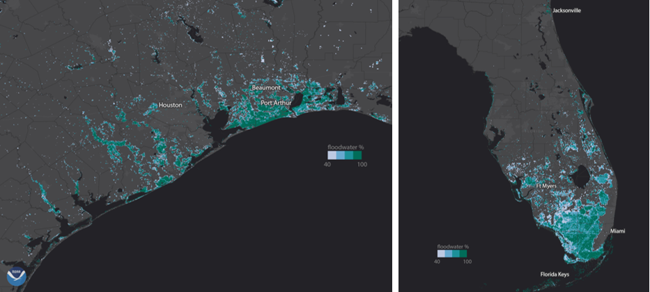
NOAA’s GOES-16 and NOAA-NASA Suomi NPP provide FEMA with the first comprehensive view of flood zones, and aircraft see the human impact
Satellite Snapshots
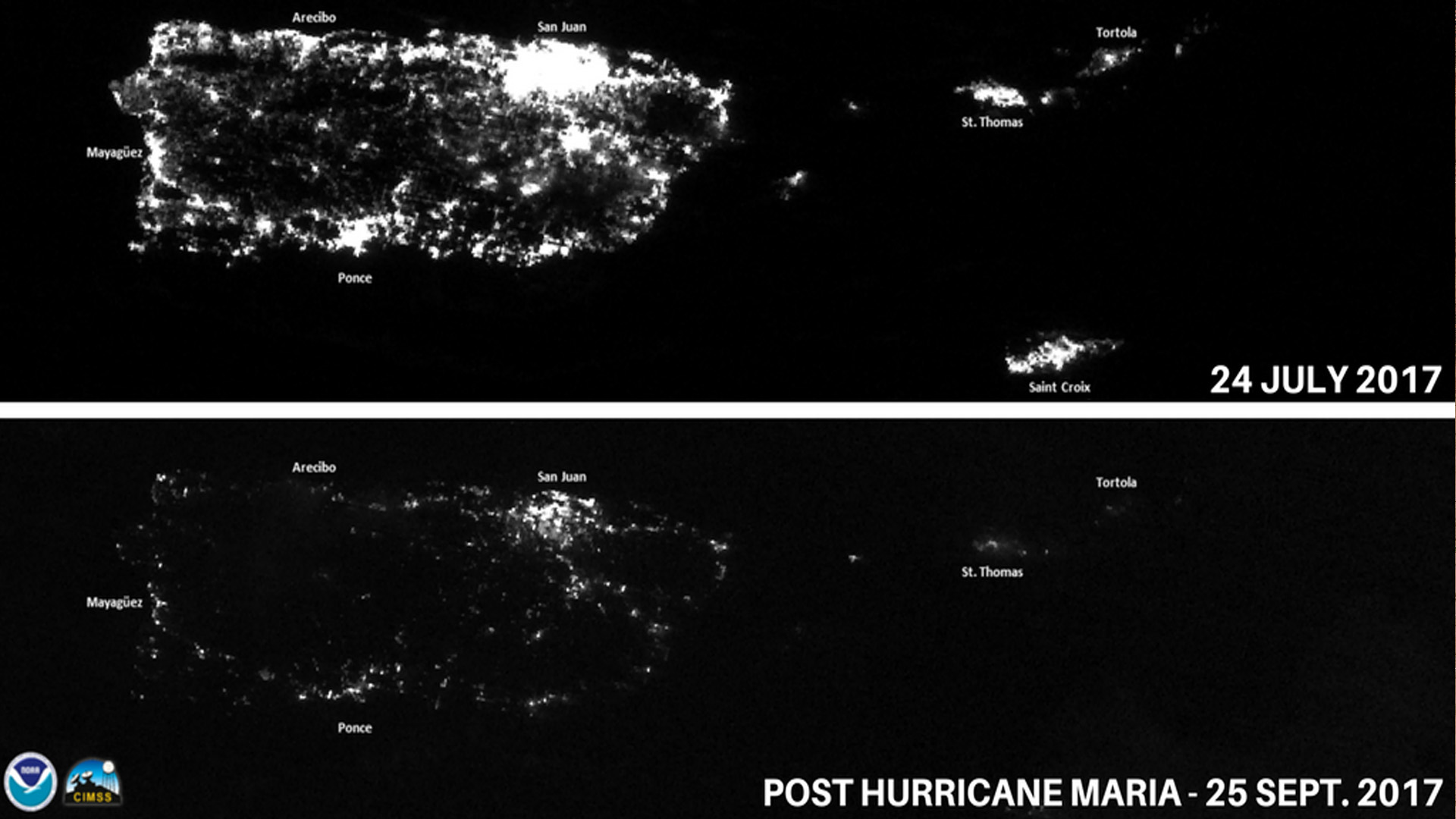
NOAA Satellites captured images of Puerto Rico after Hurricane Maria knocked out the power grid and left millions without…
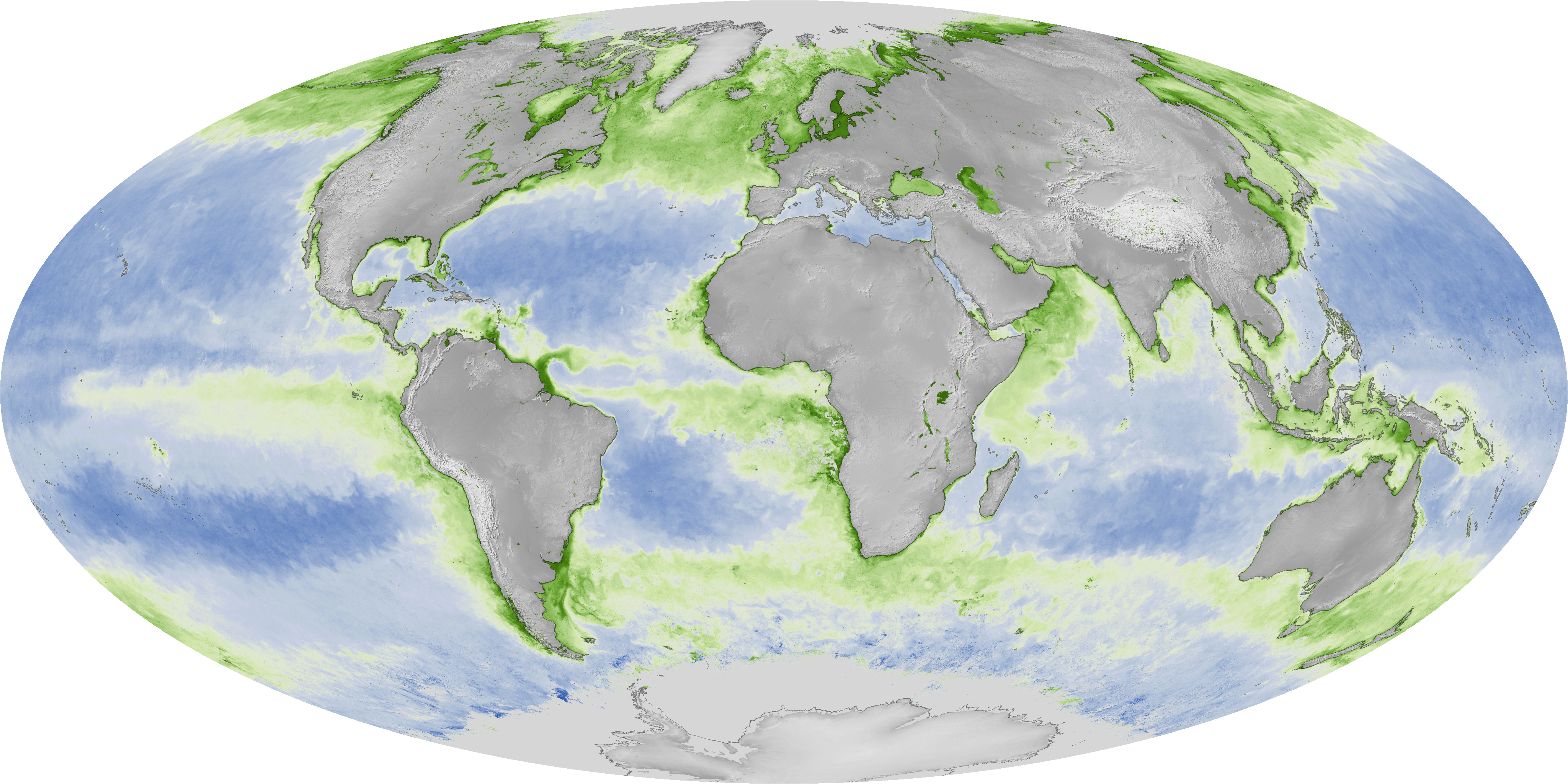
Satellite Snapshots
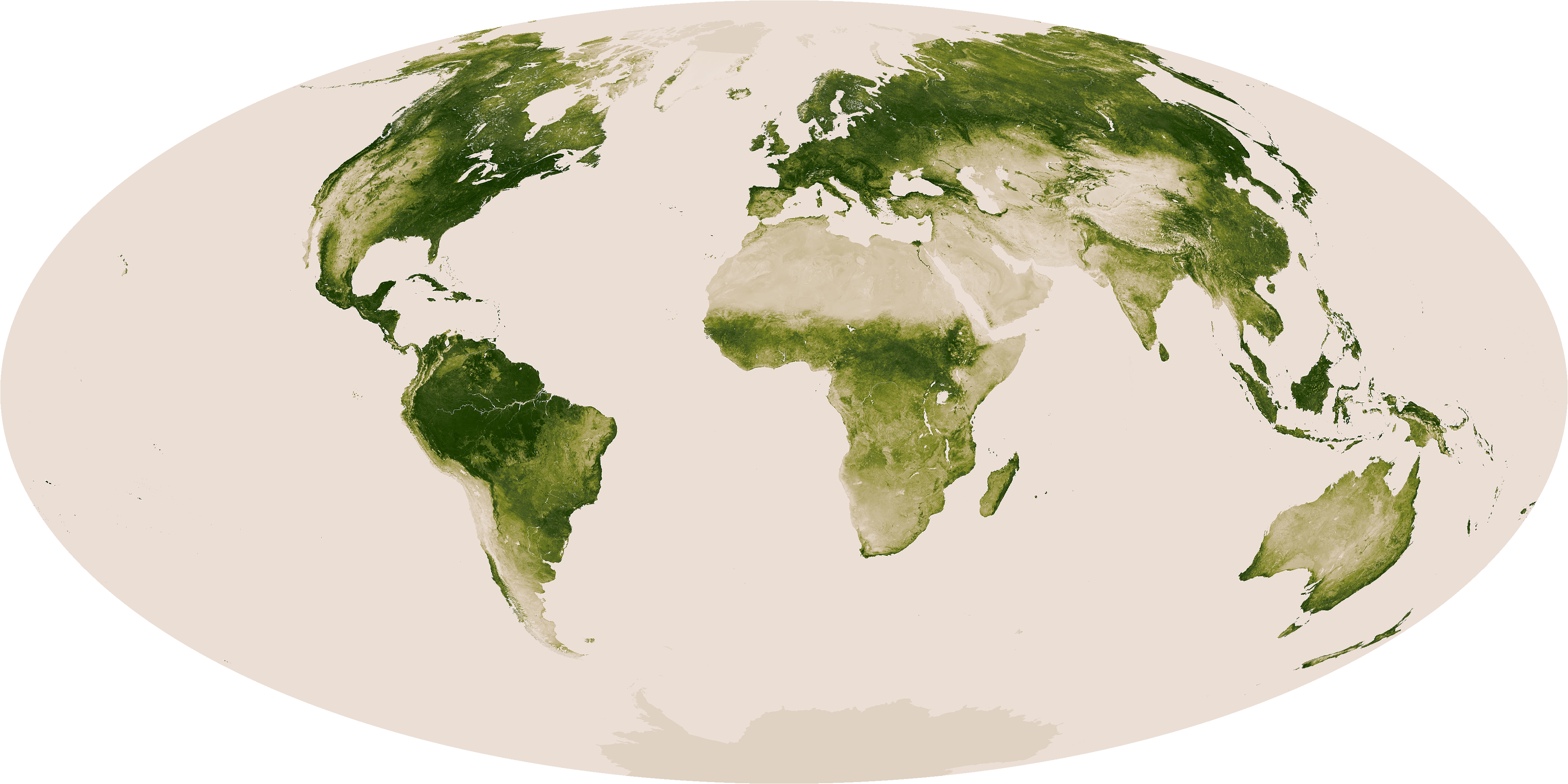
The relative greenness of the planet is shown here using a time-smoothed Normalized Difference Vegetation Index (NDVI). There are…