
Feature Story

JPSS observations enhance aviation safety by enhancing forecasts for weather and smoke, helping the FAA manage risks and minimize delays.
Feature Story

Innovative use of NOAA’s geostationary satellites (GOES) has given scientists a new way to detect large methane emissions faster and more accurately.
Announcement
NASA, on behalf of NOAA, has selected Johns Hopkins’ Applied Physics Laboratory, to build the Suprathermal Ion Sensors for the Lagrange 1 Series project, part of NOAA’s Space Weather Next Program.
Earth from Orbit
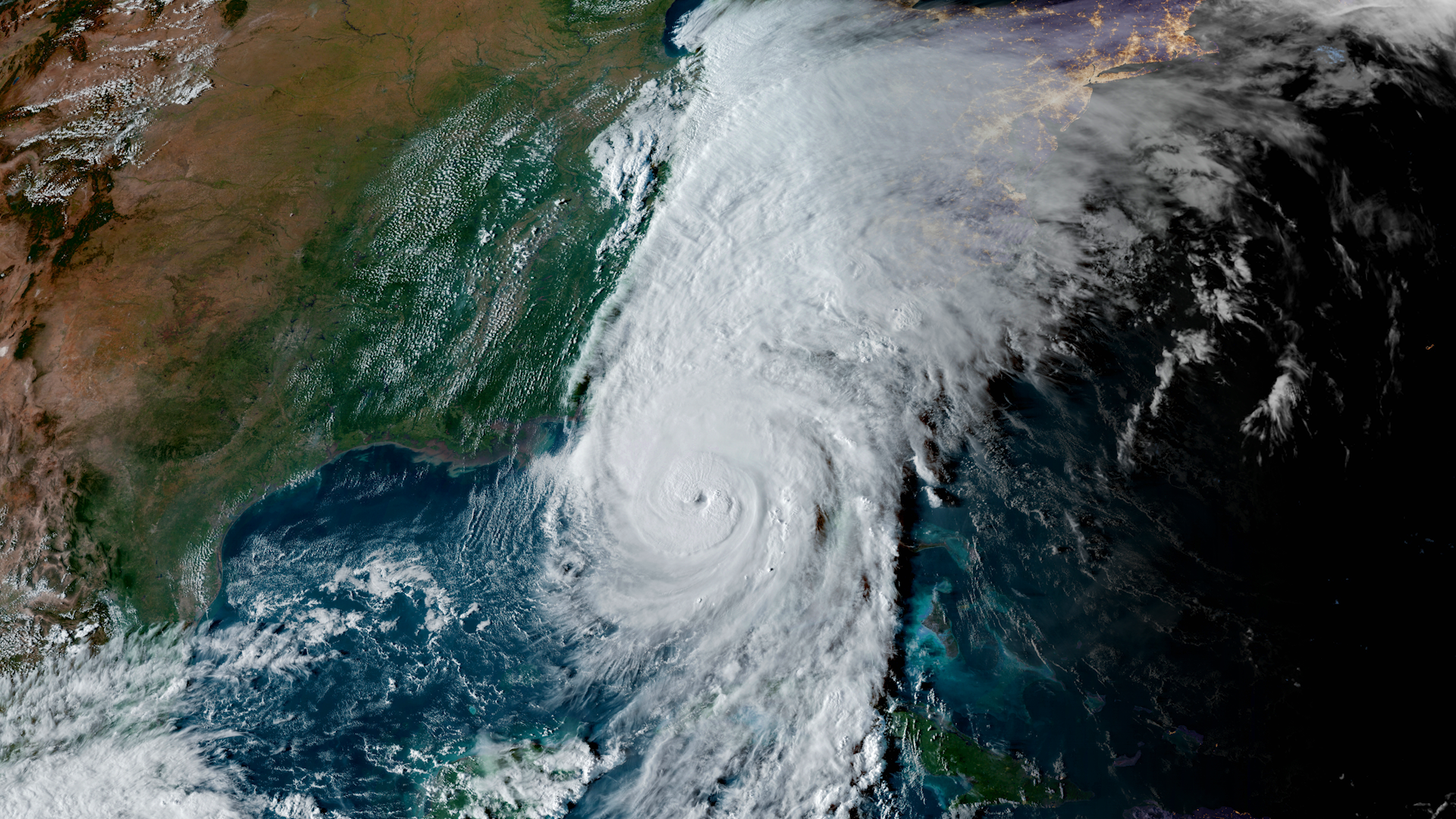
NOAA satellites constantly monitor the ocean for tropical activity. As the 2024 Atlantic hurricane season comes to a close on Nov. 30, we’re looking back at its above-average activity, with a record breaking ramp up following a peak-season lull.
Satellite Snapshots

NOAA’s GOES West satellite captured enhanced color imagery of a powerful mid-latitude cyclone and atmospheric river impacting northern California, the Pacific Northwest, and British Columbia.
Announcement
On behalf of NOAA, NASA has selected Southwest Research Institute of San Antonio to build three coronagraphs for the Lagrange 1 Series project, part of NOAA’s Space Weather Next program.
Feature Story
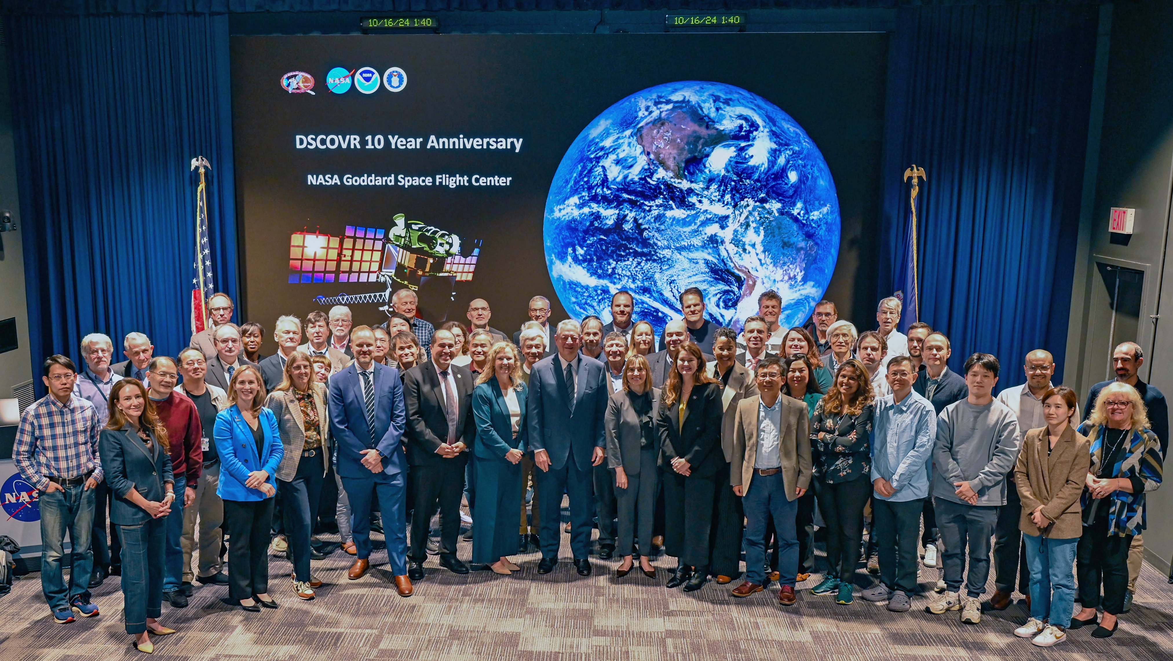
On Oct. 16, 2024, NASA’s Goddard Space Flight Center in Greenbelt, Maryland celebrated an early 10 year anniversary of NOAA’s Deep Space Climate Observatory (DSCOVR).
Earth from Orbit

NOAA recently unveiled the first images from the Compact Coronagraph (CCOR-1) and the Solar Ultraviolet Imager (SUVI), two advanced instruments onboard the GOES-19 satellite, which launched on June 25, 2024. These tools are set to revolutionize…