
Satellite Snapshots
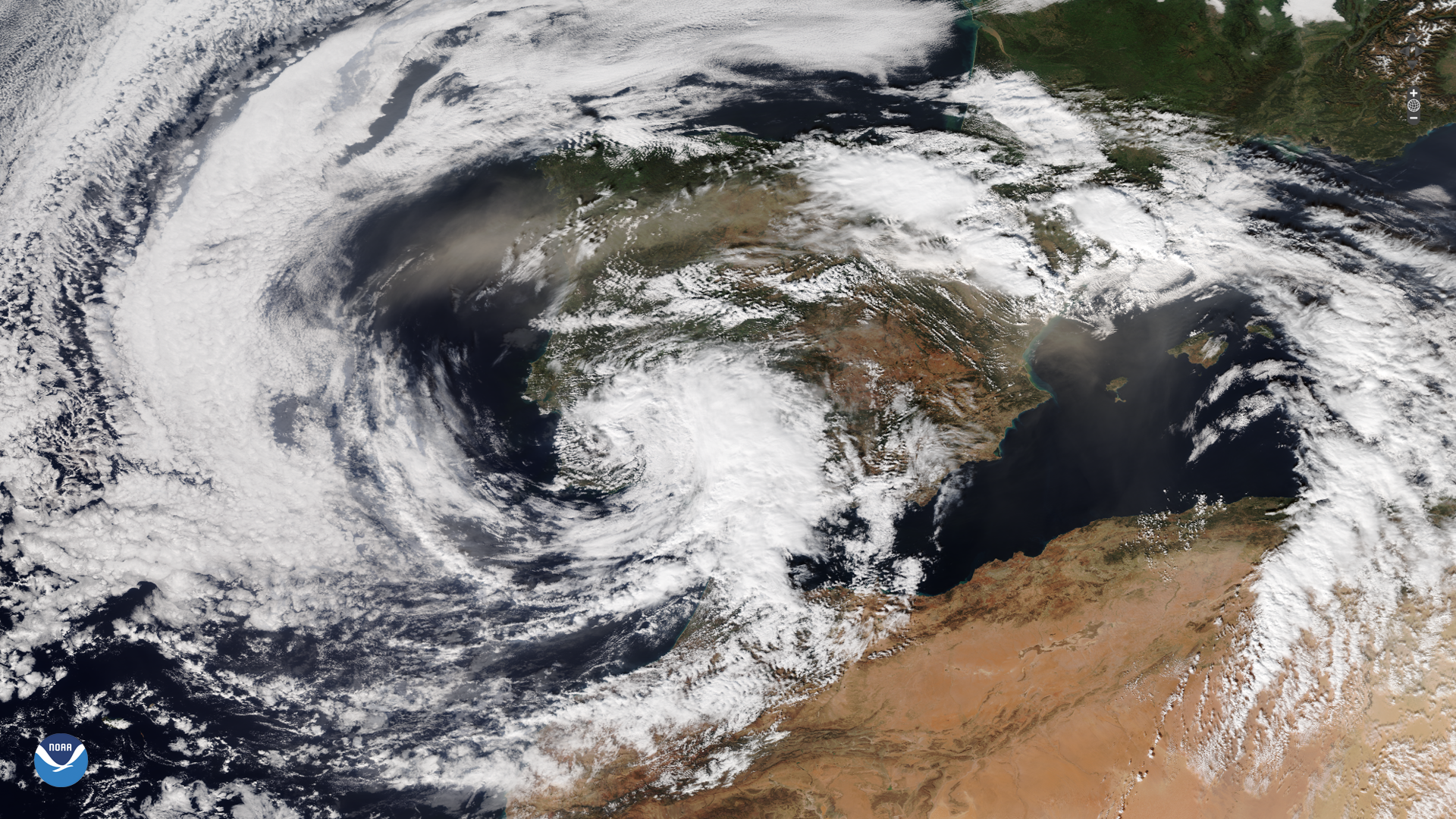
A powerful storm struck parts of Spain on Tuesday, Oct. 29, 2024, which brought severe flooding.
Feature Story
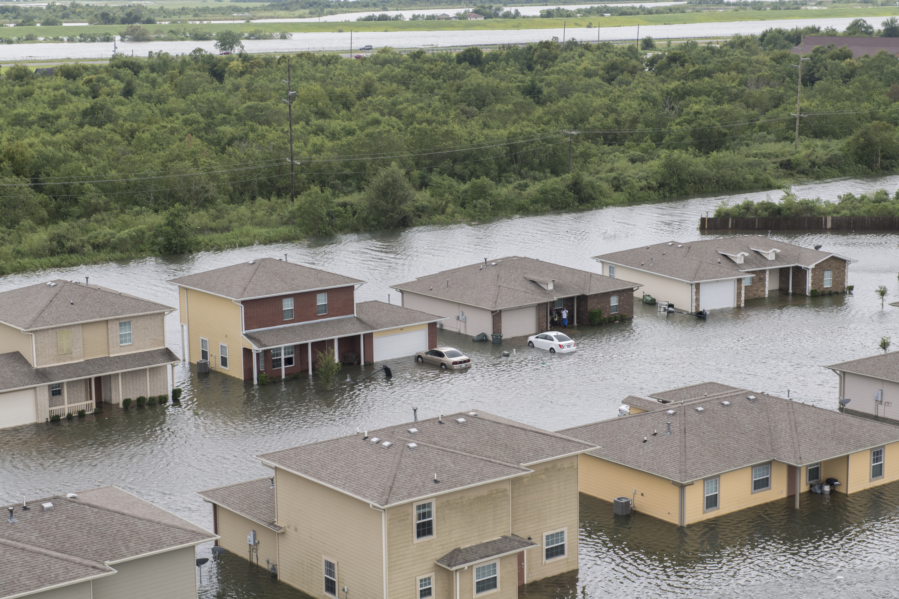
As climate change increases flood risks, accurate forecasting and resilience tools are more essential than ever.
Feature Story

As climate-driven floods intensify, VIIRS provides near real-time data to bolster global preparedness and protect vulnerable communities.
Announcement

The Solar Ultraviolet Imager (SUVI) onboard NOAA’s GOES-19 satellite, which launched on June 25, 2024, began observing the sun on Sept. 24, 2024.
Announcement
NASA, on behalf of NOAA, has selected the University of New Hampshire in Durham to build Solar Wind Plasma Sensors for the Lagrange 1 Series project, part of NOAA’s Space Weather Next Program.
Announcement
NOAA has shared the first images from the Compact Coronagraph (CCOR-1), a powerful solar telescope onboard the new GOES-19 satellite.
Feature Story
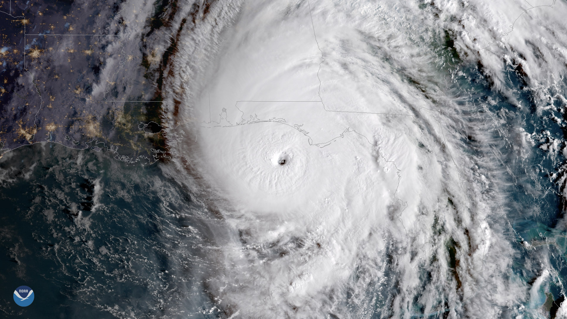
Late October has occasionally produced devastating hurricanes that have hit the United States and elsewhere.
Earth from Orbit
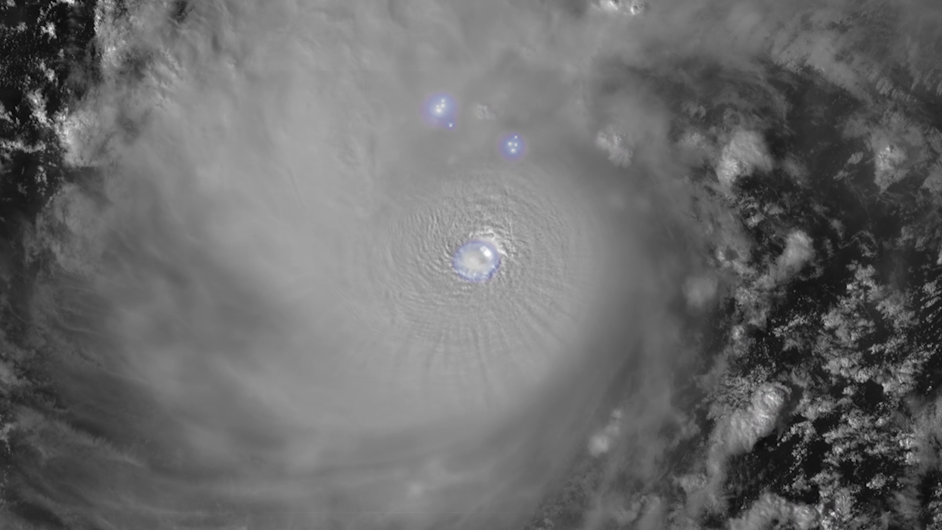
The Geostationary Lightning Mapper (GLM) instrument, onboard NOAA’s GOES-19 satellite, is now continuously observing lightning over the Western Hemisphere. GOES-19 launched on June 25, 2024.