
Satellite Snapshots
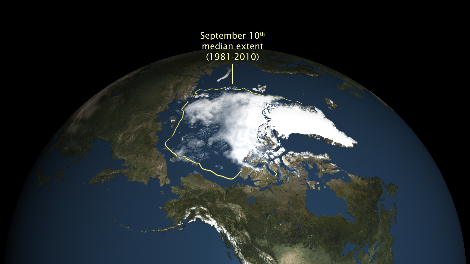
The sea ice extent shrank to 4.14 million square kilometers (1.60 million square miles). The National…
Satellite Snapshots
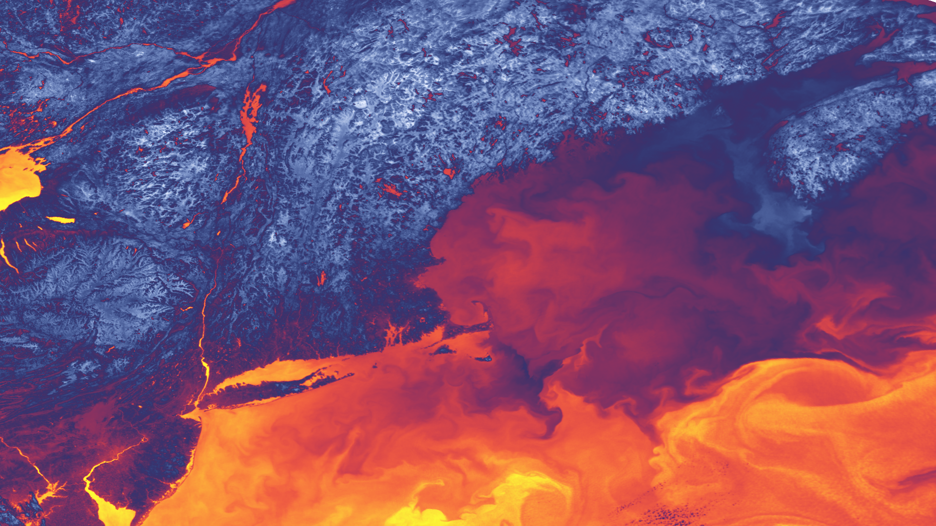
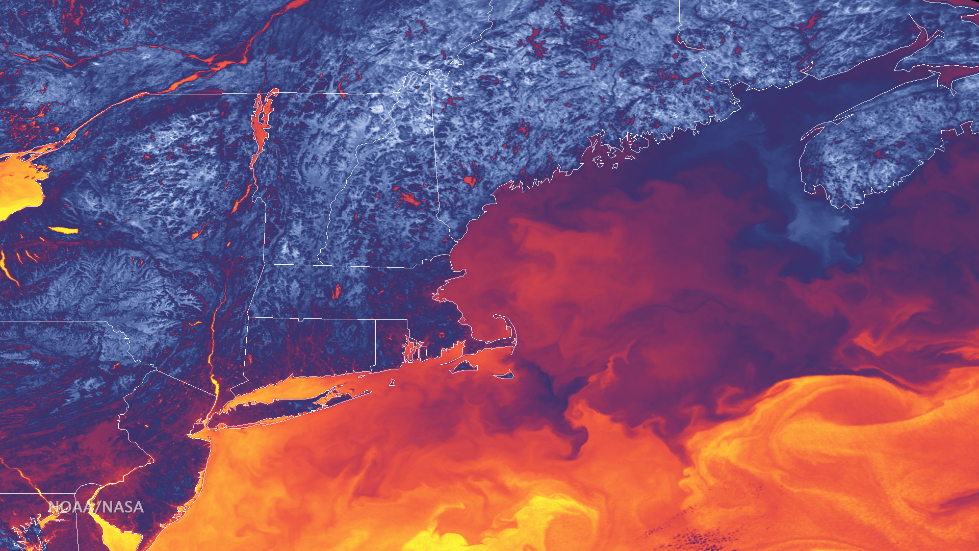
This image, captured on September 13, 2016, shows the difference in "skin temperature" -- the heat reflected off the Earth's…
Satellite Snapshots
Satellite instruments, like the Visible Infrared Imaging Radiometer Suite (VIIRS) aboard the NOAA/NASA Suomi NPP satellite, can…
Feature Story

Are you passionate about all things space, satellites and social media? Then this is the event for you. Don’t miss this…
Feature Story
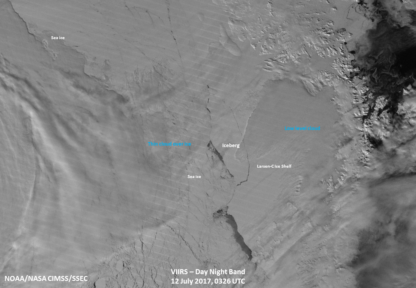
As expected, the Larsen C ice shelf calved a large iceberg estimated to have a volume twice that of Lake Erie.
Satellite Snapshots

The temperature of ocean surface waters affects many aspects of weather and climate around the globe. NOAA’s satellites take…
Feature Story
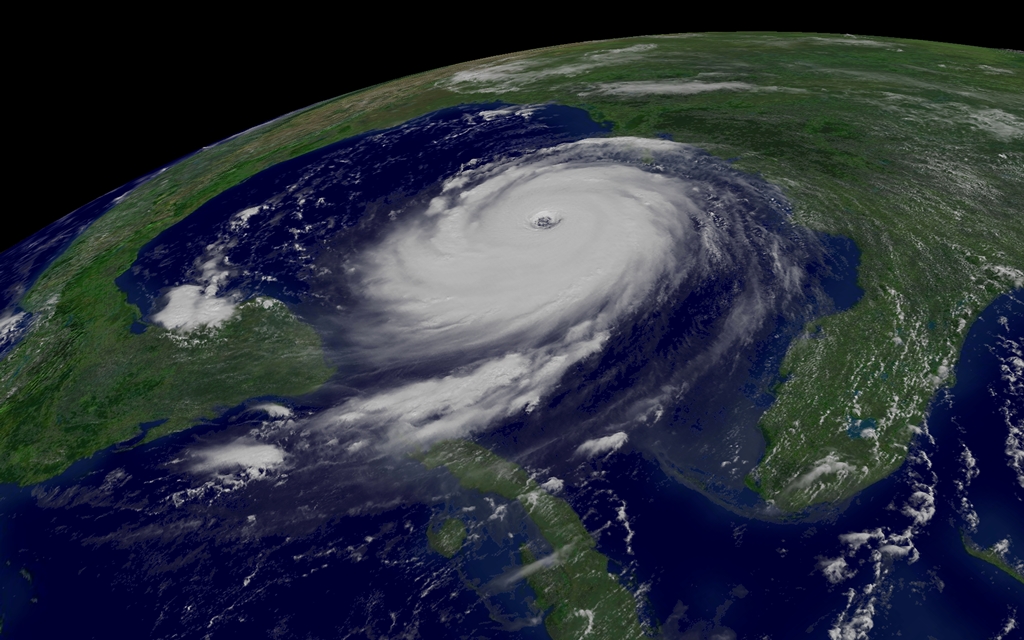
Eleven years ago, Hurricane Katrina made landfall on August 29, 2005, ravaging the U.S. Gulf Coast. Although NOAA provided an…
Feature Story

Have you ever wondered why satellites appear to be covered in gold or silver foil? Here's your answer!