
Feature Story
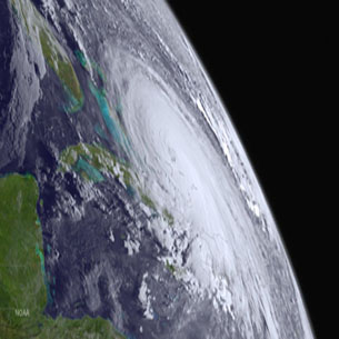
March 4, 2016, was the 6th anniversary of the launch of GOES-P (now GOES-15), one of NOAA’s Eyes in the Sky for the Western Hemisphere.
Feature Story

Why do satellites look like that? Understanding the odd shapes and sizes of these precision machines! The JPSS-1 satellite…
Feature Story
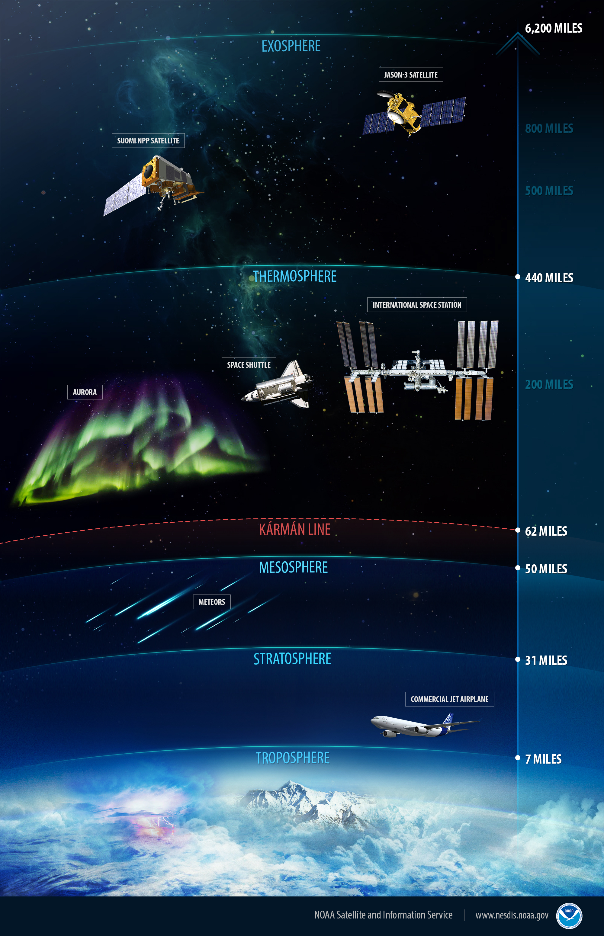
Earth's atmosphere contains the air we breathe, the weather we experience and is our natural shield against the harsh conditions of space.
Feature Story

While it may “come in on little cat feet,”unexpected areas of fog can drastically reduce visibility, creating dangerous…
Feature Story
Polar-orbiting weather satellites are essential assets that provide data that enable forecasters to make more accurate weather predictions three to se
Satellite Snapshots
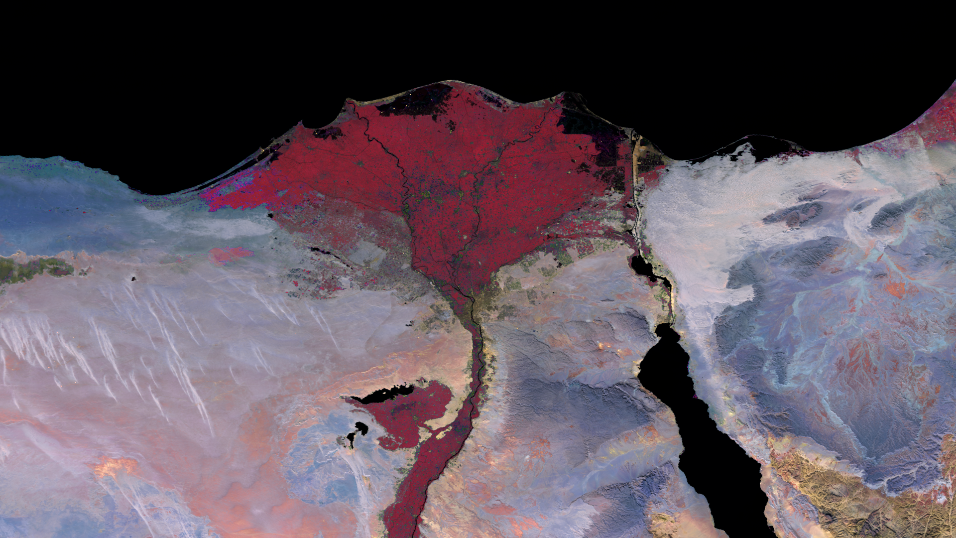
he Nile River, typically seen as a lush green river valley and delta amongst the sands of Africa, is seen here in violent red…
Feature Story

The successful launch of Jason-3 on January 17, 2016, was a major accomplishment for the Jason mission, but it is by no means the end of the road. On
Feature Story
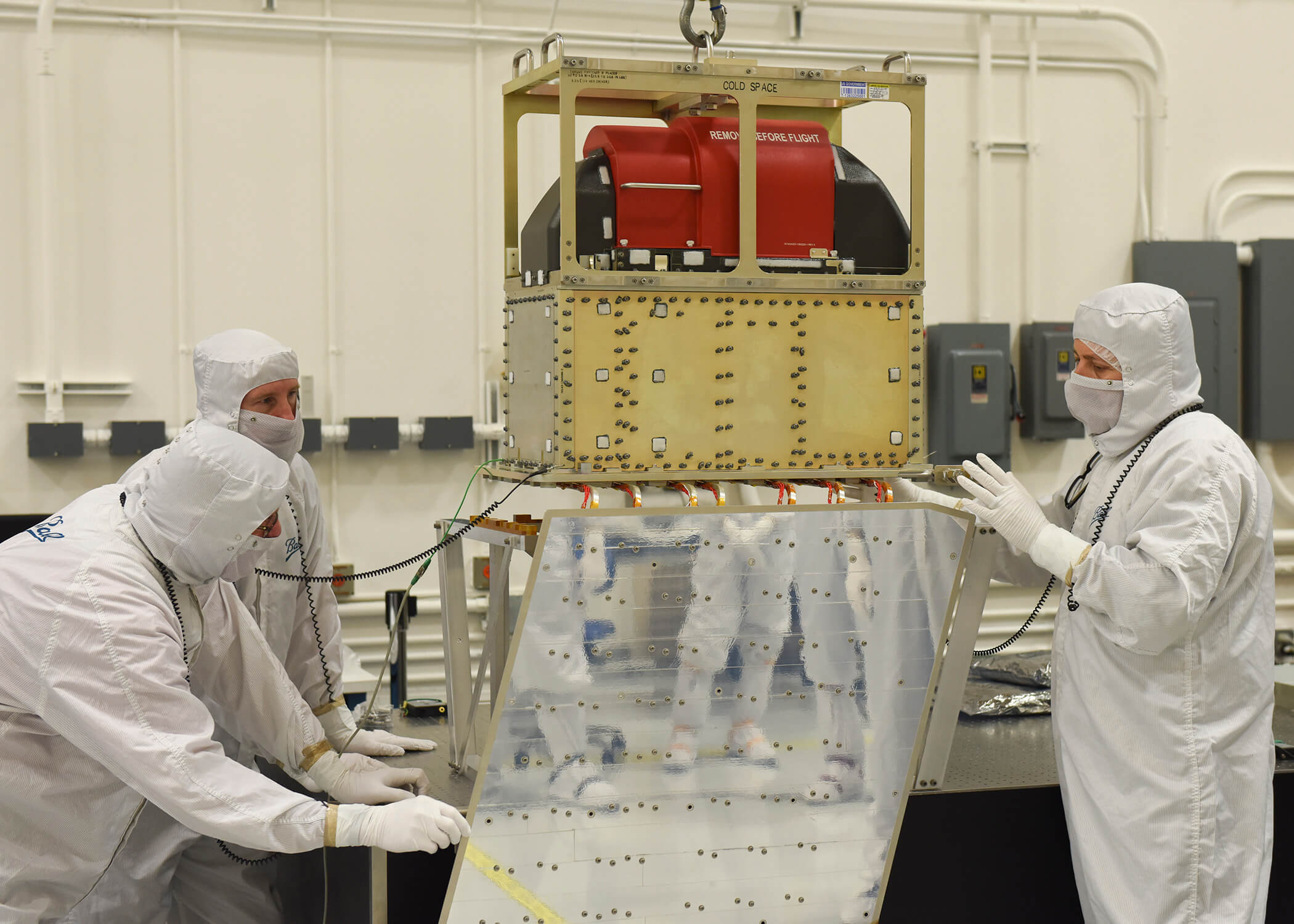
The final instrument to be integrated with NOAA’s Joint Polar Satellite System-1 (JPSS-1) satellite is now complete, moving the spacecraft development