
Announcement
NASA has selected Firefly Aerospace, Inc. of Cedar Park, Texas, to provide launch services for NOAA’s QuickSounder mission.
Feature Story

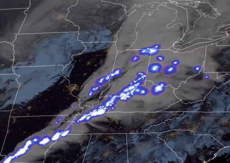
The USDA uses the Vegetation Health Index (VHI) generated with VIIRS data to enhance crop monitoring and analysis.
Announcement
On Sept. 13, NOAA awarded Knowledge Mesh/Natural Language Processing (KM/NLP) contracts with a cumulative value of $5.4 million to four companies.
Announcement
On September 17, 2024, NOAA awarded contracts totaling $4,266,400 to purchase Microwave Sounder (MWS) data from two commercial satellite companies in support of new Commercial Weather Data Pilot (CWDP) studies.
Earth from Orbit

On Sept. 18, 2024, NOAA shared the first images of the Western Hemisphere from its GOES-19 satellite. The satellite’s Advanced Baseline Imager (ABI) instrument recently captured stunning views of Earth.
Announcement
NASA, on behalf of NOAA, has selected Lockheed Martin Corp. to develop a lightning mapping instrument as part of NOAA’s Geostationary Extended Observations (GeoXO) satellite program.
Earth from Orbit
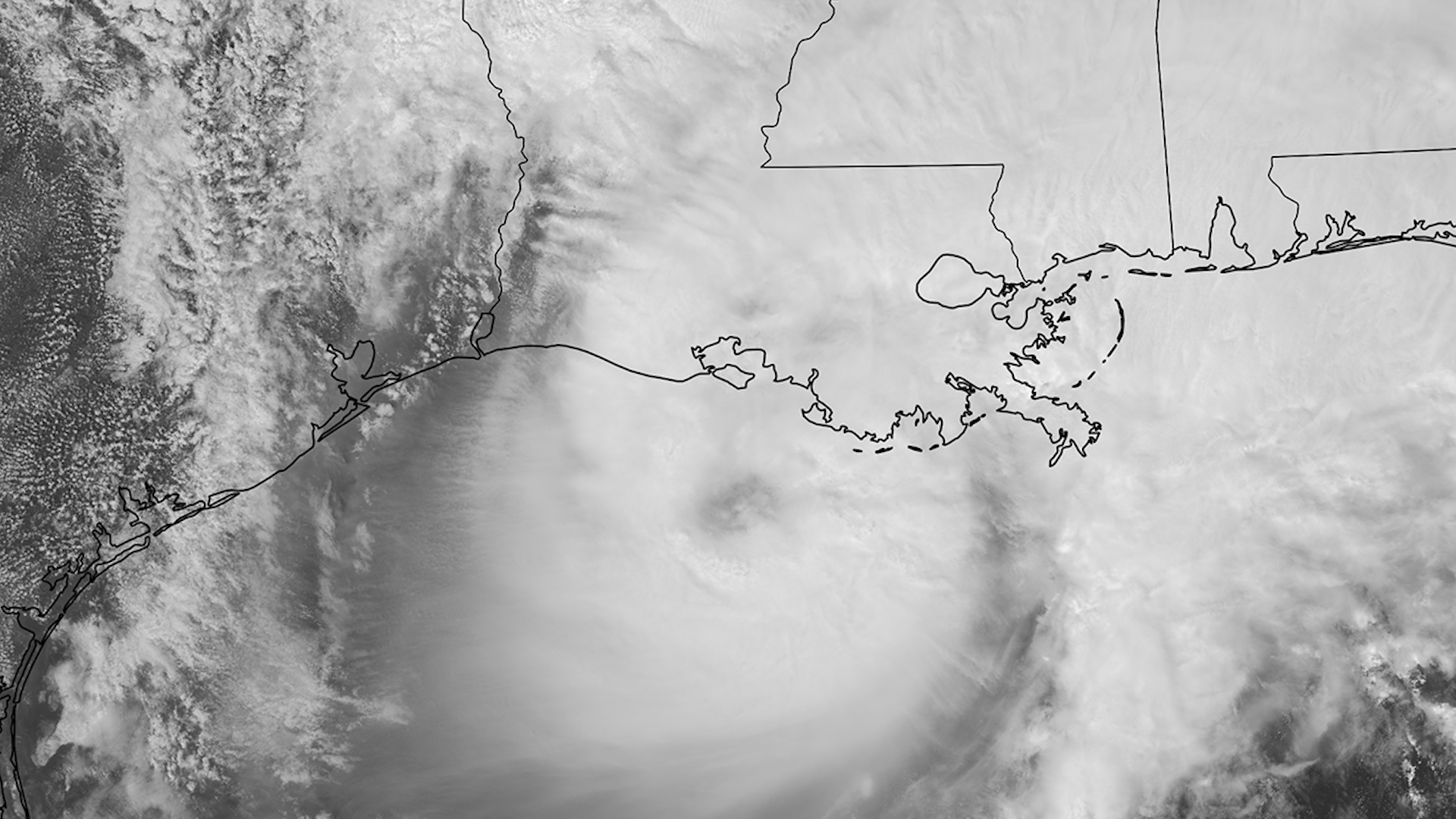
NOAA satellites have been closely tracking Tropical Storm Francine since it formed in the southwestern Gulf of Mexico over the weekend. Initially designated as Potential Tropical Cyclone Six on Sept. 8, 2024, it strengthened into a tropical storm…
Announcement
On September 4, 2024, the NOAA Commercial Data Program awarded its fourth Delivery Orders under the Radio Occultation Data Buy II (RODB-2) Indefinite Delivery/Indefinite Quantity (IDIQ) contract.