
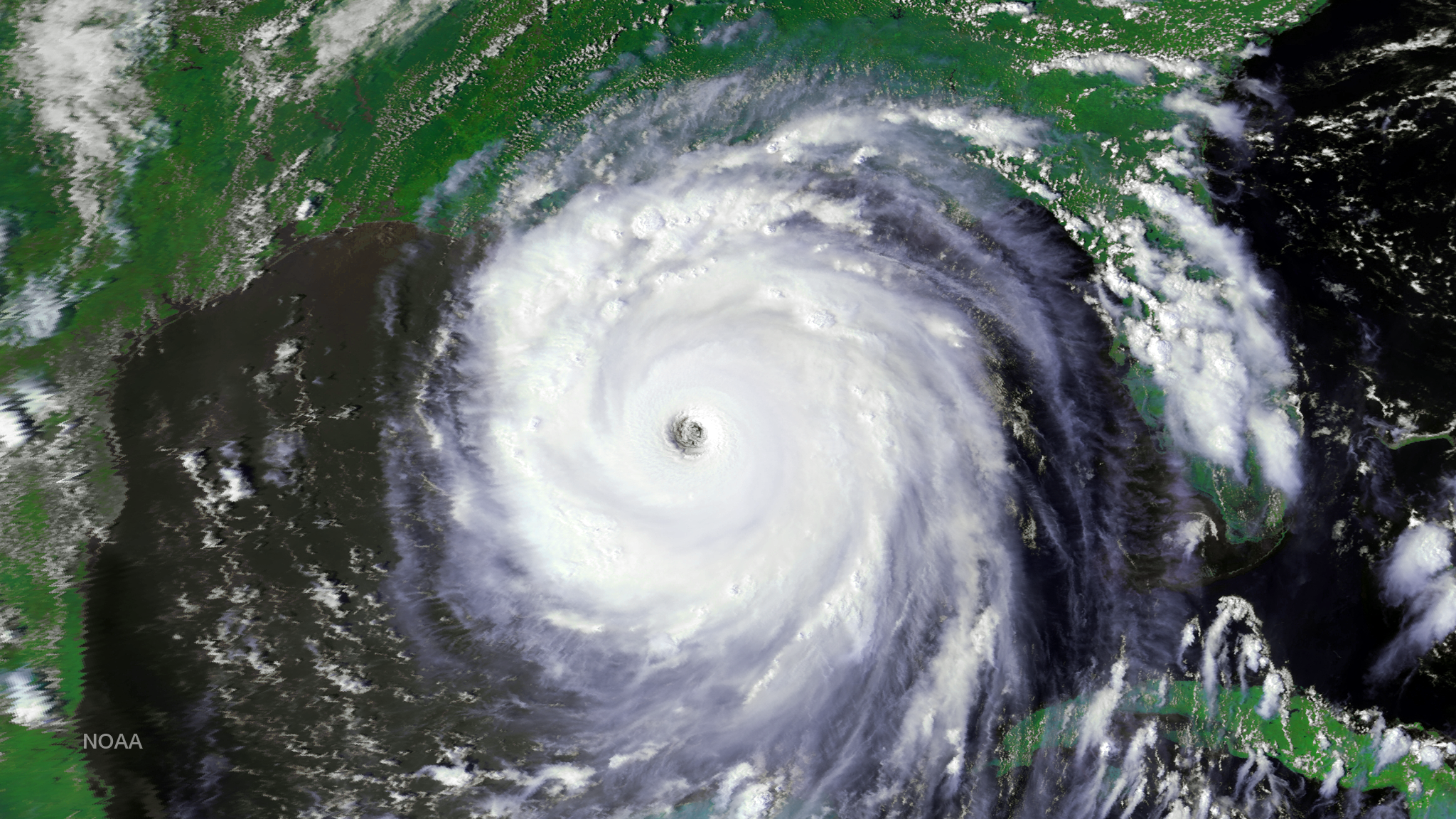
Satellite Snapshots
After more than 13 years of helping to predict weather and climate patterns and save lives in search and rescue operations, NOAA…
Feature Story
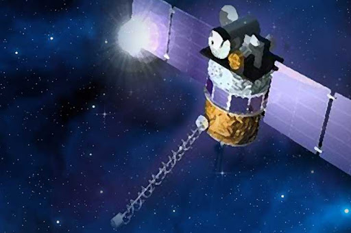
With the launch of the Deep Space Climate Observatory (DSCOVR) satellite mission in early 2015, the United States will extend its ability to give accu
Feature Story
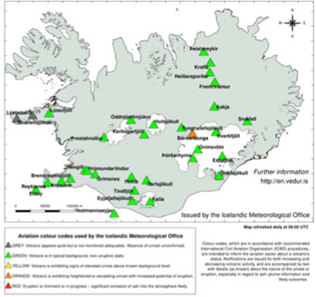
An aviation "orange" alert was posted on August 18, 2014, for Bárðarbunga, a stratovolcano located under the Vatnajökull glacier in Iceland, indicatin
Feature Story
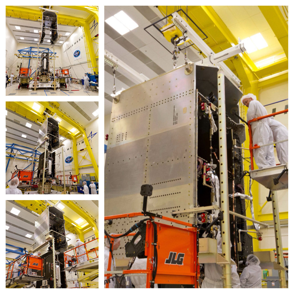
The GOES-R satellite System Module and Core Module subassemblies were successfully mated and now form the GOES-R spacecraft.
Feature Story
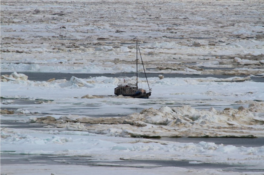
Alaskans are no stranger to dangerous jobs. Commercial fishing is continually ranked as the most dangerous job in America and commercial pilots.
Feature Story
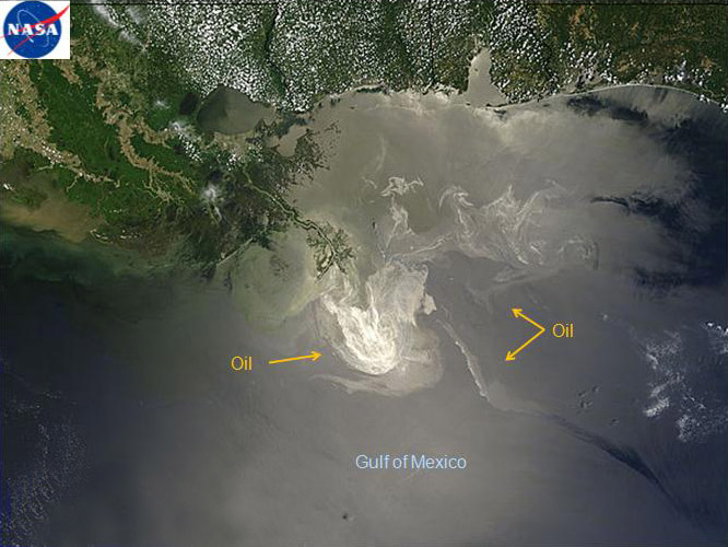
NOAA's satellites are now among the many vehicles used to provide scientific support during the assessment, response and…
Satellite Snapshots
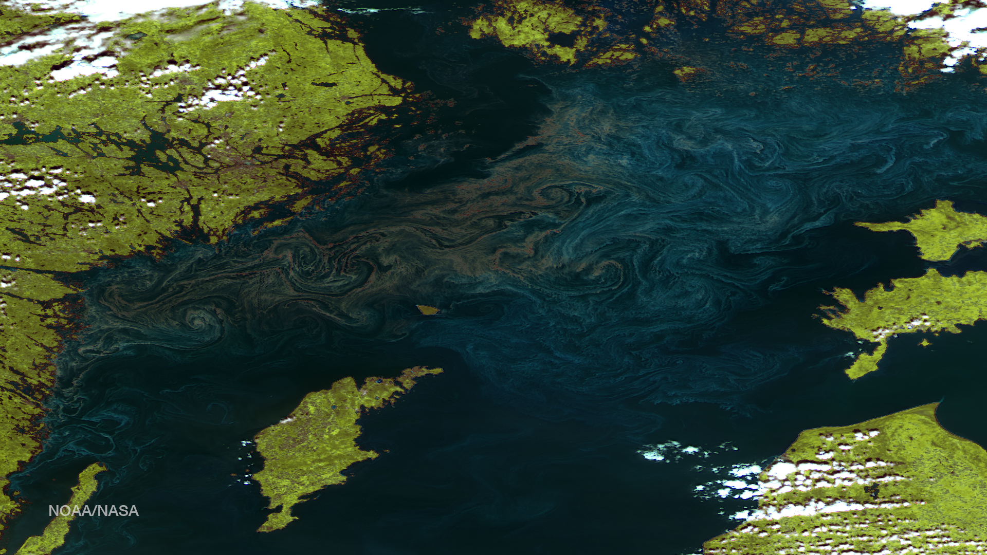
While the USGS/NASA Landsat satellite mission has taken amazing images over the last 44 years, the satellite, with its high resolution…
Feature Story
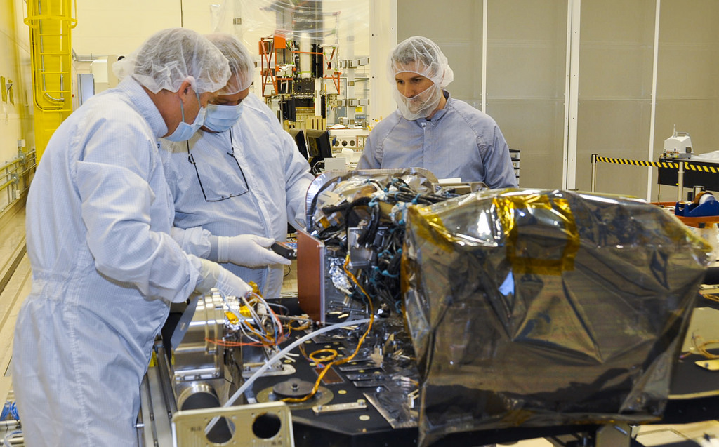
Two of the six instruments that will fly on the first Geostationary Operational Environmental Satellite-R.