
Satellite Snapshots
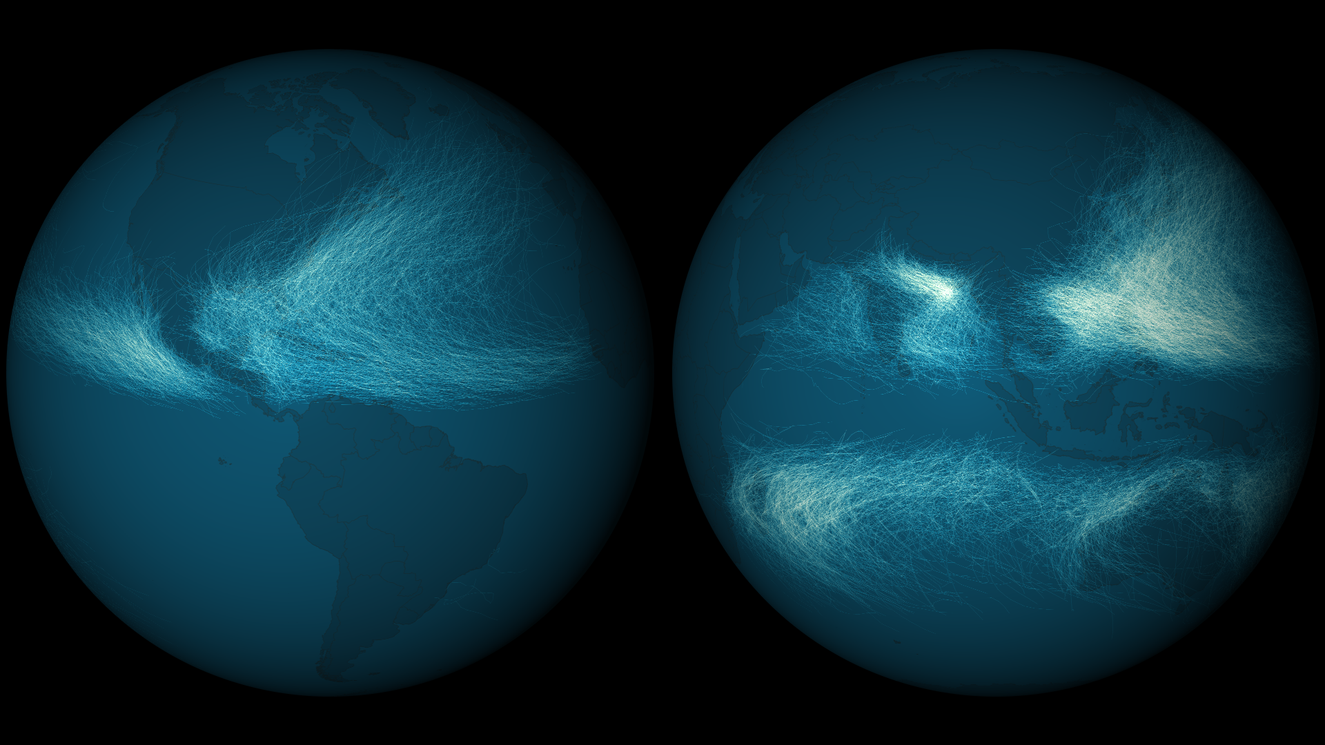
Tropical cyclones form in most ocean basins – some more frequently than others. Before the advent of the satellite era, hurricane…
Satellite Snapshots
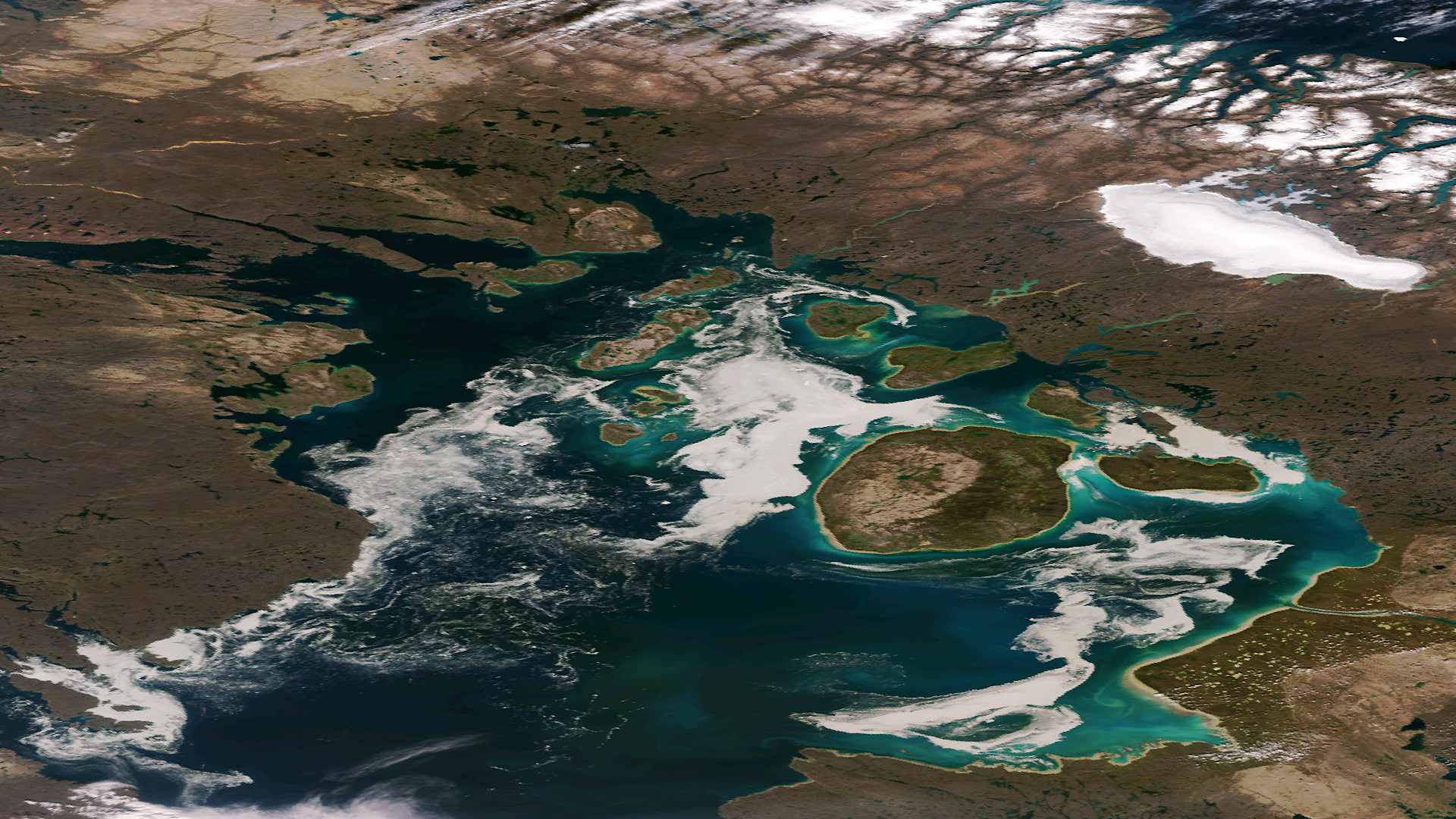
The remnants of sea ice along the Northwestern Passage in northern Canada are seen swirling with the blue green of phytoplankton in…
Satellite Snapshots

Super Typhoon Haiyan has traversed the Philippines and has entered the South China Sea. This animation shows a combination of visible and infrared…
Satellite Snapshots
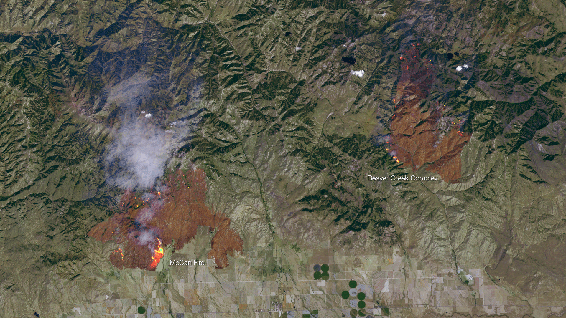
Taken on August 10th, 2013 by the Landsat-8 satellite, this image shows the active fire areas along with burn scars for the McCan and…
Feature Story
A powerful sensor onboard the Suomi NPP satellite played a critical role in locating the position of Tropical Storm Flossie.
Satellite Snapshots
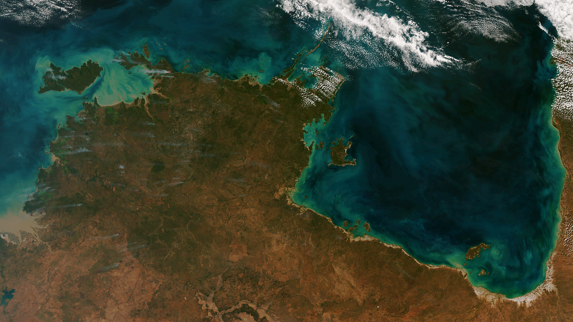
The Suomi NPP satellite captured an amazing image of northern Australia on June 25, 2013. Dozens of wildfires release wisps of smoke…
Satellite Snapshots

Although 75% of the planet is a relatively unchanging ocean of blue, the remaining 25% of Earth's surface is a dynamic green. Data from the NASA/NOAA…
Satellite Snapshots
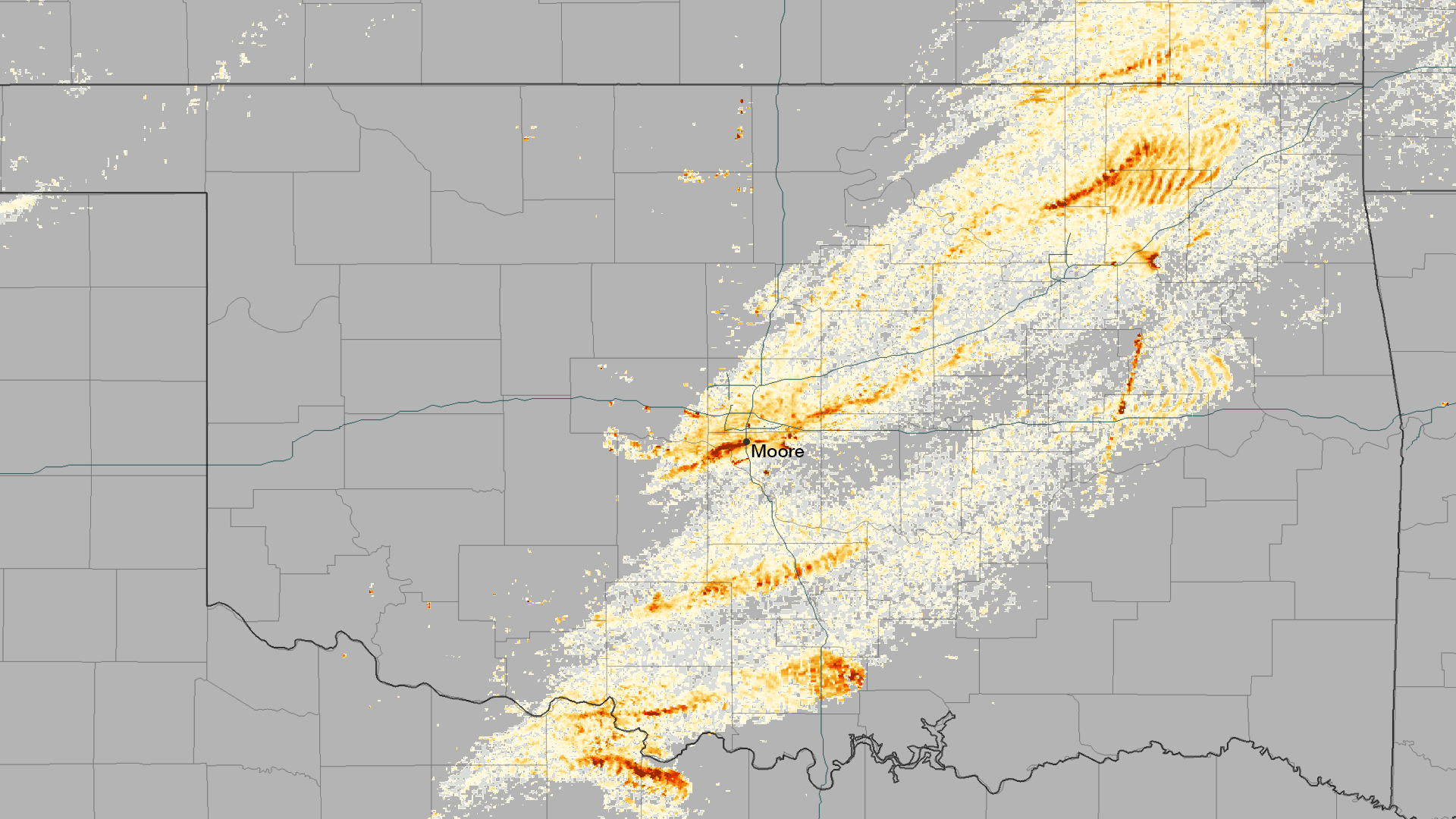
The rotation of tornadoes creates a distinctive signature in radar data, and can be used to estimate the track that the system takes…