
Satellite Snapshots
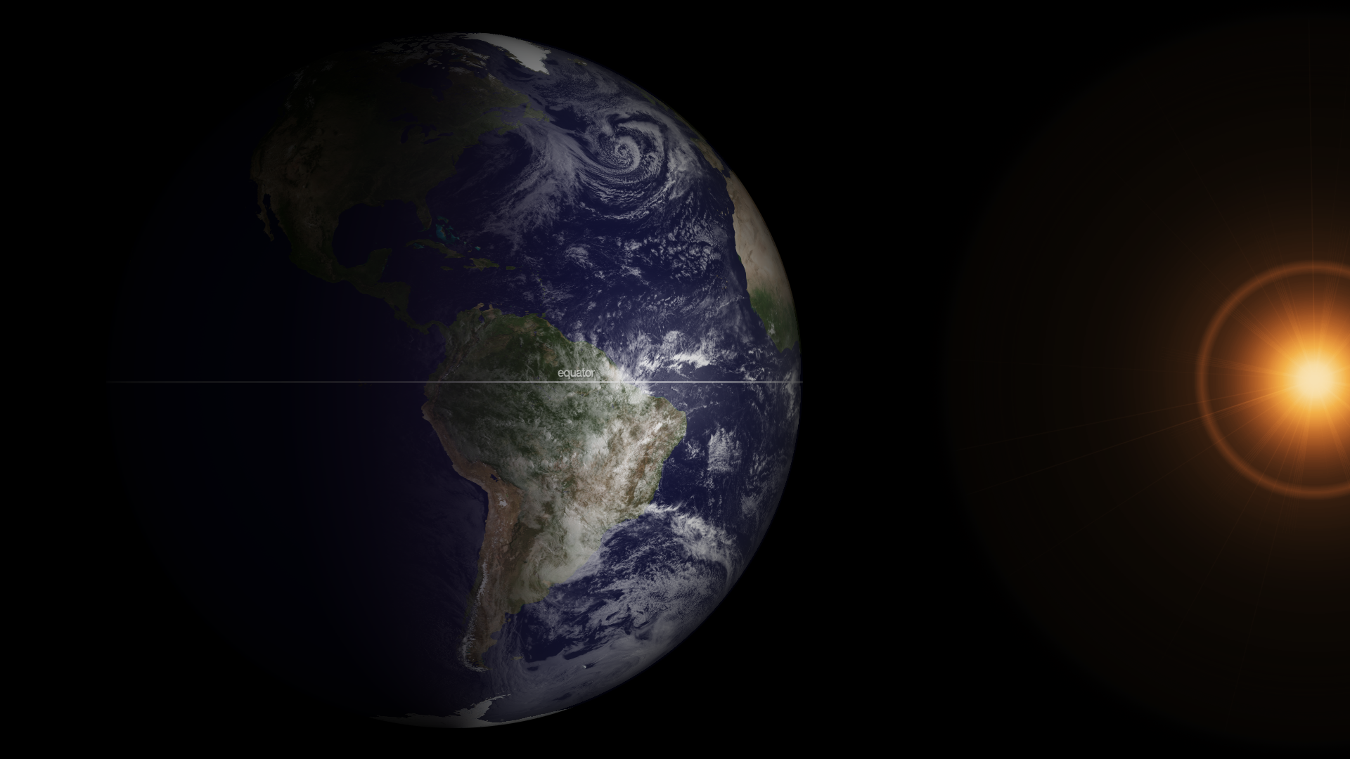
It is that time of year again (it happens twice) when the relative angle of Earth is perpendicular to the Sun, causing equal incoming…
Satellite Snapshots
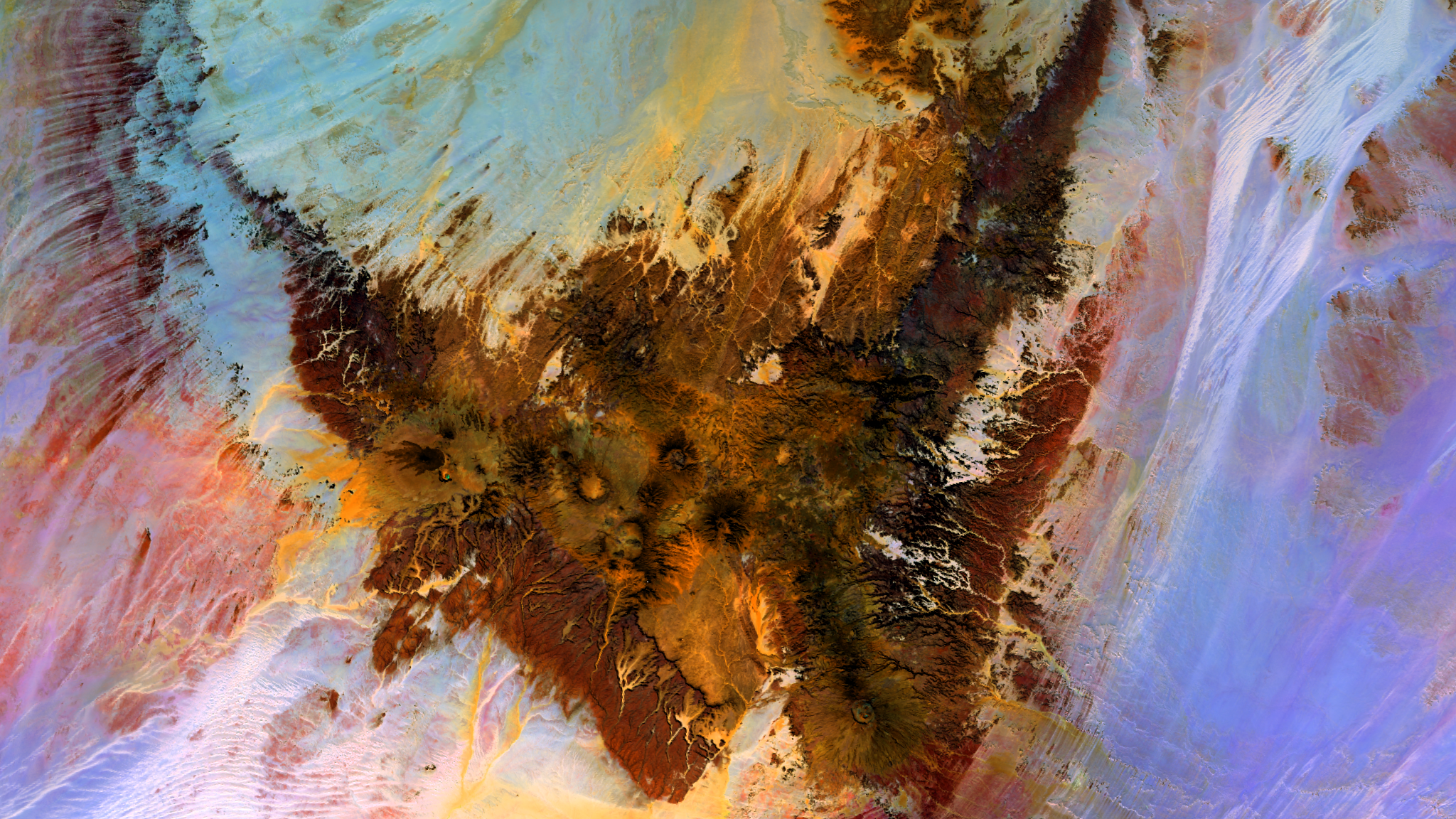
Just south of the Libyan border in Chad, there is a visible scar in the sands of the Sahara Desert. The Tibesti Mountains, shown…
Satellite Snapshots
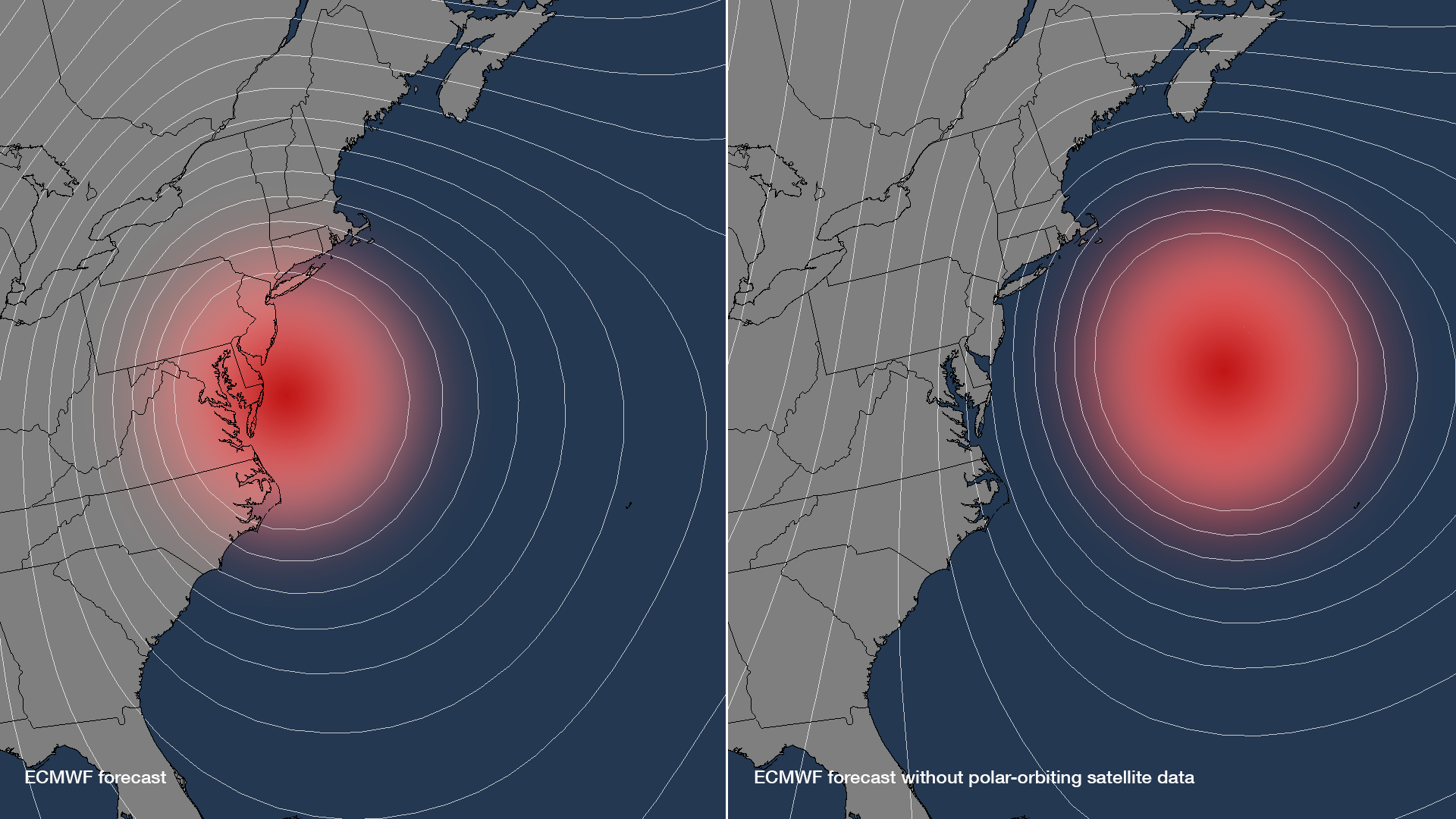
The incredibly accurate 5-day forecasts for Hurricanes Irene and Sandy have illustrated the improvements in both observations and…
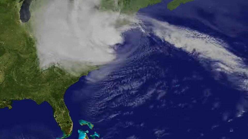
Satellite Snapshots
Five days before Sandy made landfall along the New Jersey coastline, NOAA's National Hurricane Center accurately projected the storm's path. This…
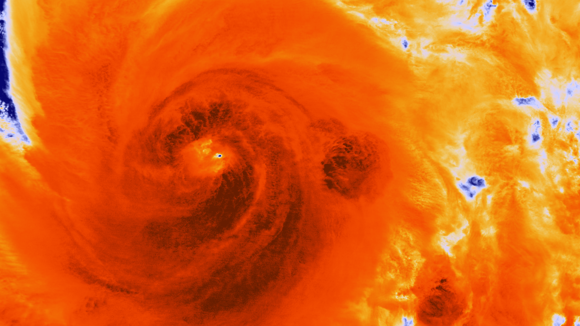
Satellite Snapshots
As the NOAA GOES-13 satellite provides on-going operational coverage of Hurricane Sandy, a special Super Rapid Scan Operations (SRSO) has been…
Satellite Snapshots
This image from the NASA/NOAA Suomi NPP satellite's VIIRS instrument shows Hurricane Sandy strengthening in the Gulf Stream as it…
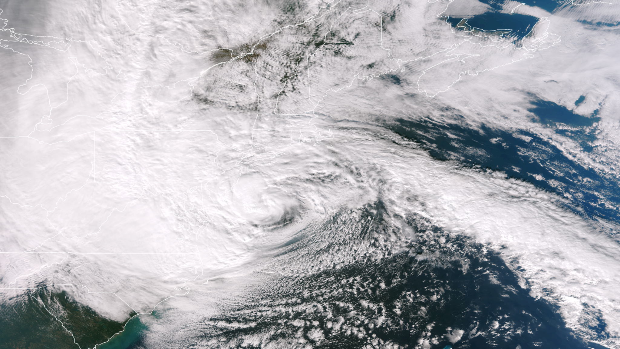
Satellite Snapshots
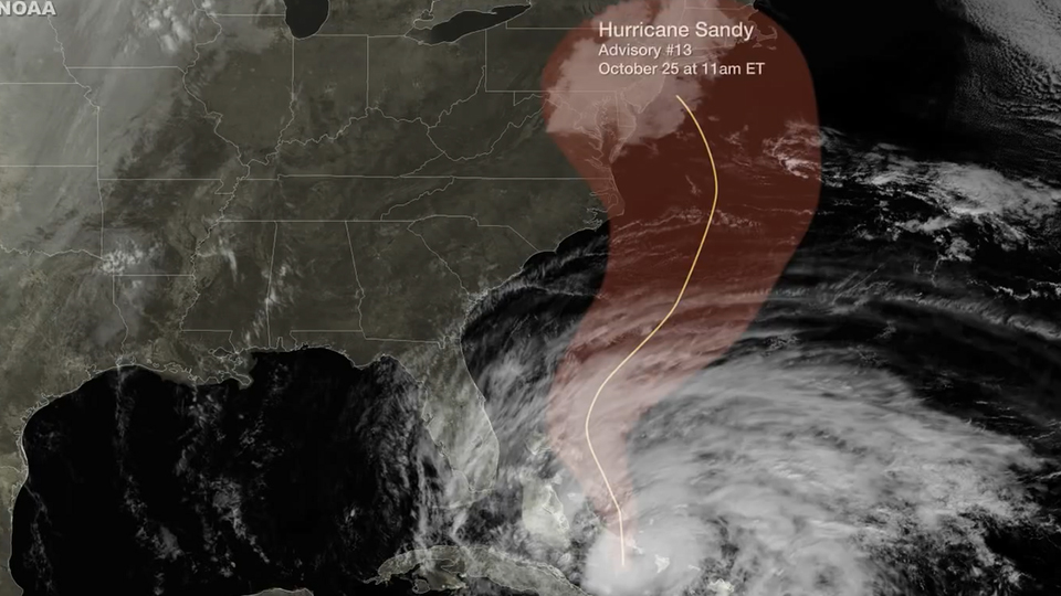
Hurricane Sandy October 2012 follows up the US east coast and devastates New York and New Jersey.
Satellite Snapshots
Early in the morning on October 25, 2012, the Suomi NPP satellite passed over Hurricane Sandy after it made landfall over Cuba and…