
Satellite Snapshots
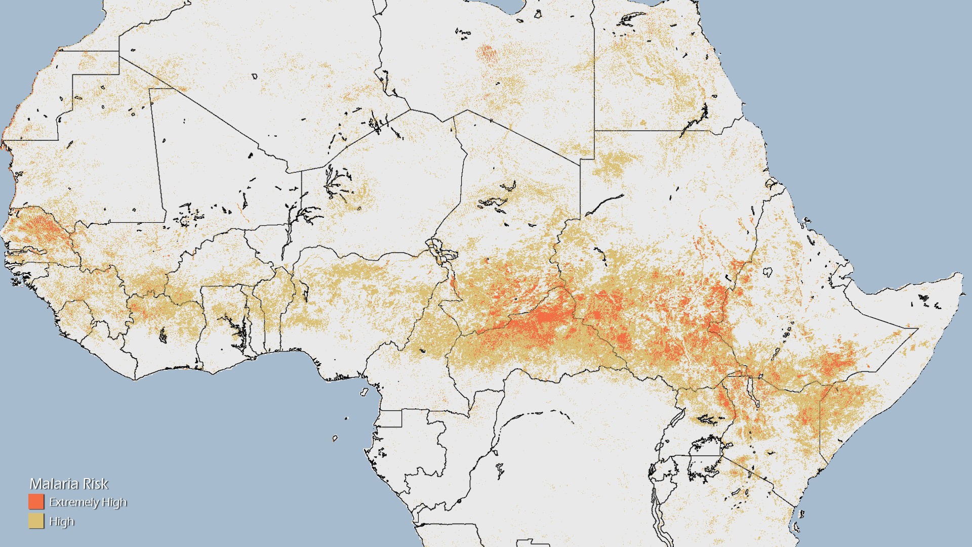
The World Health Organization estimates that a child dies every minute due to malaria. As the Horn of Africa moves into its bi…
Satellite Snapshots
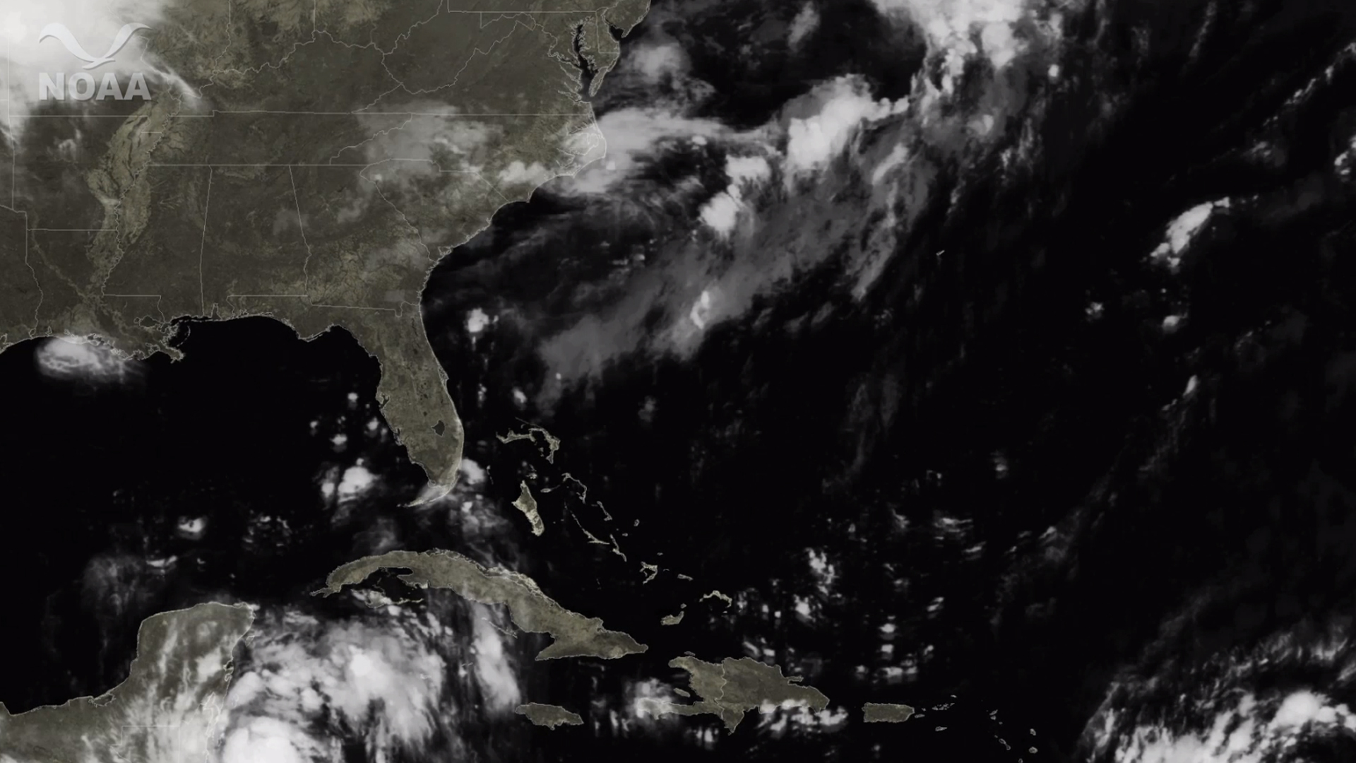
Four days before Hurricane Irene struck eastern North Carolina and tracked northward, NOAA's National Hurricane Center accurately projected the storm…
Satellite Snapshots
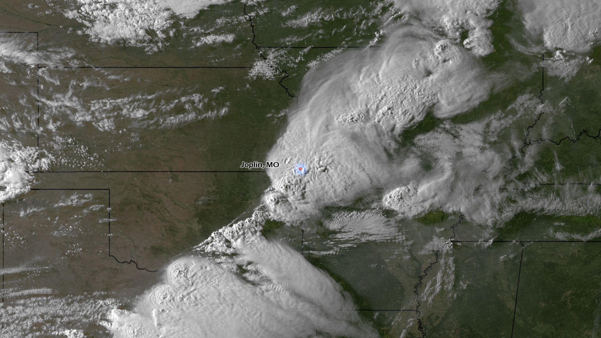
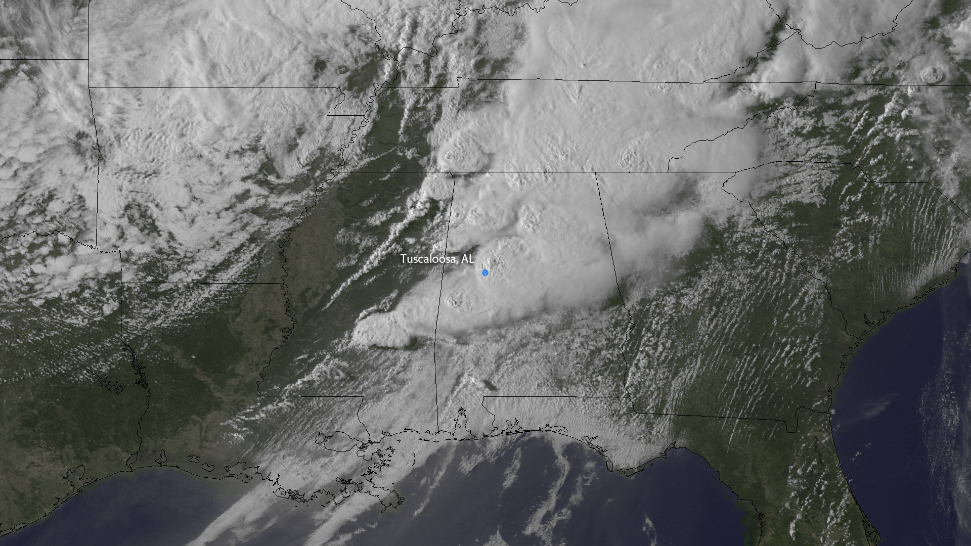
The city of Joplin, MO is reeling today after a powerful tornado spun through a densely populated part of town. This image, from GOES…
Satellite Snapshots
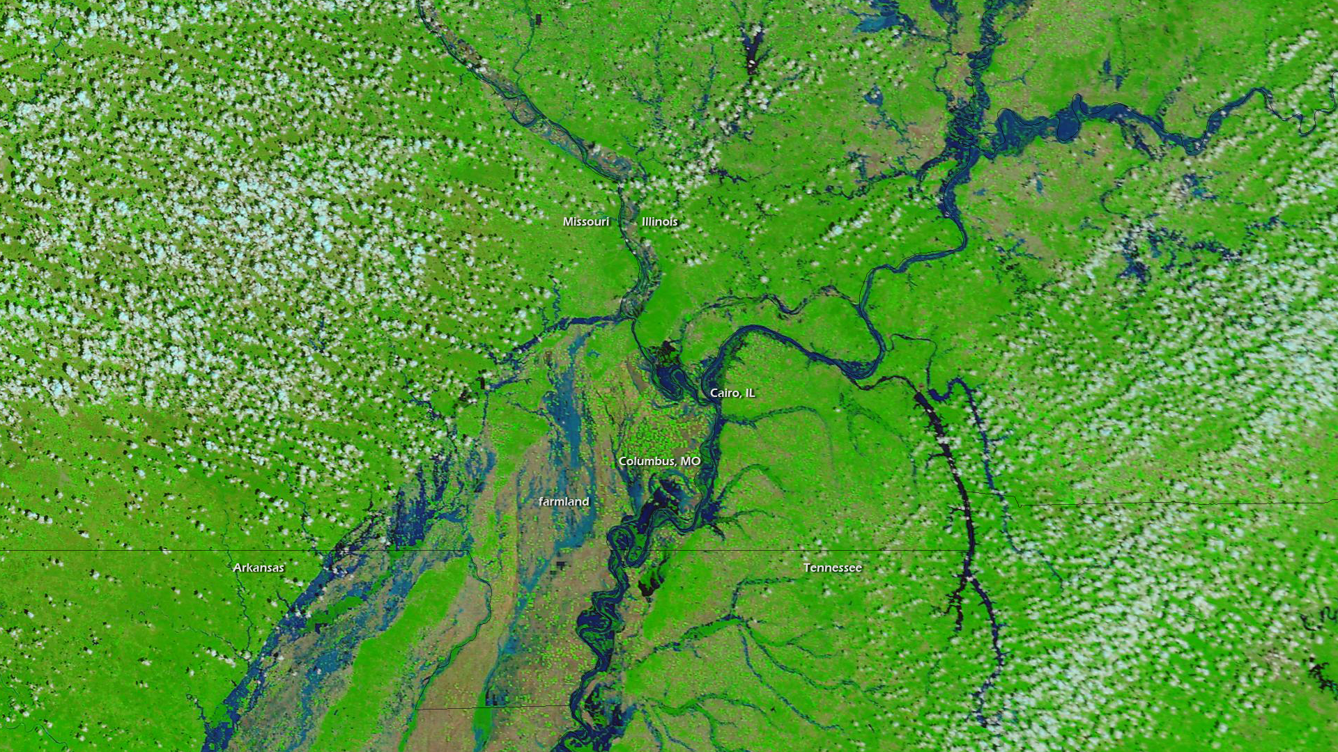
As of April 29, 2011, the National Weather Service lists 369 locations around in the country as flooded, based on river gauge…
Satellite Snapshots
Early in the evening of April 27, 2011, The GOES East satellite took this picture, mid-way through the life of a particularly long…
Satellite Snapshots
The ocean – it is the most prominent feature on Earth, and of immeasurable importance to life on the planet. But what would it look like if all of…
Feature Story
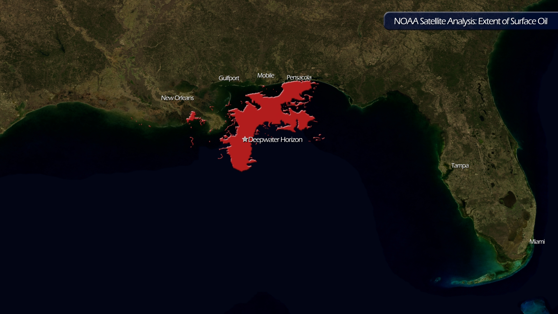
The latest data (completed on June 15, 2010) from NOAA's Satellite Analysis Branch shows the extent of surface oil in the Gulf. For a…
Satellite Snapshots

Oil has been leaking into the Gulf of Mexico since the BP Deepwater Horizon caught fire on April 20th, 2010, exploded, and…