
Satellite Snapshots
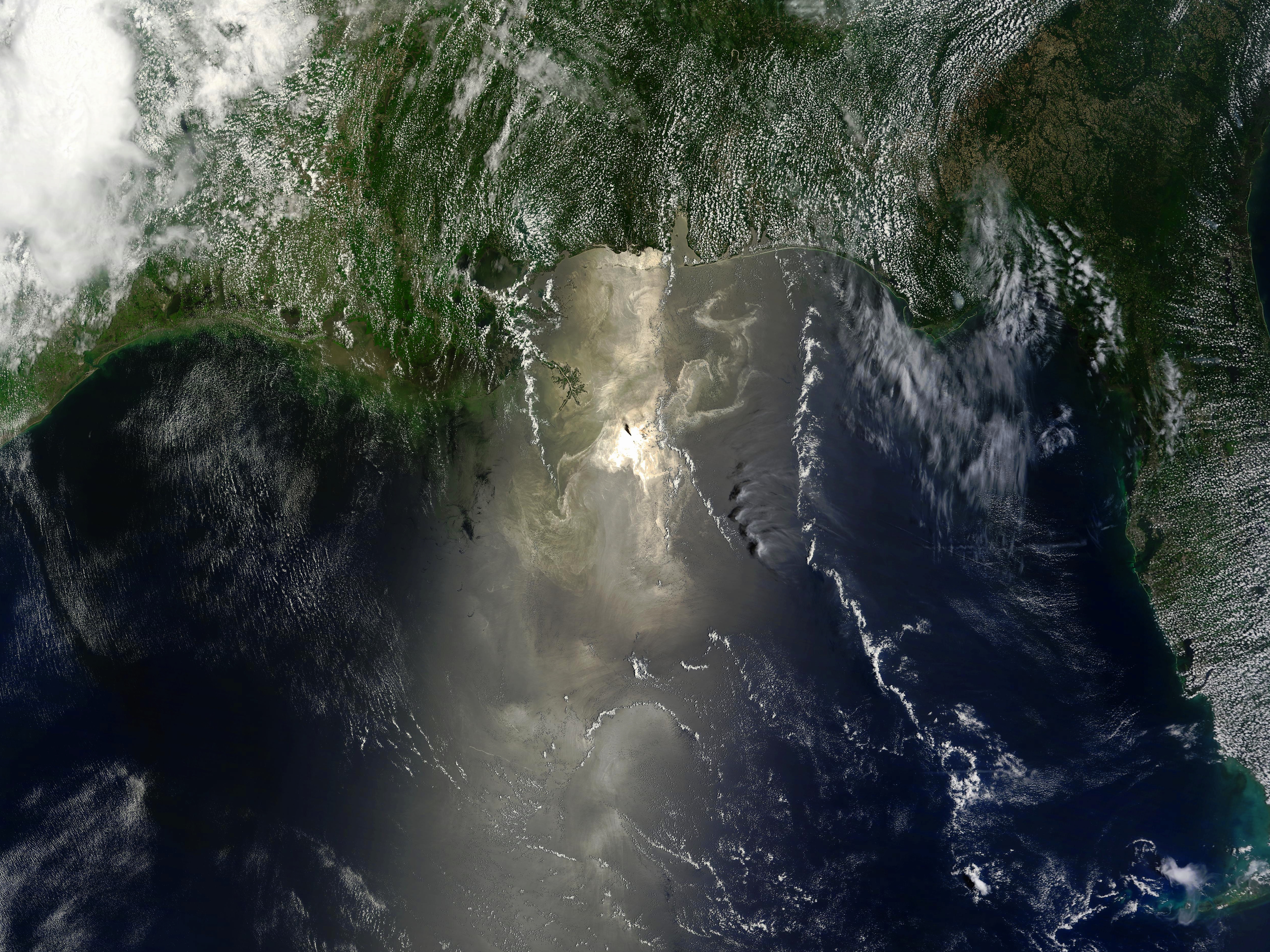
The MODIS sensor on NASA's Terra satellite passed over the Gulf of Mexico at the right time relative to the sun's position, capturing…
Satellite Snapshots
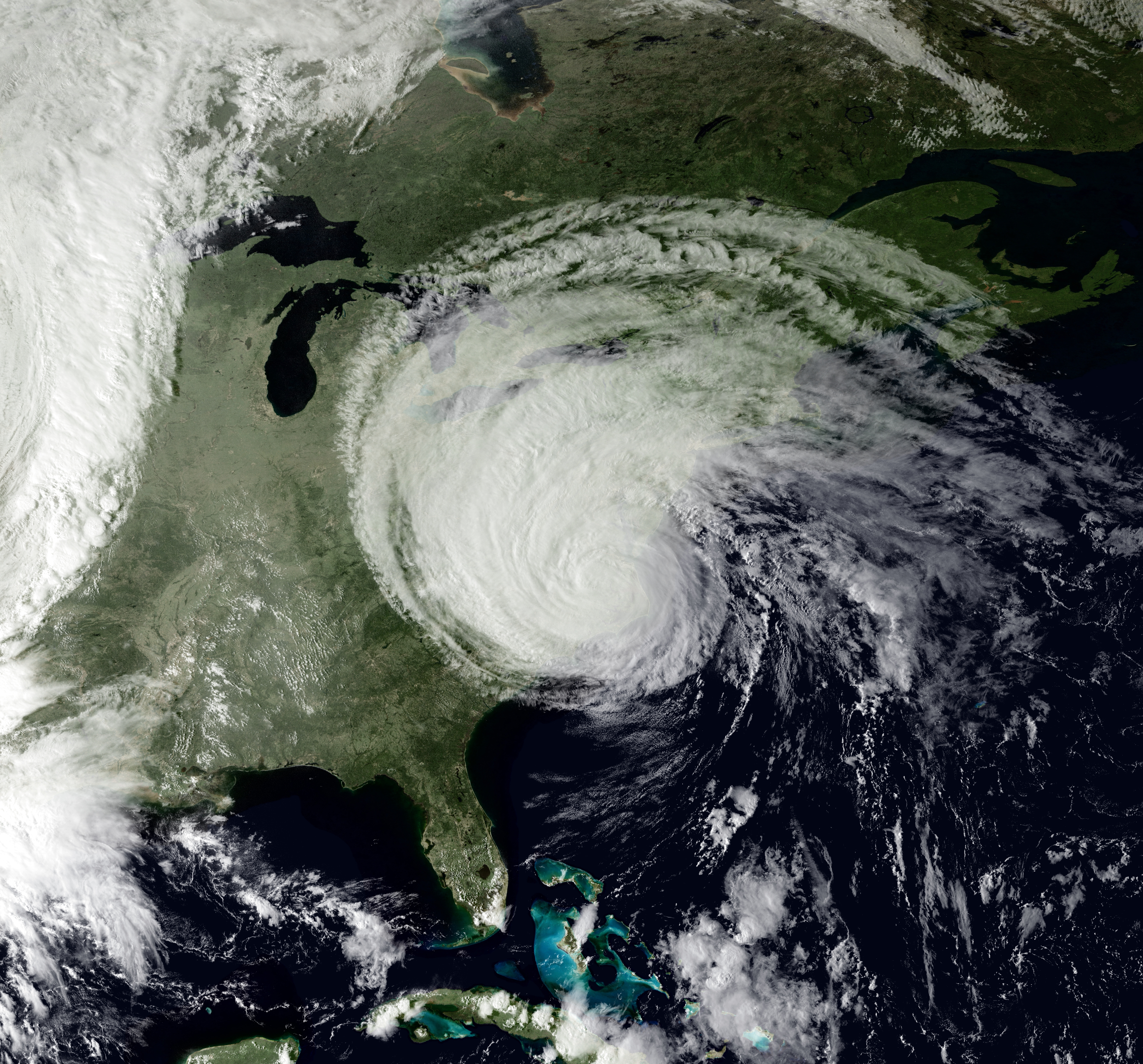
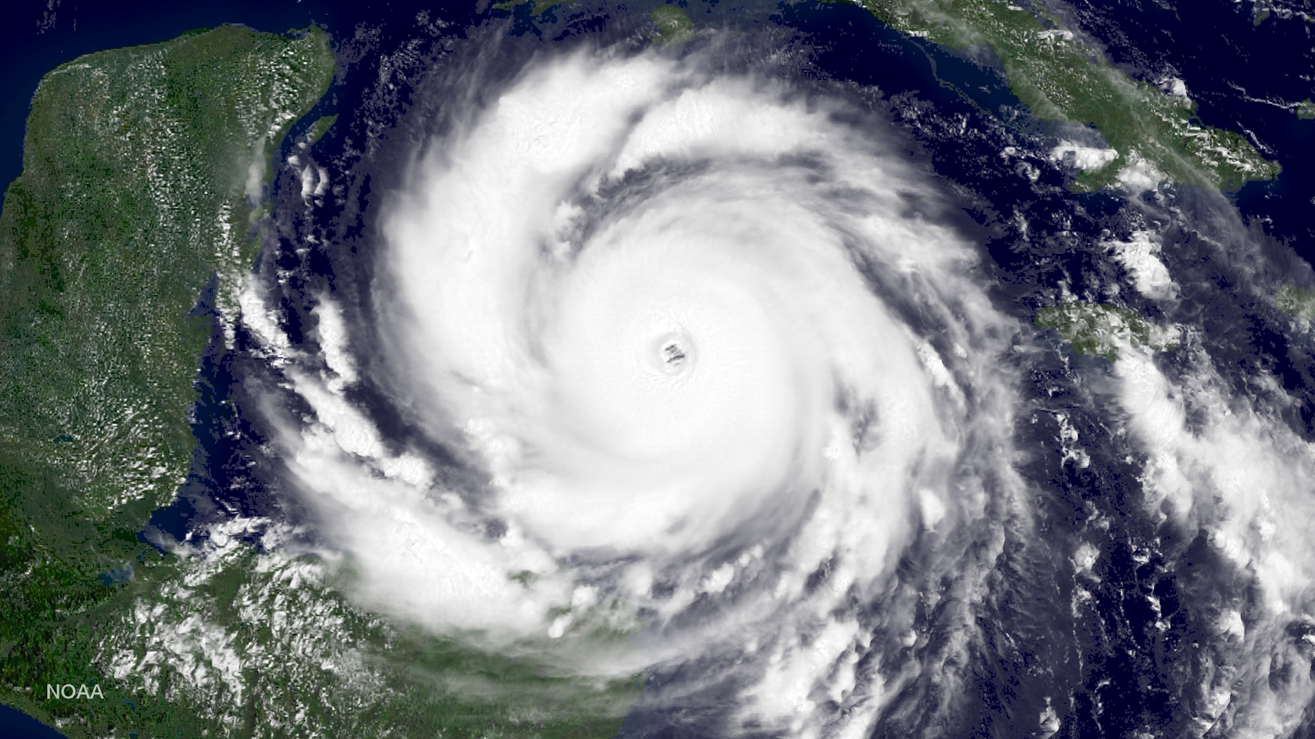
Hurricane Isabel just after it made landfall near Drum Inlet, North Carolina as shown in this image from September 18, 2003 at 2115Z
Satellite Snapshots
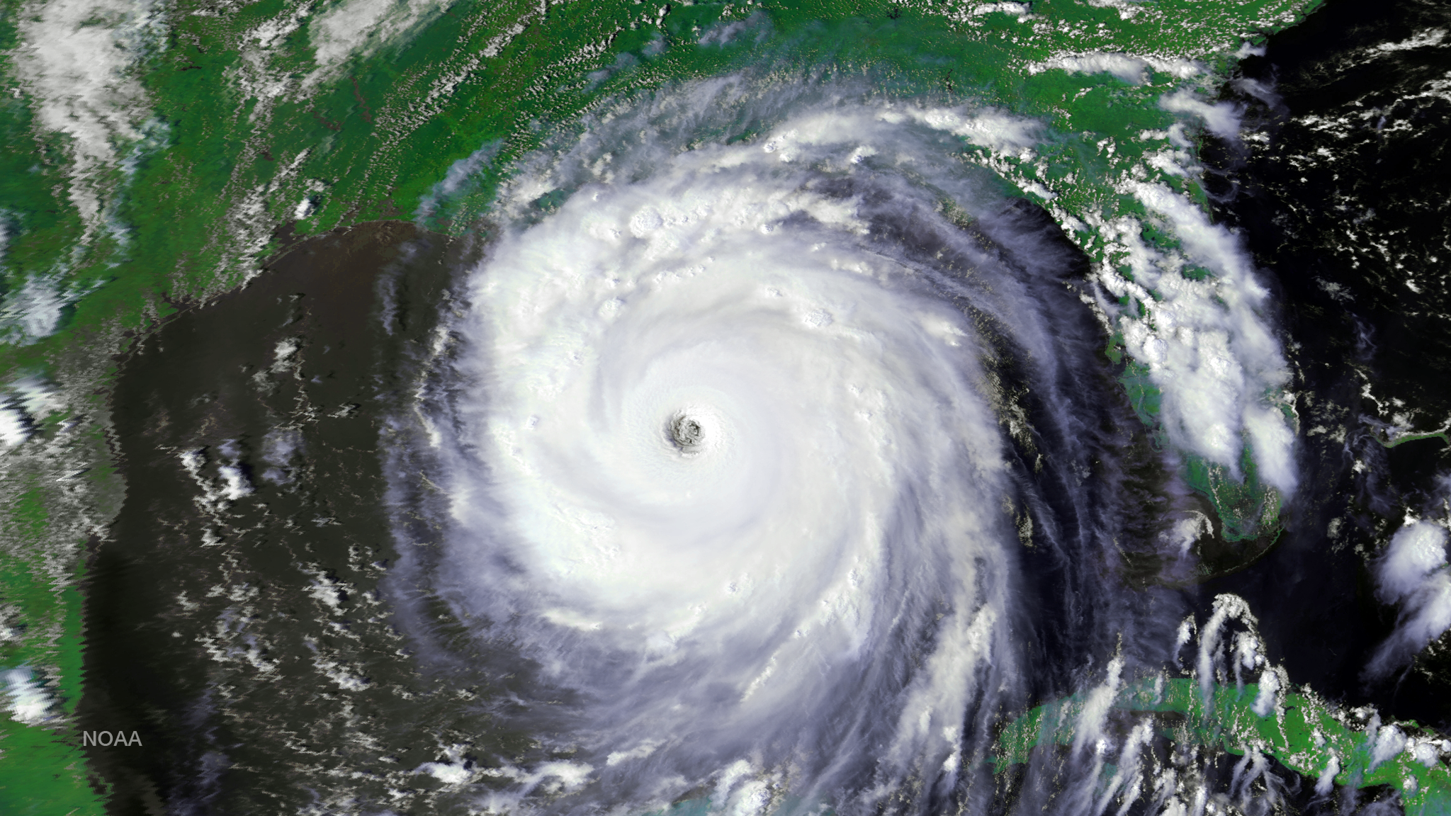
Hurricane Katrina imagery from GOES East including rapid scan data from August 22 through September 1, 2005.
Satellite Snapshots
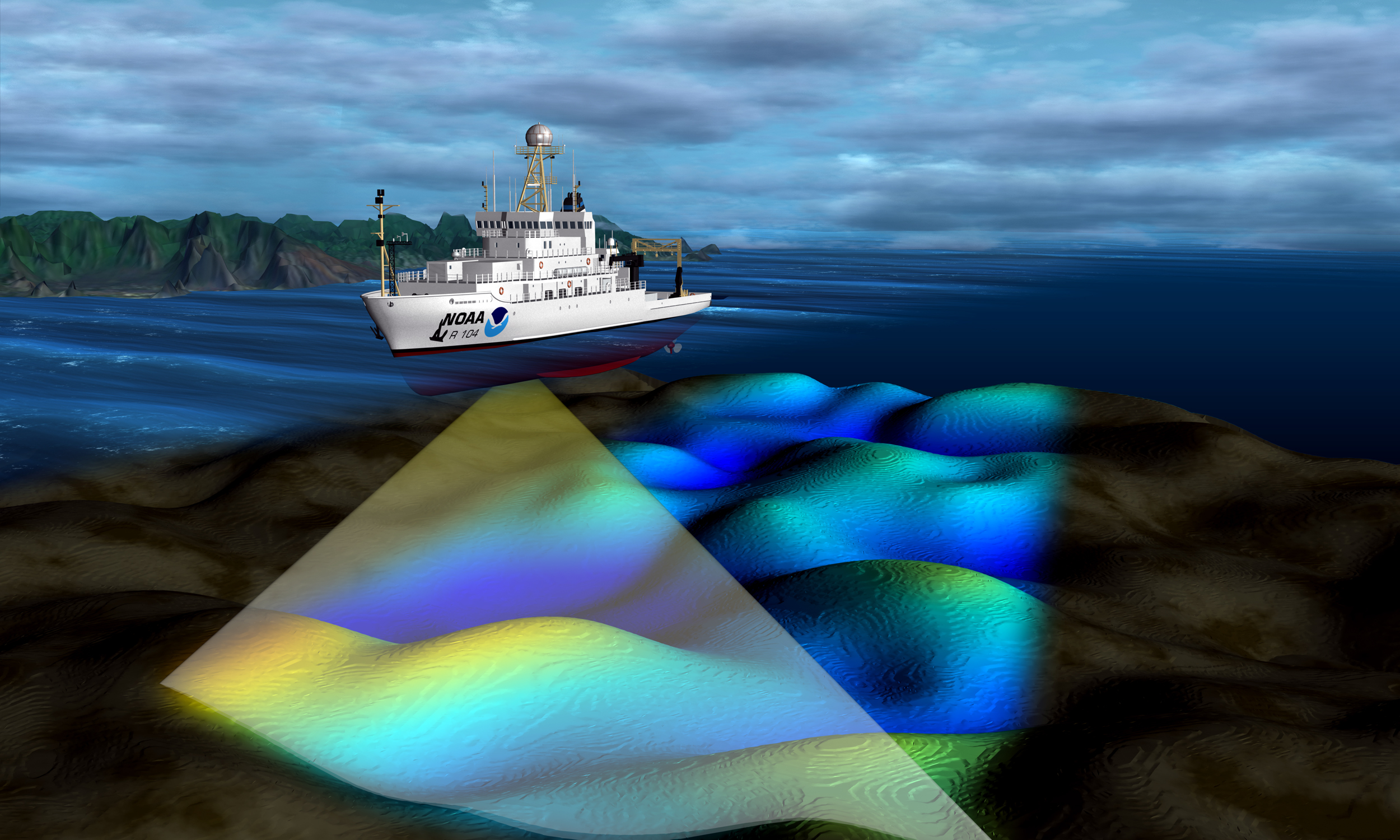
The Office of Coast Survey, part of the National Ocean Service, conducts missions to chart the coasts and ocean bottom along U.S…
Satellite Snapshots

Hypoxic zones are areas in the ocean of such low oxygen concentration that animal life suffocates and dies, and as a result are sometimes called …
Satellite Snapshots
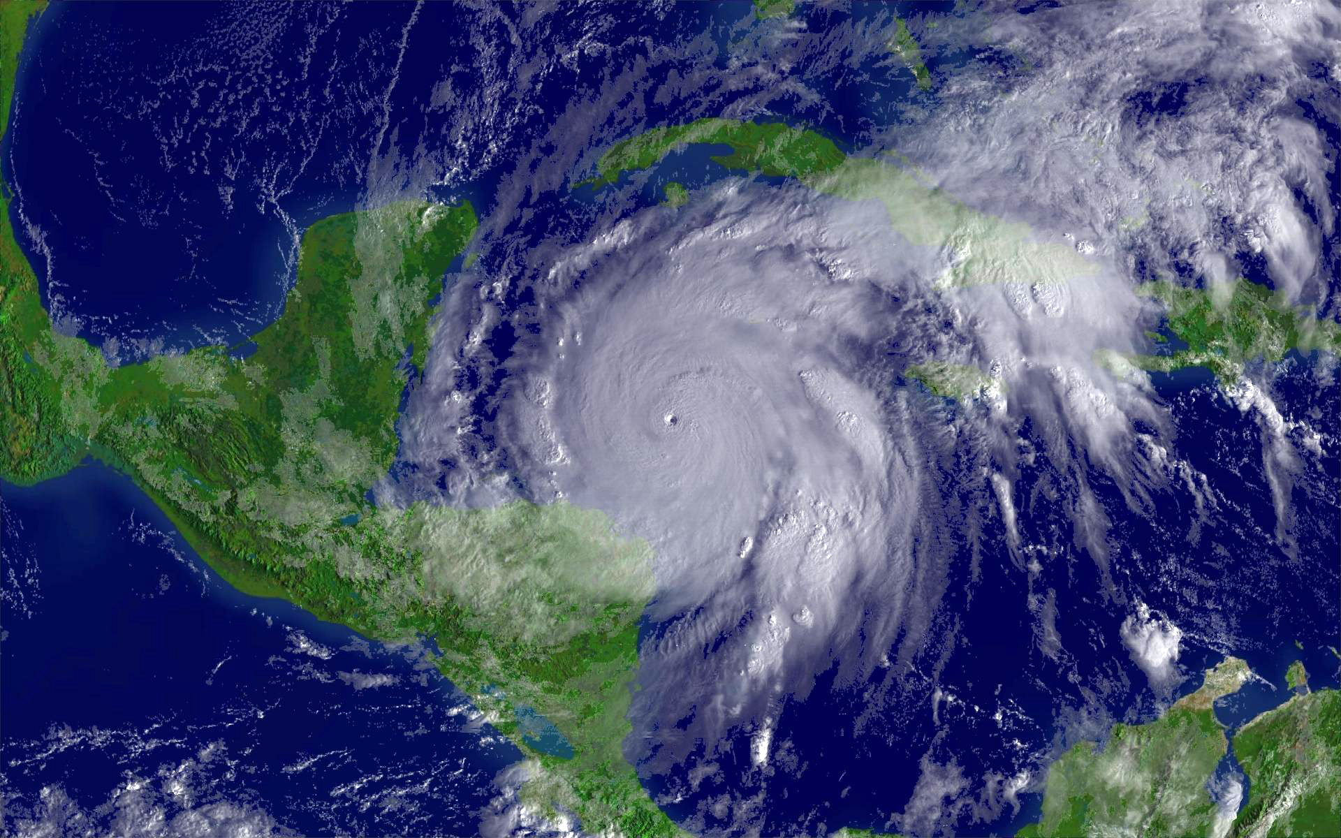
Hurricane Dean approaching Mexico's Yucatan Peninsula, GOES East August 20, 2007
Satellite Snapshots
Hurricane Wilma had the lowest central pressure of any tropical cyclone ever recorded in the Atlantic Ocean
Satellite Snapshots
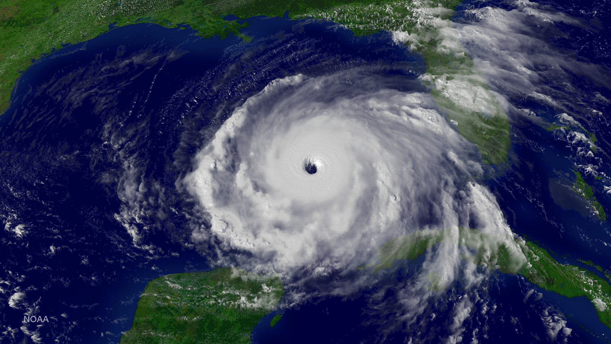
Hurricane Rita was the 4th most intense Atlantic hurricane and most intense in the Gulf of Mexico