
Earth from Orbit
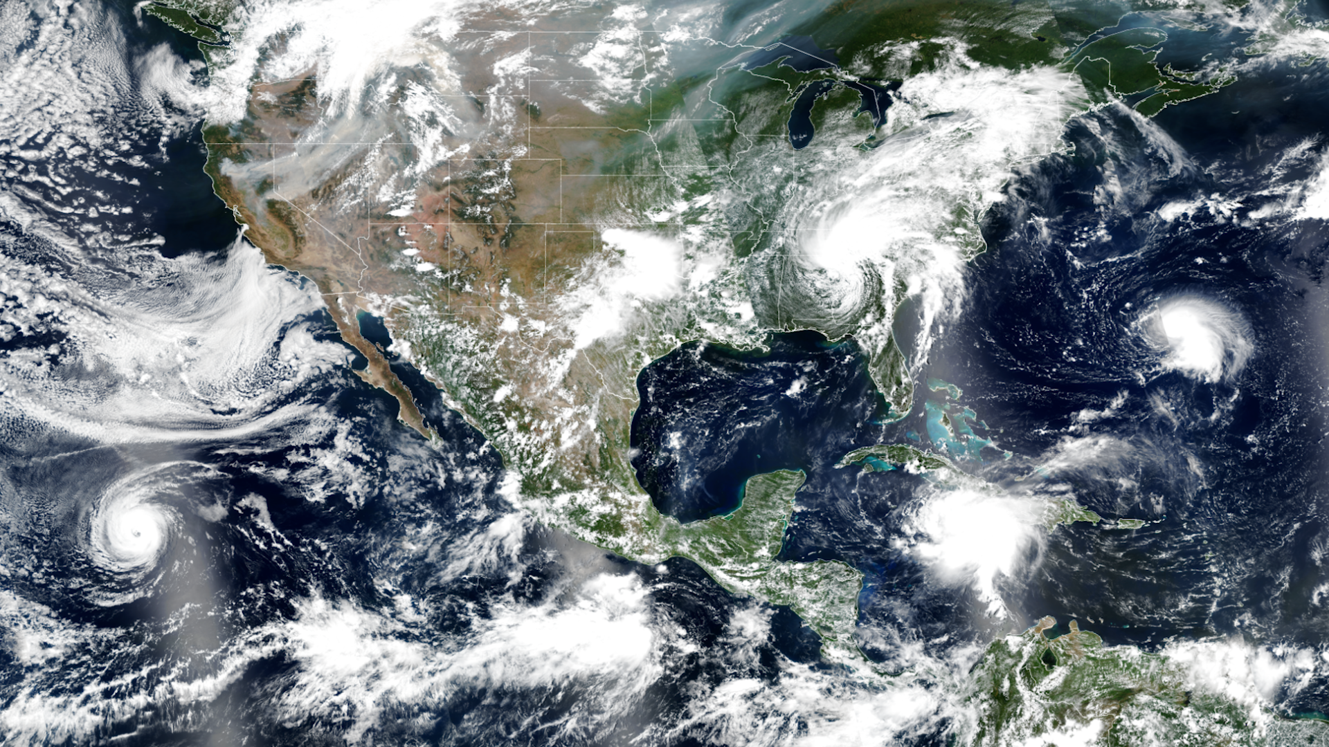
As we approach the peak of Atlantic hurricane season, activity in the tropics has ramped up.
Satellite Snapshots
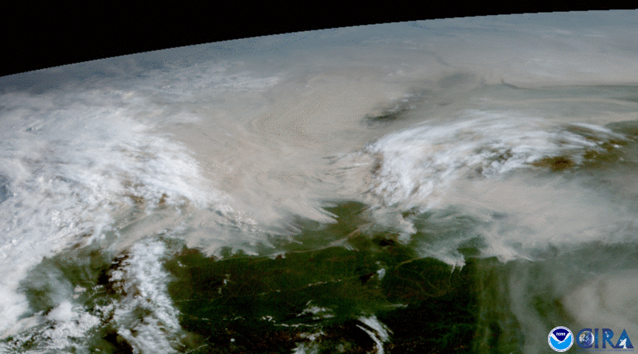
The satellite imagery above, over the course of 11 hours from August 9-10, is from the Himawari-8 satellite. It shows vast stretches of land.
Announcement
On Friday, August 13, 2021, NOAA awarded a third Delivery Order (DO-3) under its existing Indefinite Delivery Indefinite Quantity contract for radio occultation (RO) satellite weather data to Spire Federal.
Earth from Orbit

As wildfires continue to rage in North America, the Dixie Fire became the second largest fire in California history.
Satellite Snapshots
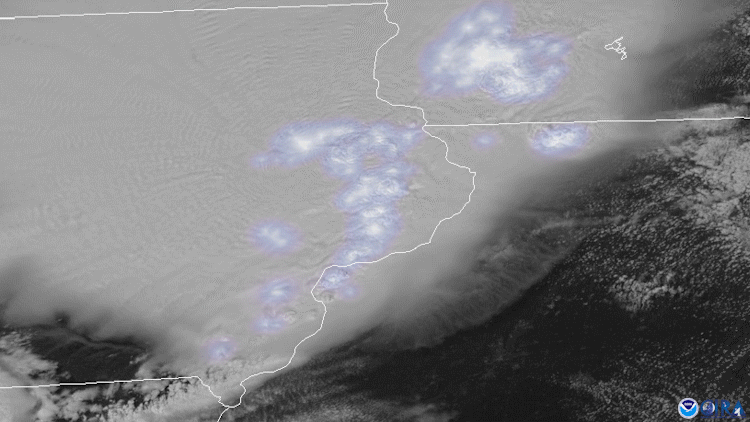
On August 10, 2020, both NOAA’s GOES East and NOAA-20 satellites tracked severe thunderstorms as they raced across much of the Midwest.
Feature Story

STAR research by the numbers, from 2004-2021: STAR researchers have published over 2500 journal articles, reports, book chapters, and datasets. STAR researchers have published in over 300 different journals; STAR researchers has been cited over 100,…
Satellite Snapshots
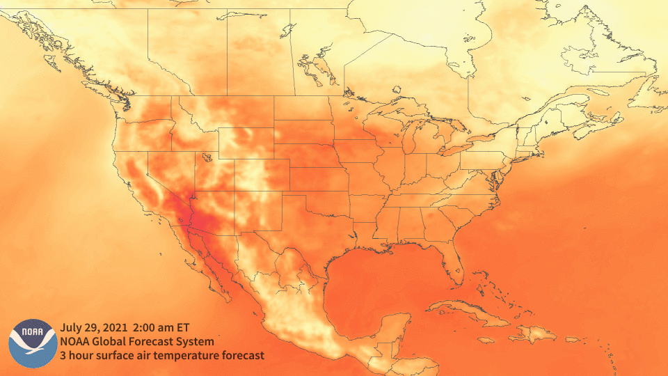
Sweltering temperatures continue to cover large portions of North America, and the excessive heat has not only contributed to a massive drought.
Feature Story

This is a collection of images of the satellite JPSS. NOAA’s Joint Polar Satellite System (JPSS) provides global observations that serve as the backbone of both short- and long-term forecasts, including those that help us predict and prepare for…