
Feature Story
Friday, June 26, 2020 NOAA maintains a fleet of satellites to monitor Earth’s weather, environment and climate. These satellites provide essential…
Satellite Snapshots
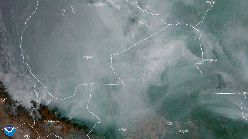
On Nov. 5, 2020, NOAA’s GOES-East satellite focused on a thick blanket of smoke billowing over forests and wetlands in central South America.
Satellite Snapshots

On Sept. 21, 2020, the NOAA-20 satellite was able to snap this cloudless True Color image of the snow-covered Tian Shan mountain…
Feature Story

Yana Gevorgyan, will be the new director of the Group on Earth Observations (GEO) Secretariat.
Feature Story

Monday, November 30, 2020Photo credit: Space Science and Engineering Center/Greg Anderson PhotographyJim Kossin is an atmospheric research scientist…
Satellite Snapshots
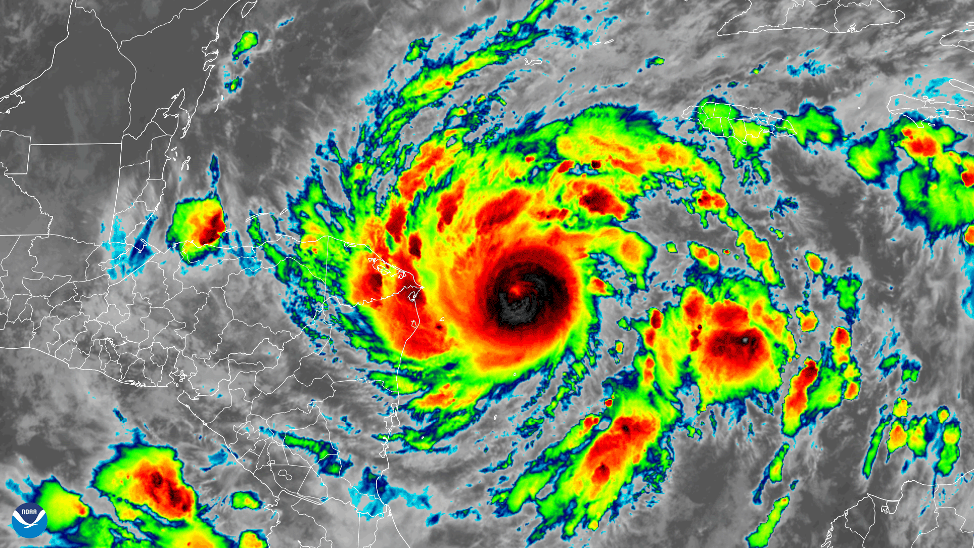
Early on November 2, 2020, the GOES-East satellite watched Tropical Storm Eta strengthen into a hurricane over the Caribbean Sea…
Satellite Snapshots
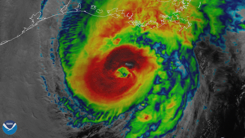
On October 28, 2020, NOAA’s GOES-East satellite viewed Hurricane Zeta make landfall at Cocodrie, Louisiana as a strong Category-2…
Satellite Snapshots
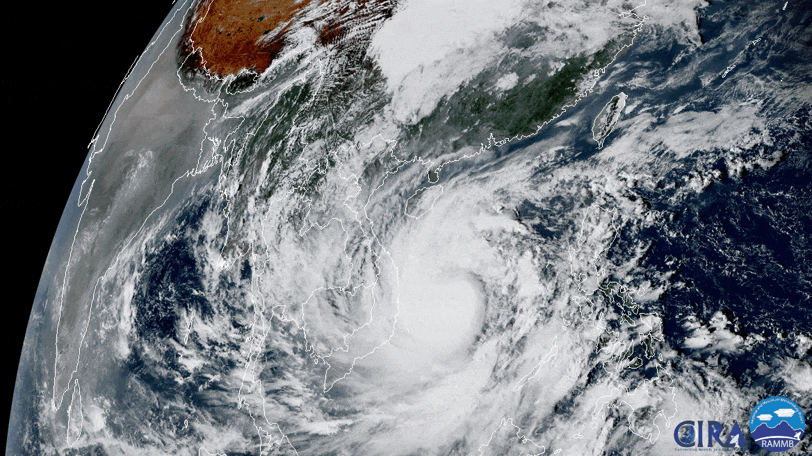
On Oct. 27, 2020, the Himawari-8 satellite, operated by our partners at the Japan Meteorological Agency , looked down from its…