
Satellite Snapshots
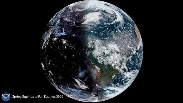
It’s officially autumn in the Northern Hemisphere—the season when days get shorter as that half of the world heads toward winter.
Satellite Snapshots

CMORPH (NOAA Climate Prediction Center MORPHing technique) showed total rainfall produced by Hurricane Sally over several days.
Satellite Snapshots
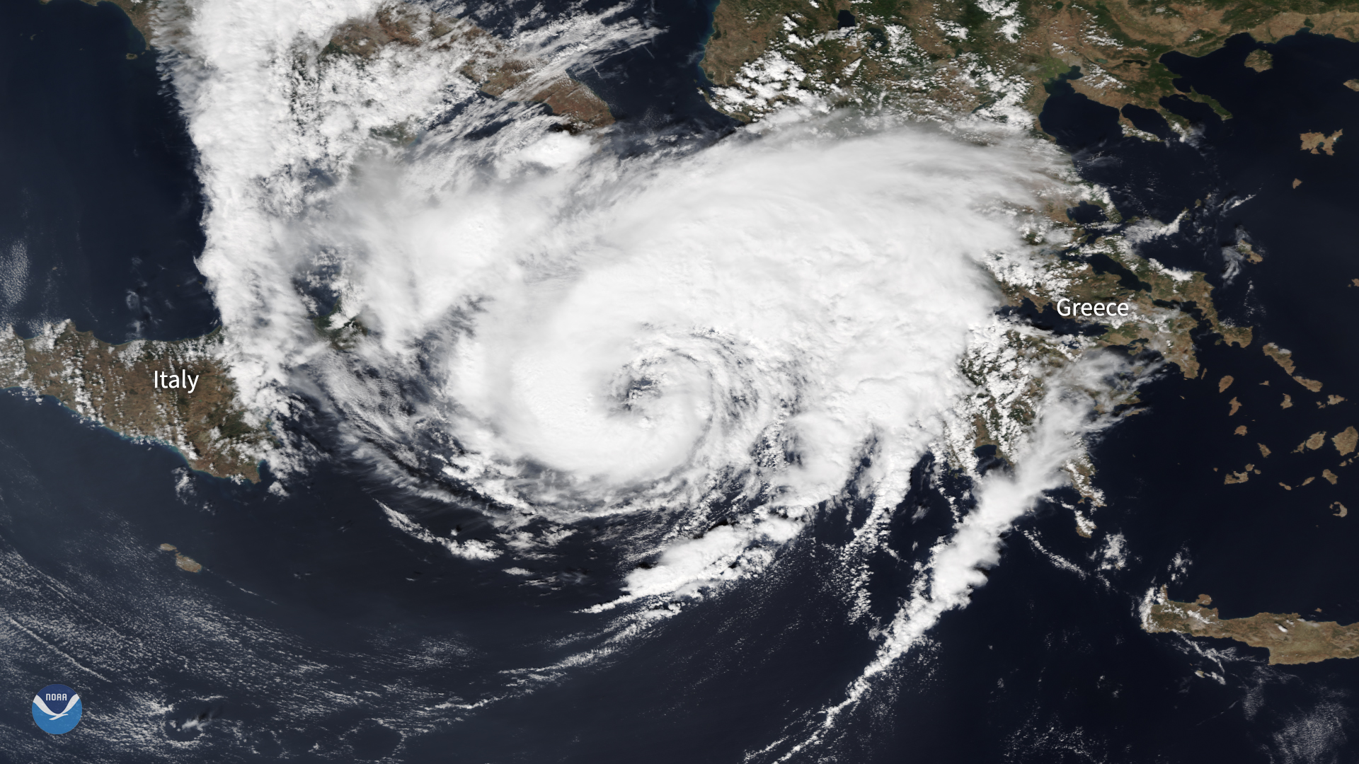
The NOAA-20 satellite zoomed in on a hurricane-like storm over the Mediterranean, known as a "medicane," as it approached western Greece.
Feature Story
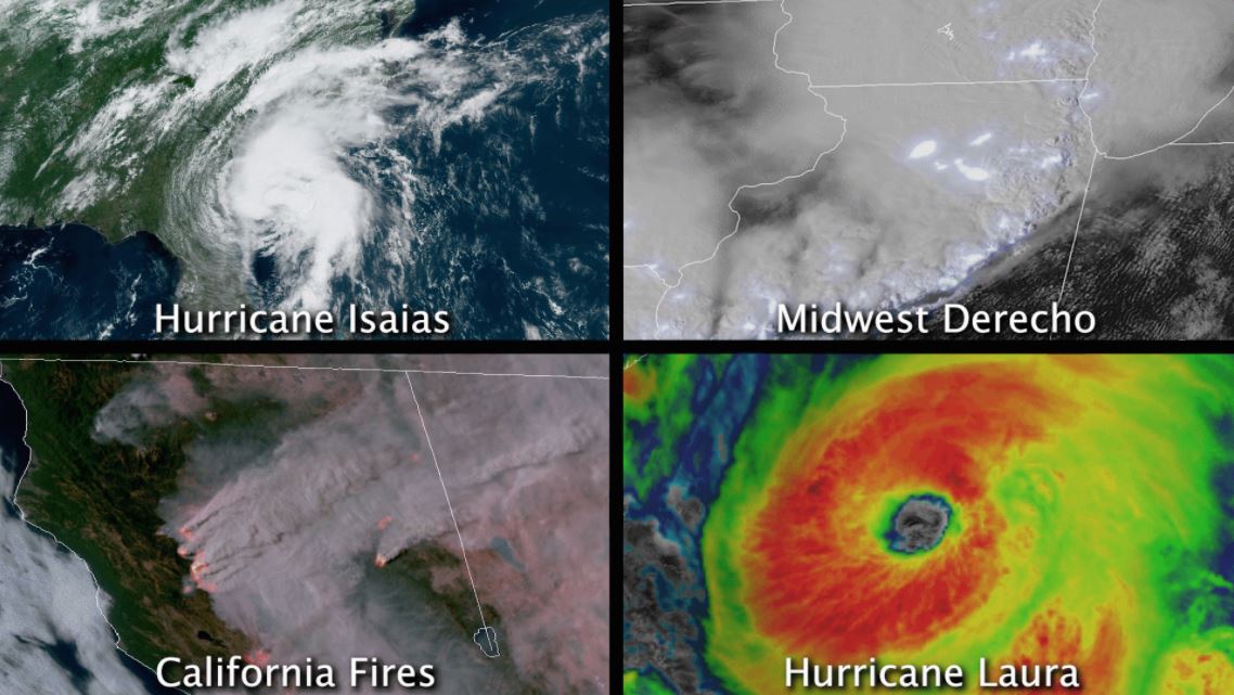
In August 2020, the contiguous U.S. saw at least four different billion-dollar disasters.
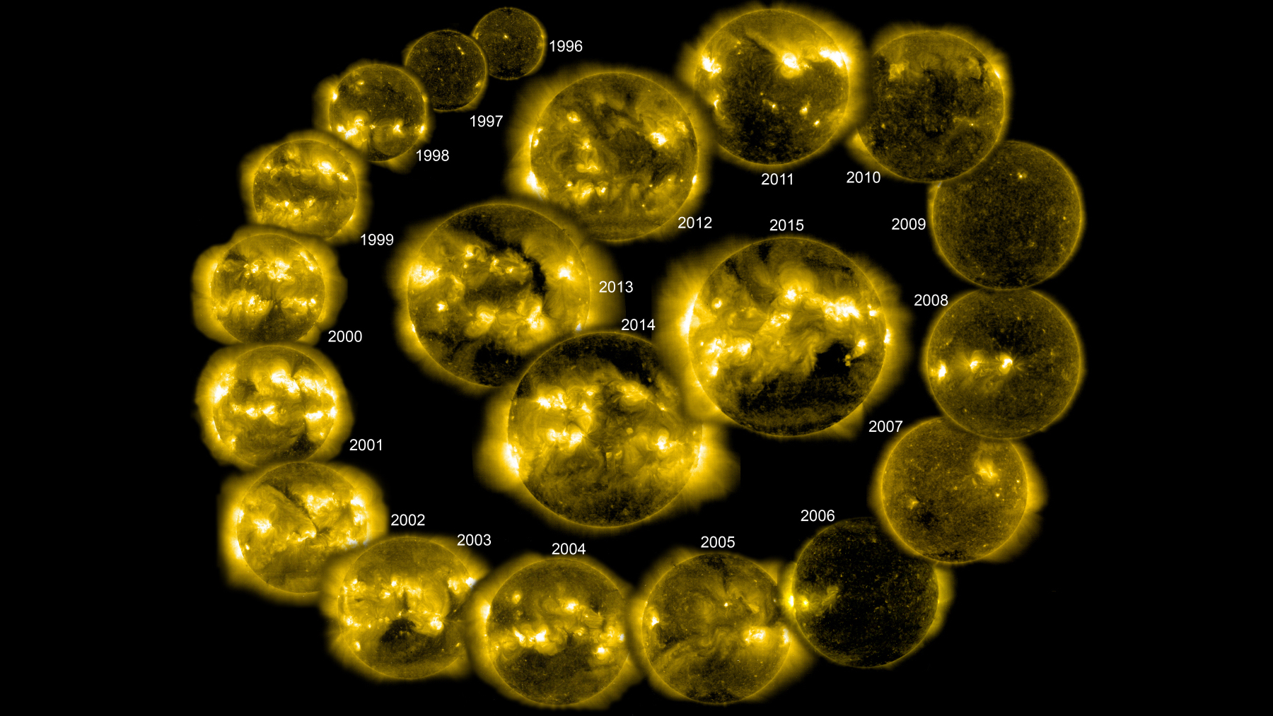
September 15, 2020 We are now officially in Solar Cycle 25! A prediction panel co-chaired by NOAA and NASA has determined that the solar minimum…
Satellite Snapshots
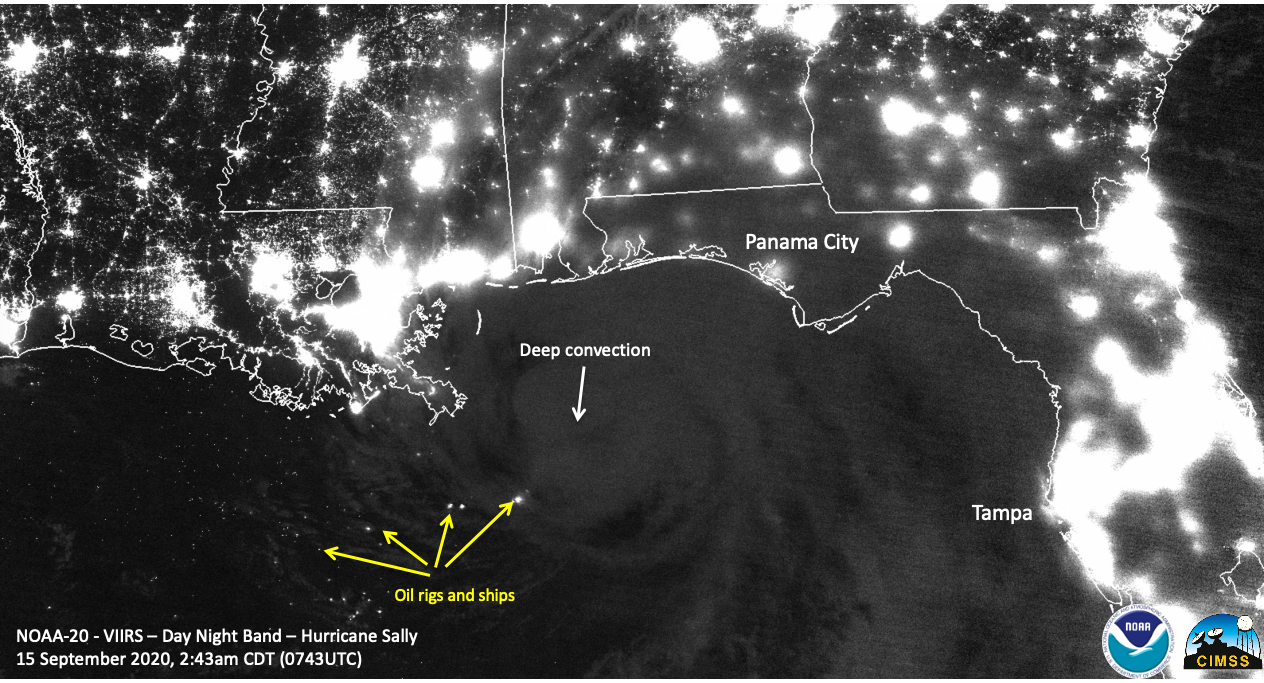
Day/Night band imagery shows us nighttime views of clouds and lights. This image was captured by NOAA-20 on Sept. 15, 2020.
Feature Story
As an agency, NOAA’s science isn’t just limited to Earth and its atmosphere. NOAA’s reach goes…
Feature Story
NOAA is planning an advanced satellite that will improve forecasts and warnings for potentially damaging solar activity.