
Satellite Snapshots
Hurricane Delta is expected to swing up over the warm waters of the Gulf of Mexico and make landfall along the northern Gulf Coast
Satellite Snapshots
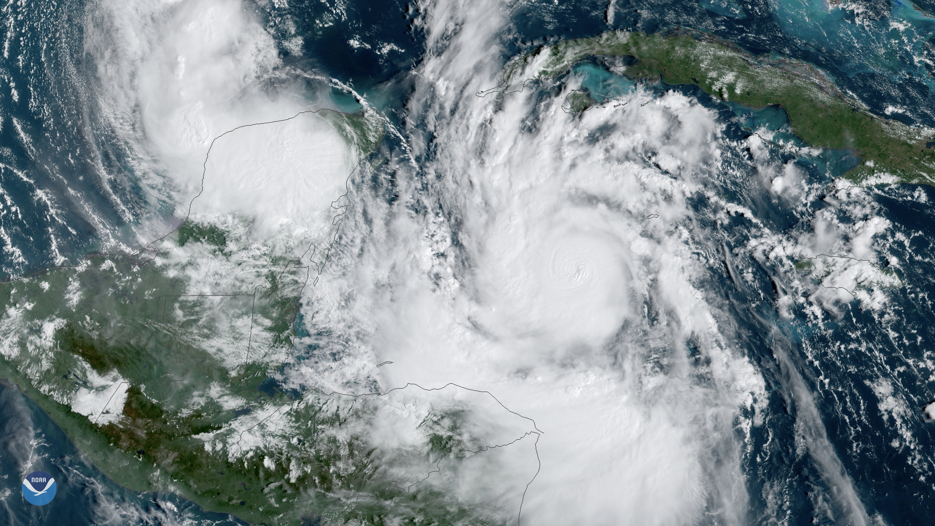
On Oct. 5, 2020, NOAA's GOES-East satellite watched Tropical Storm Delta form in the Caribbean Sea.
Satellite Snapshots
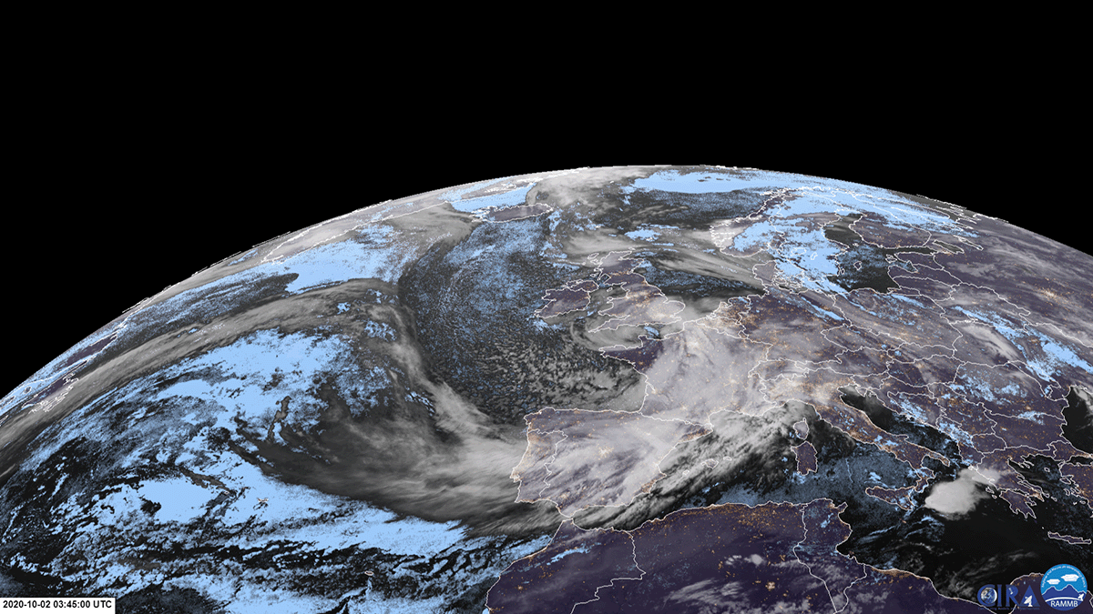
On October 2, 2020, EUMETSAT’s Meteosat-11 satellite viewed Storm Alex as it transversed southeastward across France.
Satellite Snapshots
October 01, 2020 On September 27, 2020, NOAA’s GOES-West satellite continued watching the spate of wildfires that are engulfing the West Coast. These…
Announcement
On September 30, 2020, NOAA released a Request for Information (RFI) seeking information on commercial capabilities to inform a potential Commercial Weather Data Pilot (CWDP) Round 3 for terrestrial weather applications, as well as future pilots for…
Feature Story
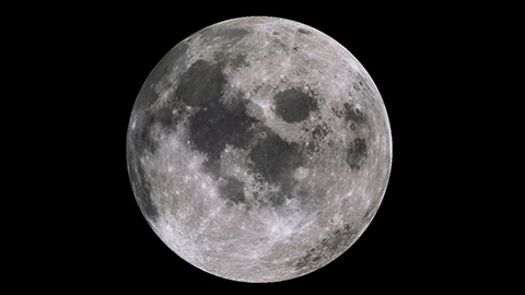
October 2020 will offer a rare celestial treat—a full Harvest Moon on October 1st and a second full “Blue Moon” on…
Feature Story

NOAA's GOES-T satellite is fully assembled and beginning a set of rigorous tests to ensure it can withstand launch and orbit conditions.
Satellite Snapshots
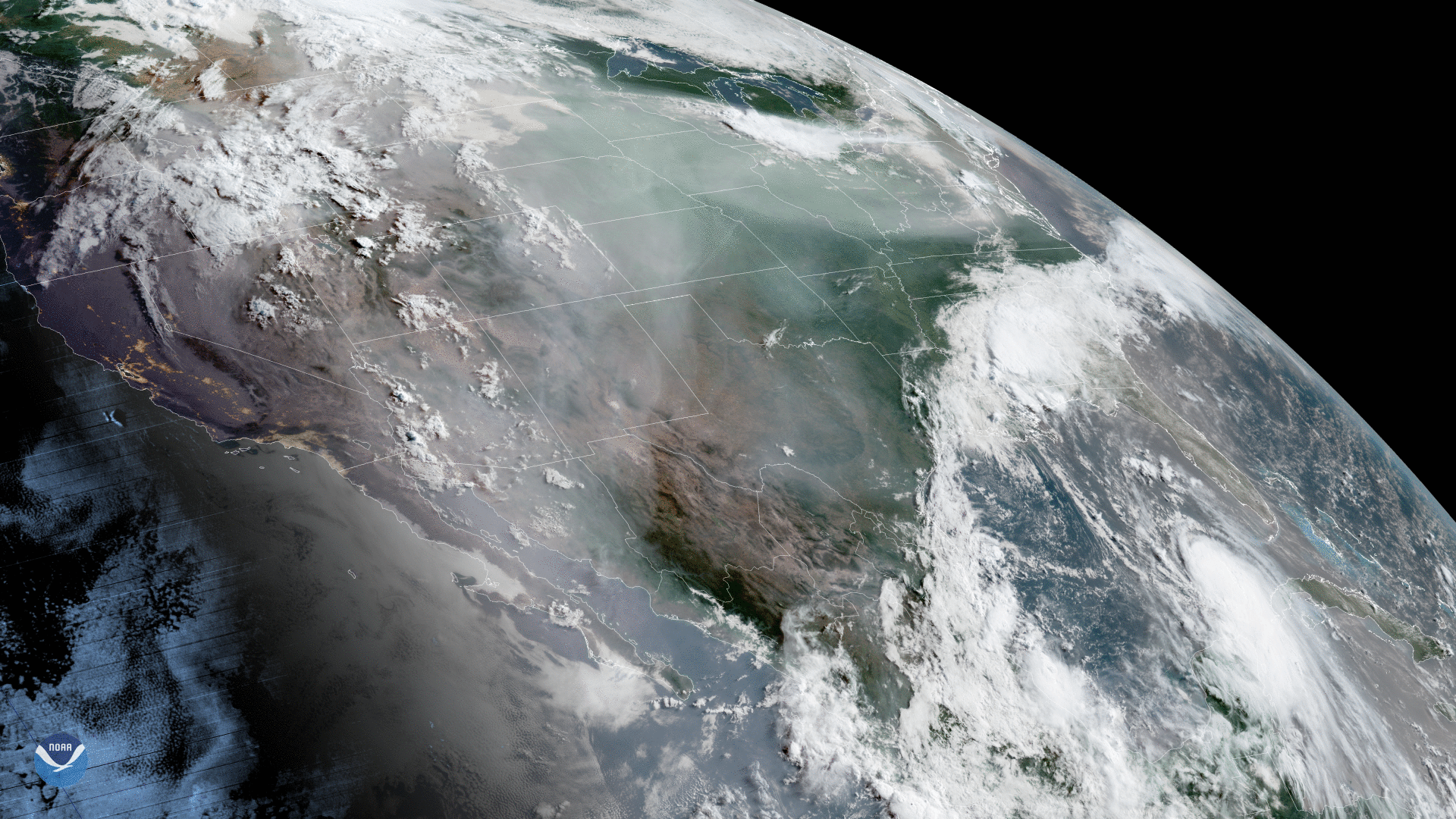
GOES-West captured this dynamic GeoColor imagery of North America, where wildfires have been ravaging…