
Satellite Snapshots

GOES-West captured this impressive view of the eye of Hurricane Douglas as it spun over the Pacific.
Satellite Snapshots
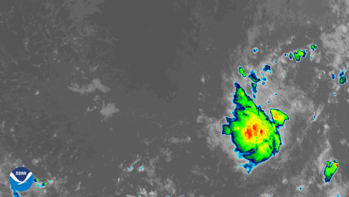
GOES-East zoomed in on newly-formed Tropical Storm Gonzalo.
Satellite Snapshots

May 21, 2020 On May 20, 2020, the VIIRS instrument , aboard both the Suomi-NPP (S-NPP) and NOAA-20 satellites, showed record flooding of the…
Satellite Snapshots
July 21, 2020 On July 19, 2020, NOAA’s GOES-East satellite viewed clusters of supercell thunderstorms sliding across eastern Wyoming. Supercells,…
Feature Story

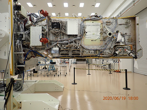
On May 20, 2020, the prime contractor of the Argos-4 HoPS mission, General Atomics (GA), hosted a major milestone, its Delta Critical Design Review (CDR) virtually for its customers.
Satellite Snapshots
July 17, 2020 Off the west coast of Florida, NOAA’s GOES-East satellite “saw” a line of storms bubble up on July 16, 2020. The storms hit the Tampa…
Satellite Snapshots
July 16, 2020 Over the course of several days, unusually heavy monsoonal rains have fallen over China and neighboring countries, including India and…
Feature Story
In four different U.S. cities are four shipping containers, each one carrying an instrument that will travel to space to…