
Satellite Snapshots
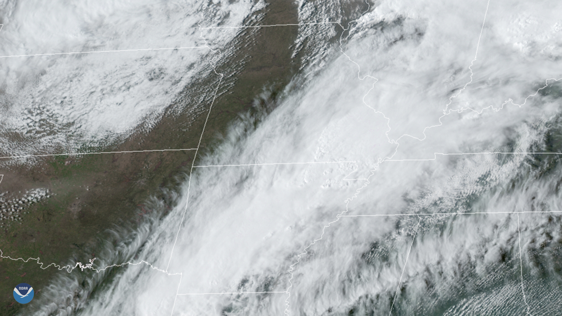
March 30, 2020 On March 28, 2020, GOES-East tracked supercell thunderstorms in Arkansas, which later produced several tornadoes. This included an EF3…
Satellite Snapshots
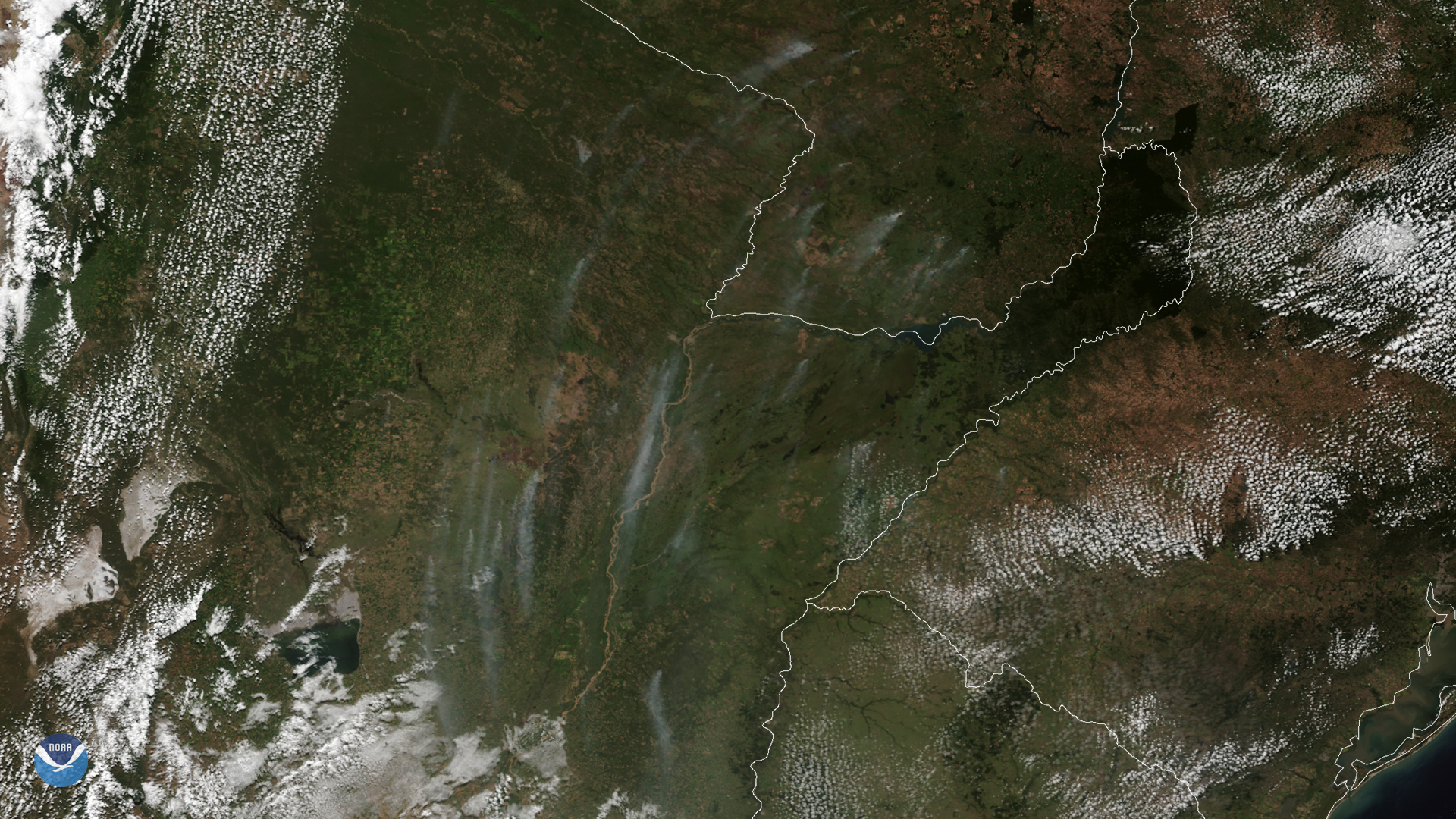
On March 24, 2020, NOAA’s GOES-East satellite zoomed in on wispy smoke plumes from fires burning in Argentina and Paraguay. These vast…
Satellite Snapshots
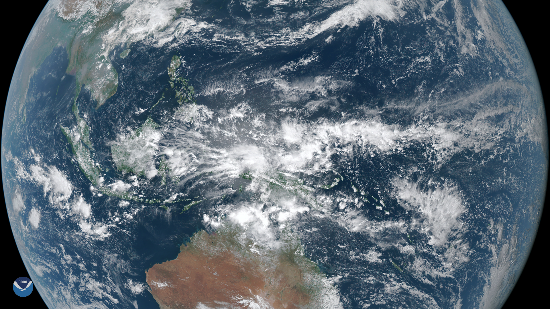
On March 23, 2020, the Himawari-8 satellite spied dense clouds producing heavy rain over Indonesia. Located between the Indian and…
Satellite Snapshots
March 24, 2020 On March 24, 2020, the GOES-East satellite viewed the Yucatán Peninsula as prescribed fires peppered its northwestern coast. Its…
Satellite Snapshots
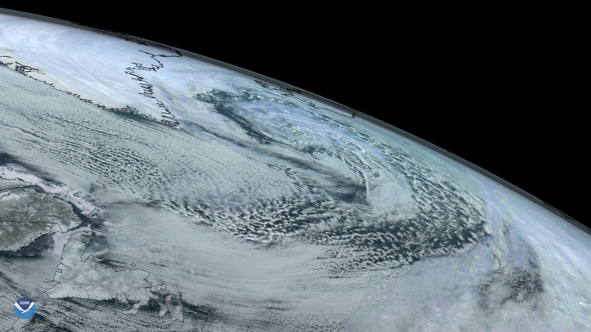
On Sunday, March 22, 2020, the GOES East satellite captured imagery of a large extratropical mid-latitude cyclone in the North…
Satellite Snapshots
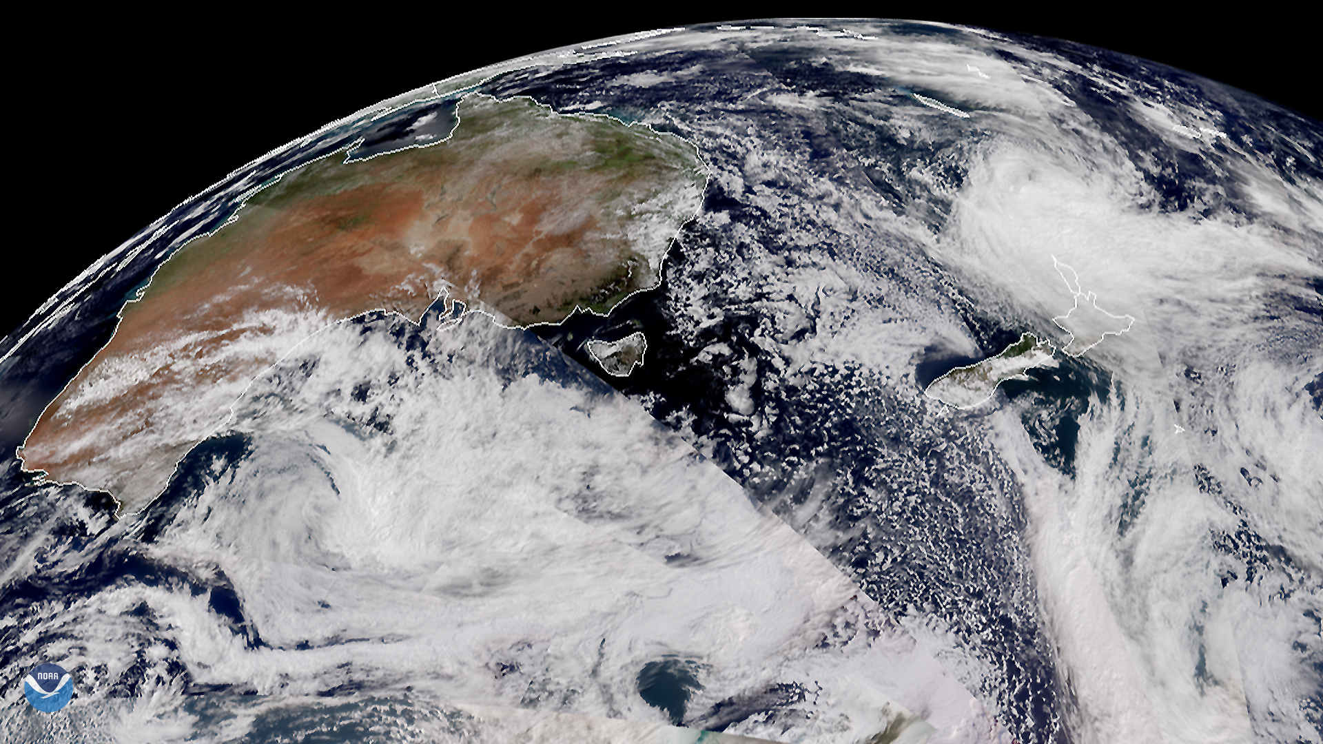
March 20, 2020 On March 18, 2020, the Suomi-NPP (or SNPP) and NOAA-20 satellites displayed a segment of the Southern Hemisphere, showing the ever…
Satellite Snapshots
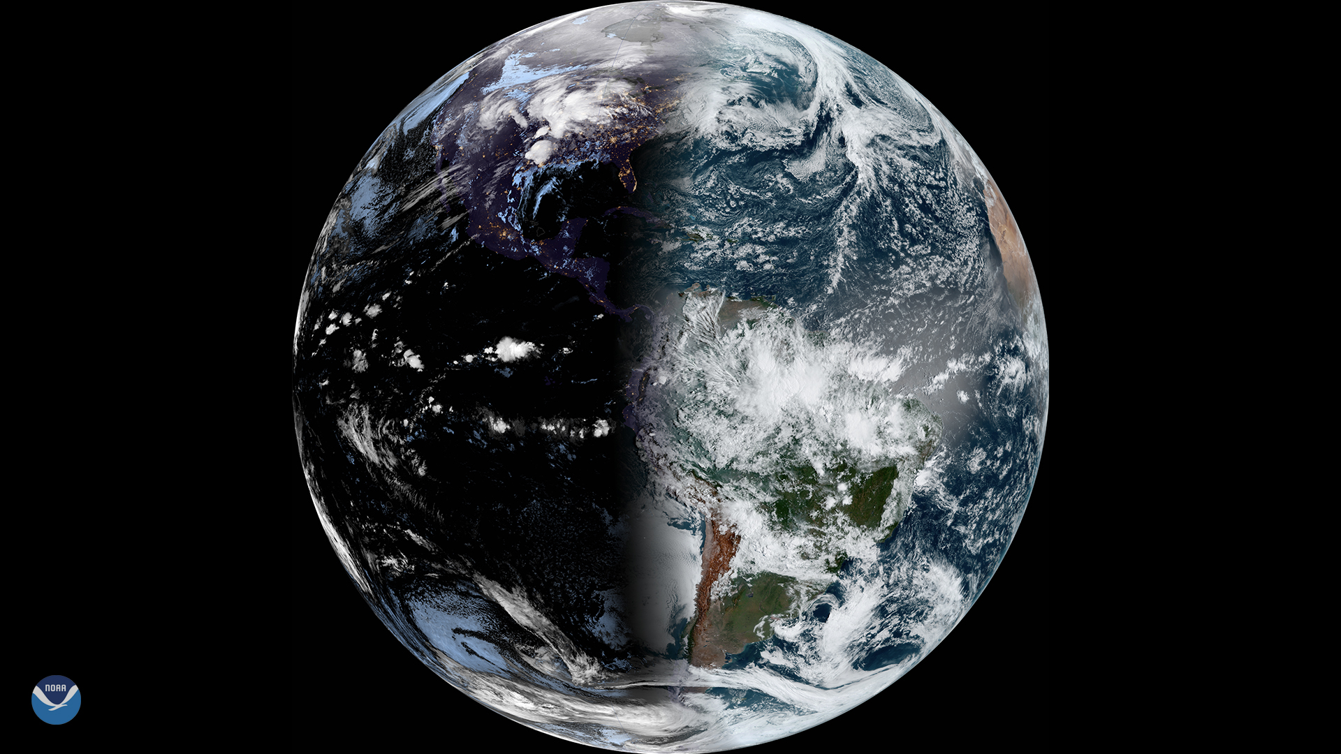
This year, the vernal equinox occurs on March 19, 2020. The last time it occurred this early was in 1896.
Feature Story

With the change of seasons, there comes increased risk of severe weather.