
Satellite Snapshots
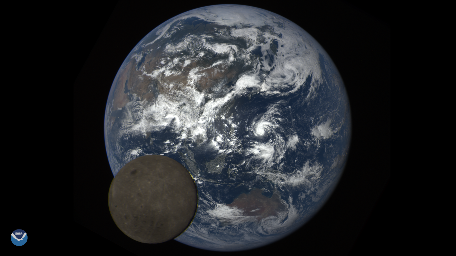
Tonight will be the biggest and brightest full moon, colloquially called a "supermoon," of 2020.
Feature Story
April 06, 2020 Happy SARSAT Beacon Awareness Day! The Search and Rescue Satellite Aided Tracking (SARSAT) system is recognized by emergency…
Satellite Snapshots
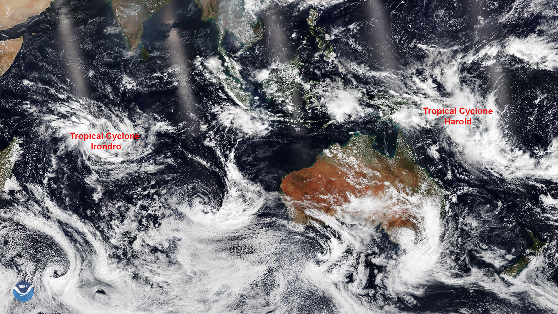
NOAA-20 captured this imagery of two tropical cyclones that developed in the Southern Hemisphere. The…
Satellite Snapshots
April 02, 2020 On March 29, 2020, the NOAA-20 satellite viewed the snowpack on top of the Hindu Kush Himalayas. During this time of the year, when…
Satellite Snapshots
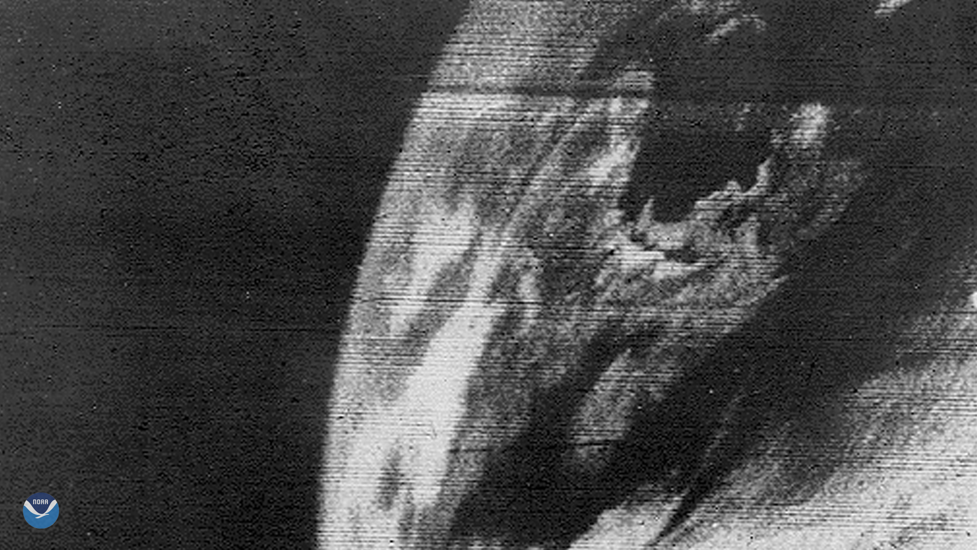
April 01, 2020 On April 1, 1960, 10 years before NOAA was established, NASA launched the Television Infrared Observation Satellite (TIROS-1), which…
Satellite Snapshots
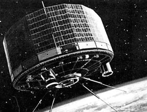
Tuesday, March 31, 2020On April 1, 1960, the National Aeronautics and Space Administration (NASA) launched TIROS-1, the world’s first successful…
Feature Story
Honoring the 60th Anniversary of the First Weather Satellite Launch web map in new window On April 1, 1960, the first operational weather satellite,…
Satellite Snapshots
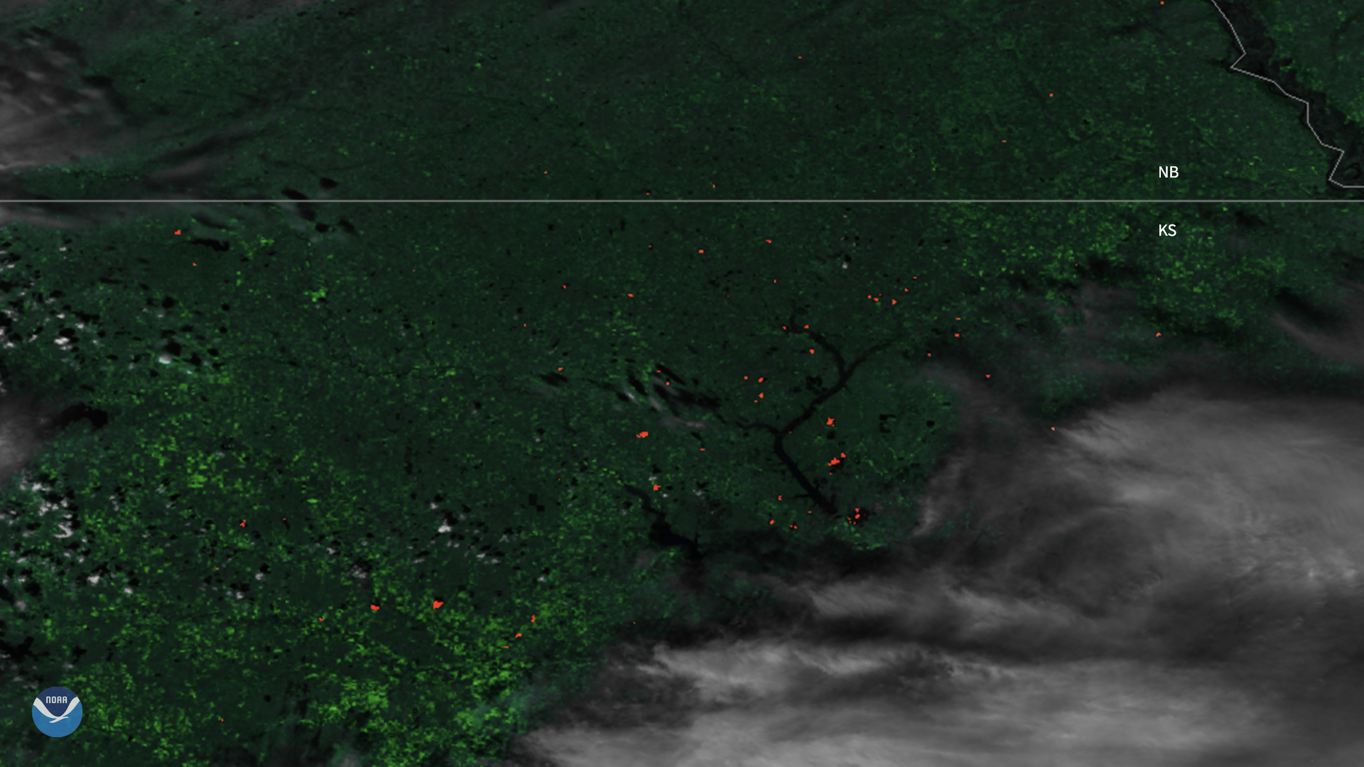
The Suomi-NPP satellite captured imagery of fires dotting Kansas as it passed overhead.