
Earth from Orbit

NOAA satellites have been closely monitoring the Jones Road Fire, which erupted on Tuesday, April 22, 2025, in a region of eastern New Jersey known as the Pine Barrens. Fueled by strong, gusty winds, low humidity, and dry undergrowth, the blaze has…
Feature Story
NOAA satellites closely monitored a powerful and devastating storm system that tore through the central and eastern United States from March 14-16, 2025.
Earth from Orbit
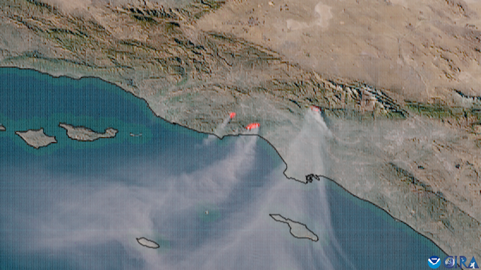
This week, critical fire weather conditions persisted across coastal Southern California, driven by moderate to locally strong winds
Satellite Snapshots
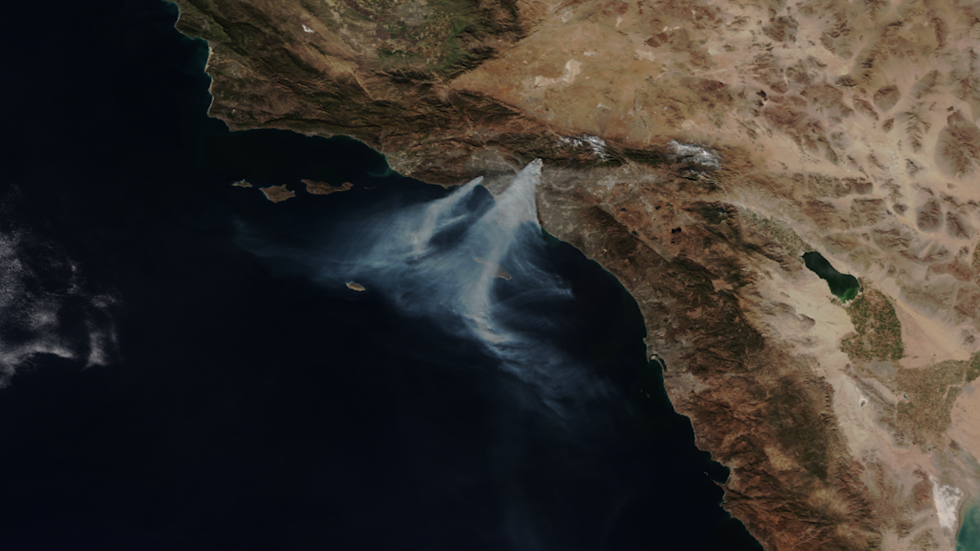
NOAA satellites have been closely monitoring multiple wildfires that began erupting in southern California on Tuesday, Jan. 7, 2025 and are continuing to devastate the region.
Feature Story

As wildfires become more frequent and severe, accurate forecasting is essential for saving lives, protecting property, and managing resources effectively.
Earth from Orbit

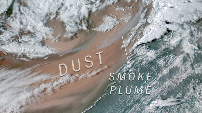
Roughly 100 wildfires are raging out of control across the western United States and hundreds more are burning in Canada, destroying homes, forcing evacuations, and affecting air quality. NOAA satellites have been closely monitoring these blazes,…
Satellite Snapshots
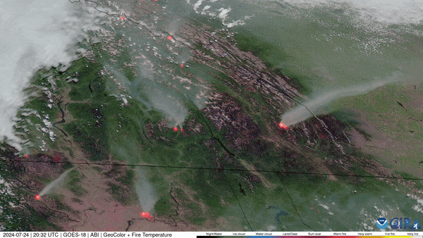
The 2023/2024 winter season was the warmest on record for Canada and continuing drought conditions led to an early start of the wildfire season for the western part of the country.
Announcement

Atmospheric models assimilate ozone and trace gas data from JPSS instruments to improve real-time predictions of global air quality.