
Earth from Orbit

Since mid-May, NOAA satellites have been closely monitoring heat signatures and thick plumes of smoke (some stretching thousands of miles) from wildfires burning across Canada. Driven by heat, drought, and dry conditions, more than 160 fires kicked…
Earth from Orbit

NOAA satellites have been monitoring a potent and complex spring weather pattern responsible for nearly a week-long stretch of severe weather, including two destructive tornado outbreaks across the central U.S. from May 15–16 and May 18–20, 2025.
Satellite Snapshots
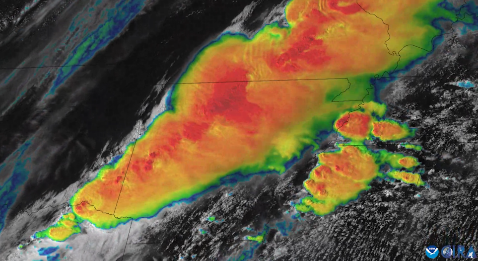
On April 2, 2025, NOAA’s GOES East (GOES-16) satellite captured imagery of numerous severe thunderstorms erupting across the Mississippi and Ohio river valleys.
Feature Story
NOAA satellites closely monitored a powerful and devastating storm system that tore through the central and eastern United States from March 14-16, 2025.
Feature Story
From their orbits, NOAA satellites can play a vital role in detecting and tracking severe weather, providing forecasters with critical data to predict and monitor life-threatening conditions.
Earth from Orbit

NOAA satellites have been tracking a major spring storm system pushing across the central United States this week. The system has prompted NOAA’s National Weather Service (NWS) to issue widespread weather alerts for everything from blizzard warnings…
Feature Story

As a winter storm brought its fury to Washington, D.C. and the Mid-Atlantic region on January 6, 2025, NOAA’s National Environmental Satellite, Data, and Information Service played a pivotal role in monitoring and supporting the nation’s response to…
Satellite Snapshots
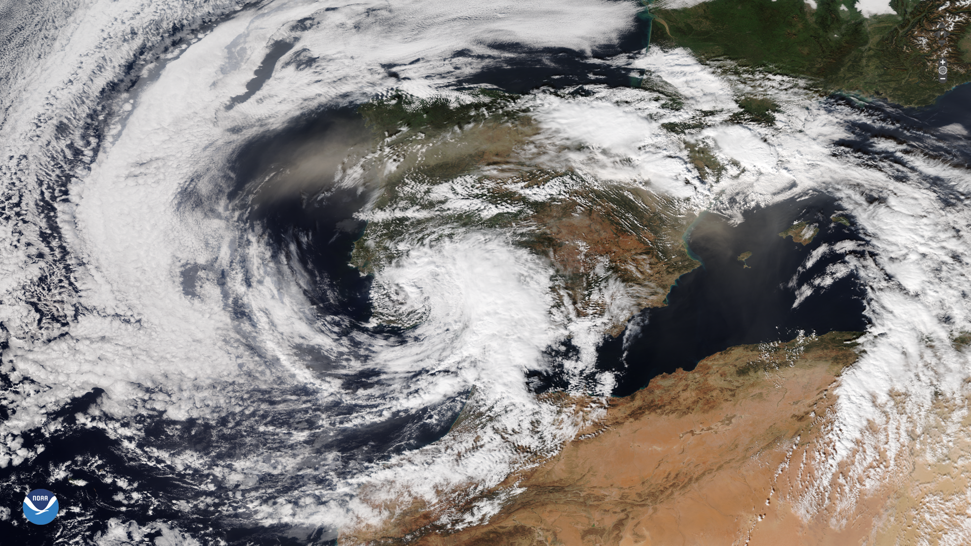
A powerful storm struck parts of Spain on Tuesday, Oct. 29, 2024, which brought severe flooding.