
Satellite Snapshots

NOAA Satellites Show Changes in the Great Salt Lake Over Twelve Years Through Enhanced Color Imaging
This series of 26 enhanced color images via NOAA’s Joint Polar Satellite System (JPSS) Program satellites shows the water level changes in Utah’s Great Salt Lake from May 2012 to Nov. 2024.
Feature Story
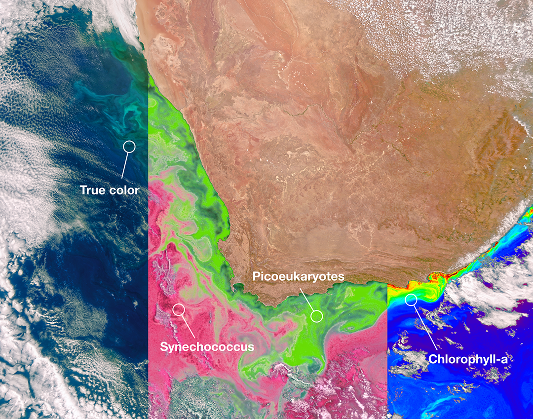
NOAA offers a comprehensive set of ocean color products that integrate information from NOAA, NASA, and international partner satellites. These products are used to assess water quality and monitor potentially harmful algal blooms in order to…
Earth from Orbit
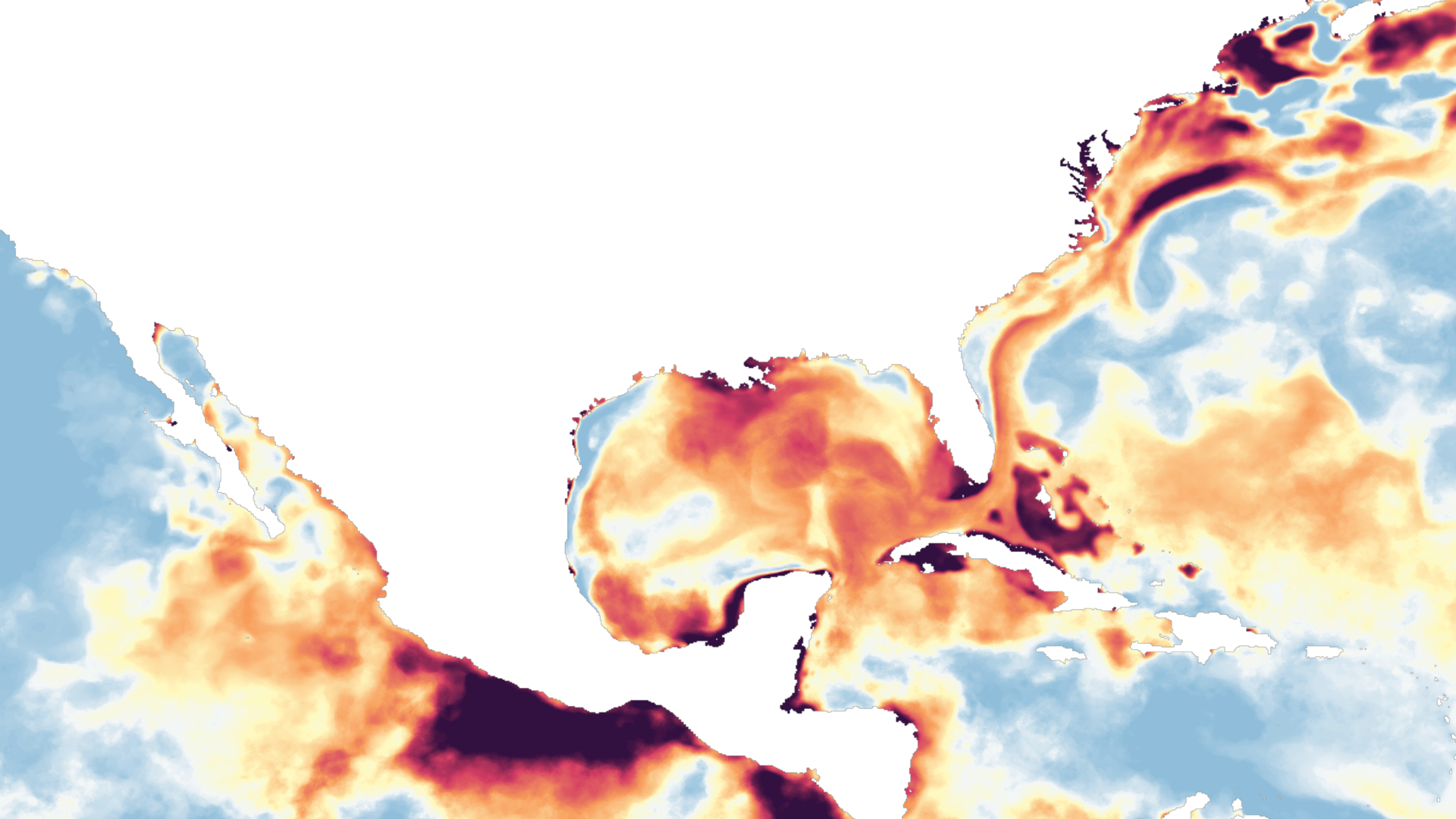
Since April 2023, NOAA has been monitoring a steady rise in ocean temperatures, which is resulting in unprecedented heat stress conditions in the Cari
Feature Story
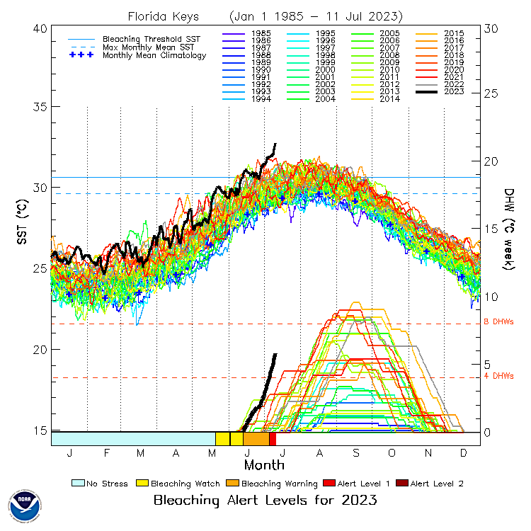
The current marine heat wave is raising new concerns about the potential impact on the fragile coral reefs beneath the ocean’s surface.
Announcement
NASA Awards Contracts for NOAA Ocean Color Instrument Phase A Study
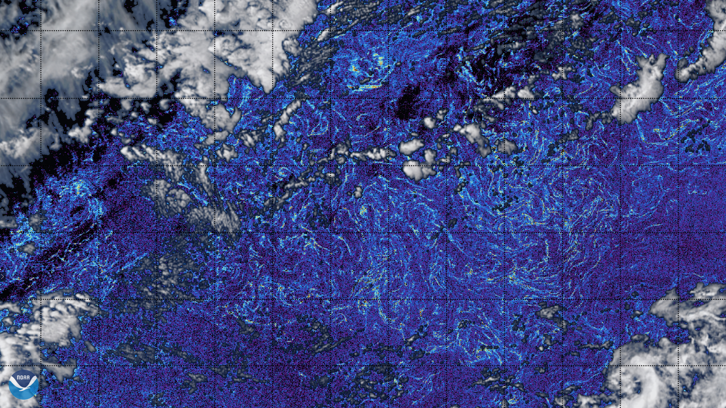
Earth from Orbit
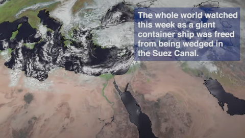
Imagery from the NOAA-20 satellite showed more than 400 cargo ships backed up in the Red Sea and Bitter Lake due to a ship blocking the Suez Canal.
Satellite Snapshots
Ten years ago today, a 9.1 magnitude earthquake struck off the northeastern coast of Honshu on the Japan Trench, a…
Satellite Snapshots
March 08, 2021 NOAA CoastWatch Atlantic OceanViewer, on March 3, 2021, captured imagery of massive amounts of Sargassum algae on the normally crystal…