
Satellite Snapshots

NOAA satellites have been monitoring several large wildfires in Minnesota.
Satellite Snapshots
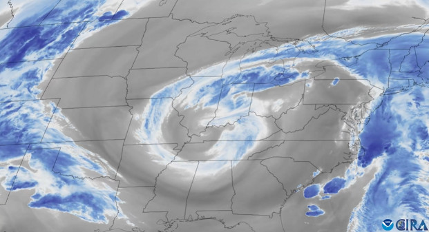
From May 2 to 5, 2025, water vapor imagery from NOAA’s GOES East satellite helped track a swirling low pressure system over the eastern United States.
Announcement
In August 2024, NOAA released the summary of the results of the Space Weather Data Pilot conducted under NOAA’s National Environmental Satellite, Data, and Information Service (NESDIS) Commercial Data Program.
Earth from Orbit

NOAA satellites have been closely monitoring the Jones Road Fire, which erupted on Tuesday, April 22, 2025, in a region of eastern New Jersey known as the Pine Barrens. Fueled by strong, gusty winds, low humidity, and dry undergrowth, the blaze has…
Feature Story

The JPSS VIIRS Day/Night Band, with its low-light sensitivity, captures auroras and shows how solar particles interact with Earth’s atmosphere.
Earth from Orbit

NOAA satellites have been monitoring Earth’s weather and environment since 1970, which also happened to be the year the first official Earth Day took place!
Satellite Snapshots

NOAA’s Joint Polar Satellite System (JPSS) satellites captured striking imagery of sediment runoff due to flooding in the Mississippi River delta from April 8–13, 2025.
Feature Story

The Johns Hopkins Applied Physics Laboratory (APL) has released the results of the nation’s first end-to-end Space Weather (SWx) Tabletop Exercise (TTX), which was held on May 8-9, 2024. The After Action Report is now available to the public.