
Feature Story
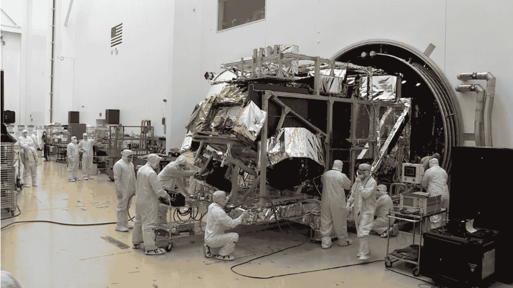
NOAA’s JPSS-2 satellite has cleared a critical testing milestone, bringing it a step closer to launch. On Saturday, the polar-orbiting satellite emerg
Feature Story

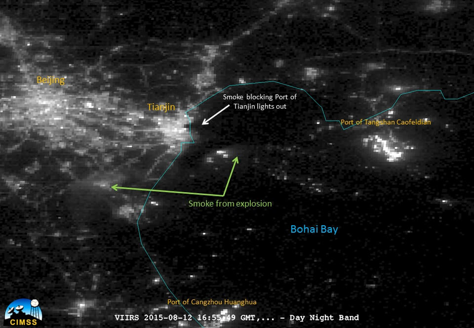
NOAA satellites improve estimates of wildfire smoke, air quality predictions
Feature Story
NOAA and NASA are now targeting November 1, 2022, as the new launch date for NOAA’s JPSS-2 satellite mission.
Feature Story

For a little-known satellite instrument, the microwave sounder has a major impact on our lives.
Feature Story
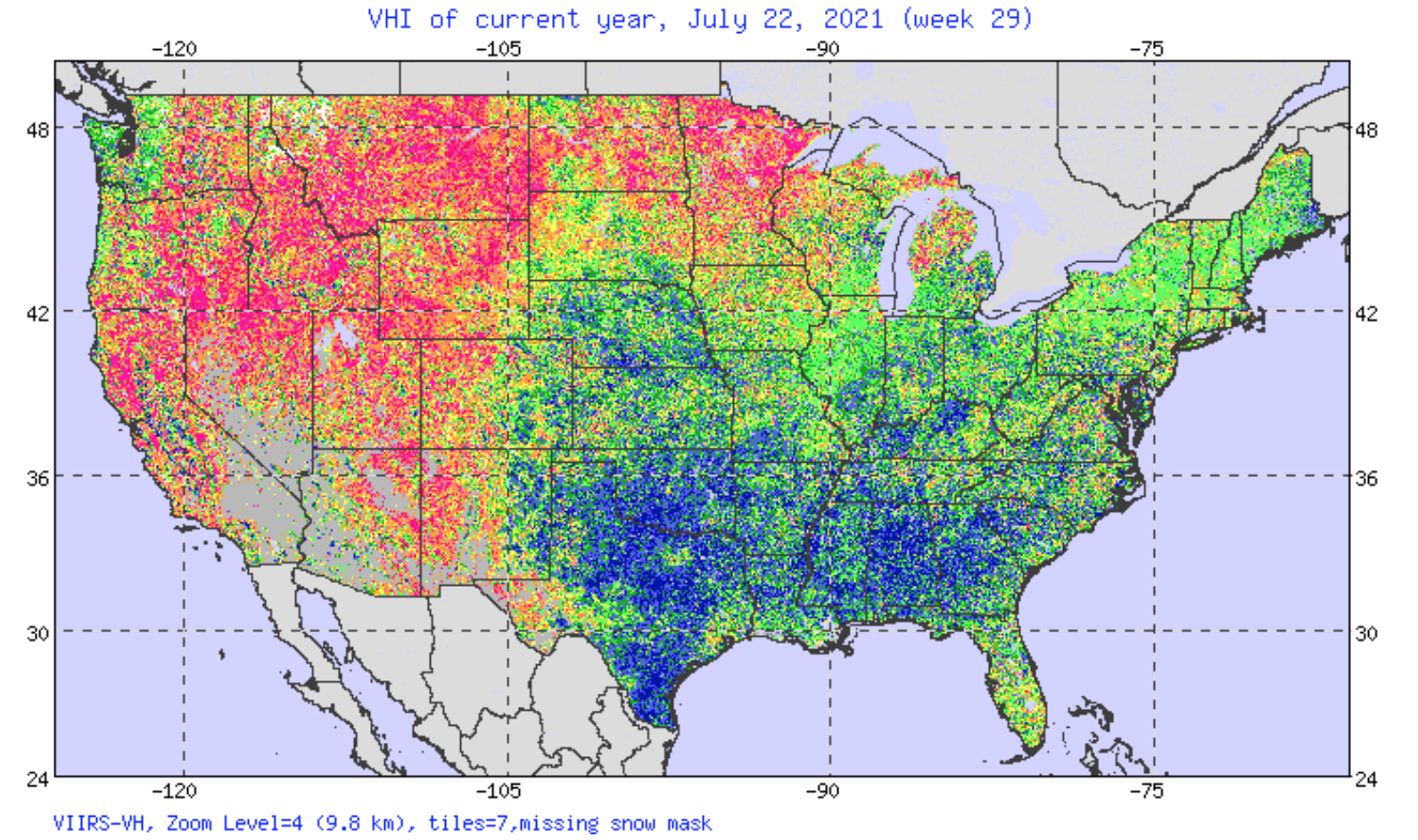
Mid-June in Utah usually marks the tail end of the most fertile time of year for crops.
Feature Story

This is a collection of images of the satellite JPSS. NOAA’s Joint Polar Satellite System (JPSS) provides global observations that serve as the backbone of both short- and long-term forecasts, including those that help us predict and prepare for…
Earth from Orbit

NOAA satellites often see patterns of clouds called gravity waves, which appear as ripples.