
Satellite Snapshots
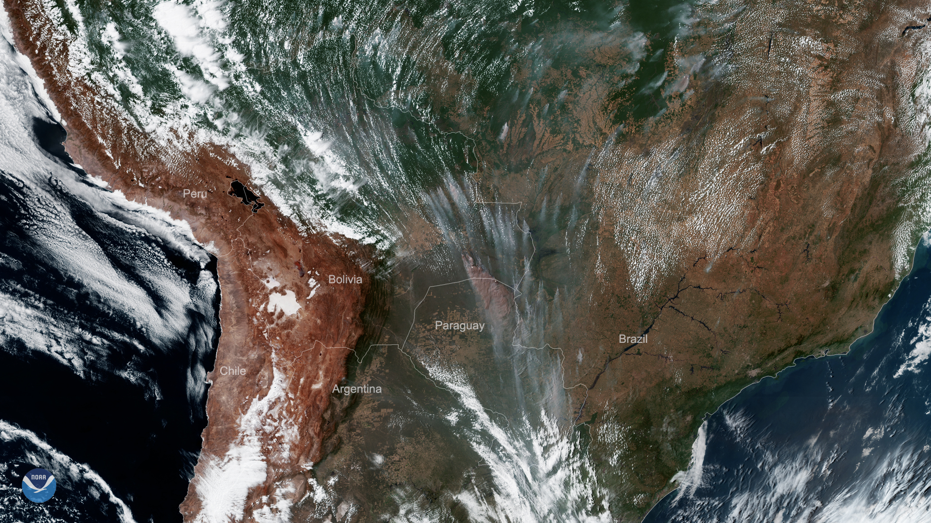
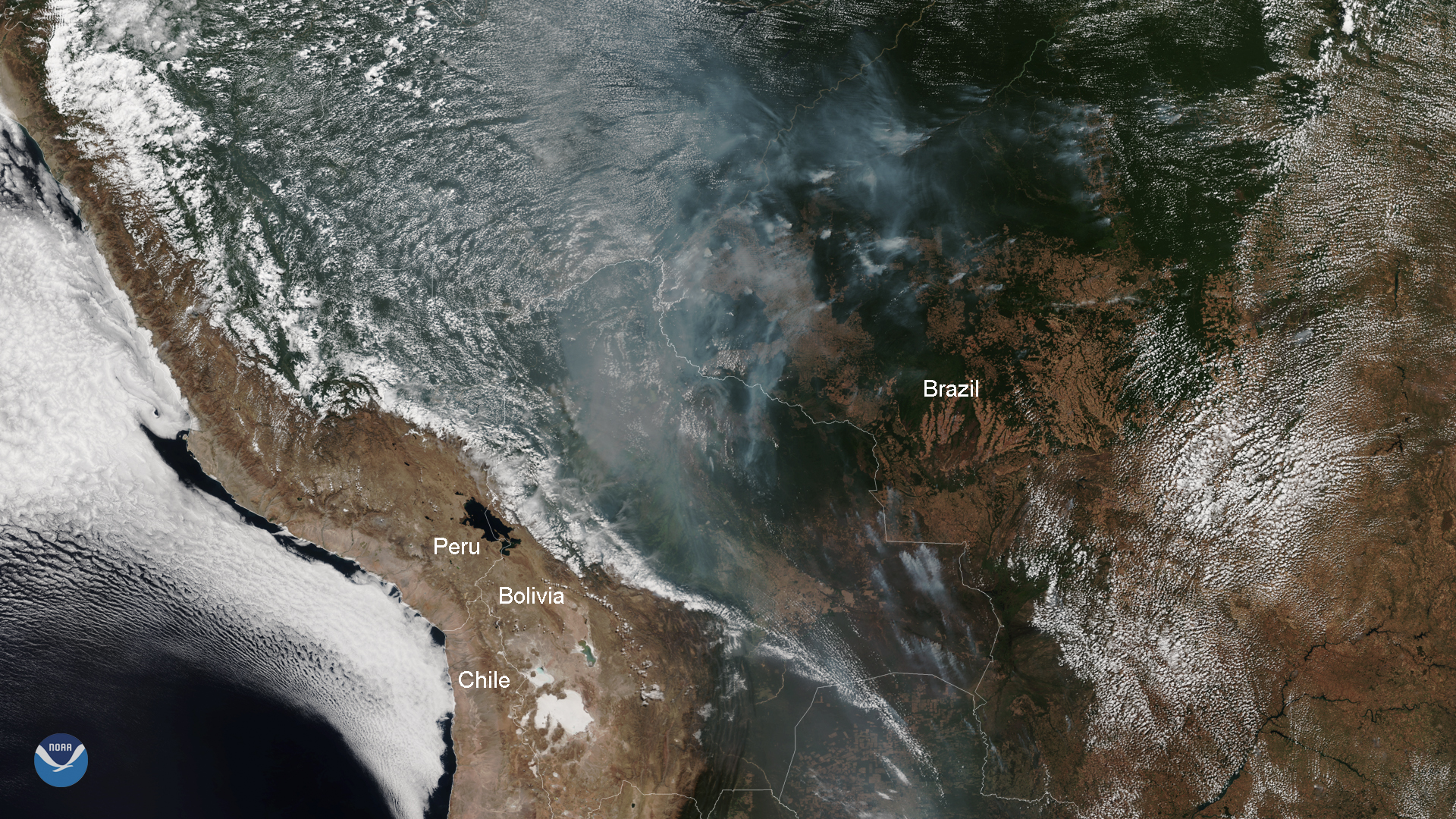
On Sept. 9, 2019, GOES East viewed severe fires in South America across Brazil, Bolivia, and Paraguay.
Satellite Snapshots
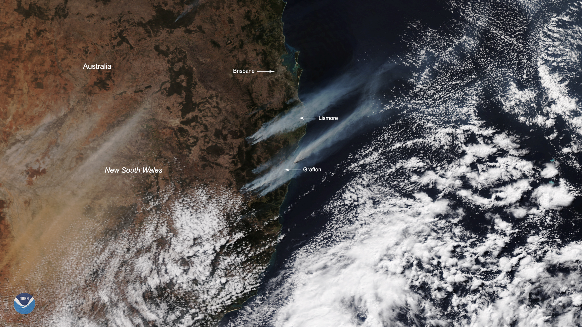
Hundreds of firefighters across New South Wales and Queensland, Australia are battling more than 140 bushfires that have broken…
Satellite Snapshots
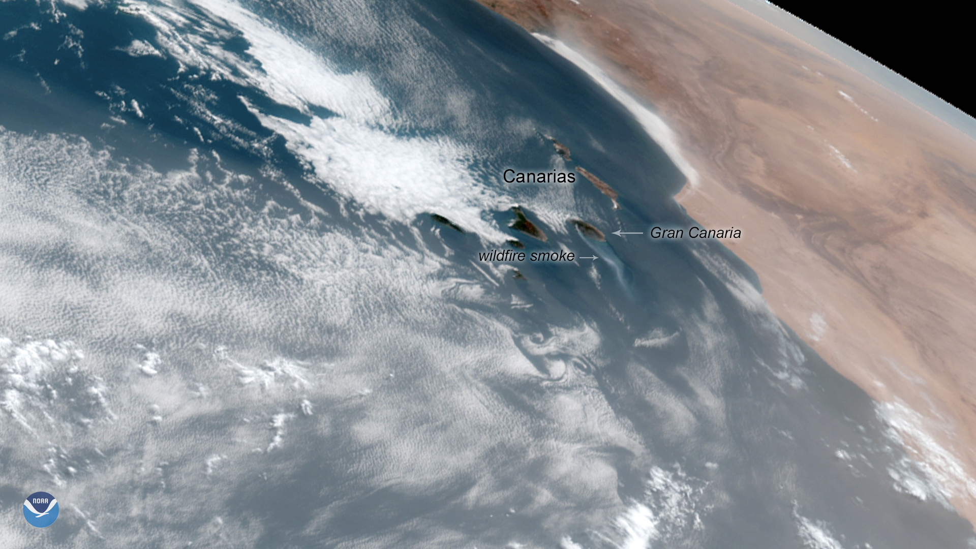
A wildfire burning on the Island of Gran Canaria in Spain’s Canary Islands is the worst in six years, authorities say. Originating…
Satellite Snapshots
August 13, 2019 Throughout most of its history, the Amazon rainforest was relatively fire-resistant thanks to its natural moisture and humidity…
Satellite Snapshots

Hazy smoke from agricultural fires in central to southern Africa can be clearly seen in this VIIRS true-color image taken by NOAA-20…
Satellite Snapshots
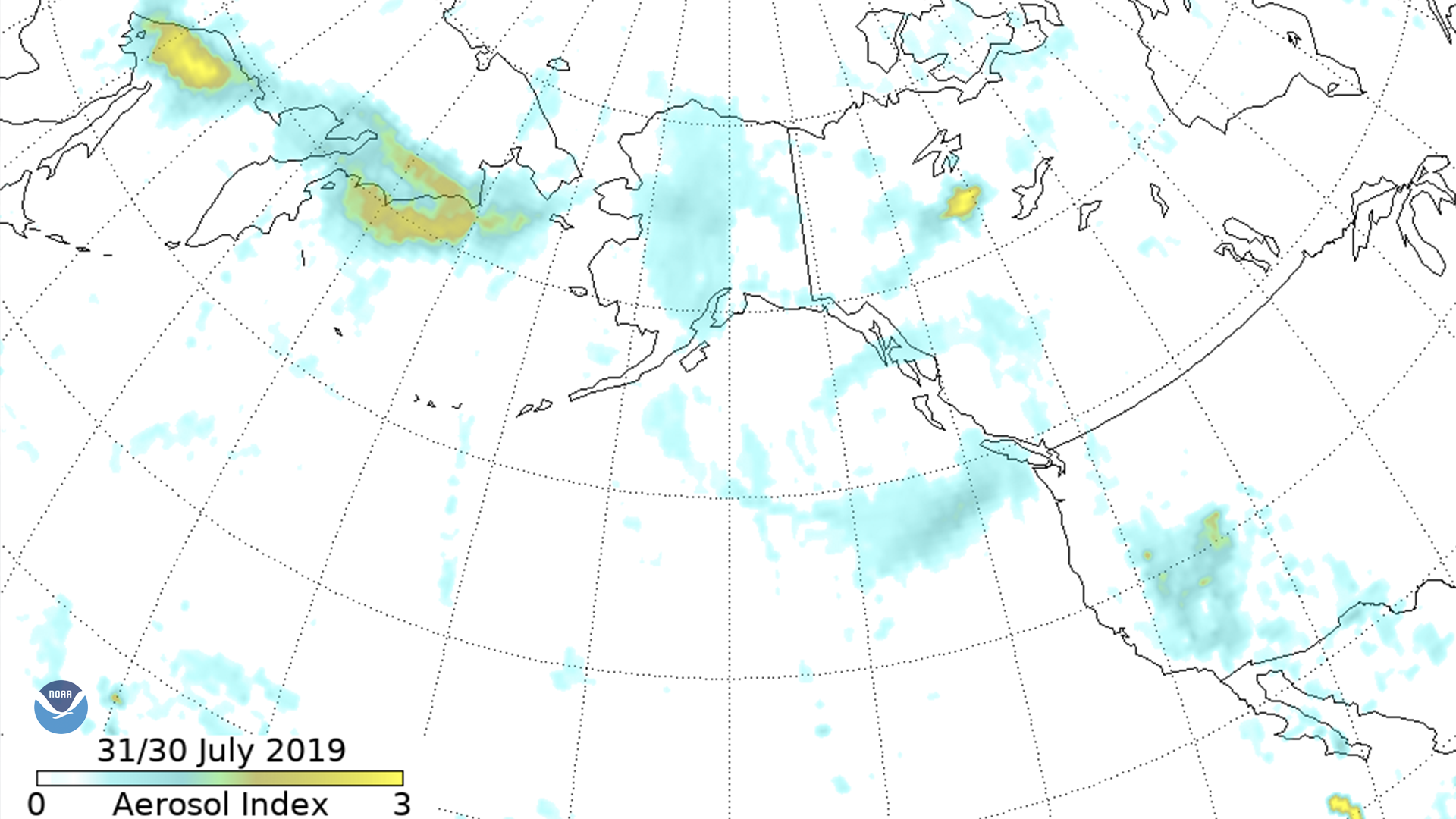
The Suomi-NPP Ozone Mapping and Profiler Suite (OMPS) aerosol index shows smoke moving across eastern Russia into Alaska, down the west…
Feature Story
From 10,000 feet above ground, pilots can spot the glow of a fire. Data from satellites and aircraft help make firefighting decisions.
Satellite Snapshots
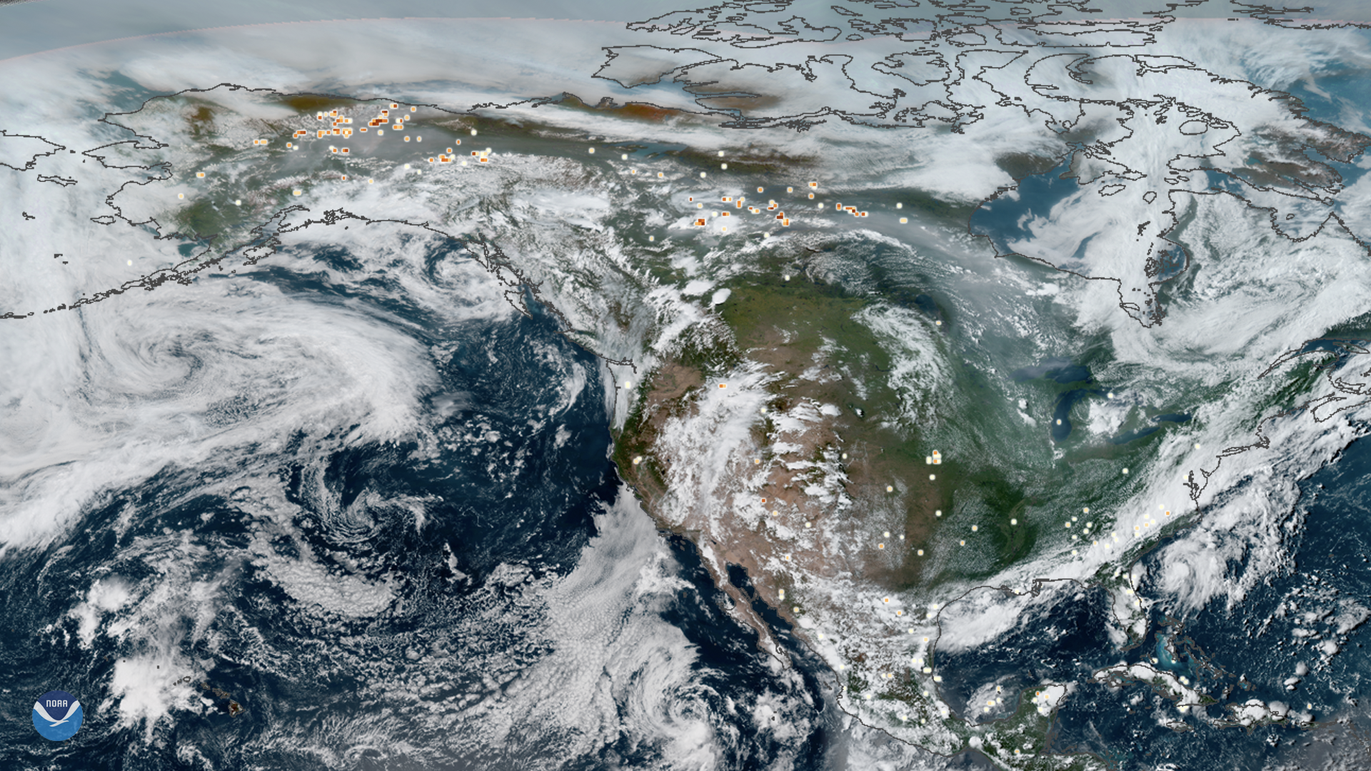
This true-color composite image of smoke from Arctic wildfires spreading across Alaska and Canada was captured by both GOES East and…