
Earth from Orbit
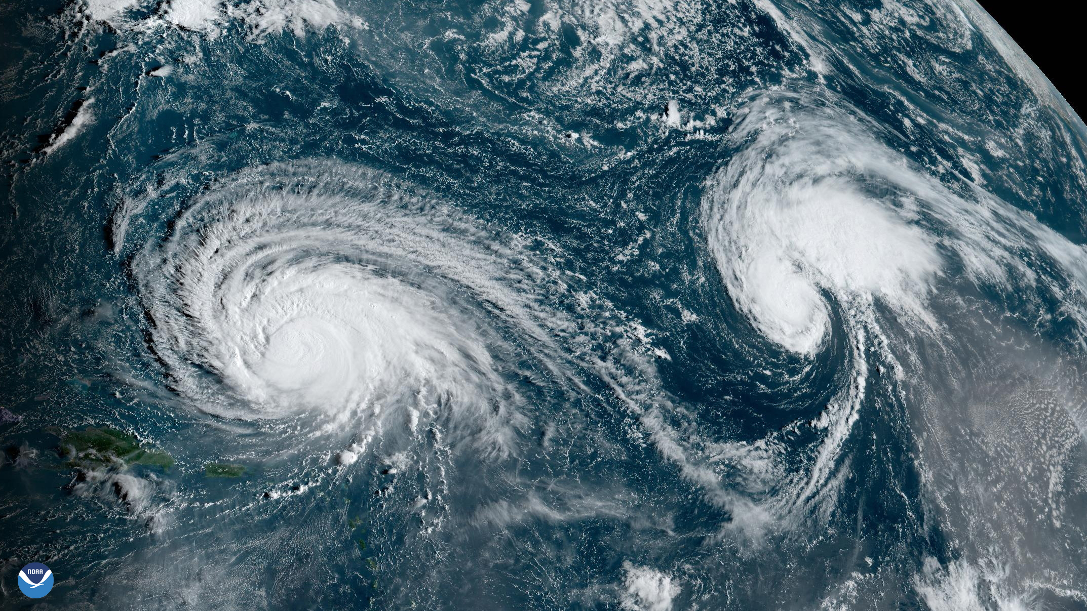
NOAA satellites constantly monitor the oceans for tropical activity. As the 2023 Atlantic hurricane season comes to a close, we’re looking back at this above-normal season.
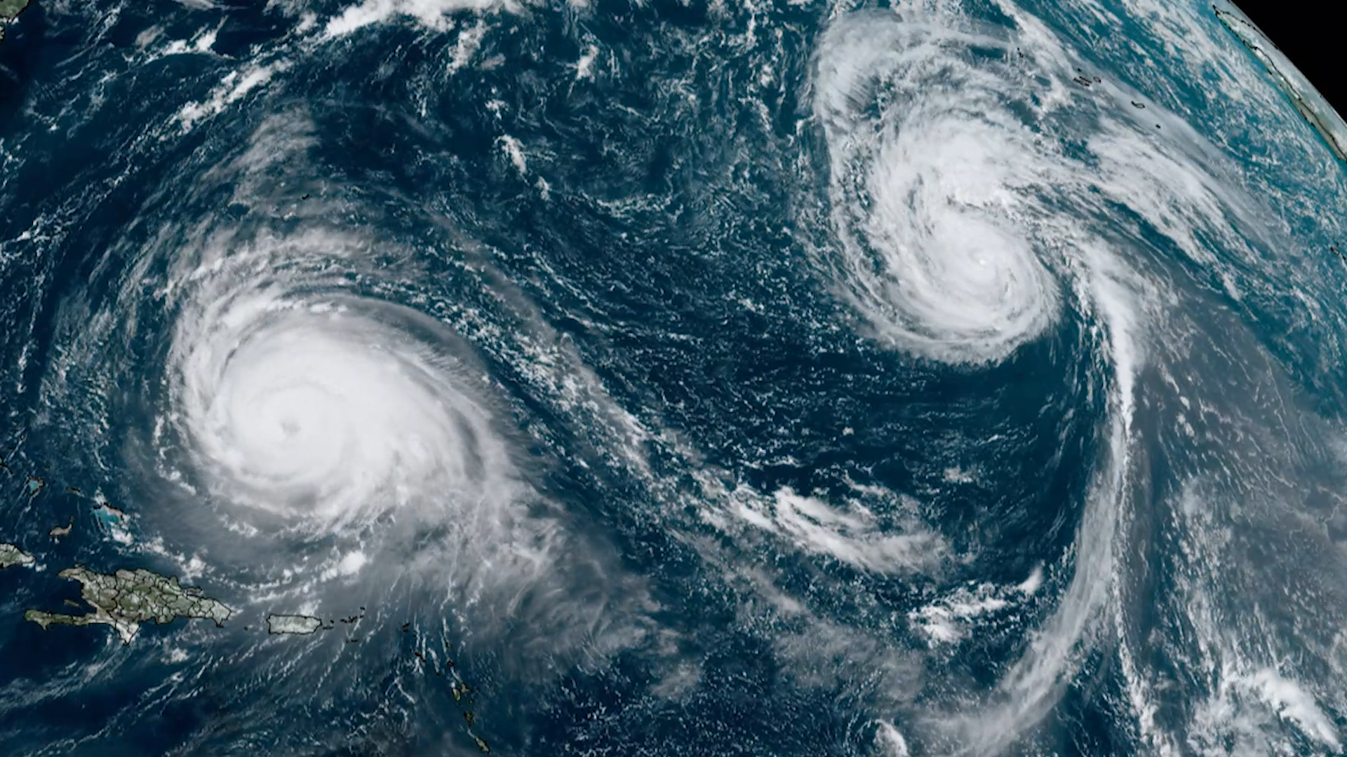
Earth from Orbit
NOAA satellites constantly monitor the oceans for tropical activity. As the 2023 Atlantic hurricane season comes to a close, we’re looking back at this above-normal season.
Earth from Orbit
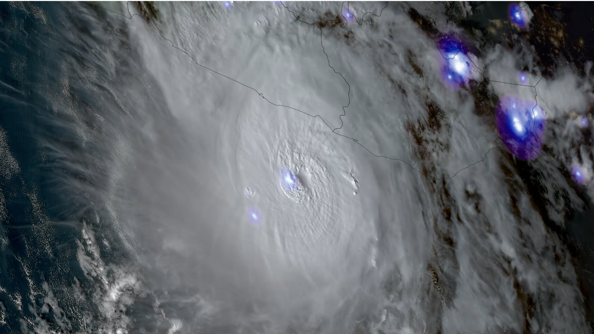
Hurricane Otis made landfall on Mexico’s southern Pacific coast, at 1:25 a.m. CDT as a Category 5 hurricane with sustained winds of 165 mph.
Earth from Orbit
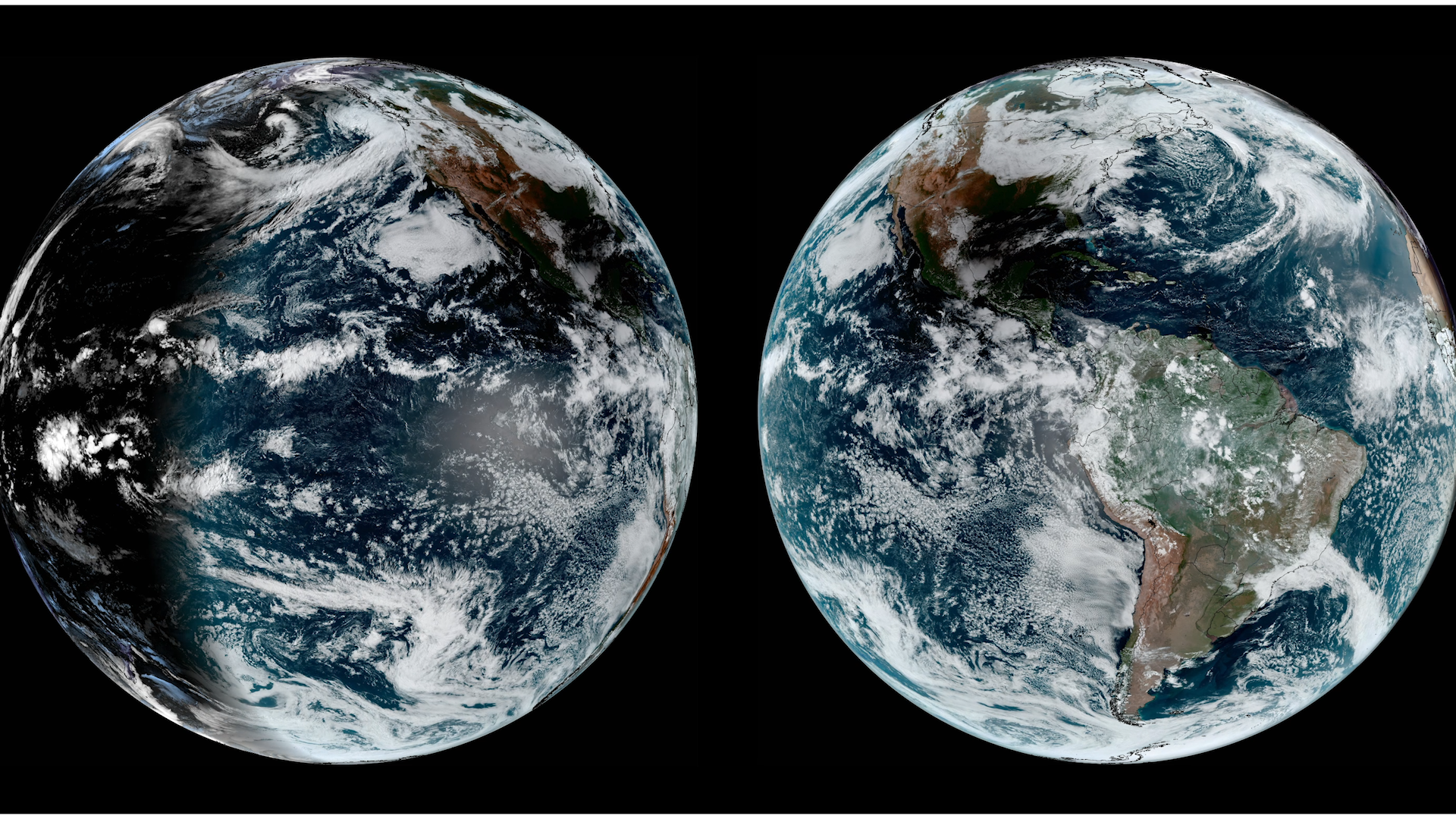
On Saturday, Oct. 14, 2023, NOAA satellites observed an annular solar eclipse traverse parts of North, Central, and South America.
Feature Story
A new product called RAVE is now operational in the U.S., which will help better determine the impacts of wildfire smoke on air quality.
Satellite Snapshots
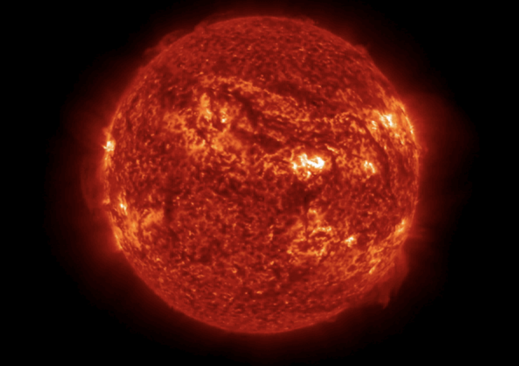
On September 16, 2023, the Solar Ultraviolet Imager (SUVI) instrument onboard GOES-East observed a large solar filament rippling off the face of the s
Announcement
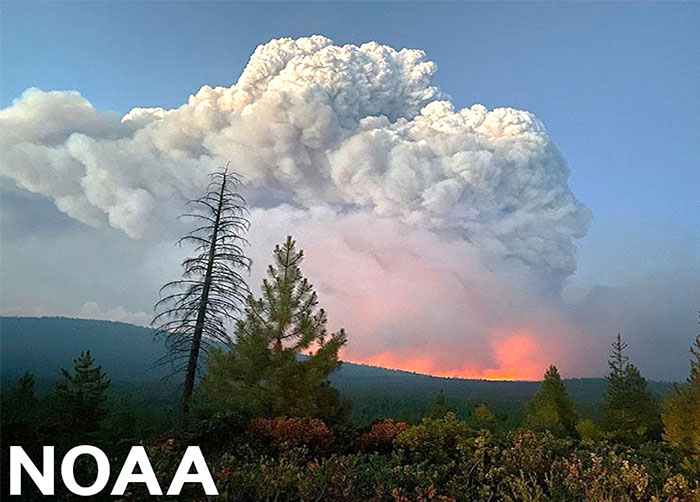
Hyperspectral soundings from low Earth orbit satellites can help predict dangerous pyrocumulonimbus clouds that form when wildfires give off heat.
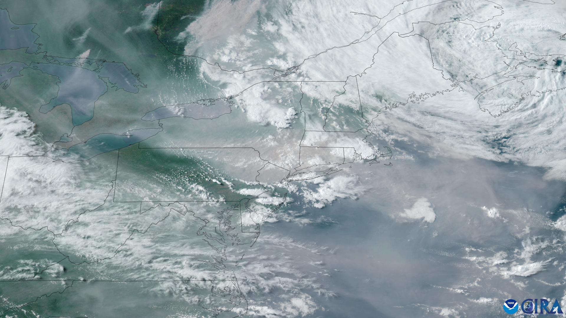
Satellite Snapshots
On the morning of Sept. 11, 2023, at 7:30 a.m. EDT, the Advanced Baseline Imager onboard NOAA’s GOES East satellite captured the above GeoColor image