
Feature Story
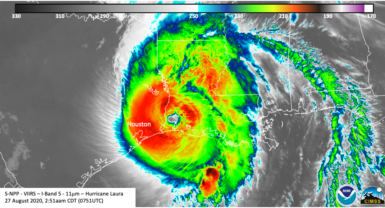
Hurricane Laura made landfall Thursday morning, hammering the Louisiana and Texas coasts with 150 mile-per-hour winds
Feature Story

A new product that alerts pilots to clouds, icy conditions and dangerously cold temperatures is tapping into NOAA’s Joint…
Feature Story

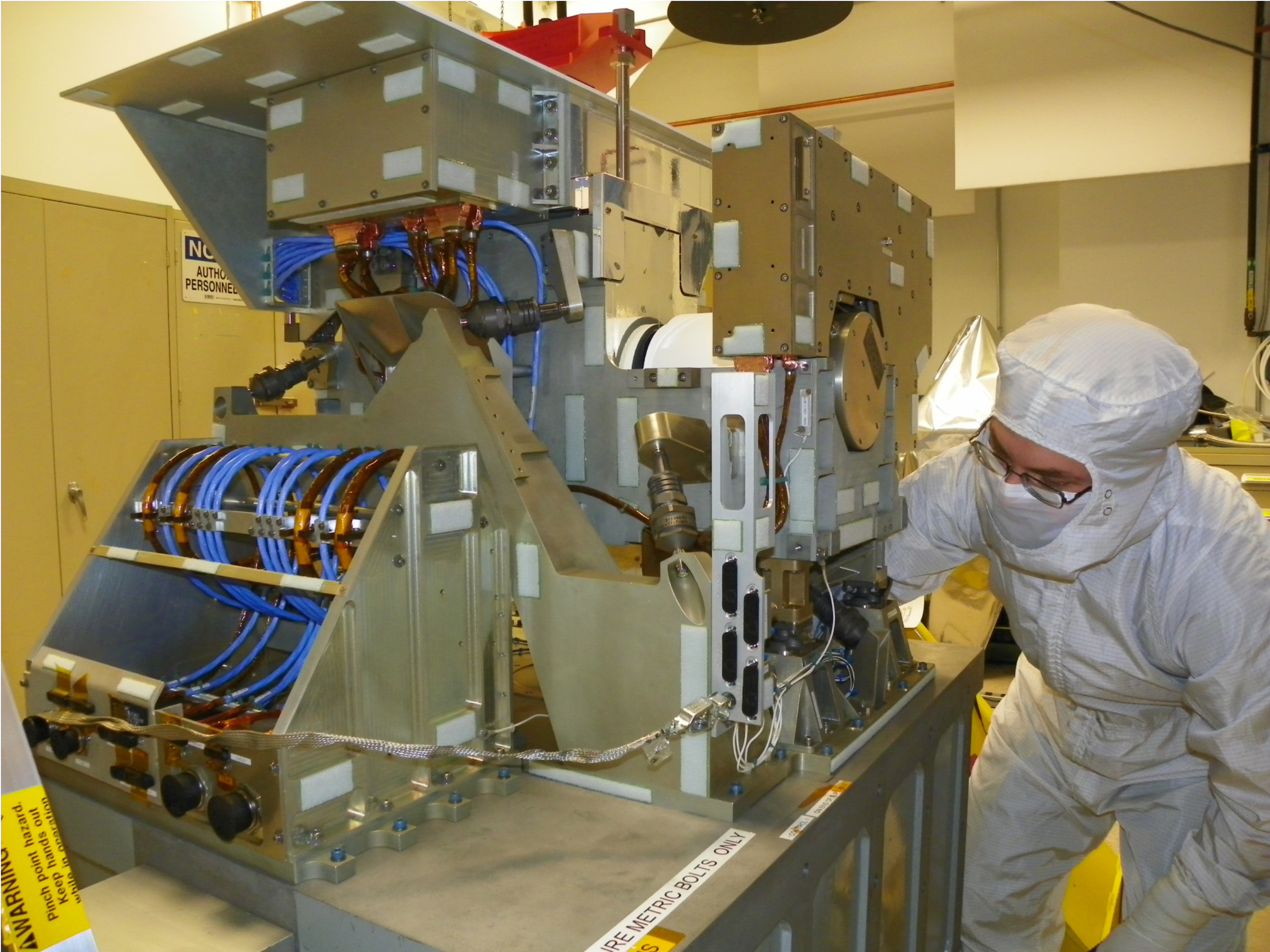
The Cross-Track Infrared Sounder (CrIS) instrument built to fly on the Joint Polar Satellite System (JPSS)-2 satellite is ready to ship to the spacecr
Feature Story
Honoring the 60th Anniversary of the First Weather Satellite Launch web map in new window On April 1, 1960, the first operational weather satellite,…
Feature Story
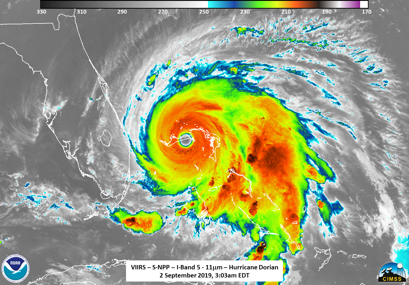
As Hurricane Dorian made landfall over two islands in the Bahamas, NOAA's Joint Polar Satellite System satellites captured these infrared images.
Feature Story
A team of engineers, scientists, and satellite operators recently restored a damaged satellite instrument that is used to measure temperature and wate
Feature Story

An inflatable decelerator technology that could one day help humans land on Mars will fly on the same Atlas V rocket as the JPSS…
Feature Story
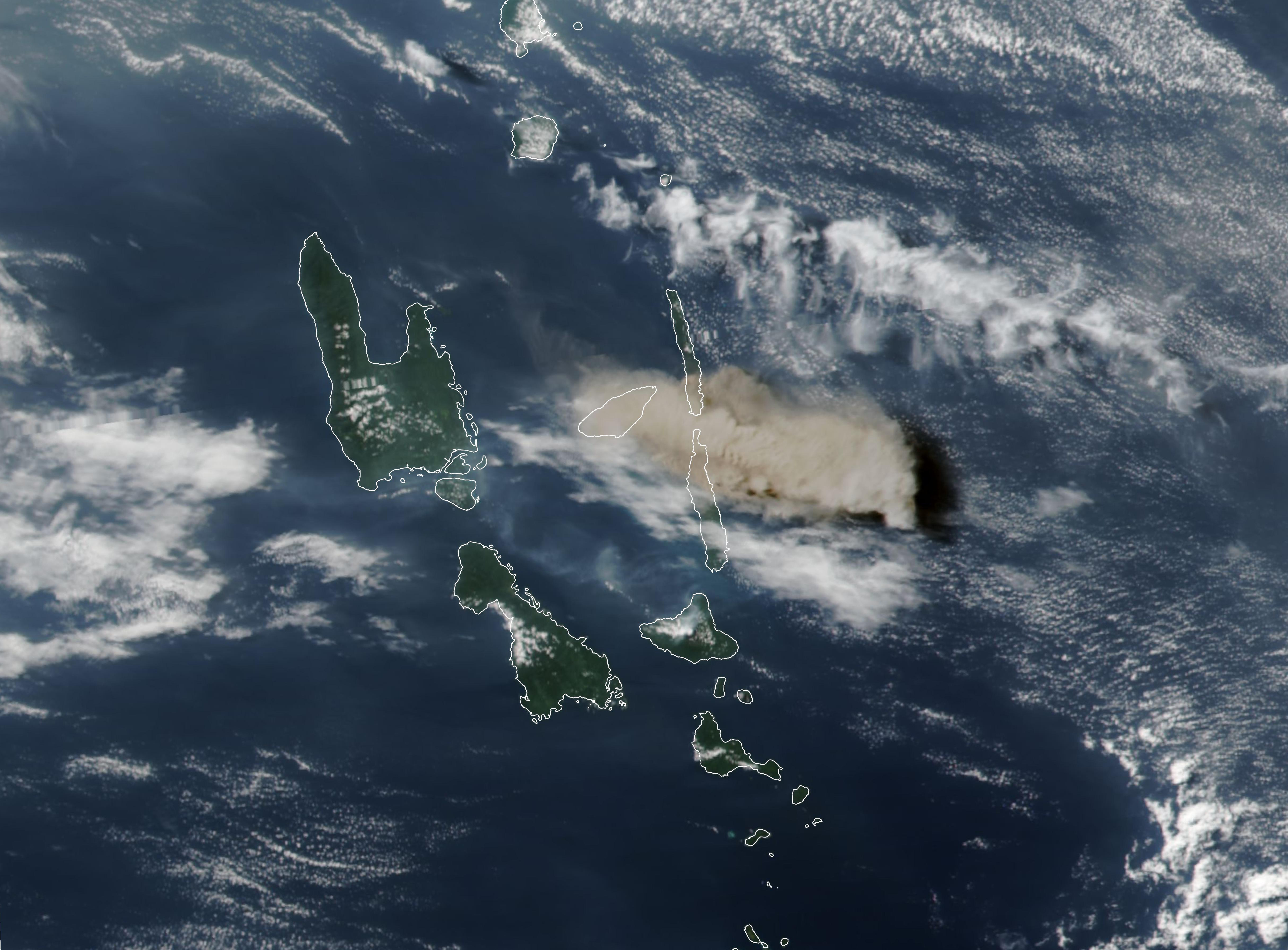
The Manaro Voui volcano on the island of Ambae in the nation of Vanuatu in the South Pacific Ocean made the 2018 record books. A NASA-NOAA satellite c