
Satellite Snapshots
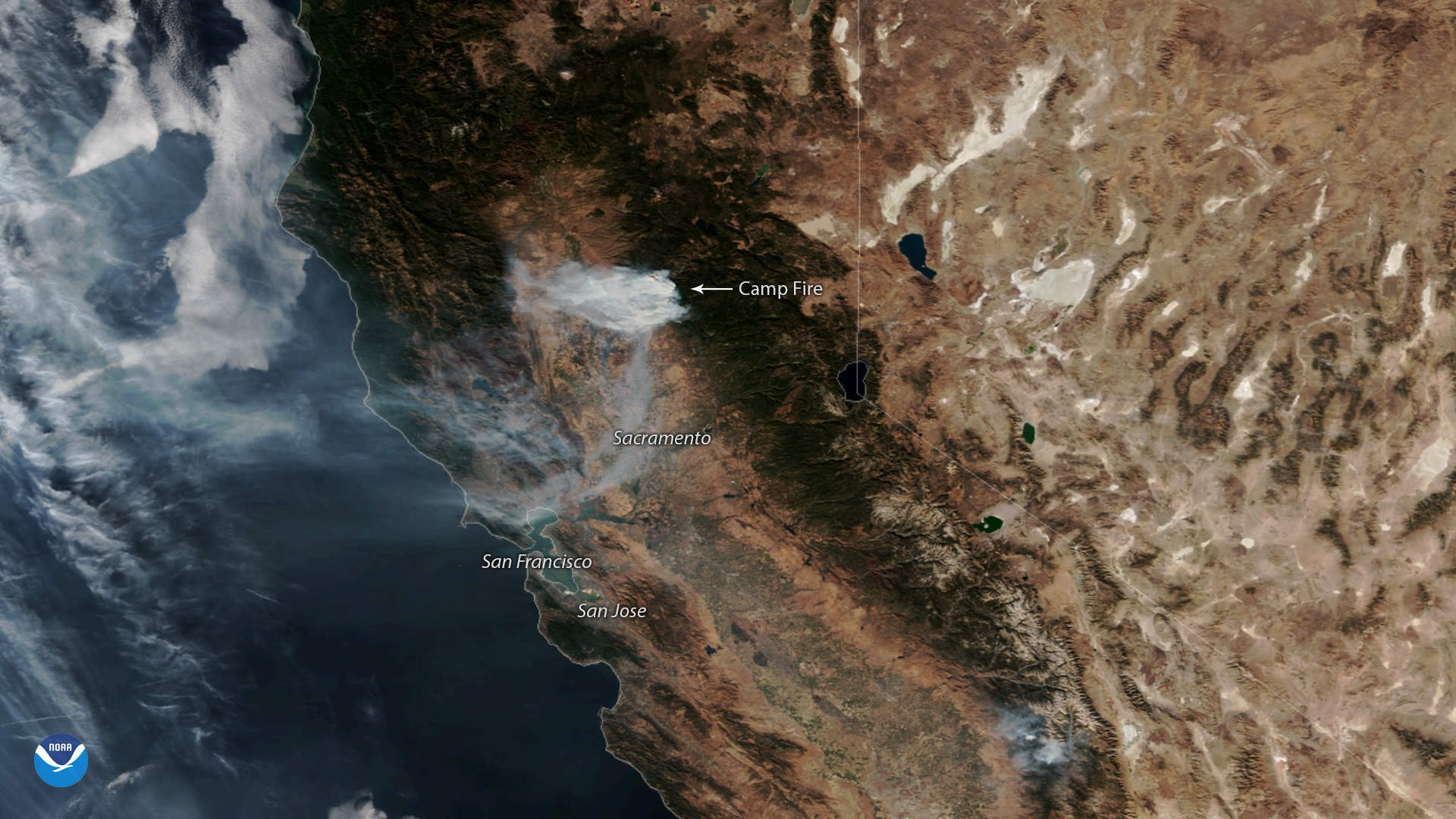
NOAA-20 captured this imagery of the fast-moving Camp Fire in Northern California on Nov. 12, 2018.
Satellite Snapshots

Plumes of smoke from California's Camp Fire are seen stretching across portions of the state in this NOAA-20 satellite image.
Satellite Snapshots

Historic heat has baked much of Europe this summer, turning the landscape from green to brown in little over a month. These two…
Feature Story
With raging wildfires torching the Western landscape, and six billion dollar weather-related disasters already experienced…
Satellite Snapshots
lumes of hazy smoke stretch across California and southern Oregon, as large wildfires continue to burn in the Western U.S. This GOES…
Satellite Snapshots
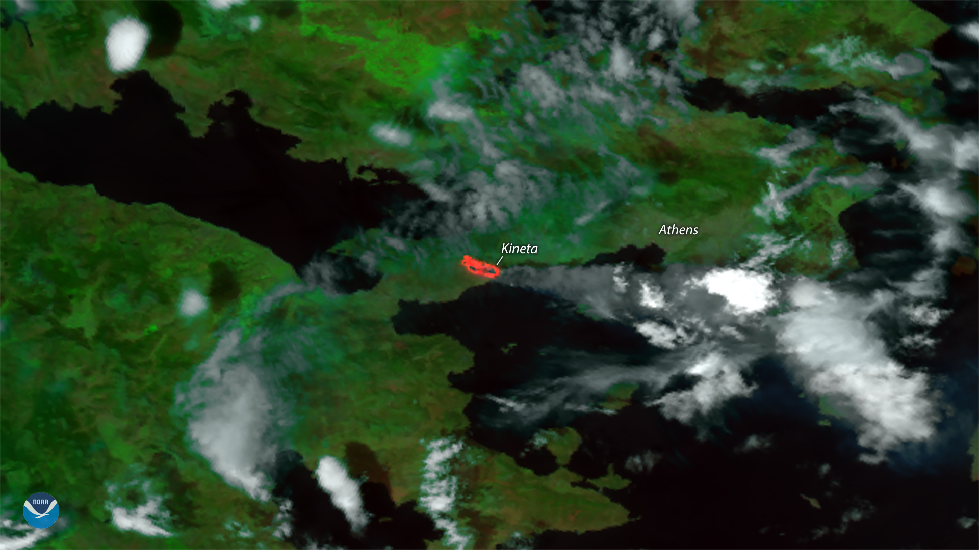
Hot, dry weather and gusty winds fueled deadly and destructive wildfires near Athens, Greece this week. This visible and thermal…
Satellite Snapshots
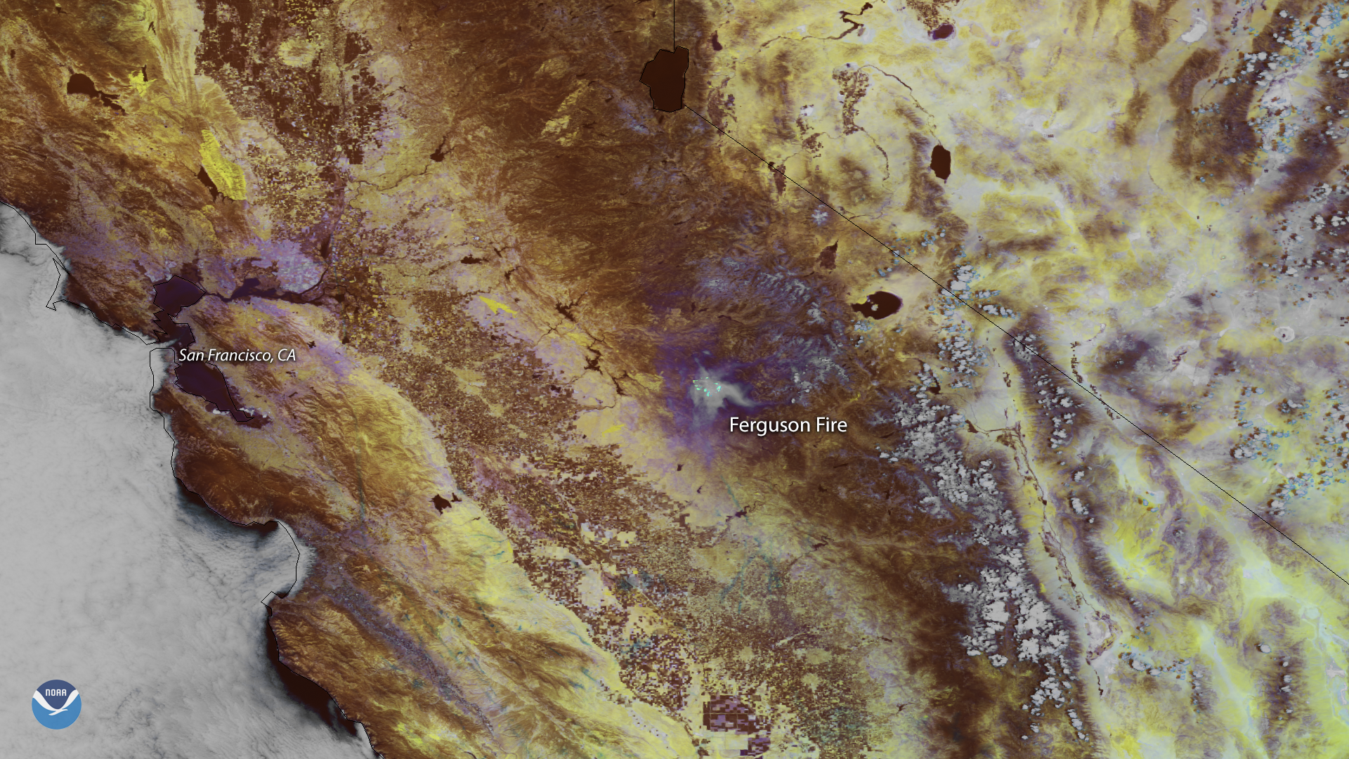
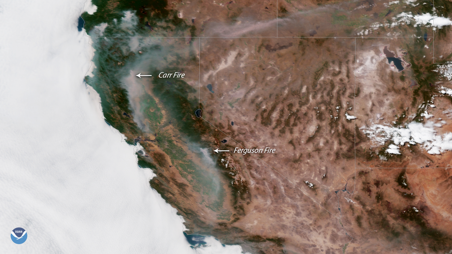
Smoke from the Ferguson Fire burning outside California's Yosemite National Park appears in this false color image captured by the NOAA…
Satellite Snapshots

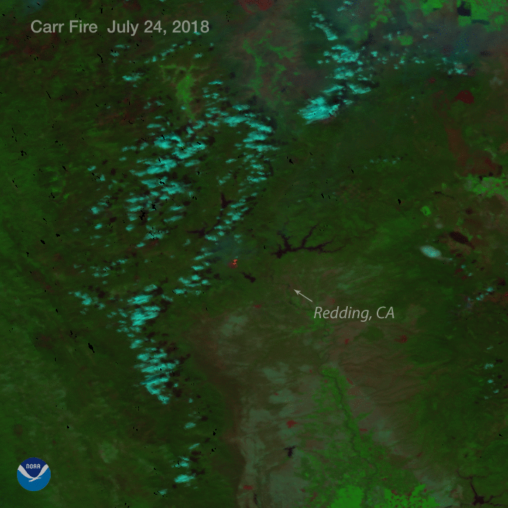
This multi-day infrared imagery from the NOAA-20 and Suomi NPP polar orbiting satellites shows the dangerous wildfires that continue to…