
Feature Story
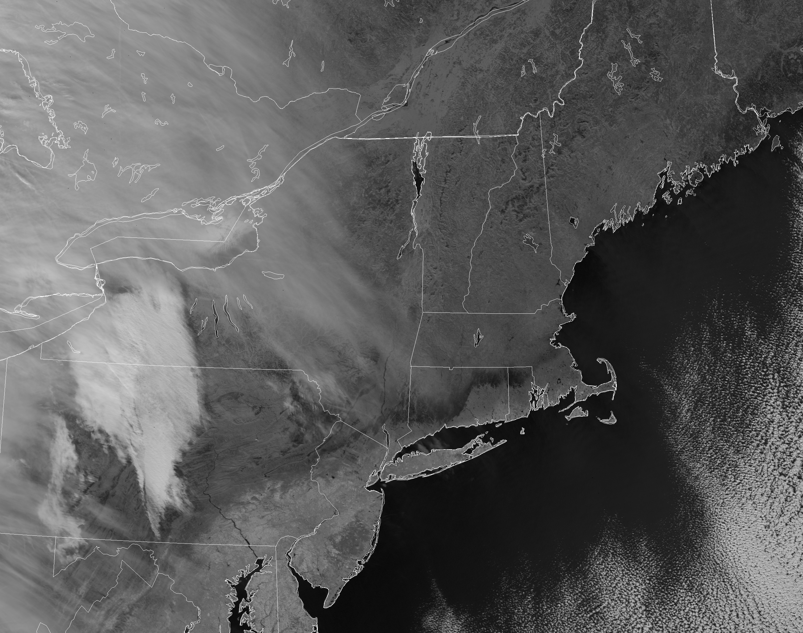
As a winter storm moved through the Northeast U.S. the weekend of Jan. 21-22, some 40 million residents watched the forecasts, wondering who would get
Feature Story
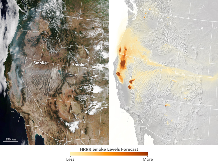
By the time the U.S. Forest Service declared the Mendocino Complex Fire 100 percent contained on Sept.18, it had scorched more than 459,000 acres, des
Feature Story
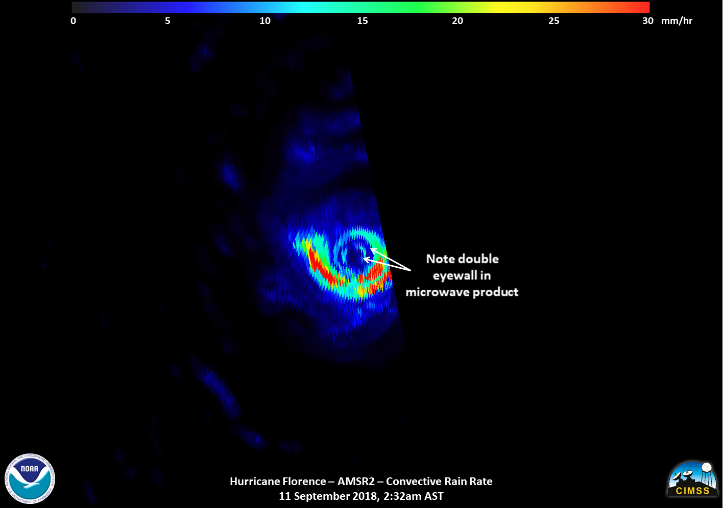
Satellite images of Hurricane Florence captured early Tuesday showed the storm developing a second, outer eyewall. By midday Tuesday, that outer eyewa
Feature Story

DATA FROM SATELLITE WILL IMPROVE WEATHER AND HAZARD FORECASTS OUT TO 7 DAYS
Feature Story

Beginning in late March, the NOAA-NASA Suomi NPP and NOAA-20 satellites detected several fires burning in Russia's far eastern Amur Province.
Feature Story
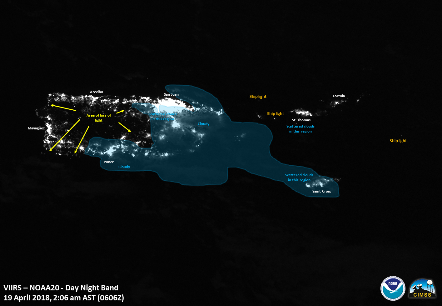
At approximately 11:04 am (EDT) on April 18, an excavator involved in an effort to remove a tower toppled by Hurricane Maria got too close to a power
Feature Story
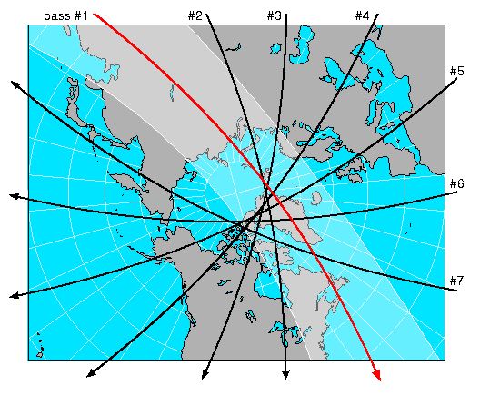
Shortly after NOAA-20 (formerly JPSS-1) launched into space on November 18, 2017, it joined its predecessor—the Suomi NPP satellite—in the same polar
Feature Story

Approximately one hour after liftoff, when JPSS-1 separated from the upper stage of the Delta II launch vehicle and its solar array deployed, the laun