
Satellite Snapshots
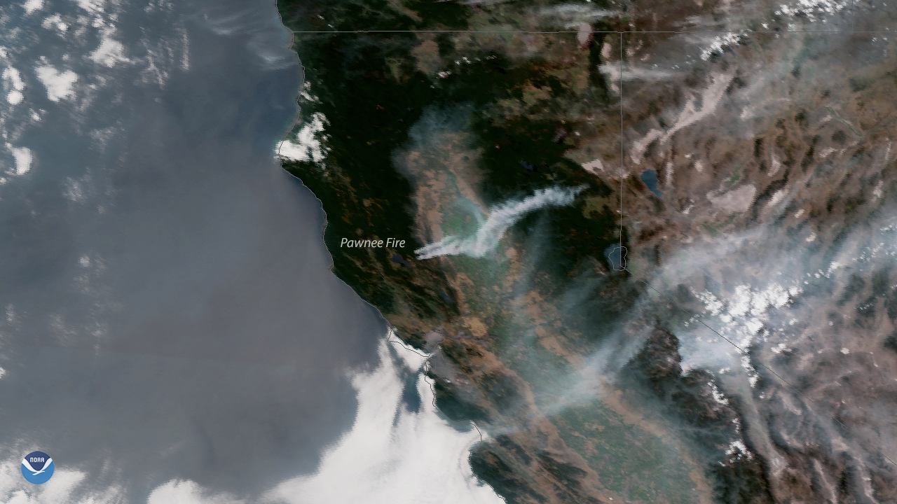
Plumes of smoke blow across northern California in the wake of several wildfires that erupted across the region due to hot, dry weather…
Satellite Snapshots
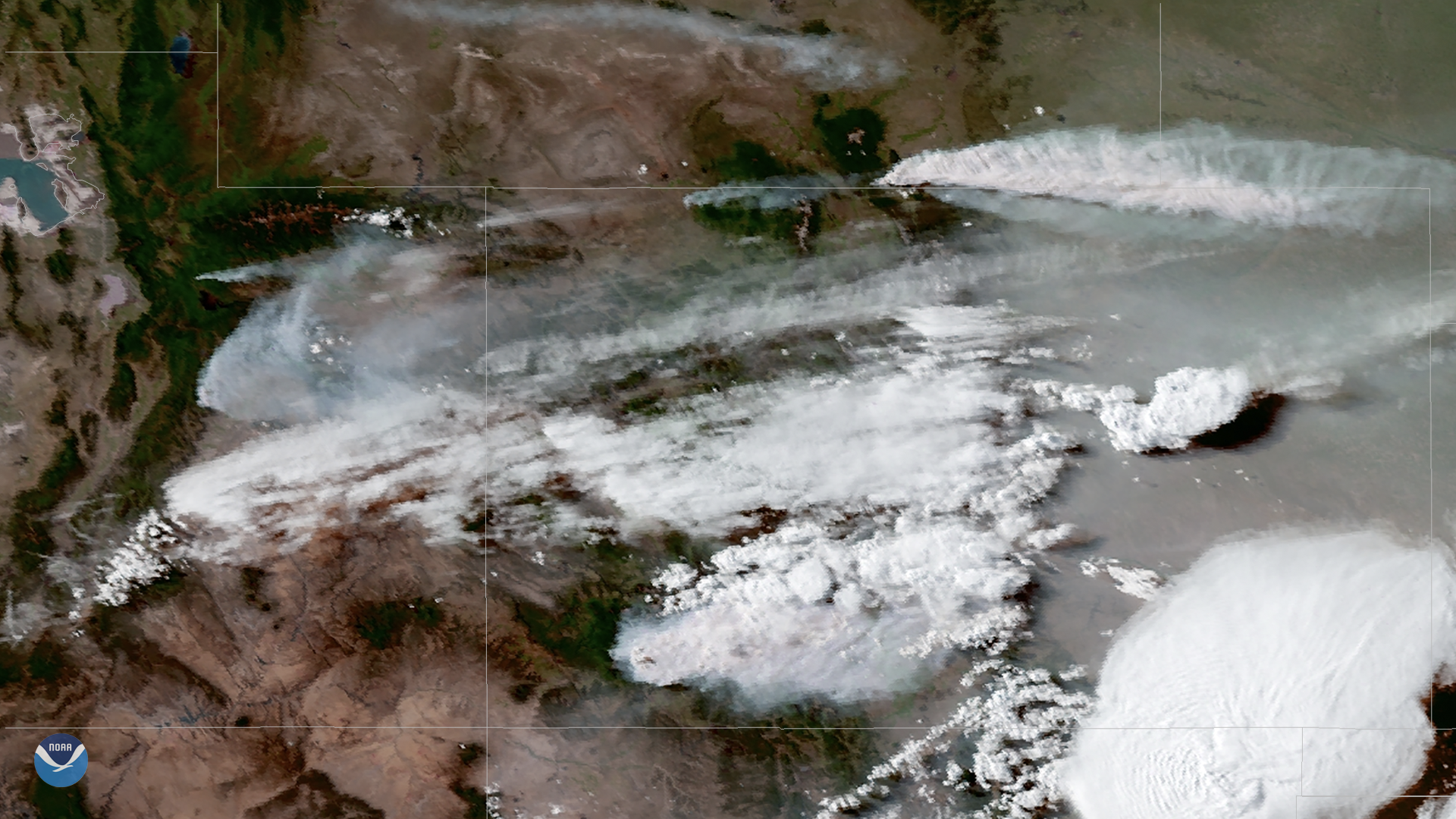
Warm, dry conditions have fueled several fires across the western United States over the past week. On June 13, 2018, the GOES East…
Satellite Snapshots
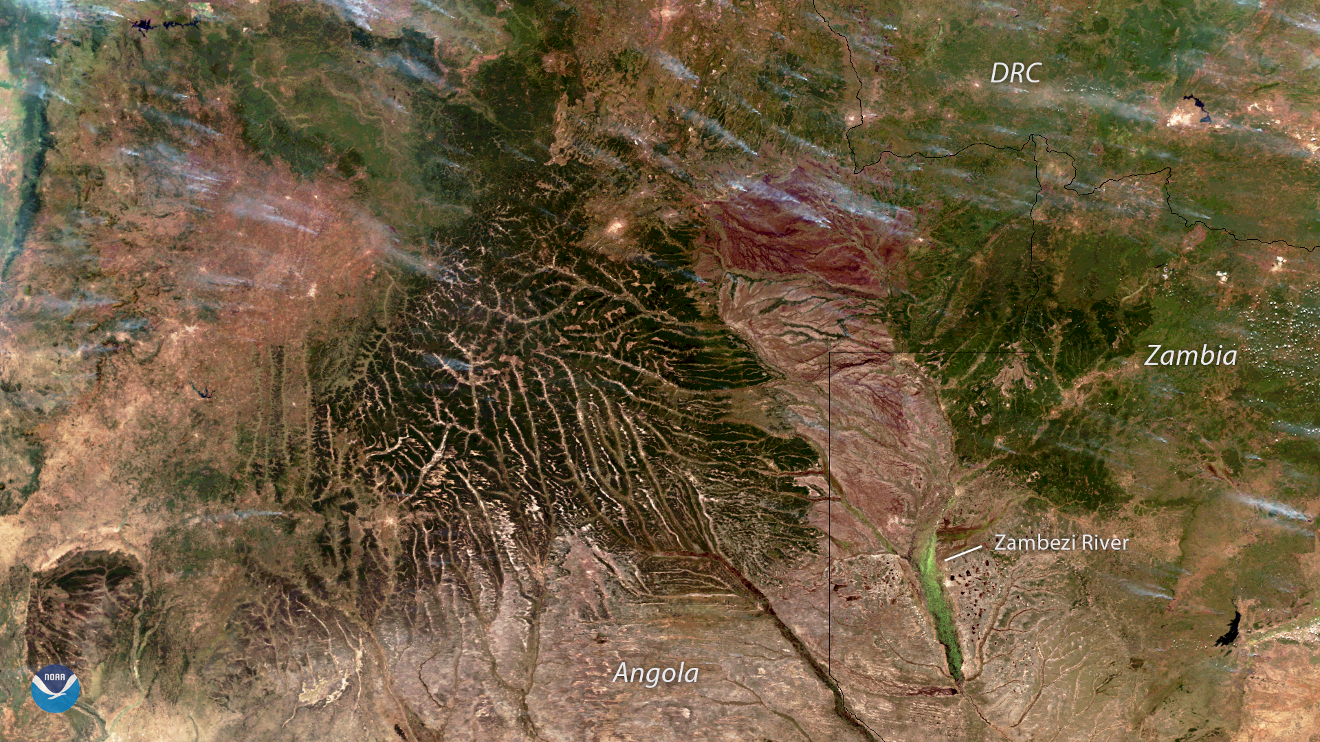
The NOAA-20 satellite captured this image of wildfires burning across Angola, Zambia and the Democratic Republic of the Congo on June 6…
Satellite Snapshots
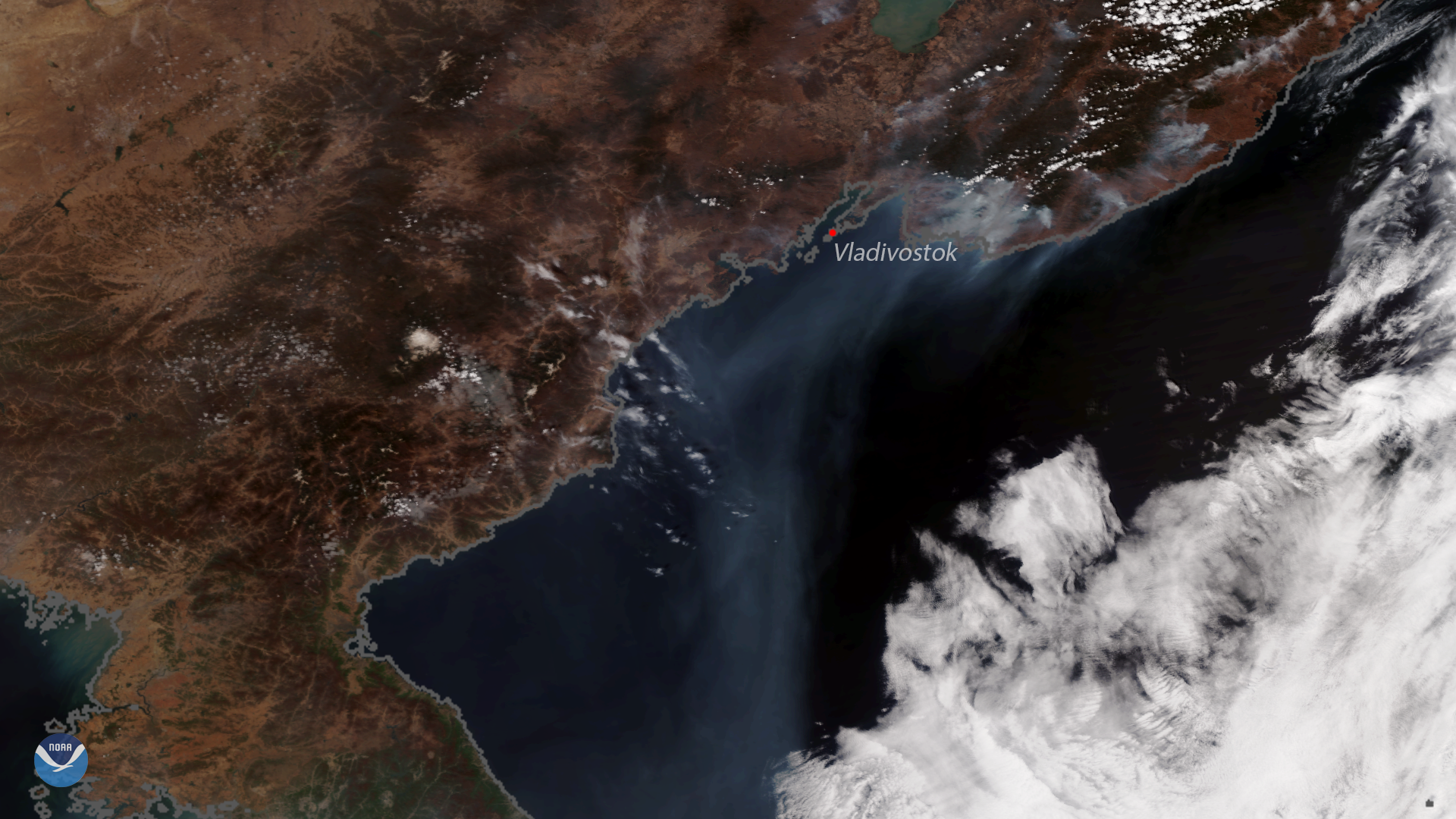
his image, captured by the NOAA-20 polar-orbiting satellite, shows several active fires burning along the coast of eastern Russia,…
Feature Story

Beginning in late March, the NOAA-NASA Suomi NPP and NOAA-20 satellites detected several fires burning in Russia's far eastern Amur Province.
Satellite Snapshots
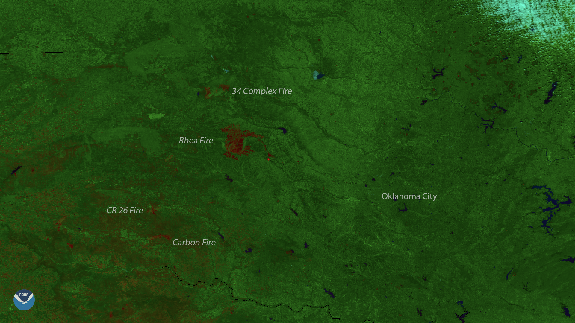
This image, captured by the Suomi NPP satellite's VIIRS instrument on April 15, 2018, shows locations of burn scars from the active…
Satellite Snapshots
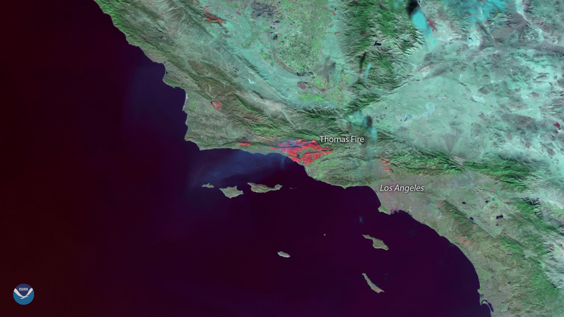
The Suomi NPP satellite's VIIRS instrument captured this image of burn scars from the massive Thomas Fire that has been raging in…
Satellite Snapshots
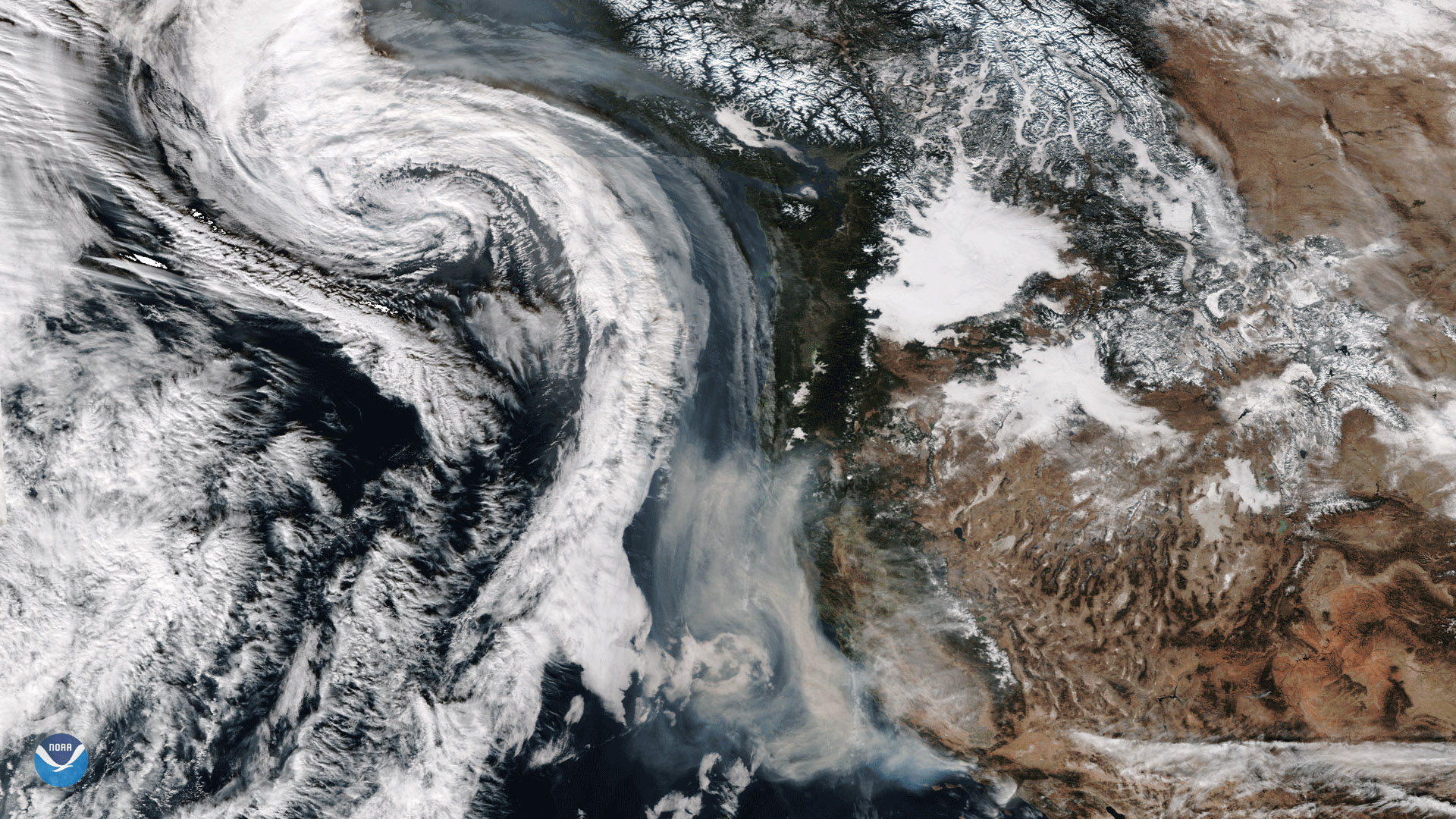
The Suomi-NPP satellite captured this image of smoke from California's wildfires being drawn northward into an approaching storm system.