
Feature Story
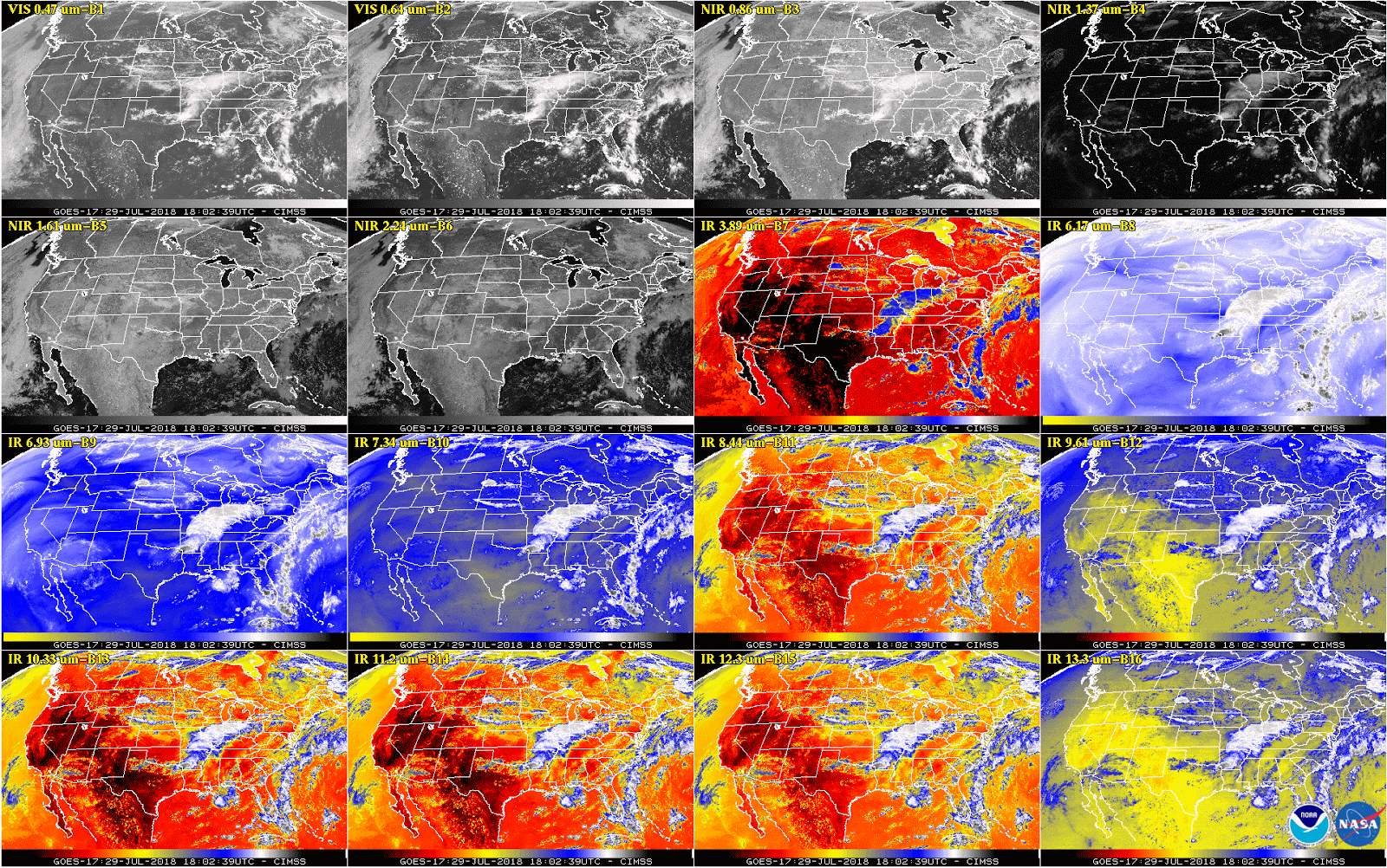
This week, NOAA will begin releasing GOES-17 Advanced Baseline Imager (ABI) “beta” level data and imagery.
Satellite Snapshots
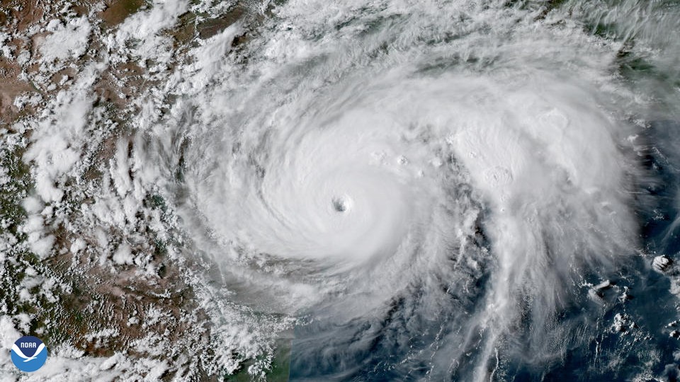
Hurricane Harvey became the first Category-4 hurricane to make landfall along the coast of Texas since Carla in 1961.
Satellite Snapshots
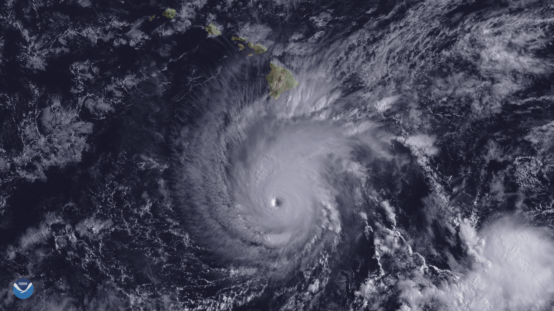
The state of Hawaii faces a significant threat from powerful Hurricane Lane, which is expected to track northward toward the islands.
Feature Story
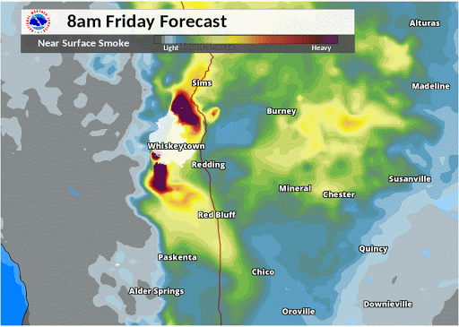
As California chokes on thick wildfire smoke, emergency responders look to a combination of powerful new NOAA satellite…
Satellite Snapshots
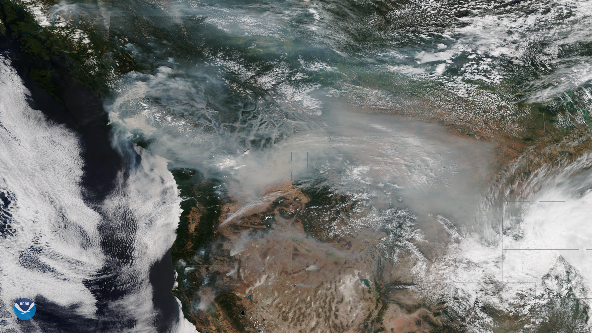
Wildfire smoke continues to cover large portions of the Western U.S. and Canada this week, as above-normal temperatures and dry…
Feature Story
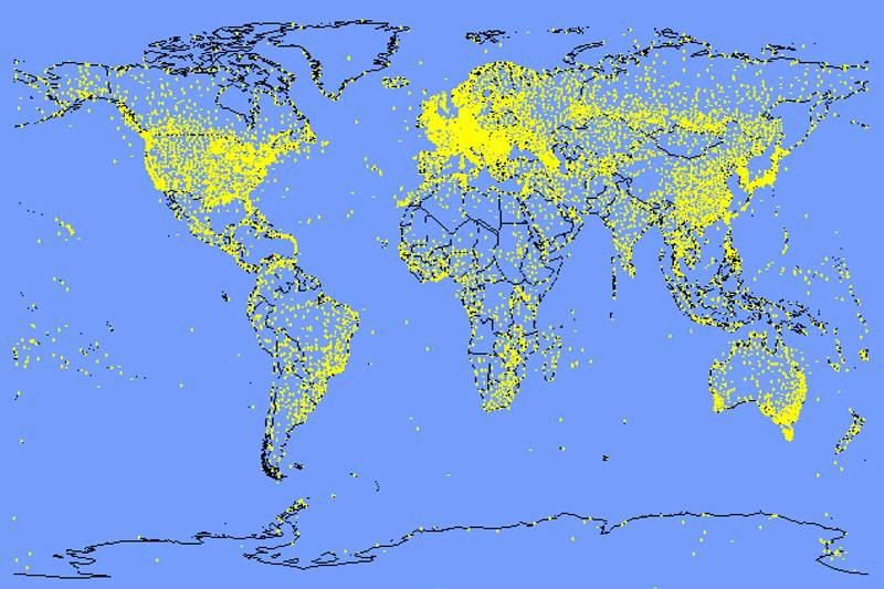
Every day, NOAA’s network of satellites and Earth-based observation system collect some 20 terabytes of environmental data…
Satellite Snapshots

Historic heat has baked much of Europe this summer, turning the landscape from green to brown in little over a month. These two…
Feature Story
This new imagery shows data are currently available from all 16 ABI channels.