
Feature Story
The chemistry of our oceans is changing. NOAA satellites are gathering data that shows the coastline of the Atlantic is…
Feature Story
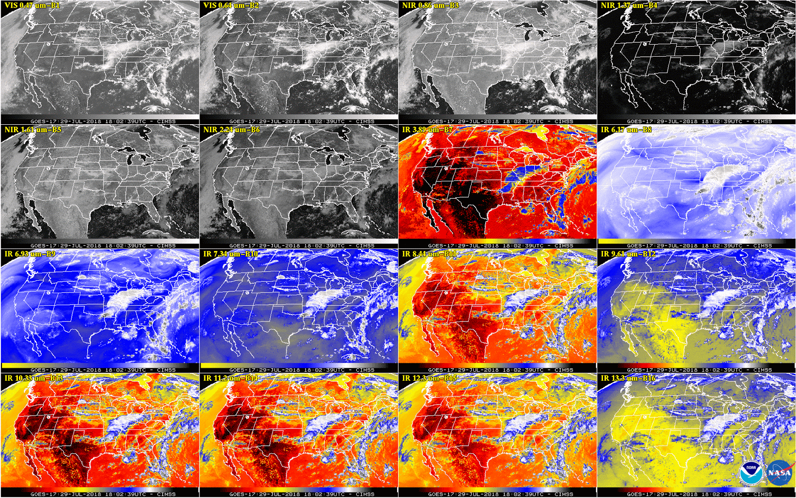
While experts continue addressing an issue with the cooling system of GOES-17’s Advanced Baseline Imager (ABI), they have…
Feature Story
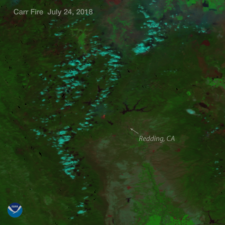
With raging wildfires torching the Western landscape, and six billion dollar weather-related disasters already experienced…
Satellite Snapshots

GOES East captured imagery of Hurricane Hector and two new tropical storms, John and Ileana, in the East Pacific on Aug. 6, 2018.
Satellite Snapshots
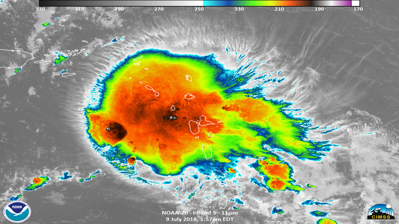
Hurricane Beryl seen by NOAA-20 July 9, 2018 in the Caribbean Sea
Satellite Snapshots

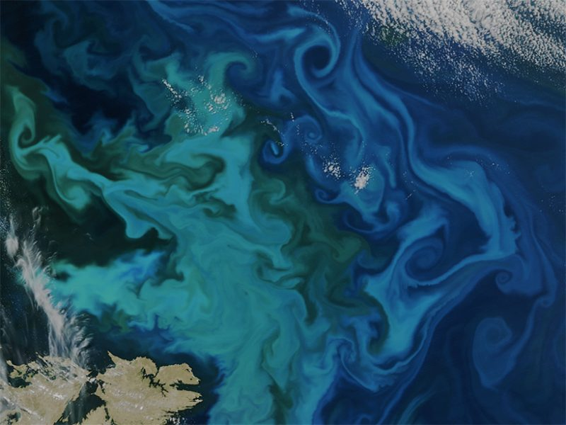
Clear skies over northern Russia and Scandinavia reveal magnificent swirls of blue and turquoise in the Barents Sea. This true-color…
Satellite Snapshots
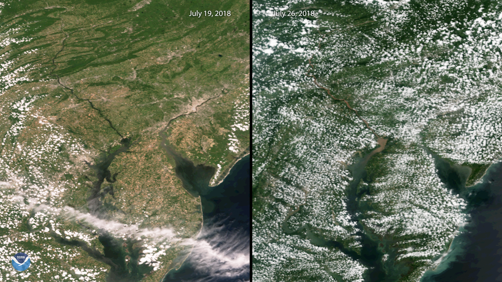
A plume of sediment flows into the northern Chesapeake Bay after several days of heavy rain in the Mid-Atlantic last week. This side-by…
Satellite Snapshots
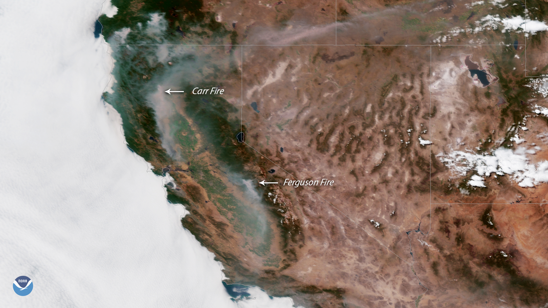
lumes of hazy smoke stretch across California and southern Oregon, as large wildfires continue to burn in the Western U.S. This GOES…