
Satellite Snapshots
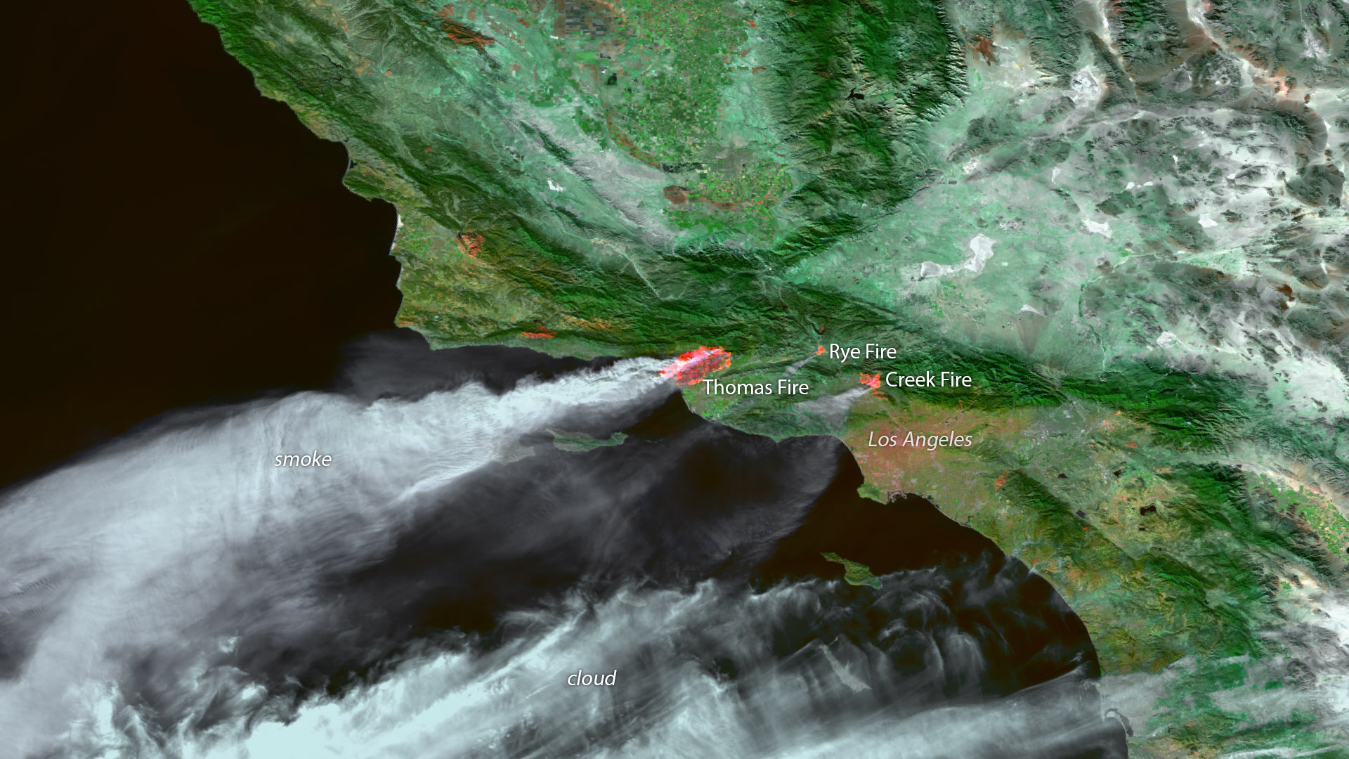
Fast-moving fires ignited this week in parts of Ventura, Oxnard, Santa Barbara and Los Angeles, California.
Satellite Snapshots
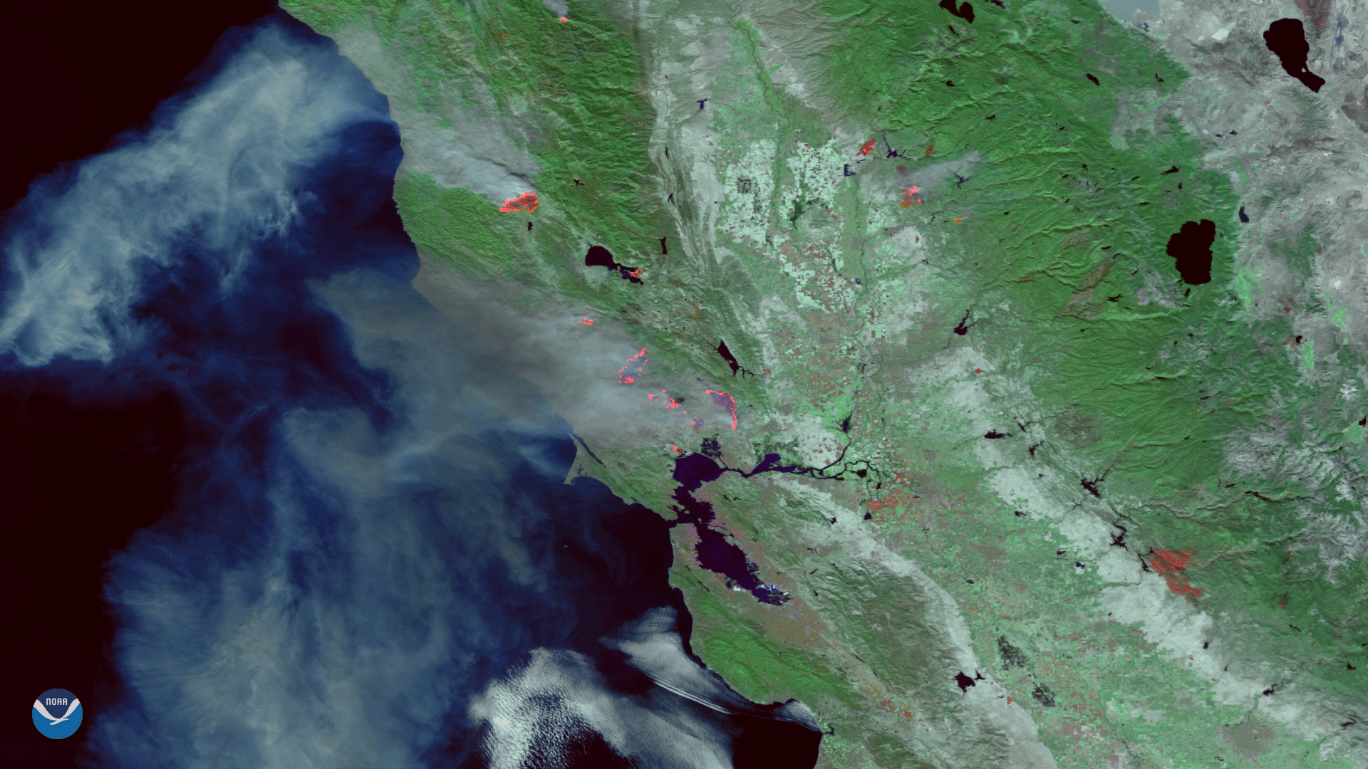
Suomi NPP satellite captured the fast moving active fires in Ventura County, California.
Feature Story
NOAA satellites have the capability to provide astounding views of the Earth. But many people want to know if these satellites can see them.
Satellite Snapshots
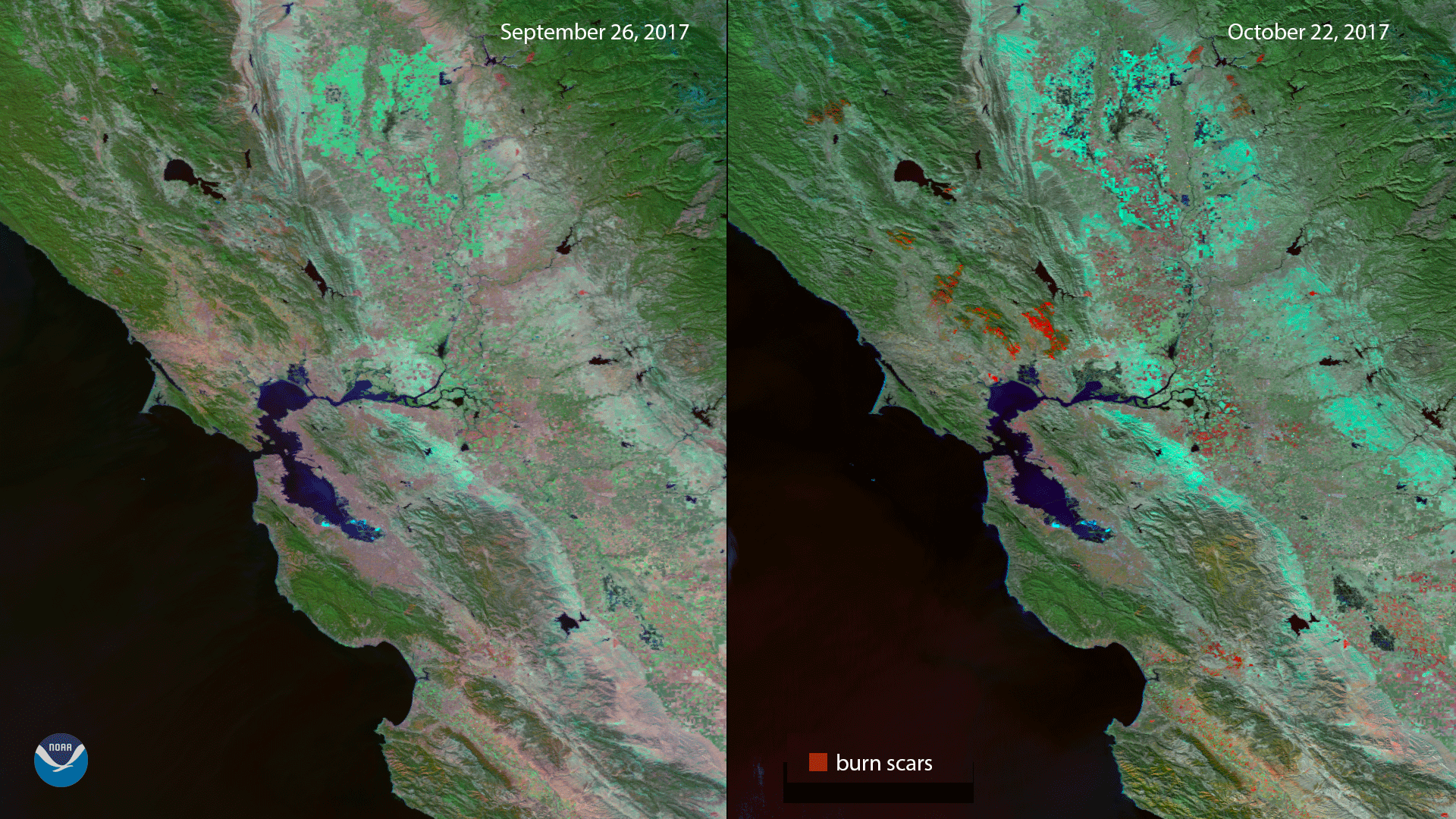
Imagery from before and after severe fires in California show the locations of burn scars.
Feature Story
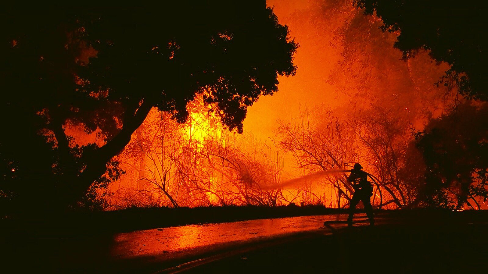
As news of the rising death toll from the California fires continues, NOAA satellites help capture the extent of the wildfires.
Satellite Snapshots
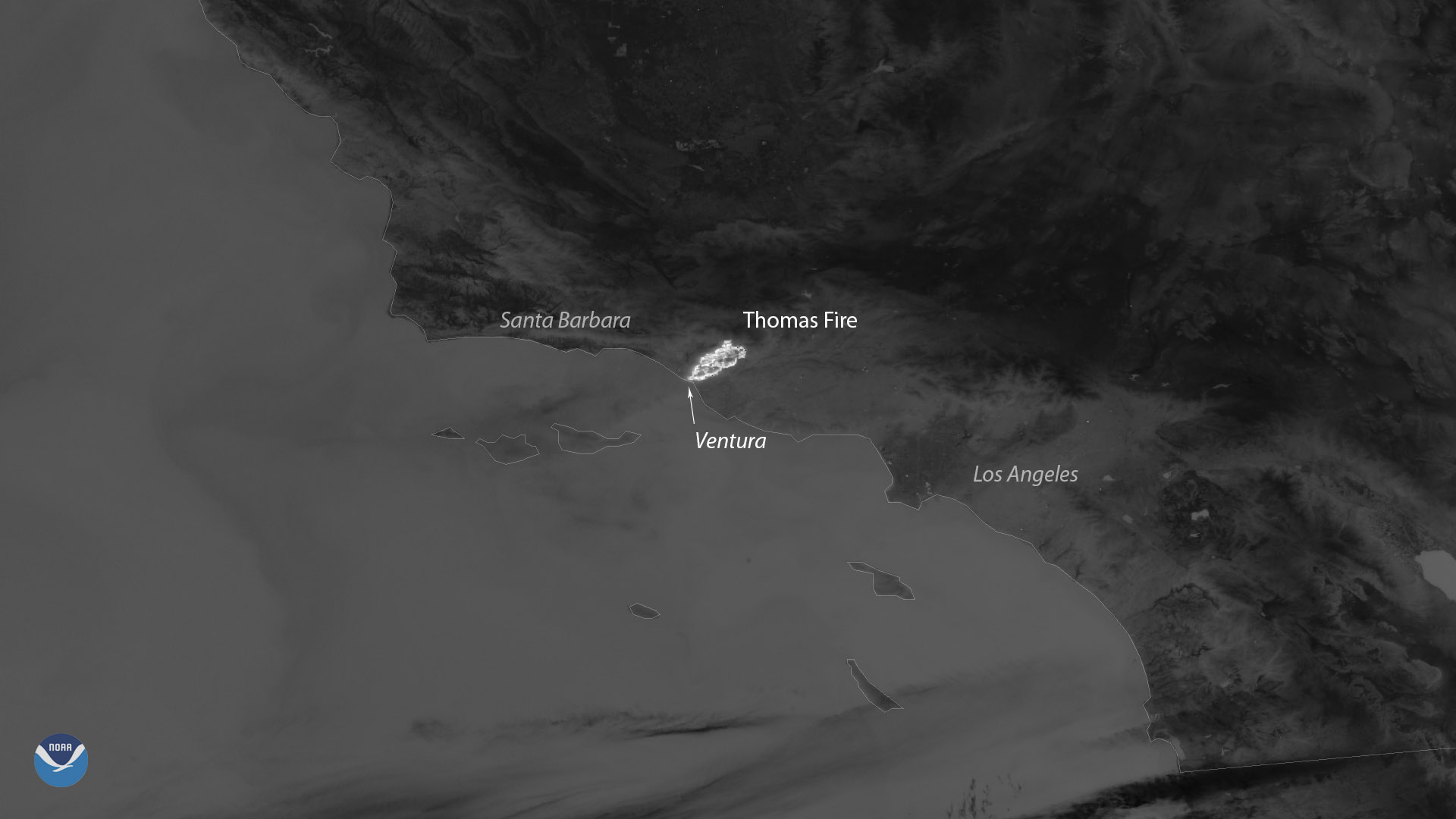
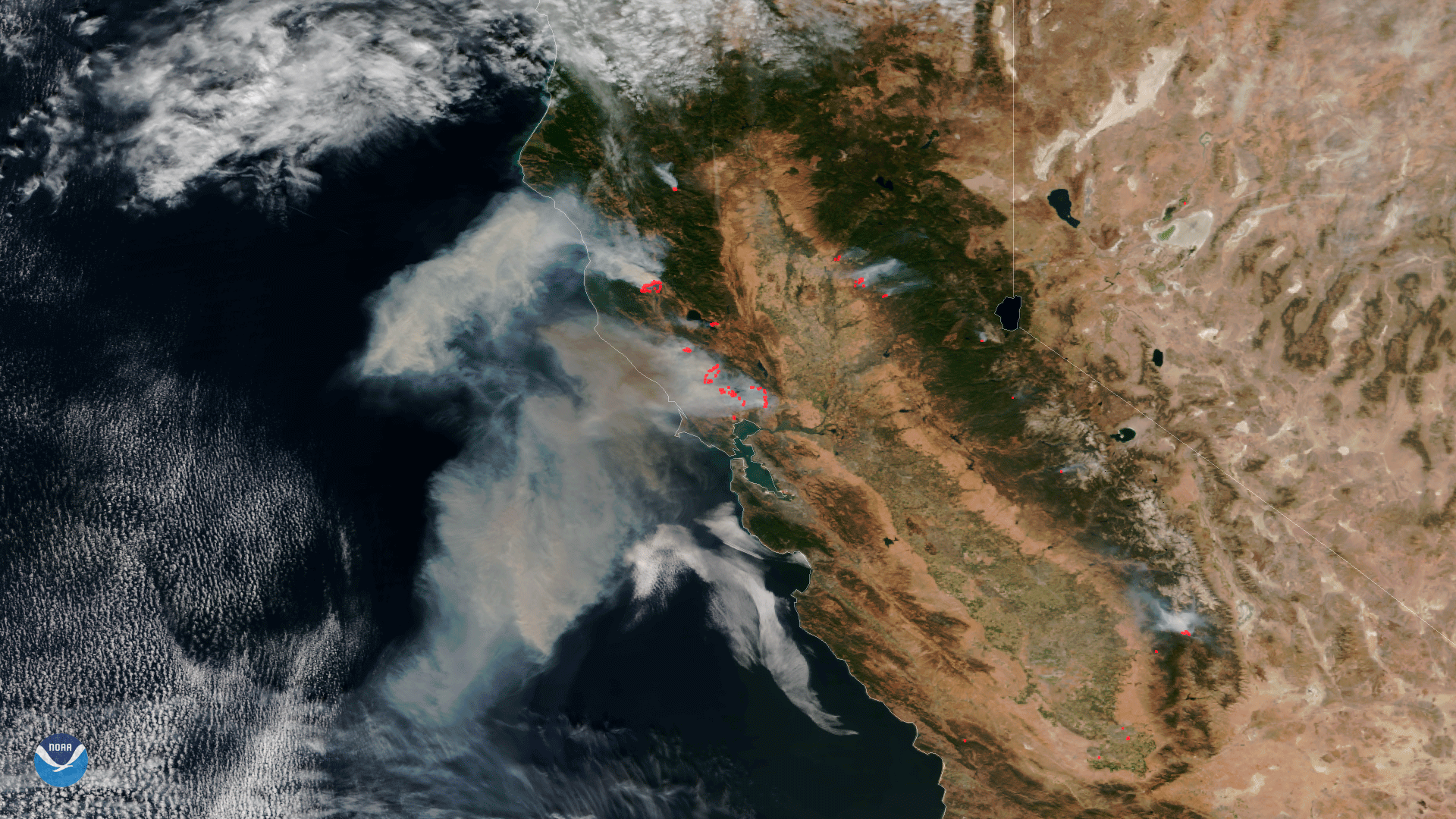
This false-color image (captured on Oct. 9th) was created by combining three of the Suomi NPP satellite's high resolution thermal visible channels.
Satellite Snapshots
Data from the VIIRS instrument aboard NOAA/NASA Suomi NPP satellite from October 9, 2017 shows the extent of the fires burning in California.
Satellite Snapshots

This data visualization shows the maximum wind gusts from Hurricane Irma from September 7 to September 10, 2017. Note how the…