
Feature Story

So, you thought ride sharing was just a new trend on Earth – it’s also about to take off – literally – in space. NOAA is rolling…
Feature Story
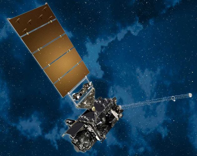
This week, top officials from NOAA shared new updates on efforts to resolve the technical issues impacting the performance of…
Satellite Snapshots
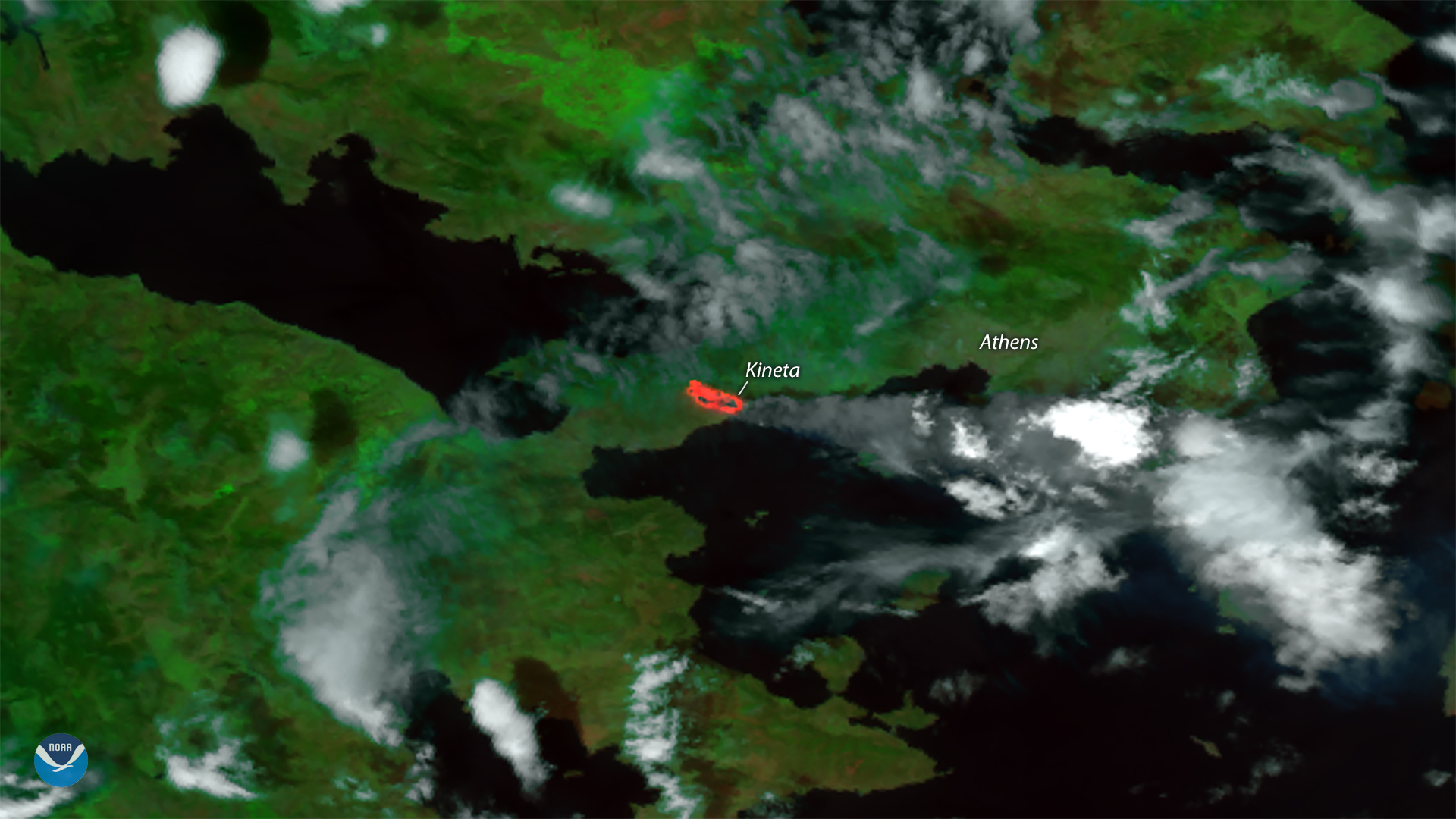
Hot, dry weather and gusty winds fueled deadly and destructive wildfires near Athens, Greece this week. This visible and thermal…
Feature Story

Top officials from NOAA's Satellite and Information Service and National Weather Service today spoke with media about the…
Satellite Snapshots
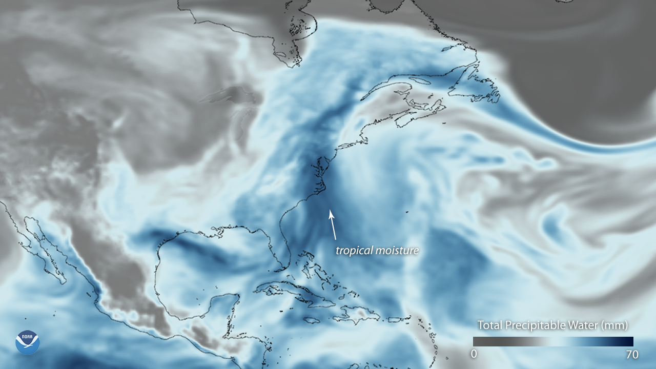
An unsettled late-July weather pattern is bringing persistent clouds and above-normal precipitation to the eastern U.S. this week. This…
Satellite Snapshots
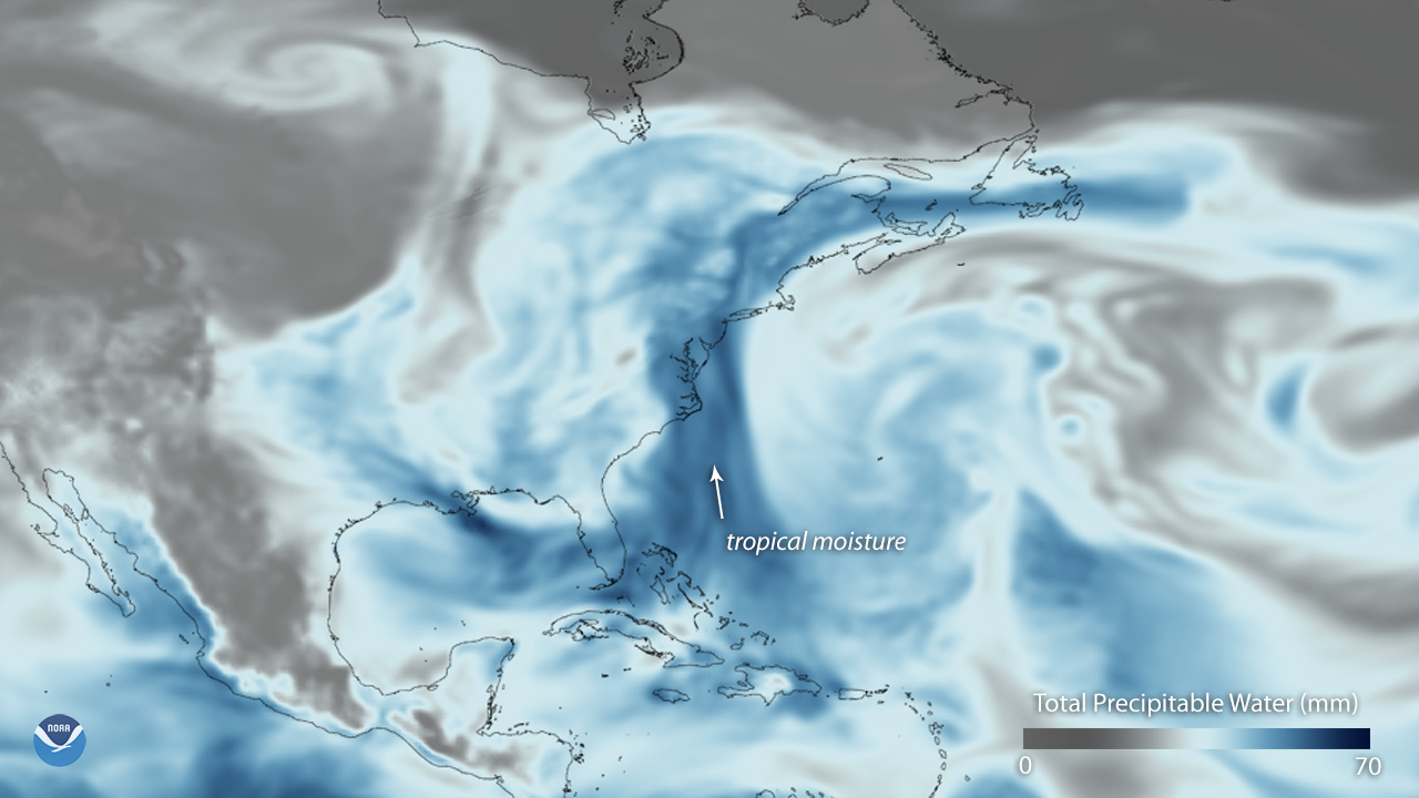
An unsettled late-July weather pattern is bringing persistent clouds and above-normal precipitation to the eastern U.S. this week. This…
Feature Story
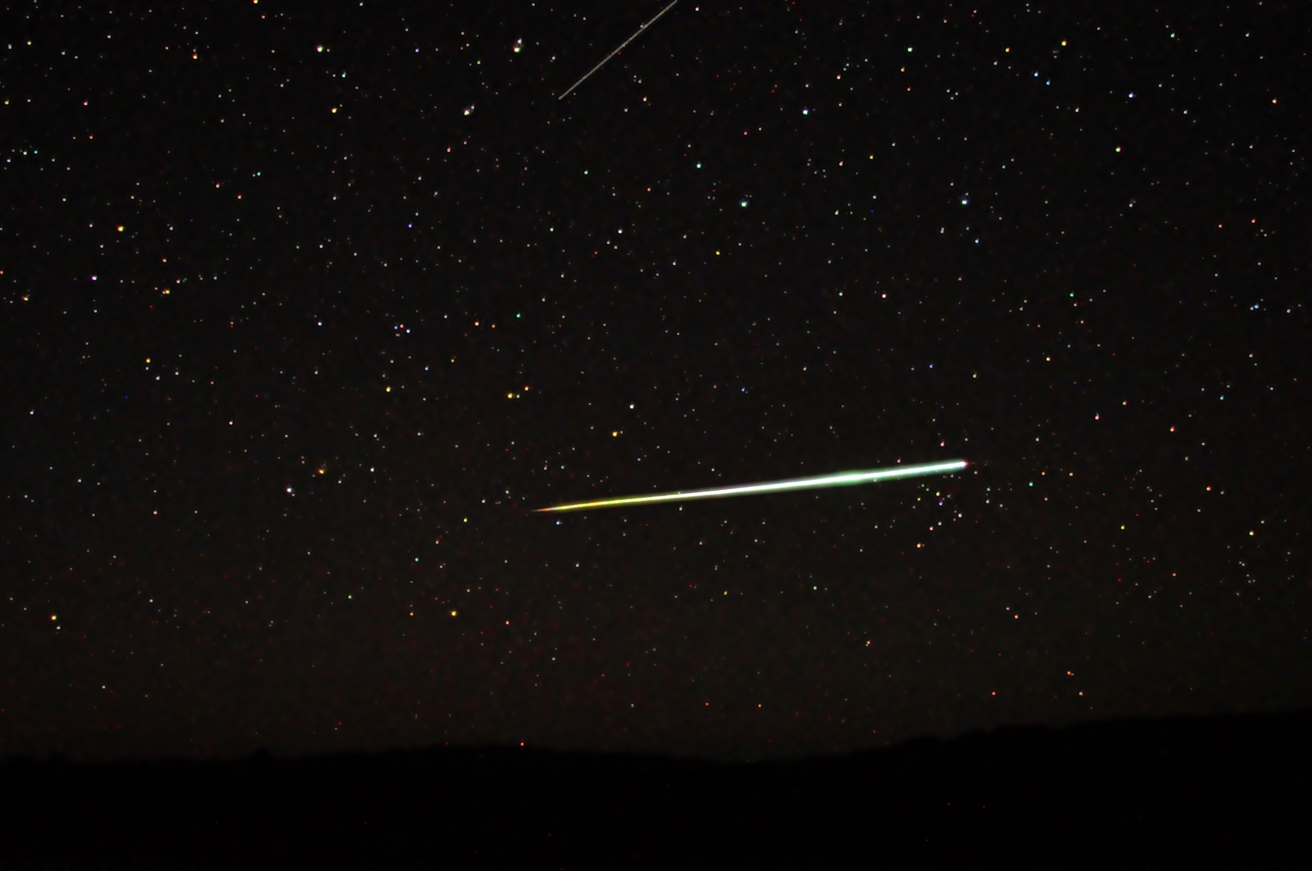
What do lightning strikes and meteoroids zipping through space have in common? It turns out they both can be tracked from a…
Satellite Snapshots
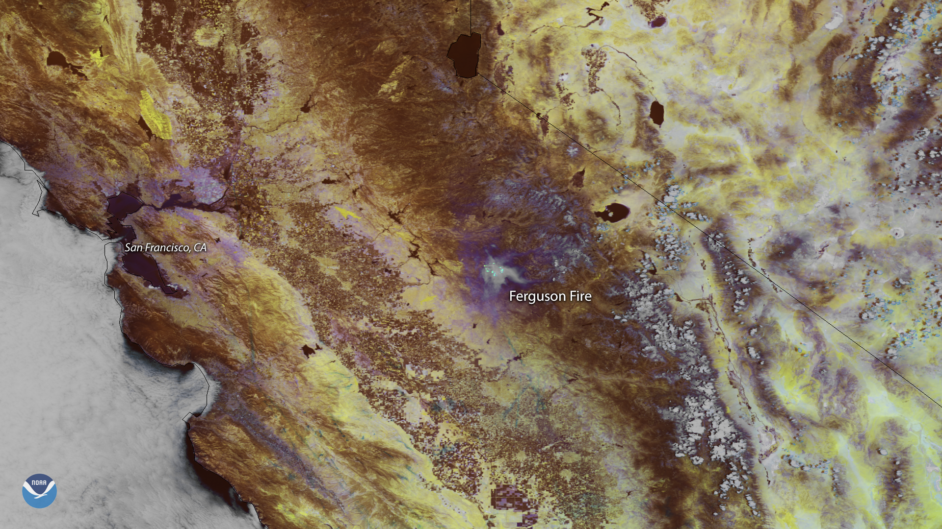
Smoke from the Ferguson Fire burning outside California's Yosemite National Park appears in this false color image captured by the NOAA…