
Satellite Snapshots
he Suomi NPP satellite's VIIRS instrument captured this image of the Fuego Volcano eruption in Guatemala on June 3, 2018. Despite…
Feature Story

In celebration of NOAA Oceans Month, NOAA is highlighting the value of data collected from the world’s oceans.
Feature Story

DATA FROM SATELLITE WILL IMPROVE WEATHER AND HAZARD FORECASTS OUT TO 7 DAYS
Feature Story
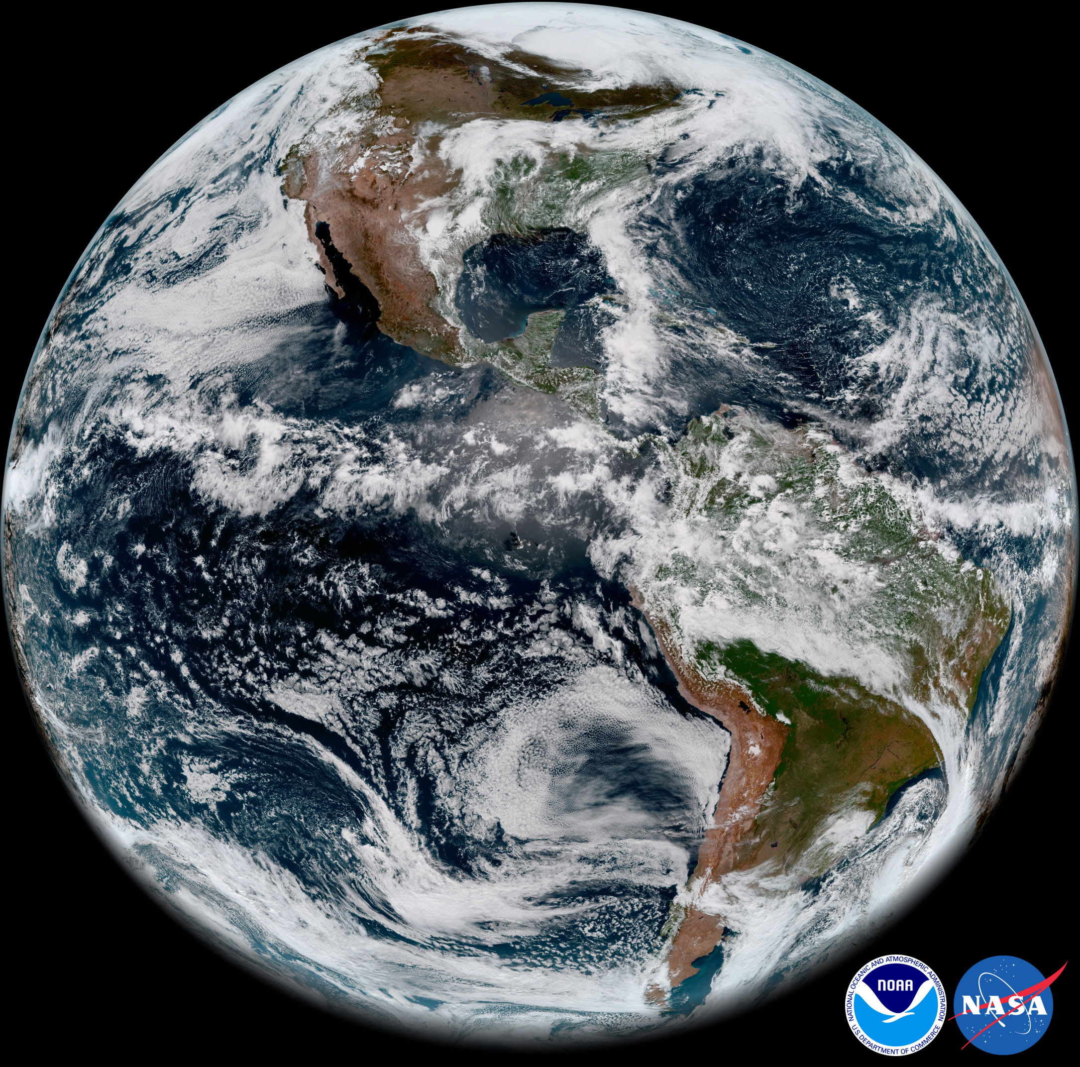
The first imagery from NOAA’s GOES-17 Advanced Baseline Imager (ABI) made its public debuttoday. GOES-17 took this stunning,…
Announcement

Advanced data will detect environmental hazards, improve weather forecasts. Weather forecasters officially have a new tool in their arsenal.
Satellite Snapshots

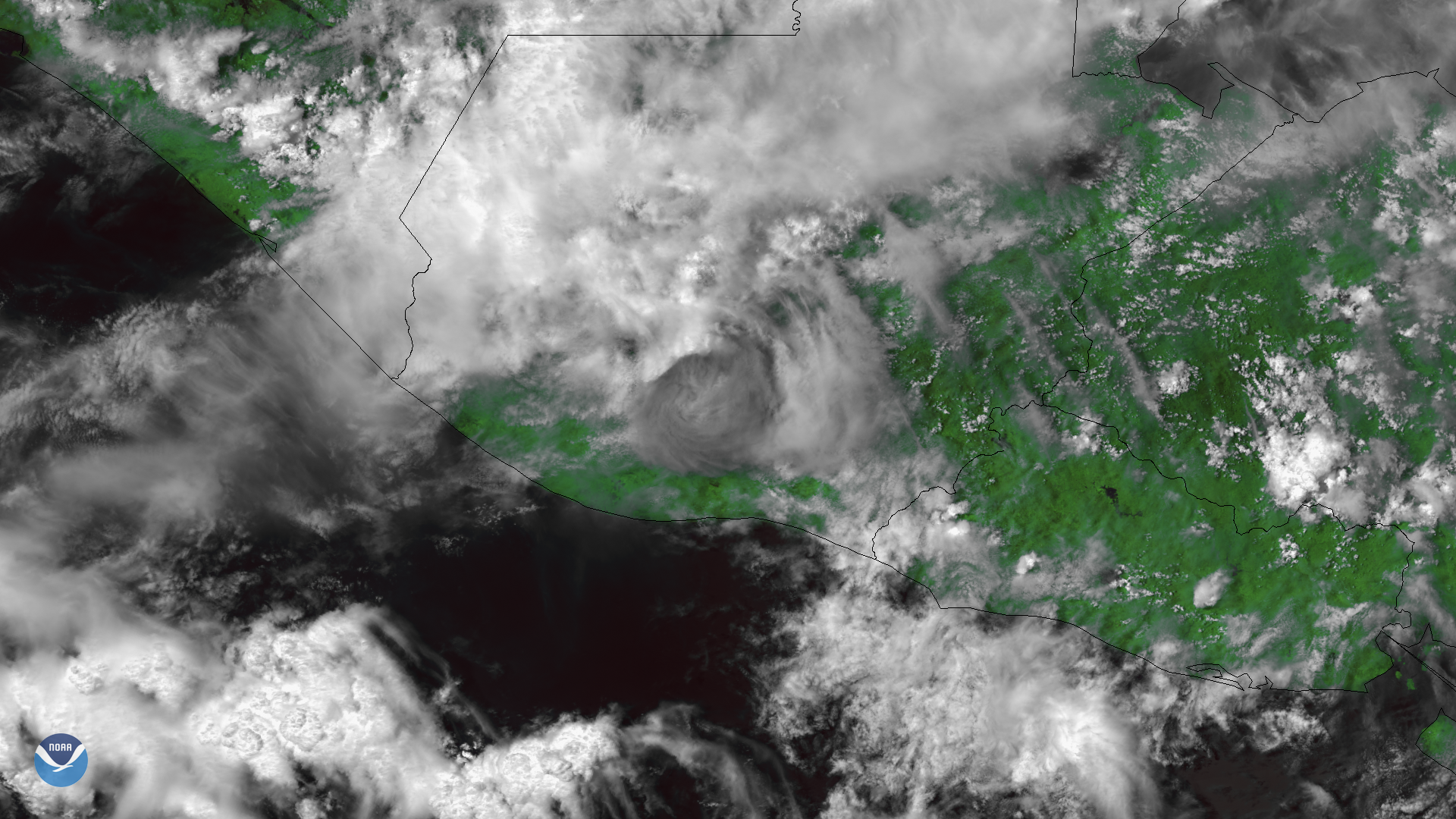
NOAA GOESEast satellite imagery of Alberto also captured the lightning during landfall within the storm - this data helps give forecasters an…
Satellite Snapshots
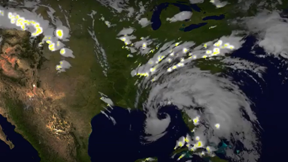
The NOAA-20 satellite's VIIRS day night band captured this nighttime image of the remnants of subtropical storm Alberto moving through…
Feature Story
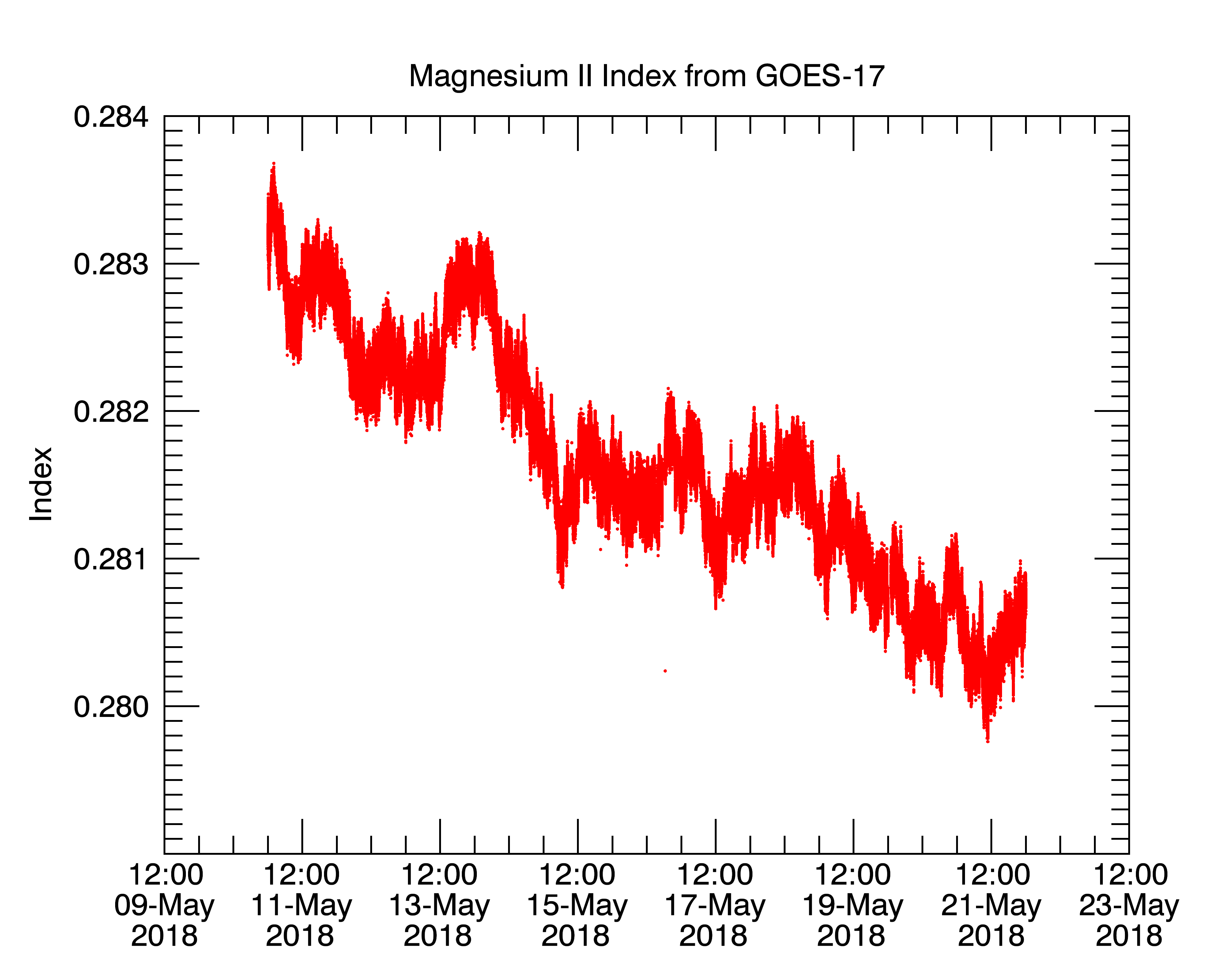
NOAA’s GOES-17 satellite has transmitted its first data from the Extreme ultraviolet and X-ray Irradiance Sensors (EXIS) space…