
Satellite Snapshots
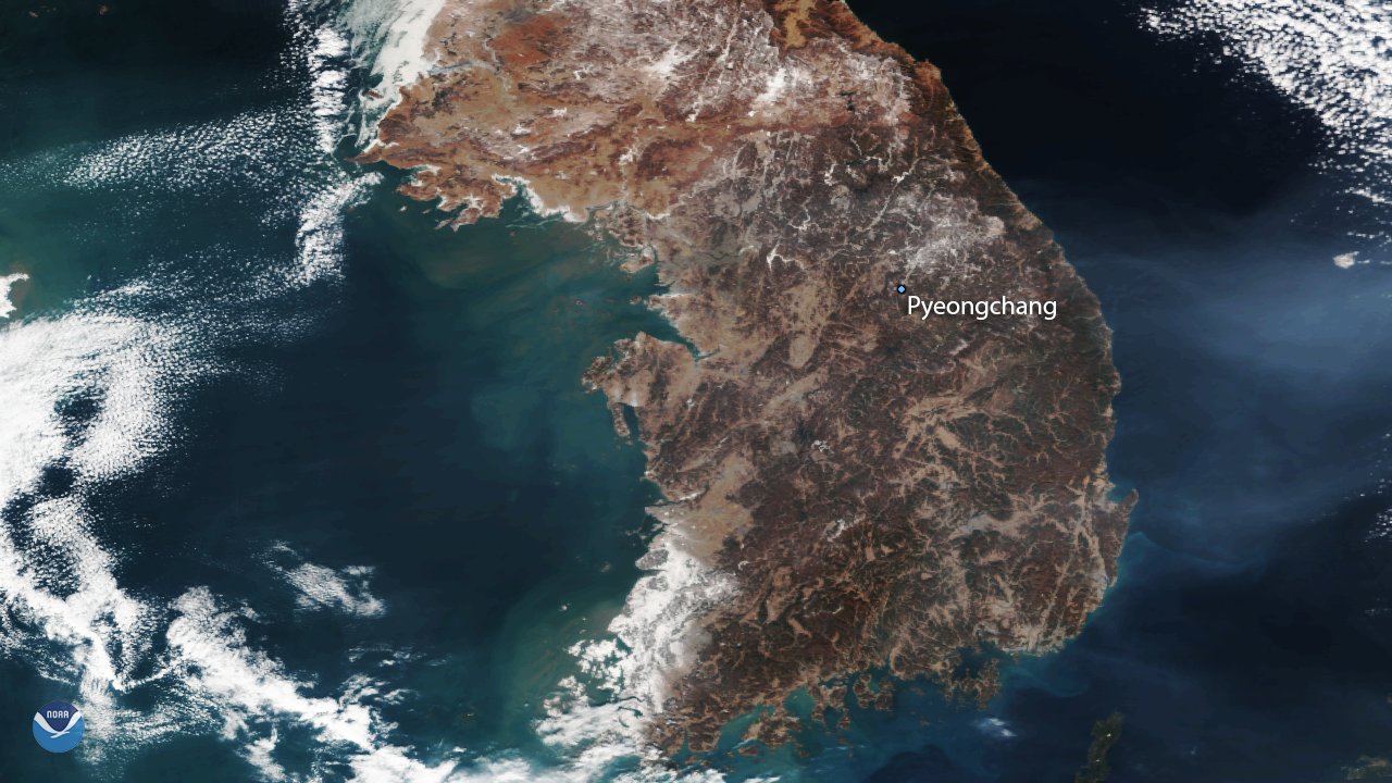
NOAA/NASA's Suomi NPP satellite captured this image of the Korean Peninsula on February 8, 2018, one day before the opening…
Satellite Snapshots
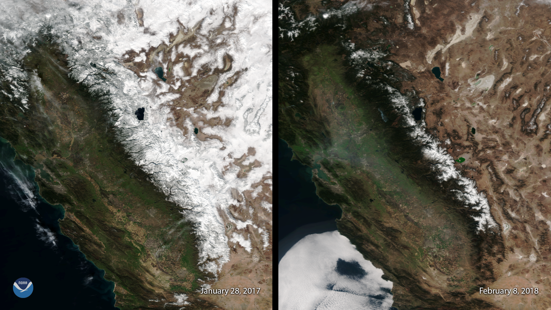
February 08, 2018 This image, captured by the Suomi NPP satellite's VIIRS instrument compares current snow cover in the Sierra Nevada mountains with…
Feature Story

In 2017, NOAA satellites helped save 275 people using personal locator beacons within the United States and its surrounding waters.
Satellite Snapshots
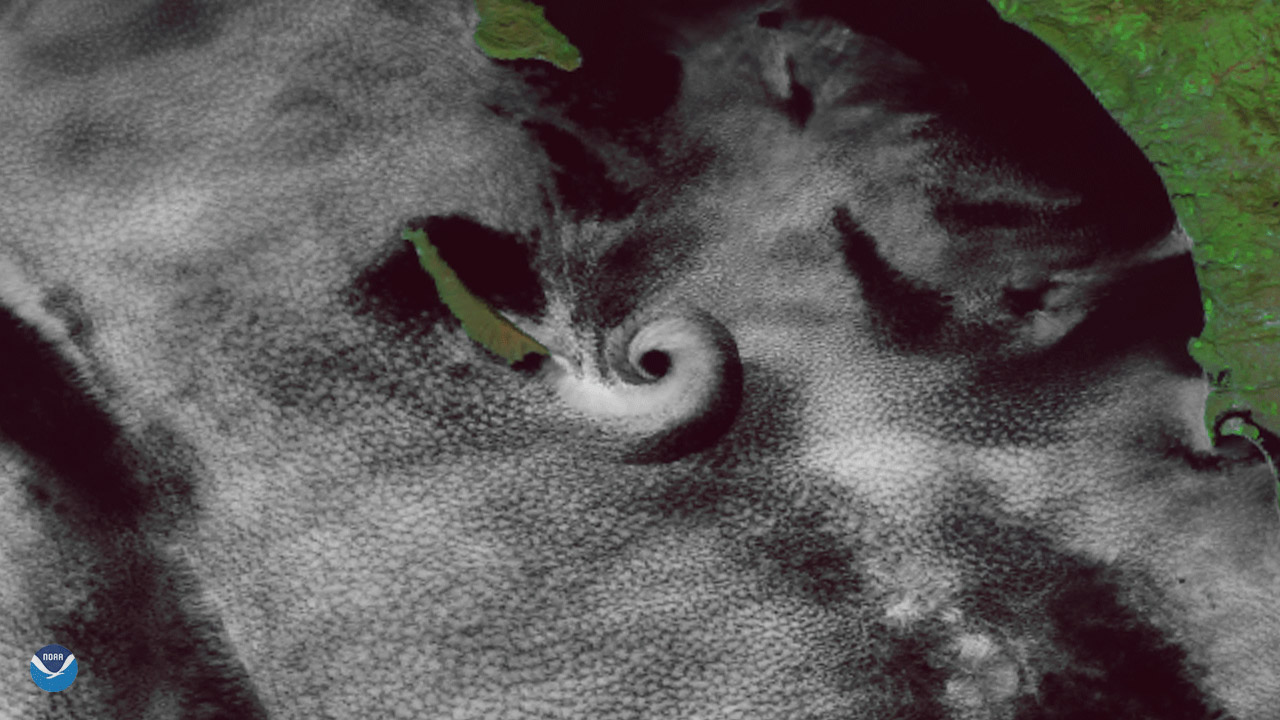
A spiral cloud appears just off the southern California coast in this image seen by the Suomi NPP satellite's VIIRS instrument on February 1, 2018.
Feature Story
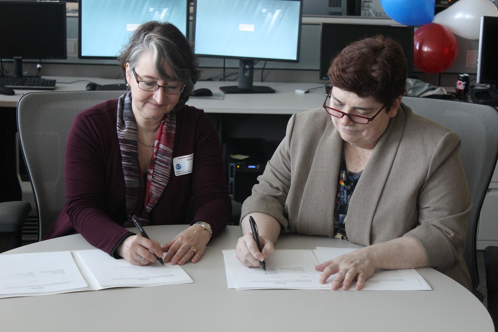
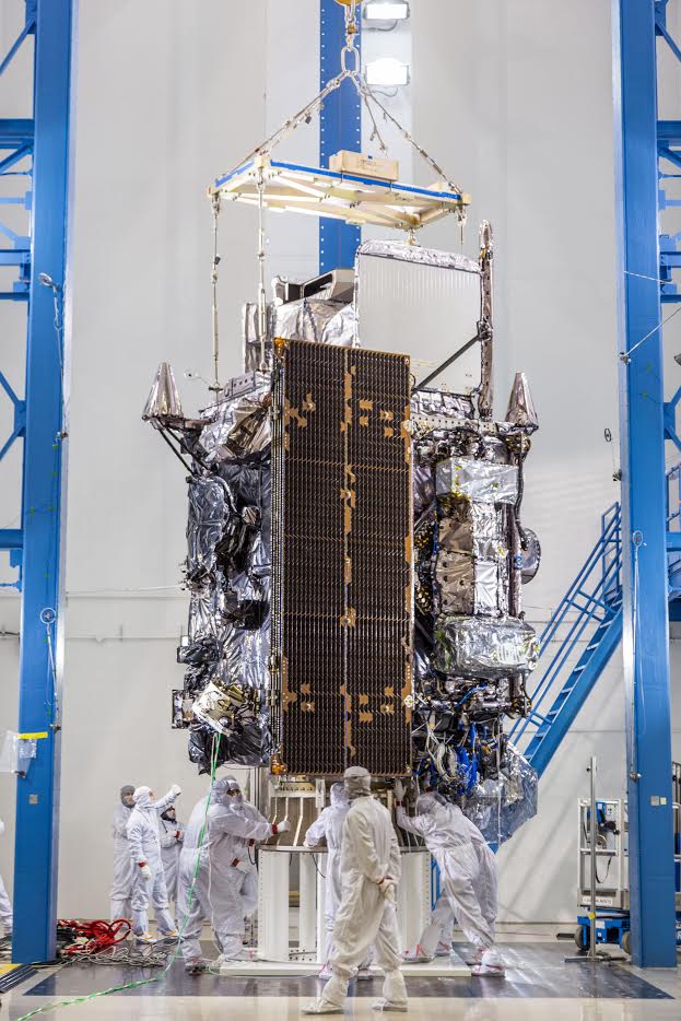
NOAA and Environment Canada (EC) recently signed an agreement which provides for mutual assistance and sharing of satellite…
Announcement
More detailed observations will improve marine, aviation forecasts and wildfire detection
Feature Story
As NOAA’s next-generation weather satellites continually improve weather forecasts in the United States and beyond, it’s…
Satellite Snapshots
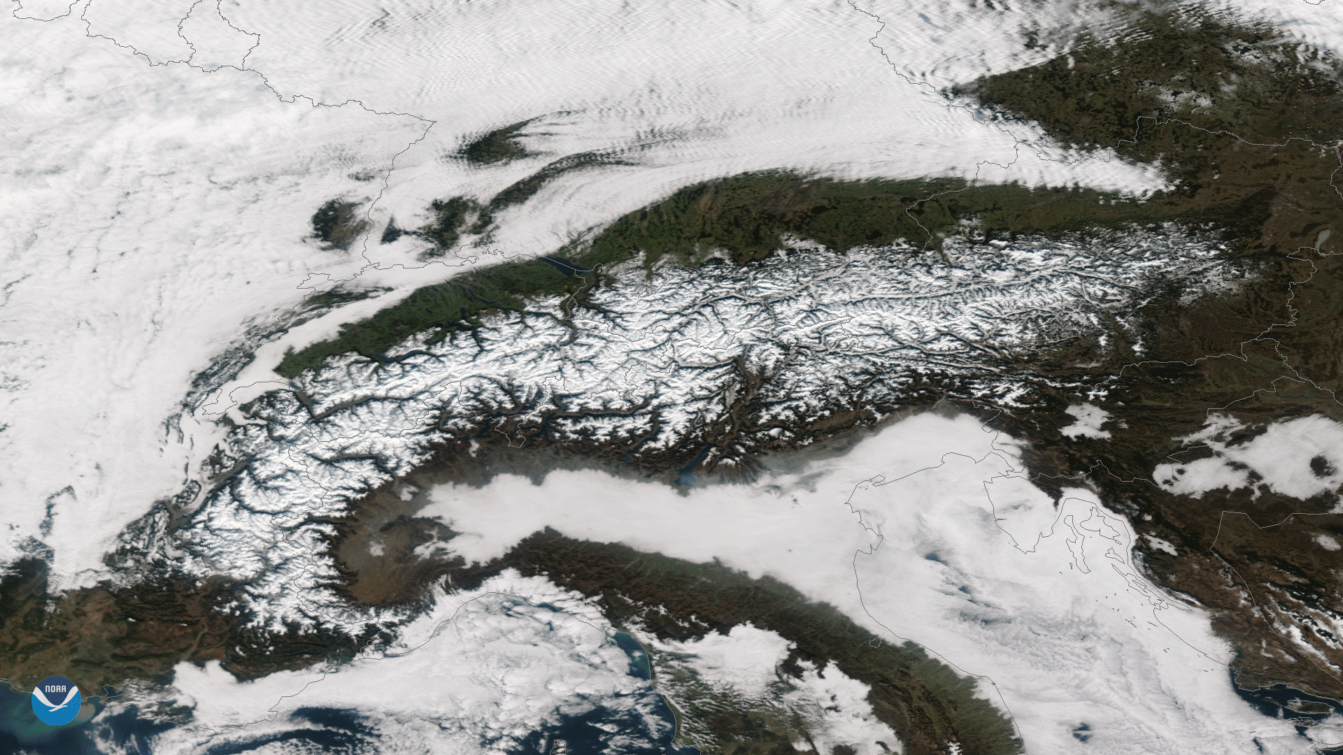
Clear skies over the snow-covered European Alps can be seen in this image captured by the Suomi NPP satellite's VIIRS instrument on…