
Satellite Snapshots
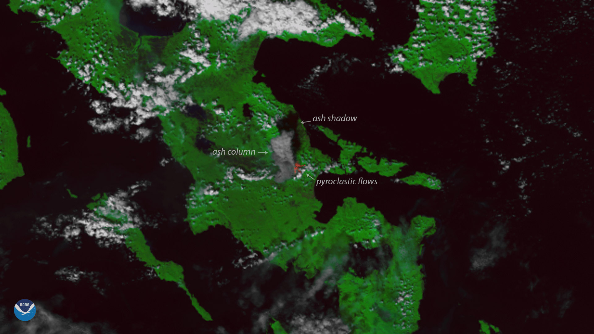
The Suomi NPP satellite's VIIRS instrument captured this image of the Mayon Volcano in the Philippines on January 22, 2018. Located…
Satellite Snapshots
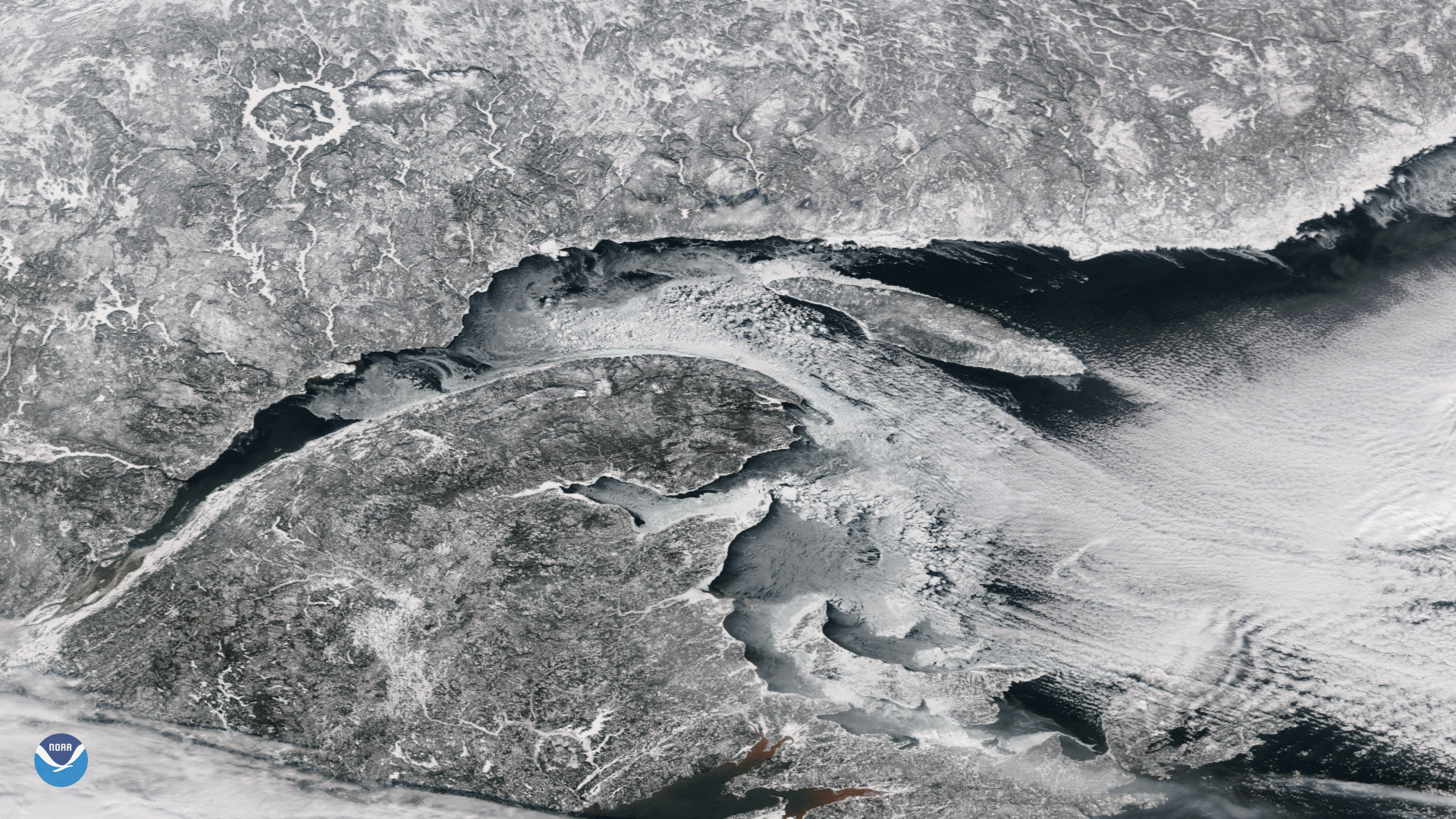
The Suomi NPP satellite's VIIRs instrument captured this view of clear skies over the mouth of the St. Lawrence River on January 22,…
Satellite Snapshots
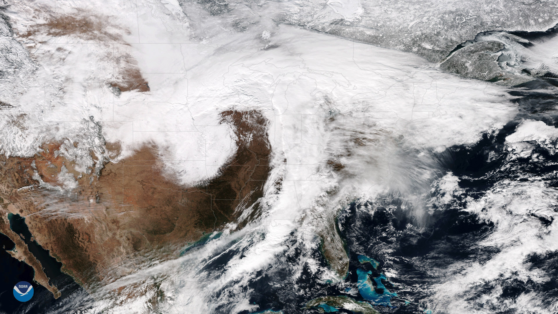
January 23, 2018 The Suomi NPP satellite's VIIRS instrument captured this image of a large winter storm moving across the central United States on…
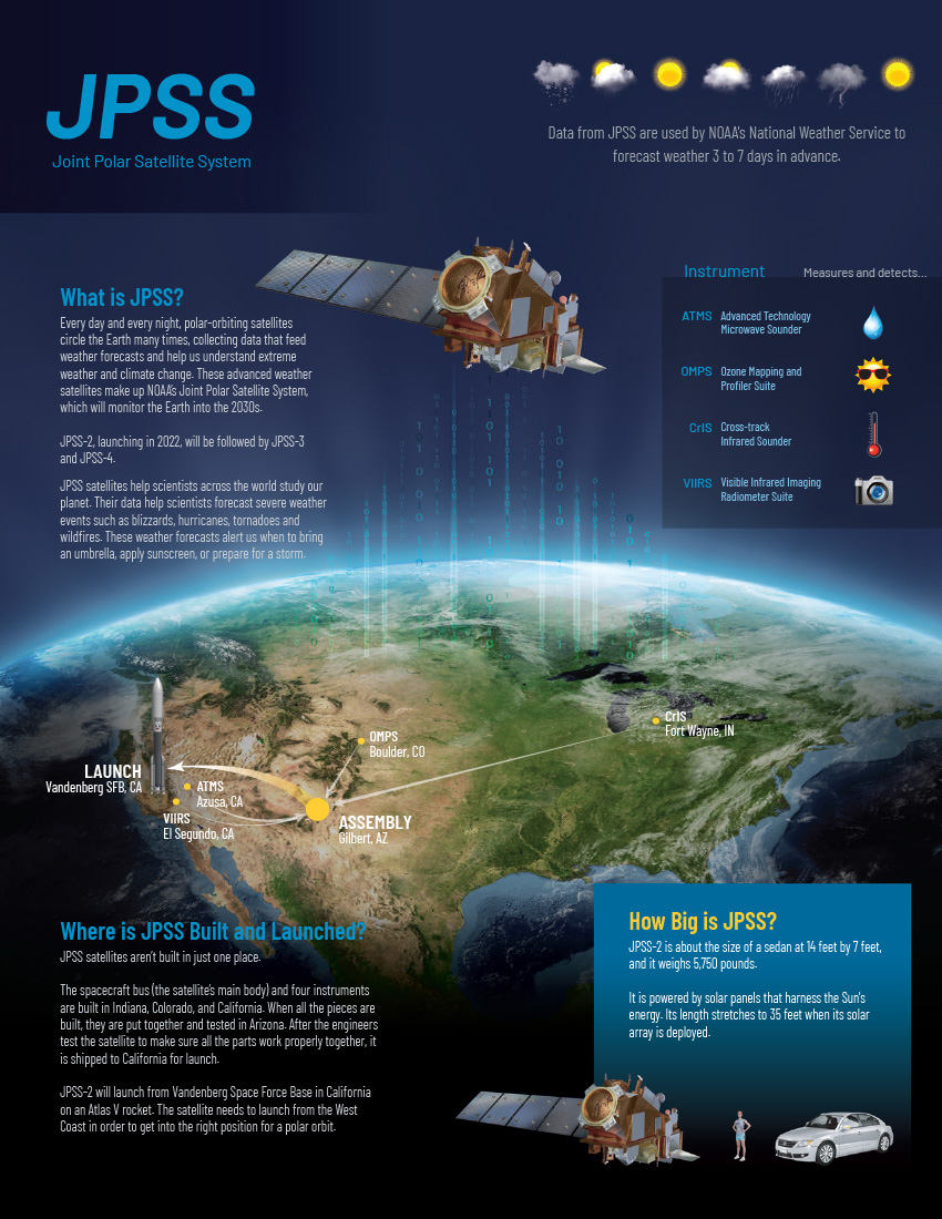
Feature Story

Yes it does! On average, a total of between 200-400 tracked objects enter Earth’s atmosphere every year. That’s about one…
Satellite Snapshots
This data visualization shows the maximum wind gusts from Hurricane Irma from September 7 to September 10, 2017. Note how the strongest wind gusts…
Feature Story

NOAA-20 captured these two images of North America five days apart (January 11, 2018 and January 16, 2018). Note the contrast in the surface temperatu
Satellite Snapshots
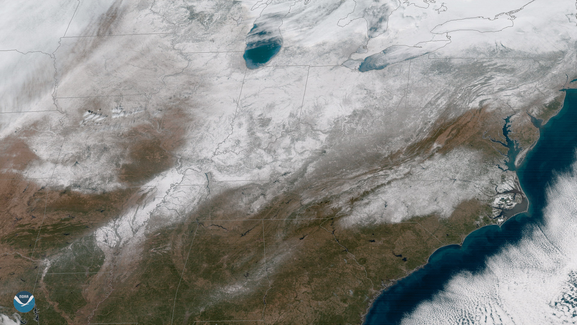
Clear skies enabled the GOES East satellite to capture this view of current snow cover over the eastern United States on January 18,…
Satellite Snapshots
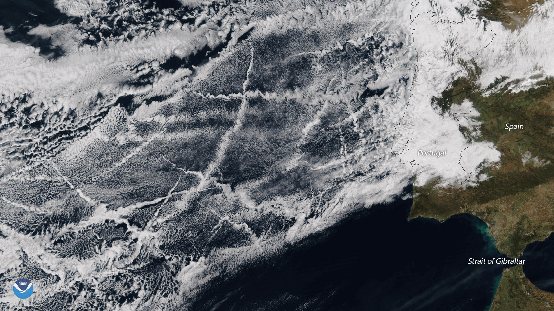
The ship tracks in this image stretch several hundred miles off the coast of Portugal, and occur in one of the most heavily trafficked areas for cargo