
Satellite Snapshots
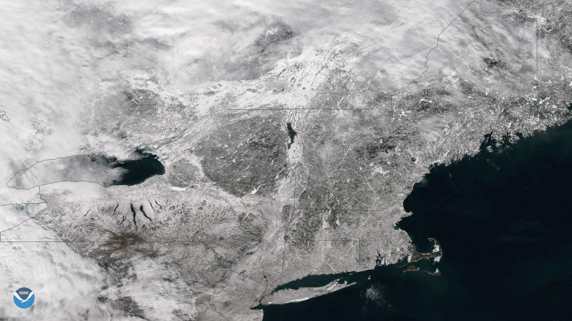
The Suomi NPP satellite flew over clear skies on January 10, 2018, capturing this image of snow on the ground in New England. Last…
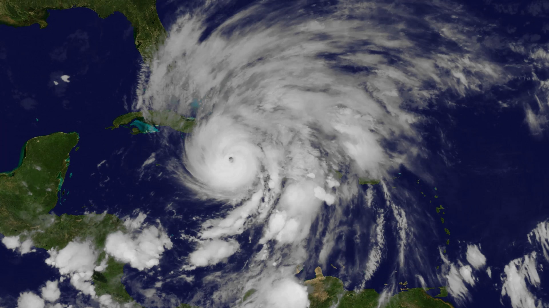
Feature Story
For more than seven years, NOAA’s GOES-13 satellite has been actively monitoring the skies over the Western Hemisphere.
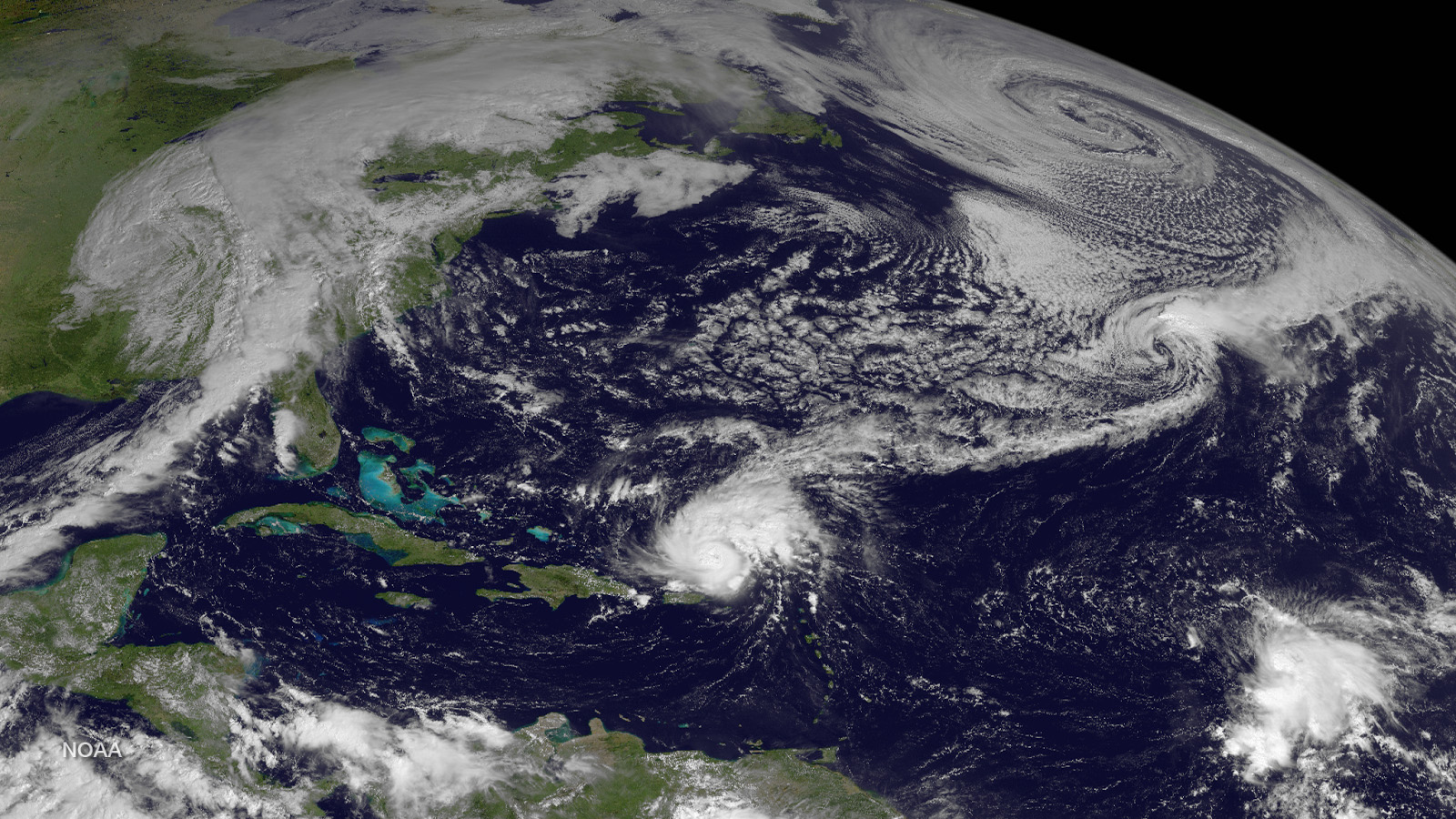
Feature Story
Makes way for next generation of weather imagery! NOAA’s GOES-13 satellite has captured some of the most notorious weather…
Satellite Snapshots
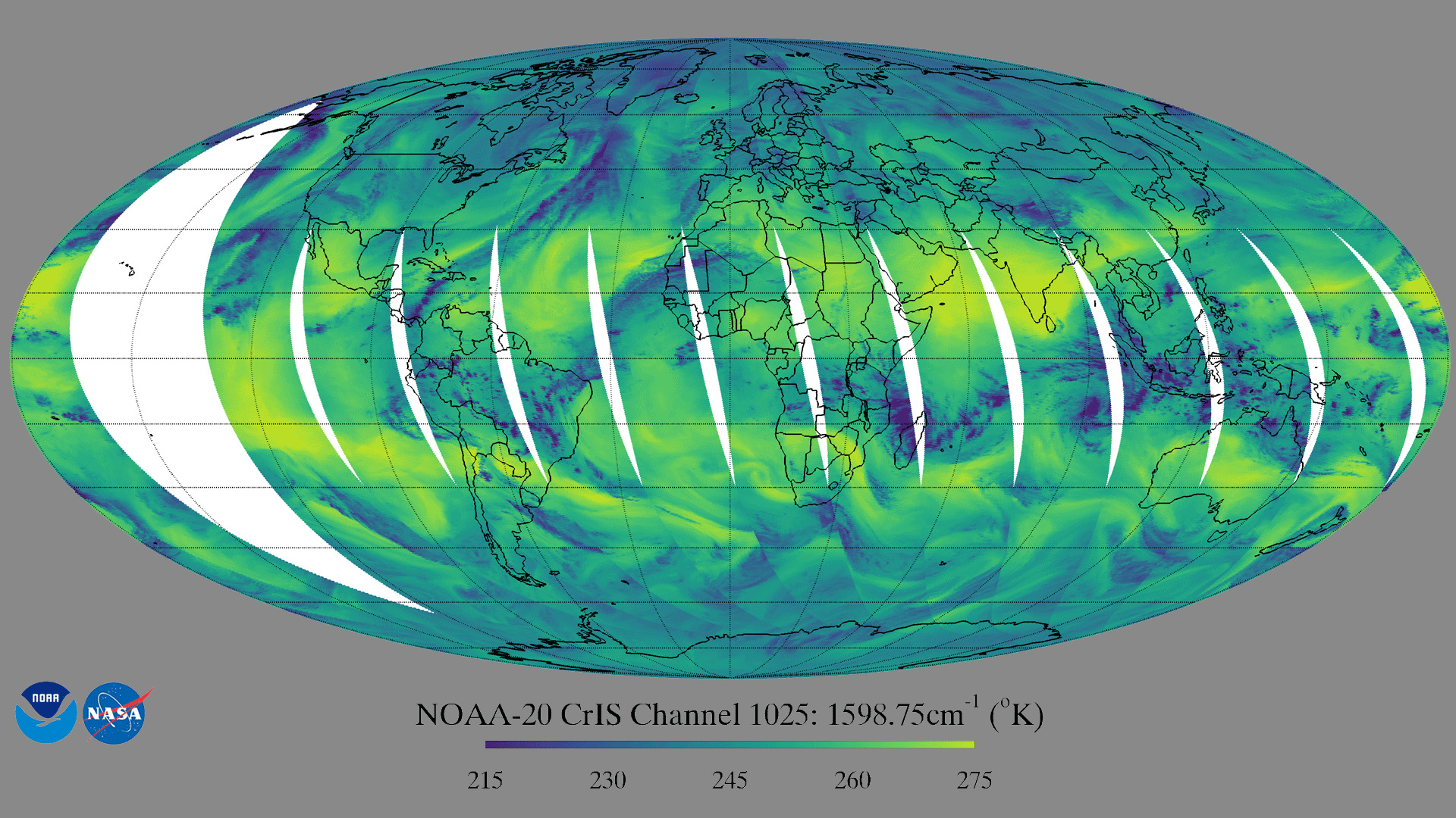
Forty-eight days after JPSS-1 (NOAA-20) was launched into Earth orbit, it sent back CrIS Imagery of the earth.
Announcement

NOAA is pleased to be a sponsor (along with NASA and USGS) of Thriving on Our Changing Planet: A Decadal Strategy for Earth Observation from Space.
Satellite Snapshots
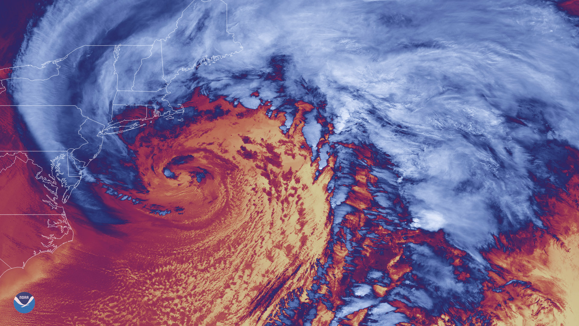
Forty-seven days after it was first launched, the NOAA-20 polar-orbiting satellite sent back its first thermal infrared images on…
Feature Story
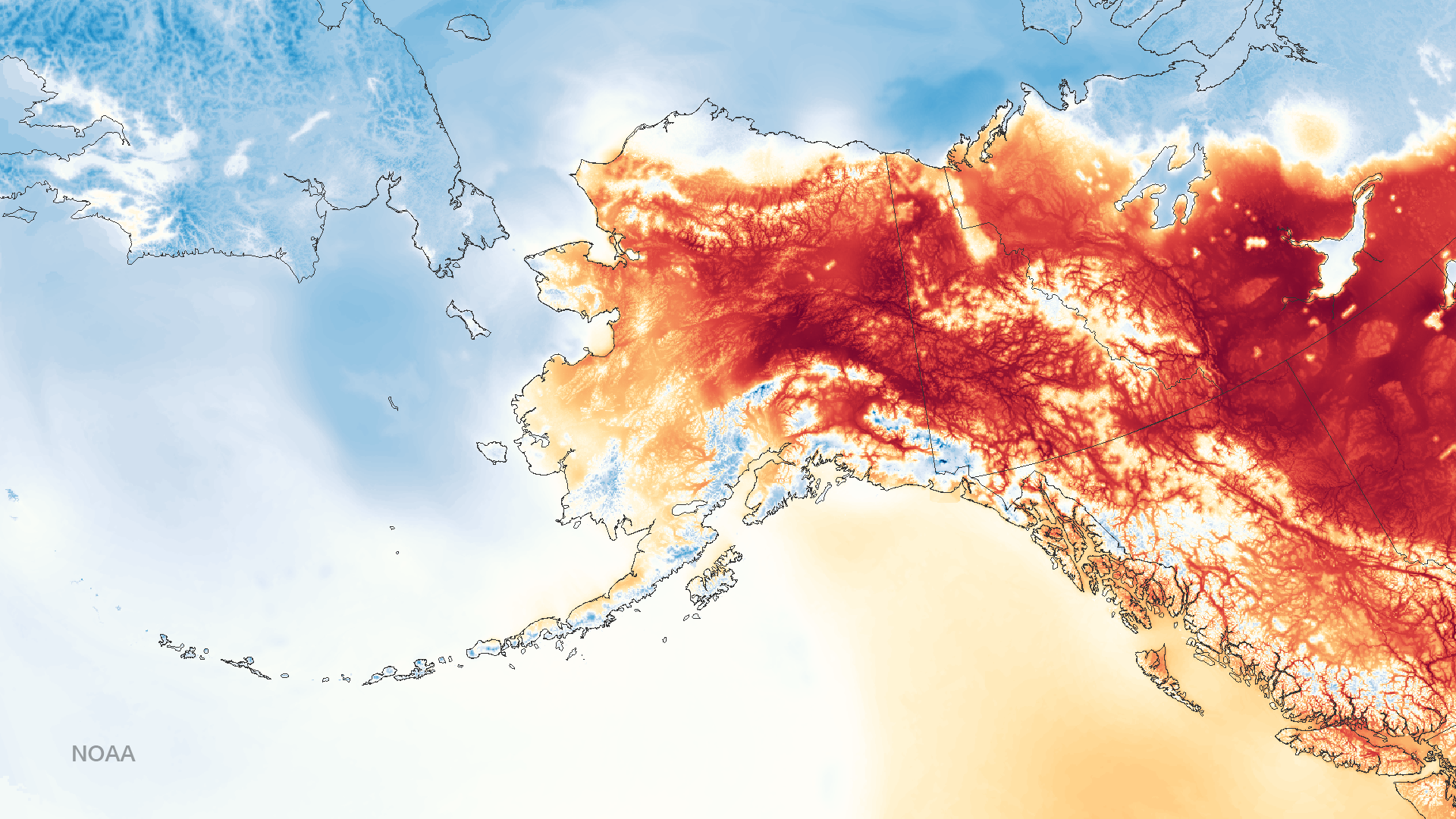
With a total area of more than 660,000 square miles, Alaska is not only the largest state in the U.S.; it's the largest state in the U.S. by far! Not
Satellite Snapshots
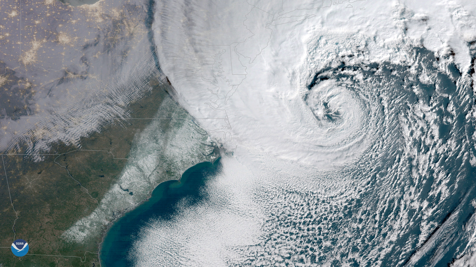
NOAA's GOES East satellite captured this geocolor enhanced image of a powerful nor'easter moving up the U.S. Eastern Seaboard on…