
Satellite Snapshots
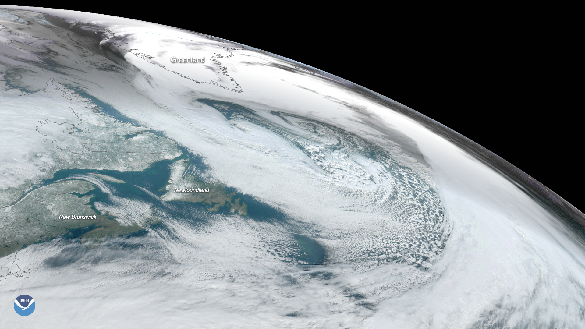
On Nov. 17, 2019, the GOES East satellite captured this image of a massive cyclone that formed over the Labrador Sea between…
Satellite Snapshots
The NOAA-20 satellite captured this imagery of a nor’easter off the mid-Atlantic coast and a low-pressure system off of Florida’s…
Satellite Snapshots
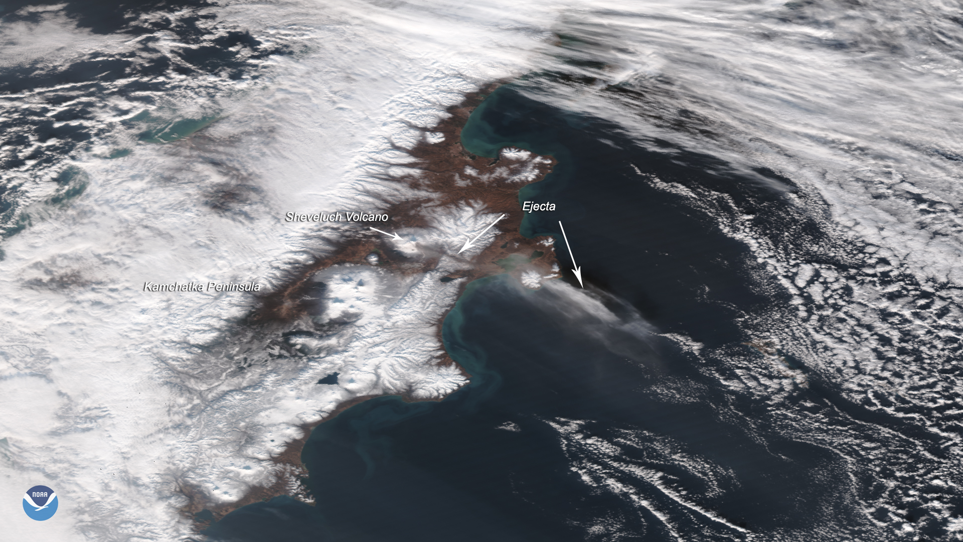
The Suomi-NPP satellite captured this image of the Sheveluch volcano erupting on Nov. 12, 2019, which affected flights over an area…
Satellite Snapshots
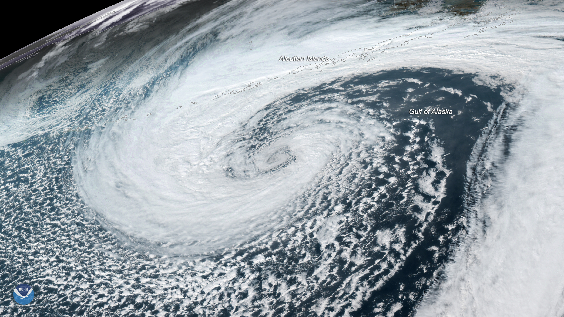
A mid-latitude cyclone was seen swirling in the Gulf of Alaska by the GOES West satellite on Nov. 12, 2019.
Satellite Snapshots
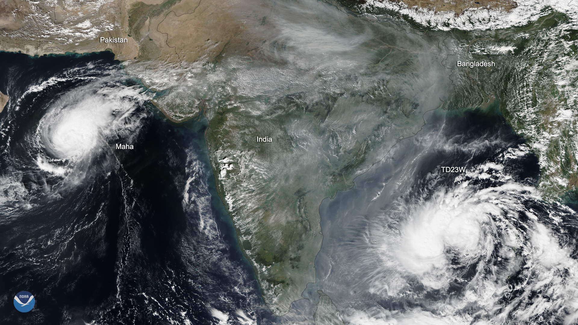
As NOAA-20 passed over India on Nov. 5, 2019, the satellite captured this dynamic image of two storm systems as well as the thick…
Satellite Snapshots
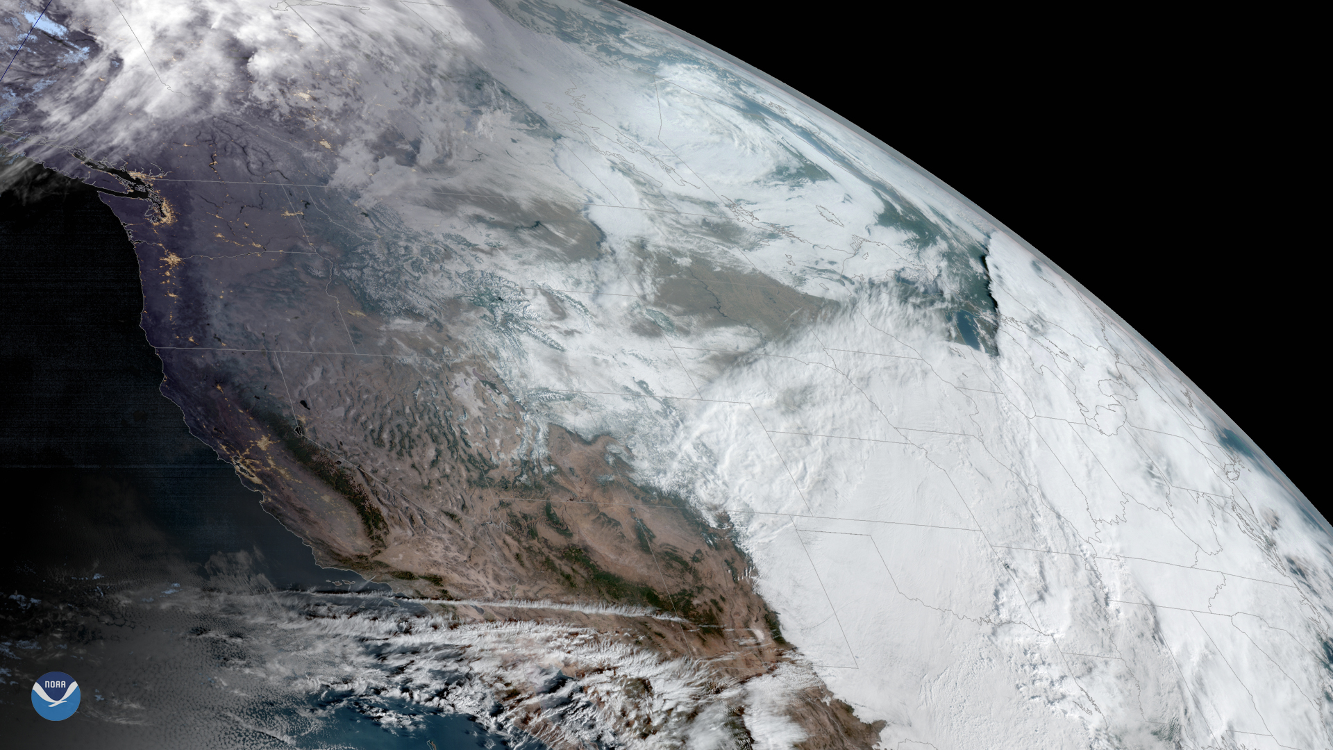
GOES West is watching an early-season snowstorm that is moving into the Plains and Midwest from the Rocky Mountains, which have…
Satellite Snapshots
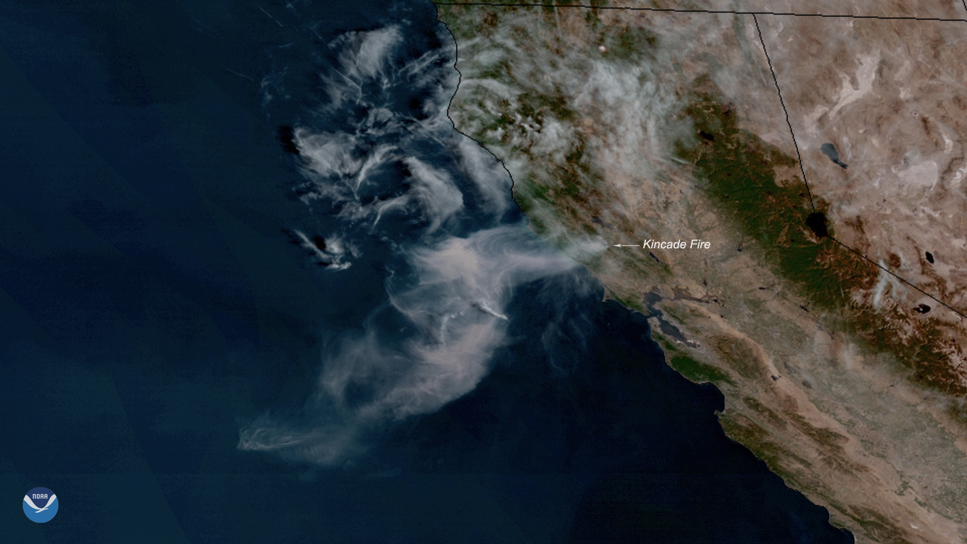
Neighborhoods across parts of Sonoma County, California, are under evacuation orders, and more are expected as the Kincade Fire…
Satellite Snapshots
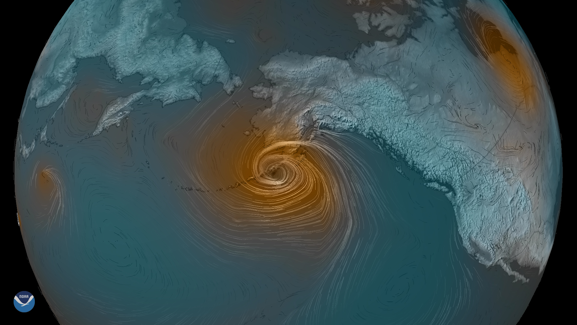
A rapidly developing low-pressure storm system is moving north over the Pacific Ocean toward southern Alaska. According to experts…