
Satellite Snapshots
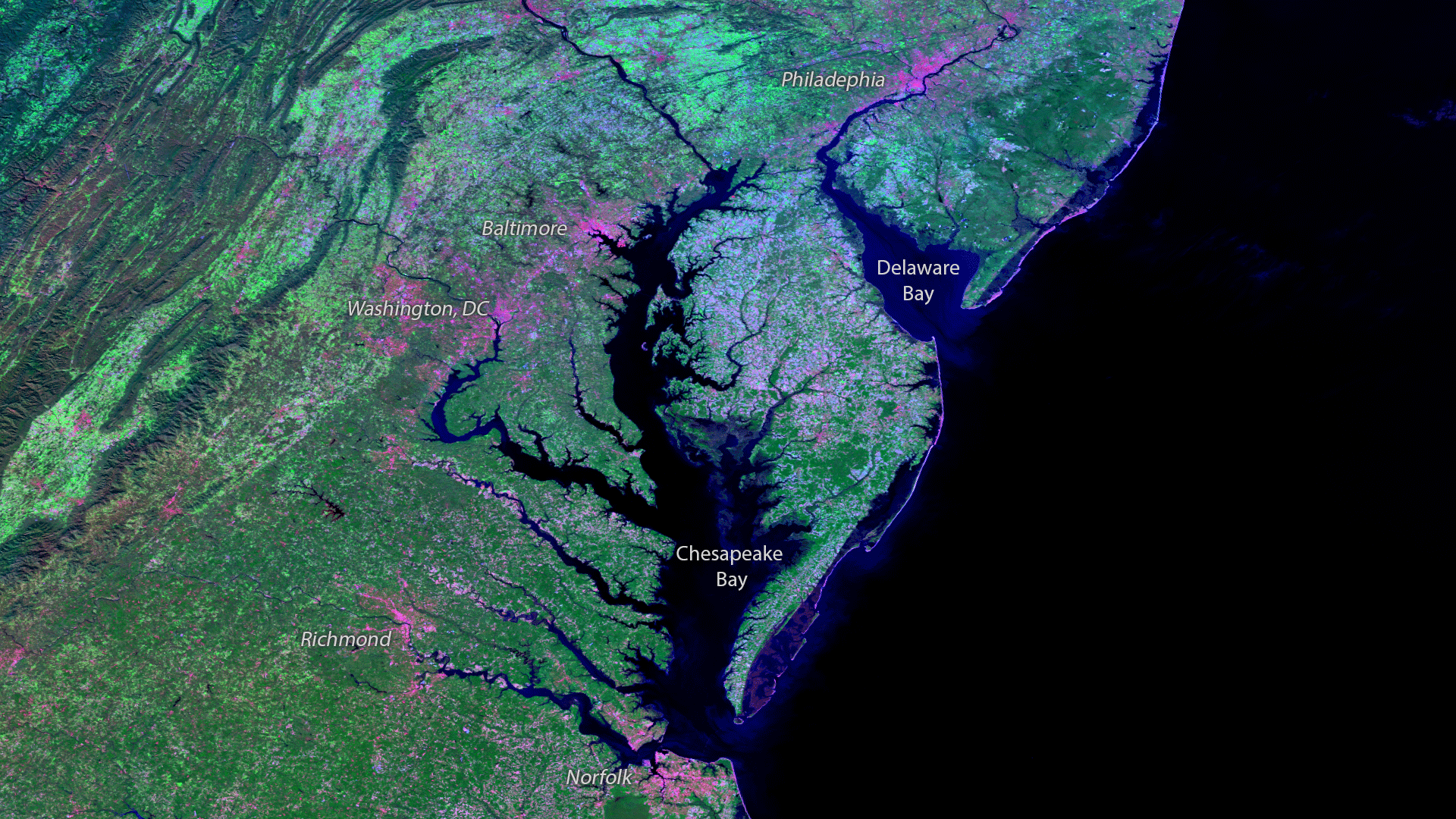
The Chesapeake Bay, North America’s largest estuary, provides a vital habitat for local marine life which supports the ecology and…
Satellite Snapshots
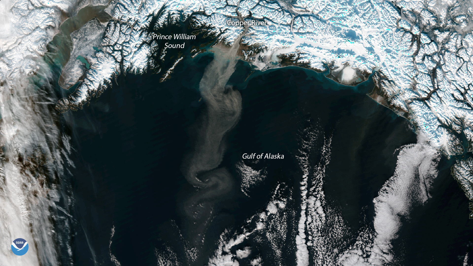
The NOAA/NASA Suomi NPP satellite’s VIIRS instrument captured this plume of glacial dust streaming into the Gulf of Alaska from the…
Satellite Snapshots
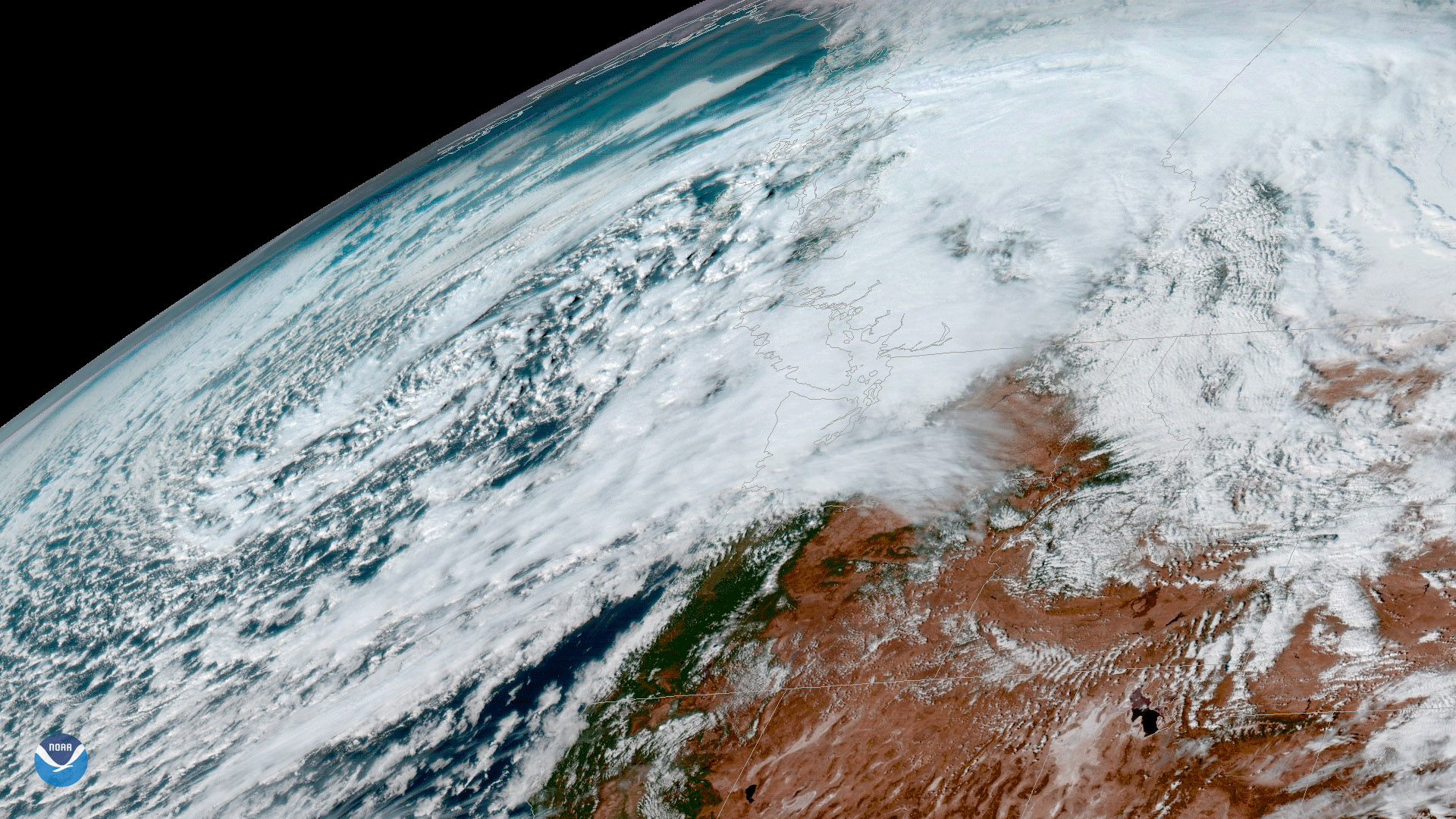
A strong low pressure system approaches the Pacific Northwest in this image from NOAA’s GOES-16 satellite, taken November 14, 2017…
Feature Story

NOAA's next-generation polar-orbiting weather satellite, JPSS-1, is on the launch pad!
Satellite Snapshots

During October, weak La Niña conditions emerged across most of the central and eastern equatorial Pacific Ocean. La Niña is likely…
Satellite Snapshots
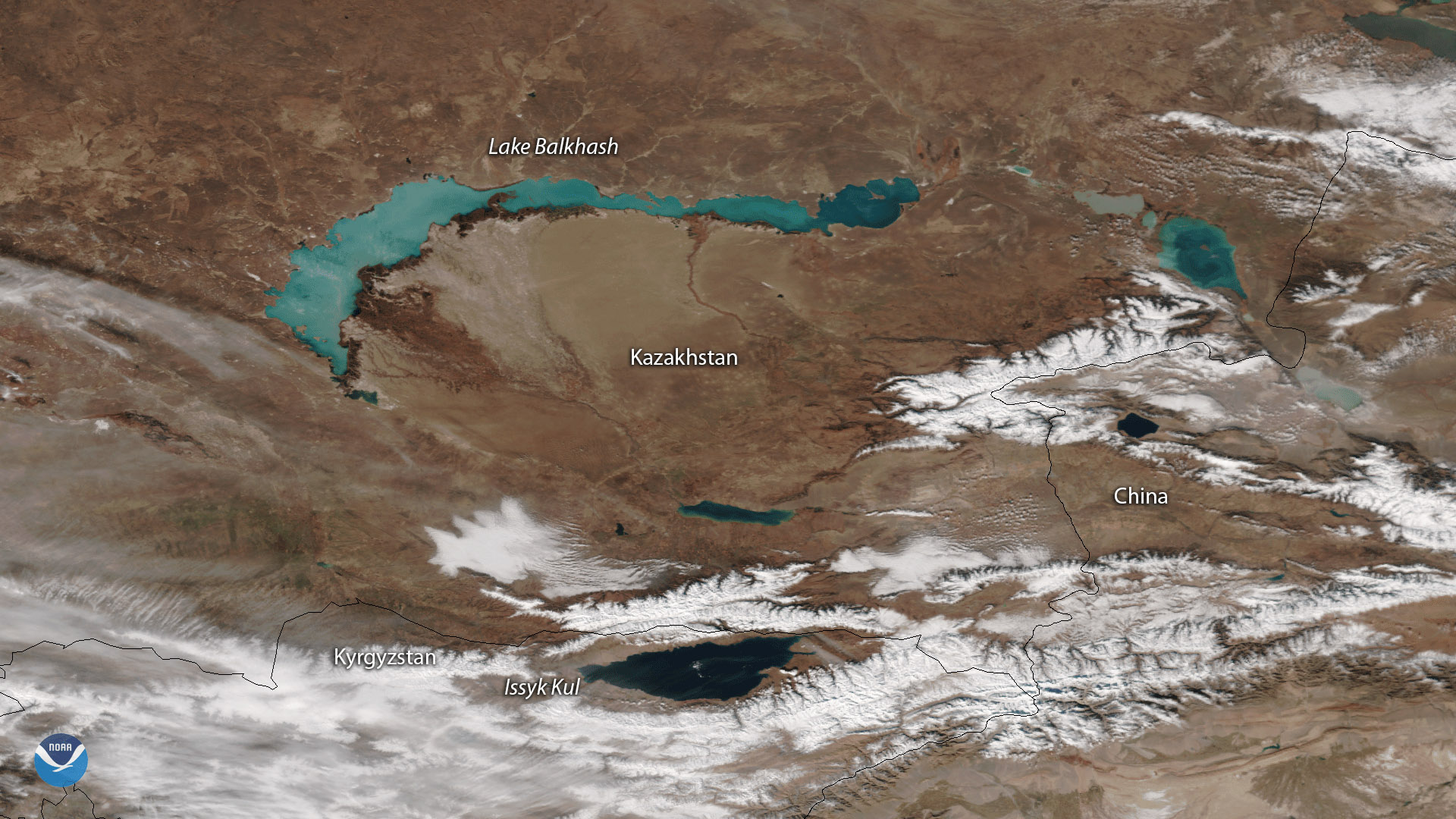
The NOAA/NASA Suomi NPP satellite's VIIRS instrument captured this image of the central Asia region bordered by Kyrgyzstan to the…
Satellite Snapshots

The Suomi NPP satellite's VIIRS instrument took this image of Tropical Storm Rina in the central Atlantic Ocean on November 7, 2017…
Satellite Snapshots

The NOAA GOES-16 satellite snapped this image of Tropical Depression 19 in the Central Atlantic Ocean on November 6, 2017. TD19 is…