
Satellite Snapshots
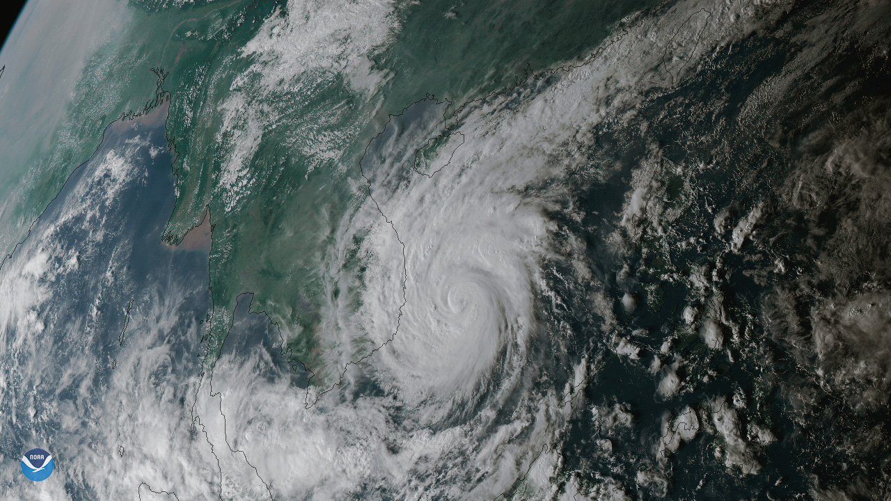
Typhoon Damrey just before hitting Vietnam with maximum sustained winds of 90 mph.
Satellite Snapshots
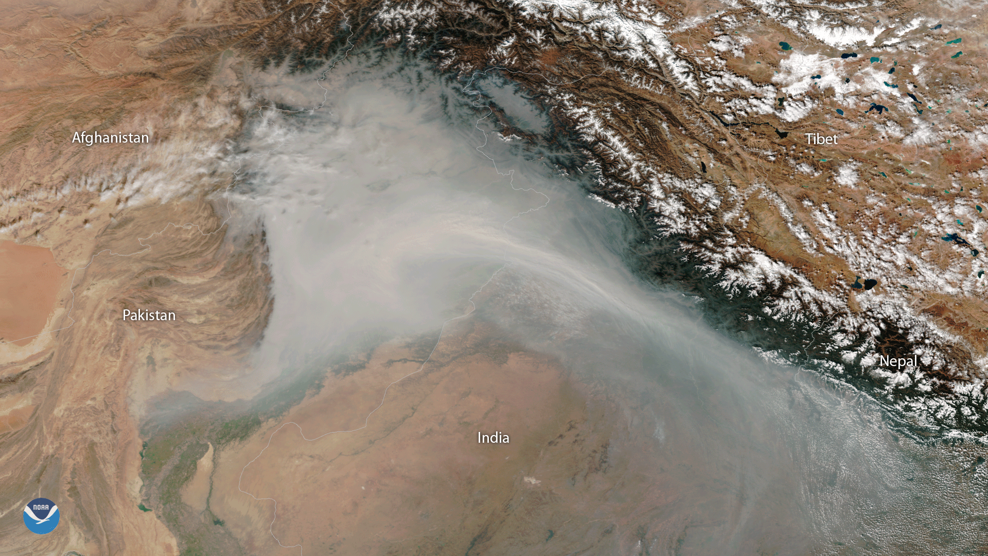
Smog covers the Upper Ganga Plain in India and Pakistan and settles in the valleys of the western Himalaya Mountains in this Suomi…
Feature Story
If you’re prepared for ghosts, ghouls and goblins this Halloween, you might want to also consider zombies...satellites that…
Satellite Snapshots

Forming the eastern boundary of the famous Transylvania region of Romania, or as Count Dracula would call it, home, the Carpathian…
Feature Story
Unusually hot days are becoming much more common. Prolonged periods of these unusually hot days - known as heat waves - are…
Satellite Snapshots
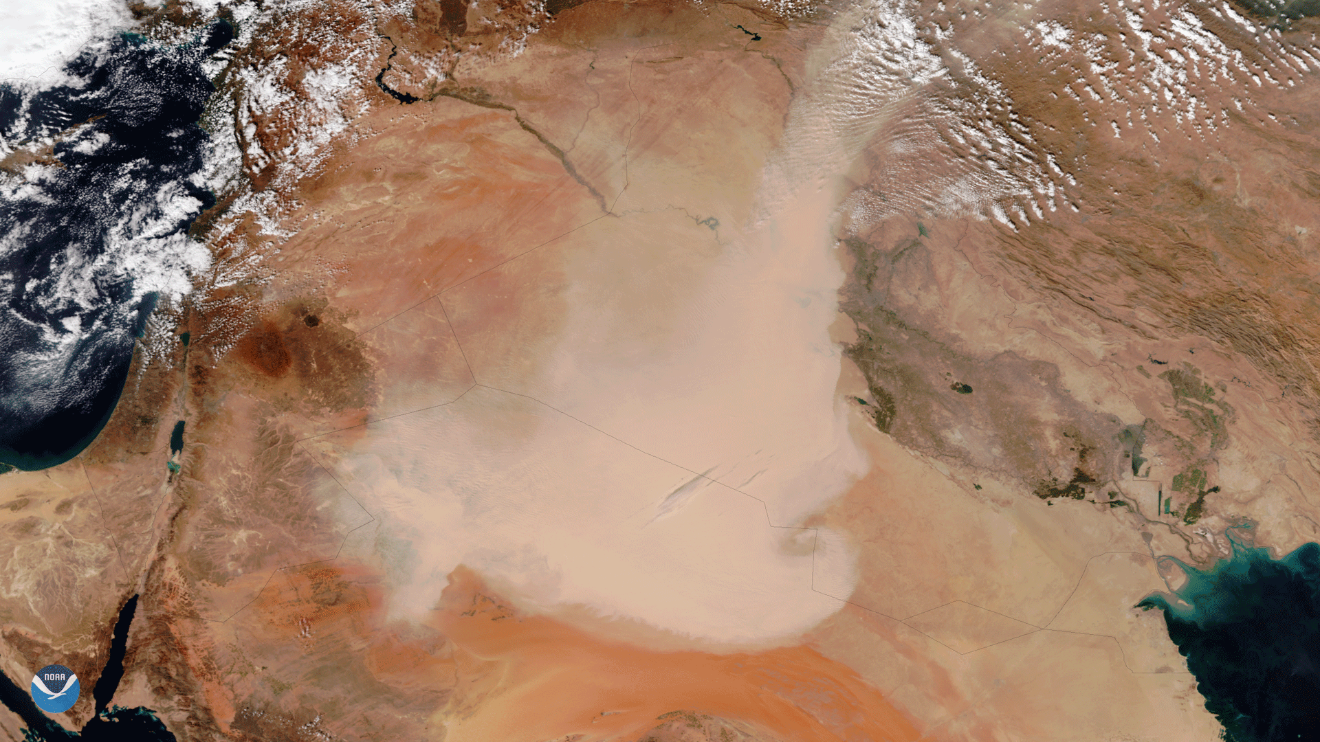
The Visible Infrared Imaging Radiometer Suite (VIIRS) aboard the NOAA/NASA Suomi NPP satellite captured this true-color image of a…
Feature Story
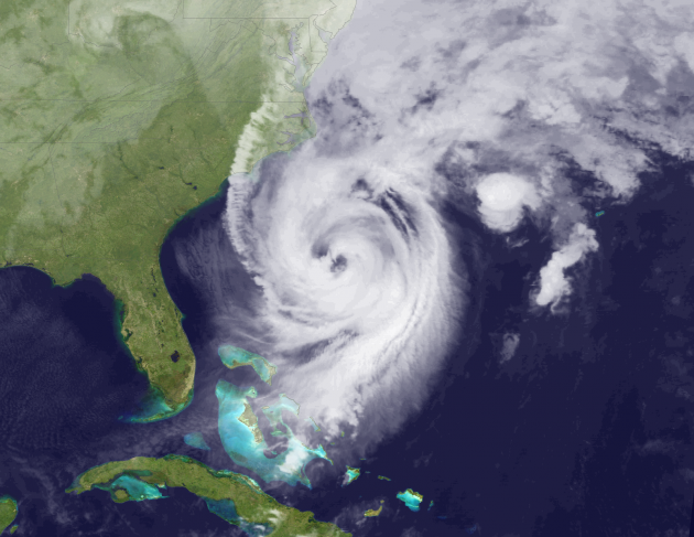
As for vampires, ghosts and goblins, well we can’t be sure...but double eyed hurricanes, now that’s a topic we can sink our…
Satellite Snapshots

A cloud-free day reveals some of the dynamic geography in a relatively remote area of the world along the borders of Afghanistan,…