
Feature Story
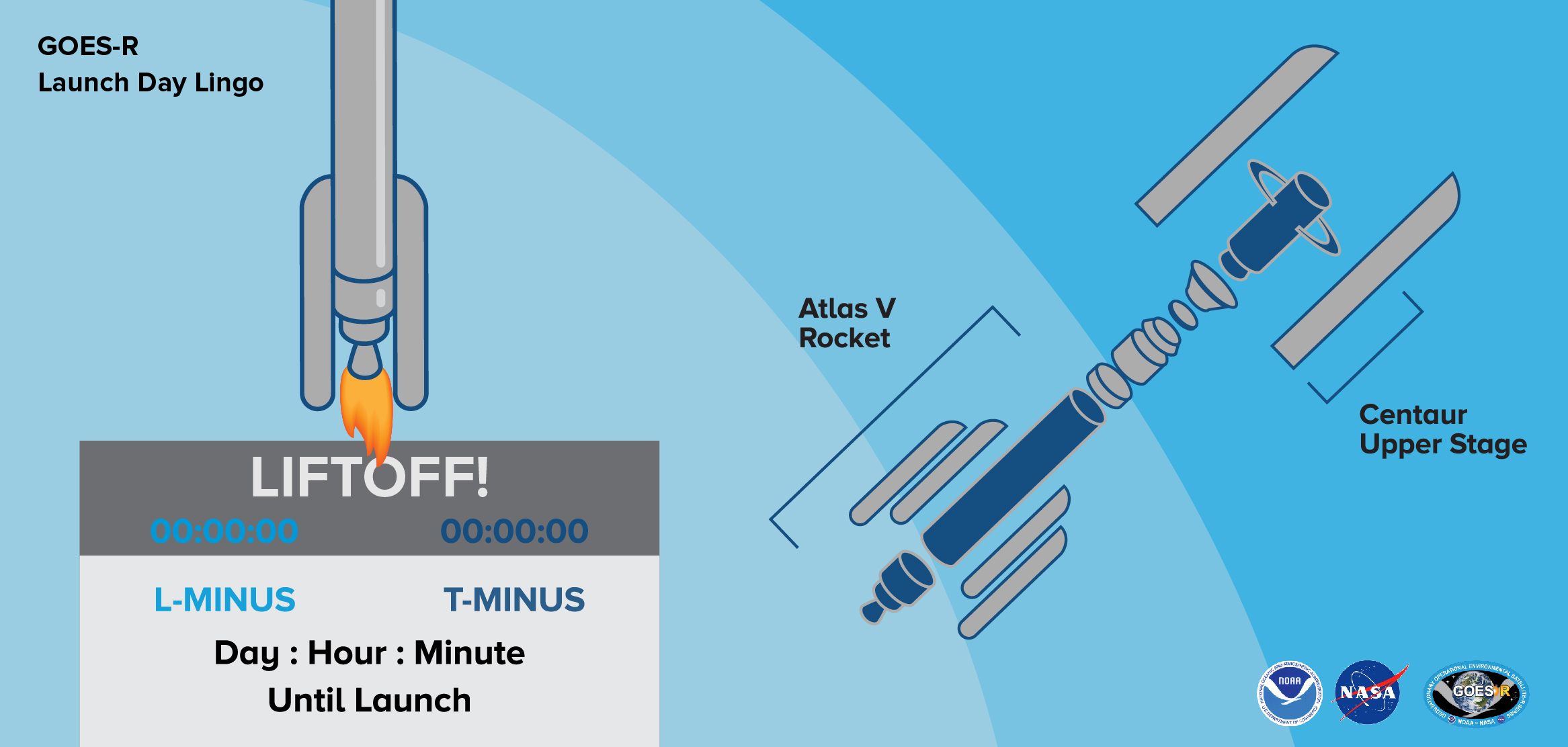
As we head toward launch, all eyes and ears will be on NOAA’s GOES-R satellite atop its Atlas V 541 rocket.
Feature Story
The Cyclone Global Navigation Satellite System, or CYGNSS, research mission will use a new technique to derive hurricane wind speeds.
Satellite Snapshots
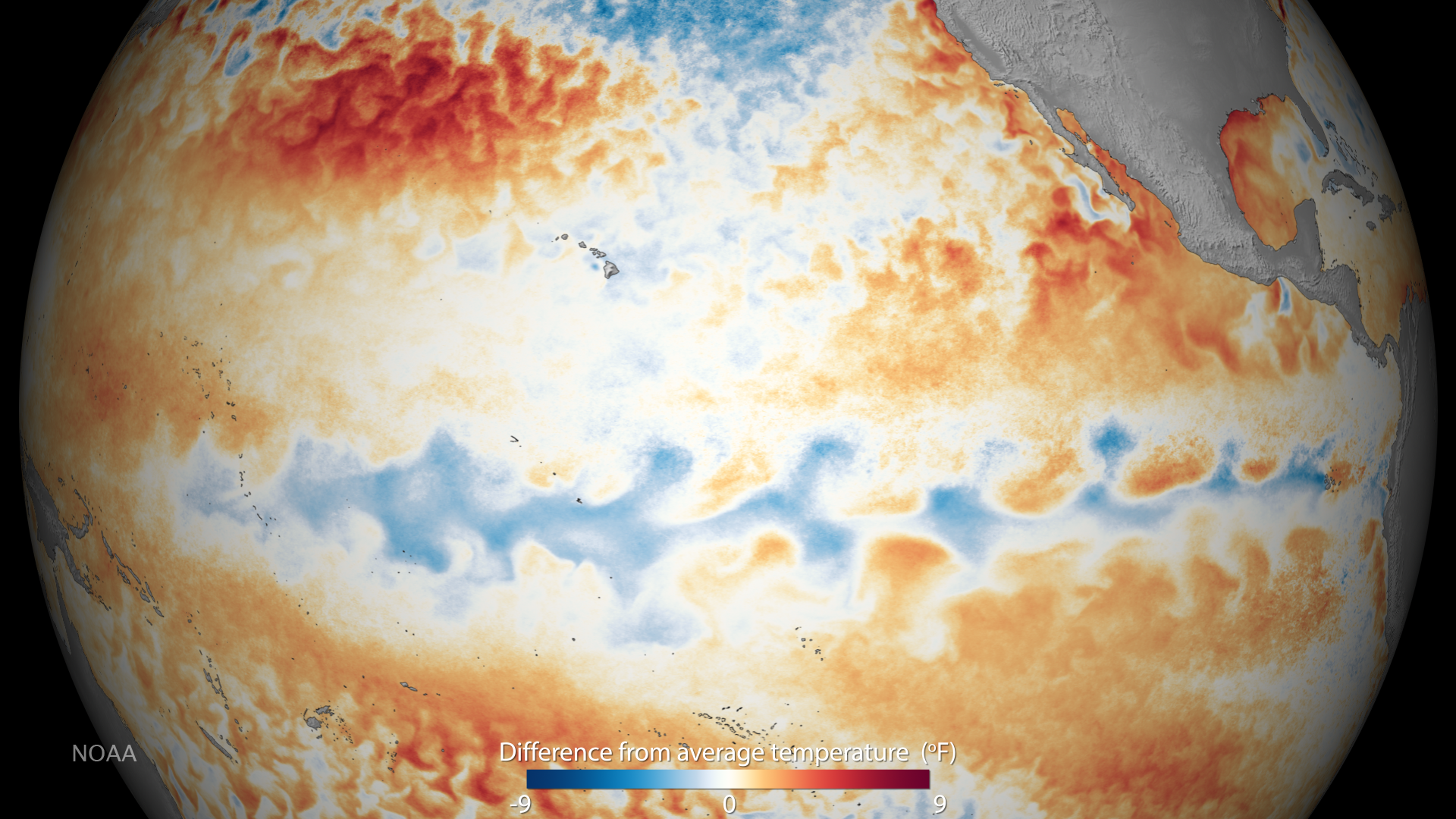
As announced by the NOAA Climate Prediction Center, La Niña conditions were observed during October, with negative sea surface…
Feature Story

Scientists with the Joint Polar Satellite Systems program at NOAA’s Center for Satellite Applications and Research have…
Feature Story
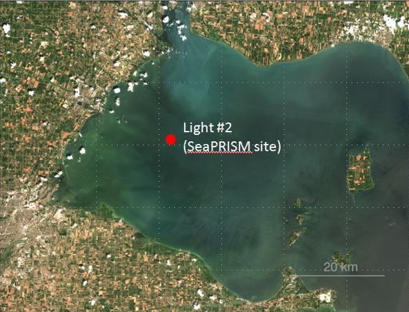
Last summer, Lake Erie became the first site in the Great Lakes—and the first site in U.S. inland waters—to participate in…
Feature Story
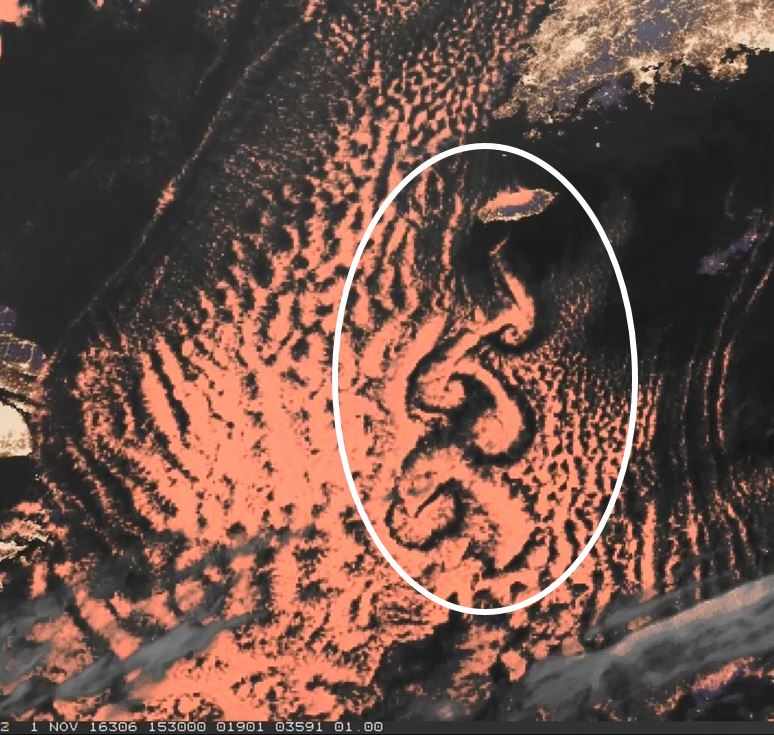
Himawari-8 spies an island creating swirling cloud streets in the East China Sea.
Feature Story

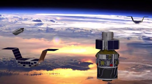
Last week, United Launch Alliance (ULA) worked to encapsulate NOAA's GOES-R satellite in its payload fairing -- another major step towards launch!
Feature Story

As Halloween approaches, the ghouls, ghosts and zombies are preparing to rise from their graves and once again roam.