
Feature Story

NOAA contributes 90% of the weather information used by the defense and intelligence communities. Satellites offer a view unrivaled by terrestrial technology.
Satellite Snapshots

NOAA satellites have been monitoring several large wildfires in Minnesota.
Feature Story

The JPSS VIIRS Day/Night Band, with its low-light sensitivity, captures auroras and shows how solar particles interact with Earth’s atmosphere.
Earth from Orbit
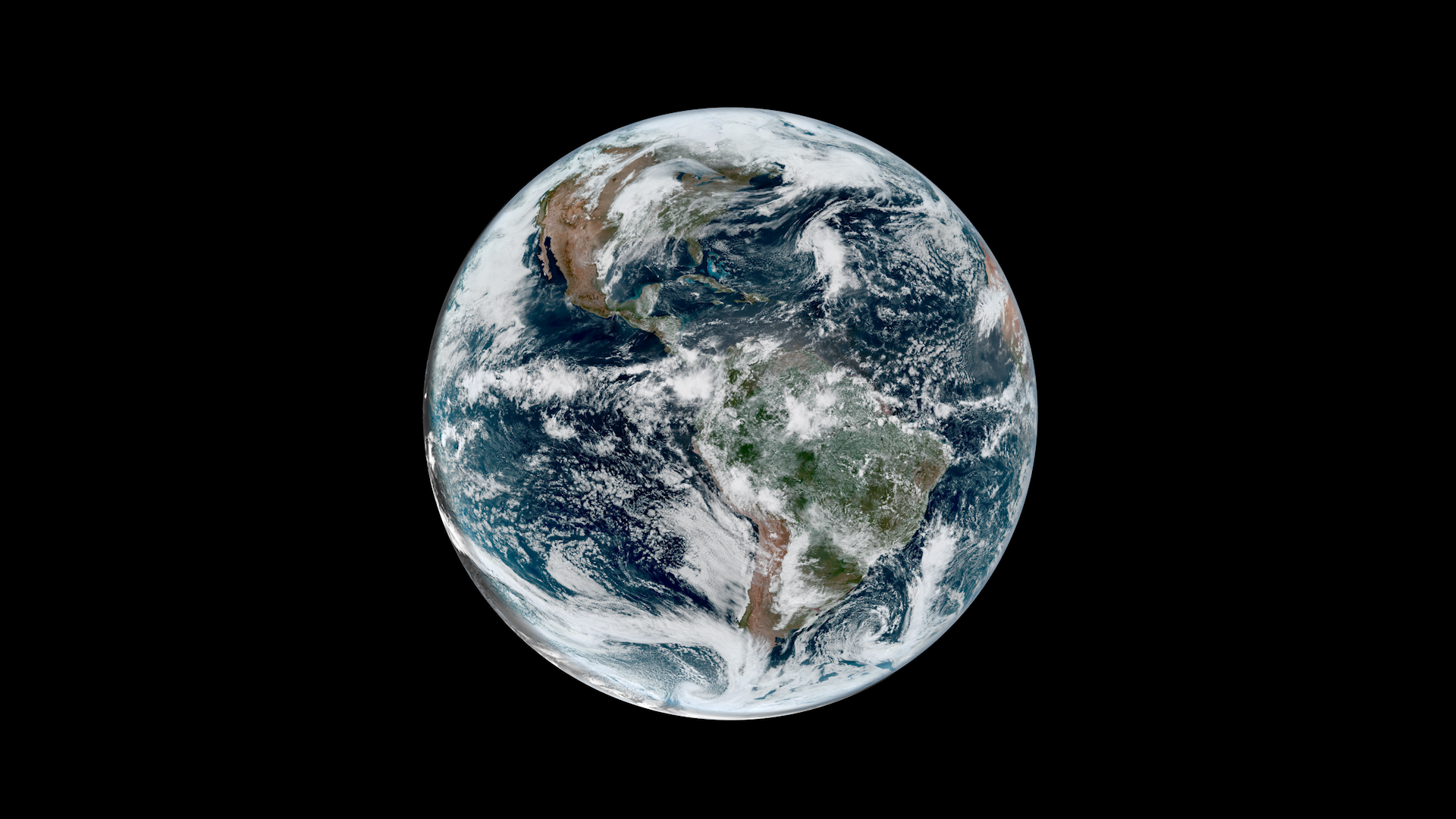
NOAA satellites have been monitoring Earth’s weather and environment since 1970, which also happened to be the year the first official Earth Day took place!
Satellite Snapshots

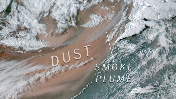
NOAA’s Joint Polar Satellite System (JPSS) satellites captured striking imagery of sediment runoff due to flooding in the Mississippi River delta from April 8–13, 2025.
Satellite Snapshots
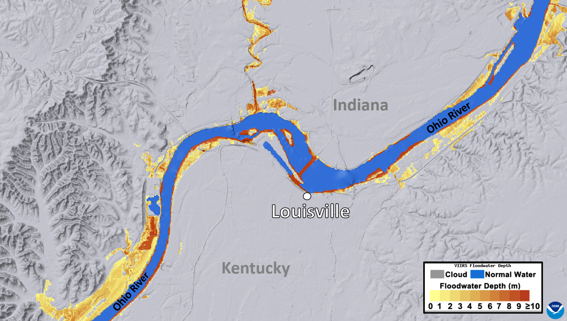
NOAA's JPSS Program satellites captured flooding along the Ohio River on April 7, 2025.
Feature Story
NOAA satellites closely monitored a powerful and devastating storm system that tore through the central and eastern United States from March 14-16, 2025.
Feature Story
From their orbits, NOAA satellites can play a vital role in detecting and tracking severe weather, providing forecasters with critical data to predict and monitor life-threatening conditions.