
Feature Story

Tuesday, February 4, 2020Photo courtesy of the Sterling, Va., NWS Forecast OfficeTen years ago this week, the Eastern U.S. was getting pounded by a…
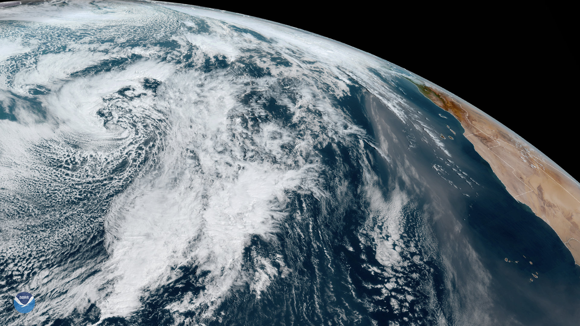
Satellite Snapshots
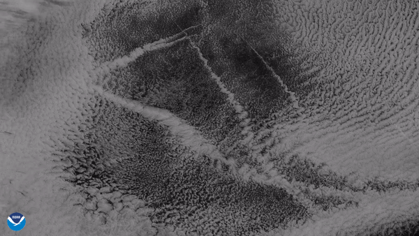
From its vantage point nearly 22,300 miles up, the GOES West satellite captured this imagery of ship tracks embedded in stratocumulus clouds.
Feature Story
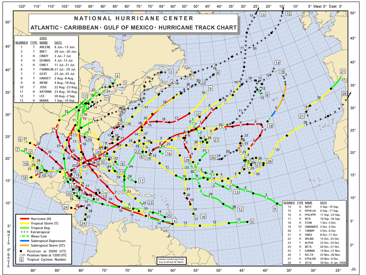
The incredible 2005 Atlantic hurricane season smashed many long-standing records. Some of the words used to describe it included,…
Satellite Snapshots
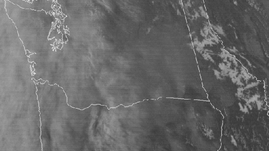
Forty years ago today, iconic Mount St. Helens erupted in southwestern Washington state in the deadliest and most economically…
Feature Story
Taking a step back and viewing the Earth from above not only can spark awe, it also can inspire change. Case in point—in…
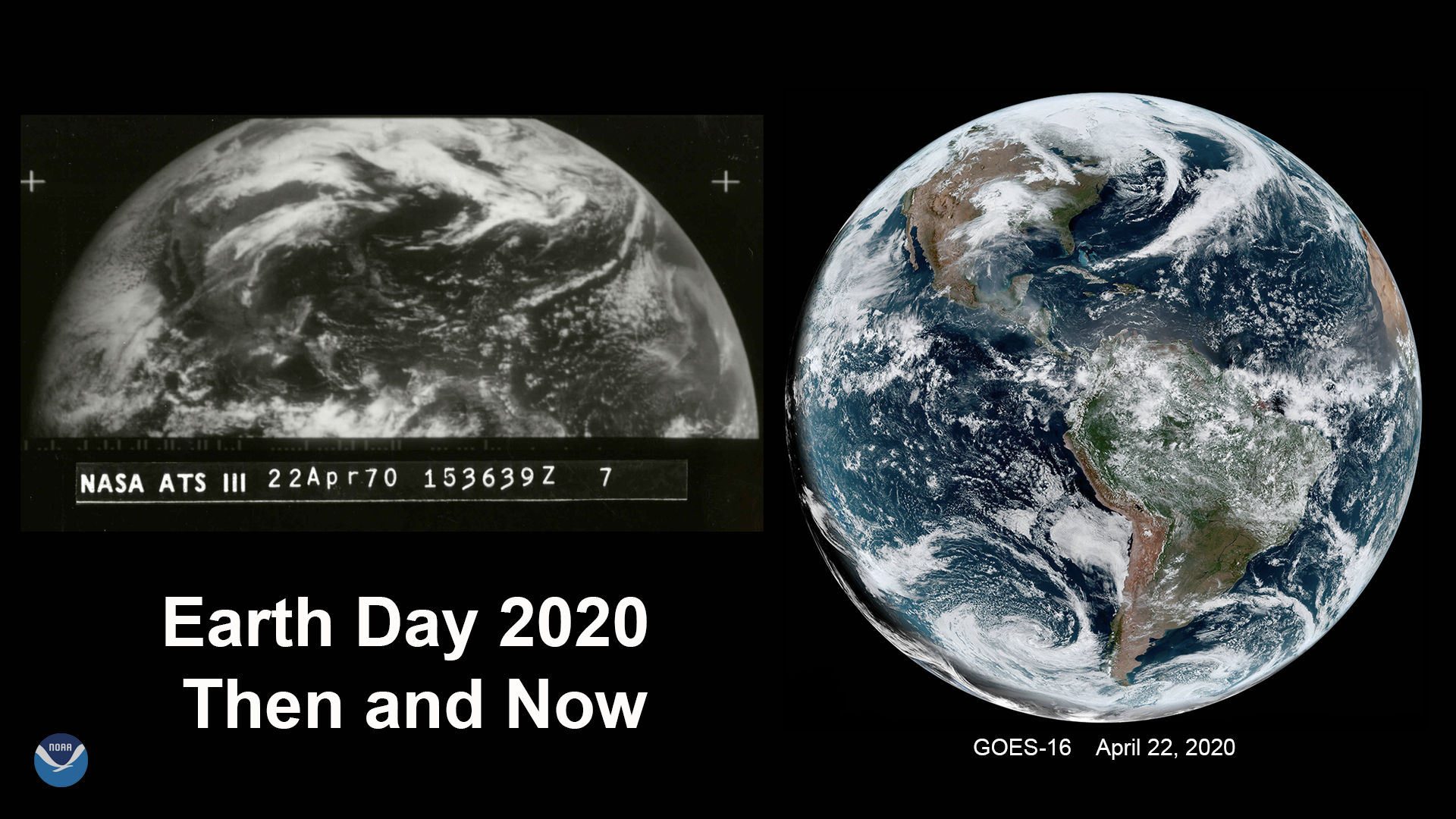
Feature Story

Earth Day celebrates its golden anniversary in 2020, NOAA too is celebrating 50 years of monitoring the Earth’s weather,…
Feature Story
GOES satellites provide beautiful images of Earth. But what you see are digital representations of the data they capture. How are the images created?
Satellite Snapshots
Numerous atmospheric events are taking place in this dynamic shot from GOES-East, taken on Jan. 31, 2020.