
Feature Story

JPSS observations enhance aviation safety by enhancing forecasts for weather and smoke, helping the FAA manage risks and minimize delays.
Earth from Orbit

NOAA satellites constantly monitor the ocean for tropical activity. As the 2024 Atlantic hurricane season comes to a close on Nov. 30, we’re looking back at its above-average activity, with a record breaking ramp up following a peak-season lull.
Satellite Snapshots
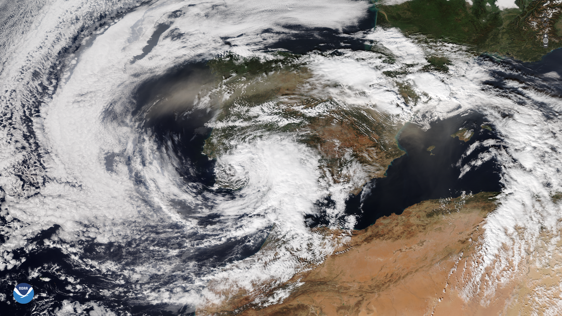
A powerful storm struck parts of Spain on Tuesday, Oct. 29, 2024, which brought severe flooding.
Feature Story

As climate-driven floods intensify, VIIRS provides near real-time data to bolster global preparedness and protect vulnerable communities.
Feature Story
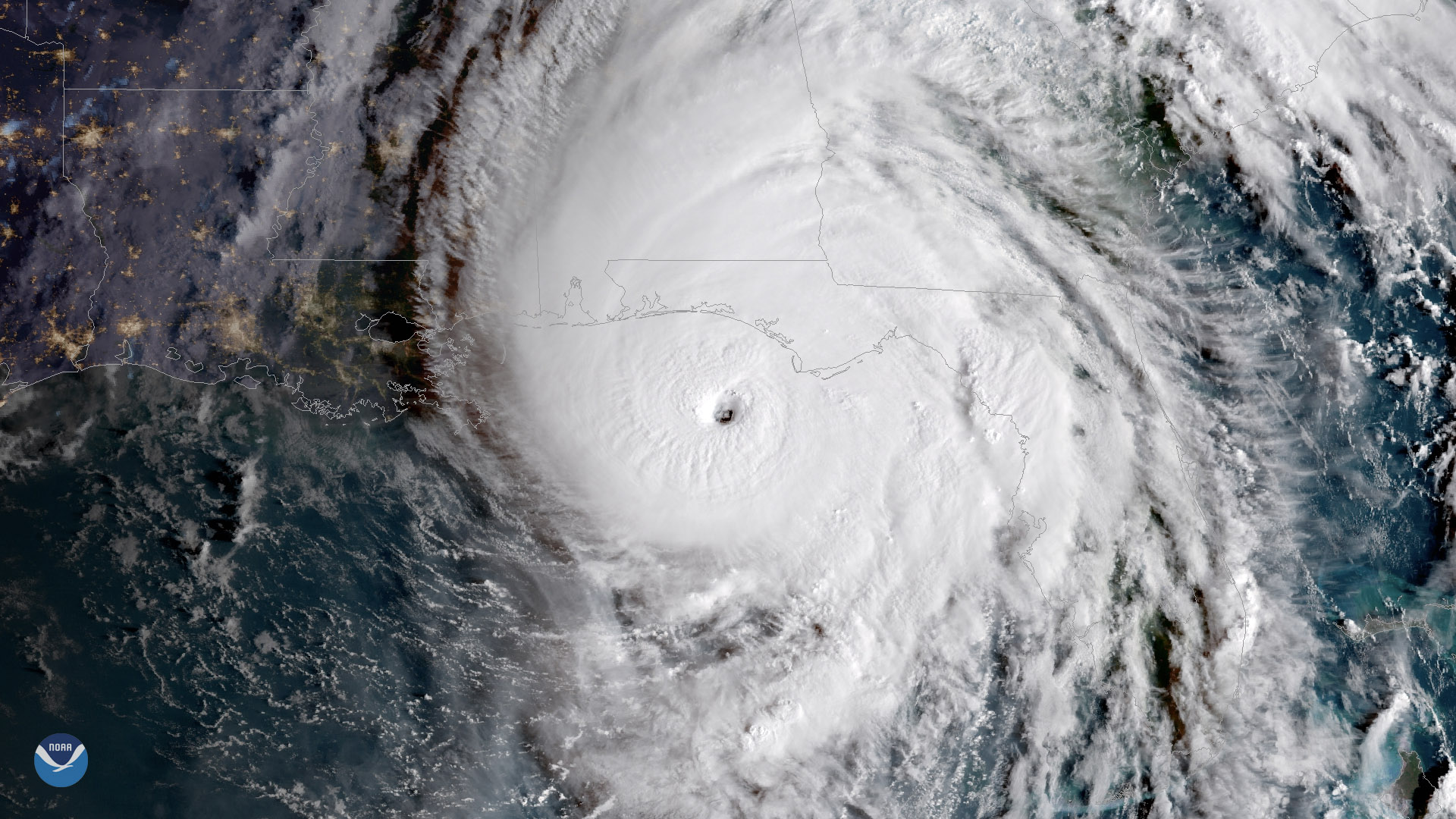
Late October has occasionally produced devastating hurricanes that have hit the United States and elsewhere.
Feature Story
Late October has occasionally produced devastating hurricanes that have hit the United States and elsewhere.
Satellite Snapshots
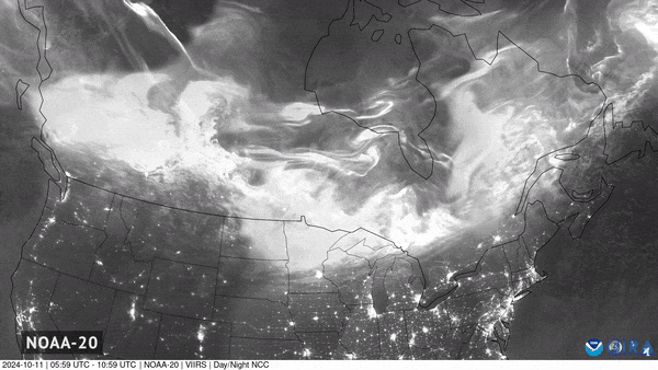
On Oct. 11, 2024, the aurora borealis dazzled many across North America due to a severe geomagnetic storm.
Satellite Snapshots
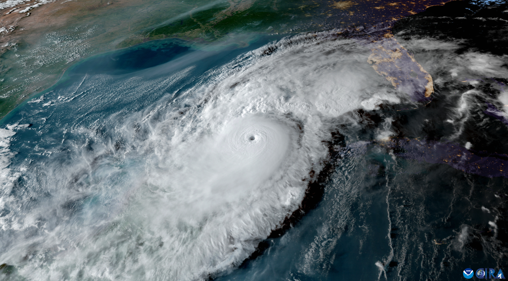
On Oct. 8, 2024, at 6:30 p.m. EDT, NOAA’s GOES East satellite captured this imagery of Hurricane Milton approaching the Gulf Coast of Florida.